Lowndes County is in the central part of the U.S. state of Alabama. As of the 2020 census, the county’s population was 10,311. Its county seat is Hayneville. The county is named in honor of William Lowndes, a member of the United States Congress from South Carolina.
Lowndes County is part of the Montgomery, Alabama Metropolitan Statistical Area. Historically it has been considered part of the Black Belt, known for its fertile soil, cotton plantations, and high number of African American workers, enslaved and later freed.
| Name: | Lowndes County |
|---|---|
| FIPS code: | 01-085 |
| State: | Alabama |
| Founded: | January 20, 1830 |
| Named for: | William Lowndes |
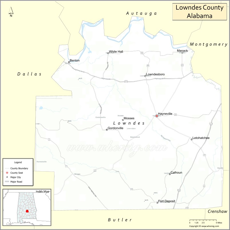
| Seat: | Hayneville |
| Largest town: | Fort Deposit |
| Total Area: | 725 sq mi (1,880 km²) |
| Land Area: | 716 sq mi (1,850 km²) |
| Total Population: | 10,311 |
| Population Density: | 14/sq mi (5.5/km²) |
| Time zone: | UTC−6 (Central) |
| Summer Time Zone (DST): | UTC−5 (CDT) |
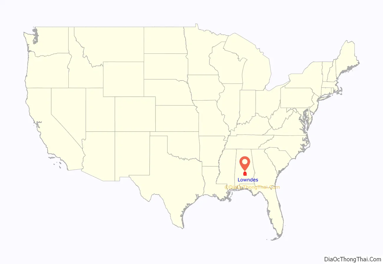
Lowndes County location map. Where is Lowndes County?
History
Lowndes County was formed from Montgomery, Dallas and Butler counties, by an act of the Alabama General Assembly on January 20, 1830. The county is named for South Carolina statesman William Lowndes. It is part of the Black Belt, where cotton plantations were developed in the antebellum years and agriculture continued as a dominant part of the economy into the 20th century.
During the Reconstruction era, blacks were elected to local and state offices. White Democrats regained power and control of the state legislature in 1874 and drove the remaining office holders out. They adopted the 1875 Constitution of Alabama and another in 1901 that disenfranchised most blacks and many poor whites. Requirements were added for payment of a cumulative poll tax before registering to vote, difficult for poor people to manage who often had no cash on hand; and literacy tests (with a provision for a grandfather clause to exempt illiterate white voters from being excluded.) The number of black voters on the rolls fell dramatically in the next few years, as did the number of poor white voters.
From the end of the 19th through the early decades of the 20th centuries, organized white violence increased against blacks, with 16 lynchings recorded in the county, the fourth-highest total in the state, which historically is among those in the South with the highest rate of per capita lynchings. Most victims were black men, subjected to white extra-legal efforts to maintain white supremacy by racial terrorism. Seven of these murders were committed in Letohatchee, an unincorporated community south of Montgomery; five in 1900 and two in 1917. In 1900 mobs killed a black man accused of killing a white man. When local black resident Jim Cross objected, he was killed, too, at his house, followed by his wife, son and daughter. In 1917 two black brothers were killed by a white mob for alleged “insolence” to a white farmer on the road. On July 31, 2016, a historical marker was erected at Letohatchee by the Equal Justice Initiative in coordination with the city to commemorate the people who had suffered these extrajudicial executions.
Because of the shift in agriculture and the Great Migration of blacks to leave oppressive conditions, population in the rural county has declined by two thirds since the 1900 high of more than 35,000. The effects of farm mechanization and the boll weevil infestation, which decimated the cotton crops and reduced the need for farm labor in the 1920s and 1930s, caused widespread loss of jobs.
Civil Rights Era
By 1960 (as shown on census tables below), the population had declined to about 15,000 residents and was about 80 percent-majority black. The rural county was referred to as “Bloody Lowndes”, the rusty buckle of Alabama’s Black Belt, because of the high rate of white violence against blacks to maintain segregation. In 1965, a century after the American Civil War and decades after whites had disenfranchised blacks via the 1901 state constitution, they maintained white supremacy by intimidation and violence, suppressing black voting.
County population had fallen by more than half from its 1900 high, as both blacks and whites moved to urban areas. Blacks still outnumbered whites by a 4-to-1 ratio. Eighty-six white families owned 90 percent of the land in the county and controlled the government, as whites had since 1901. With an economy based on agriculture, black residents worked mostly in low-level rural jobs. In the civil rights era, not one black resident was registered to vote before March 1, 1965.
The passage of the Civil Rights Act of 1964 and the Voting Rights Act of 1965 in August of that year encouraged civil rights leaders to believe they could fight racism in Lowndes. The Lowndes County Freedom Organization (LCFO) was founded in the county as a new, independent political party designed to help blacks stand up to intimidation and murder.
Organized by the young civil rights leader Stokely Carmichael of the Student Nonviolent Coordinating Committee (SNCC), in the summer of 1965 Lowndes residents launched an intensive effort to register blacks in the county to vote. SNCC’s plan was simple: to get enough black people to vote so blacks might be fully represented in the local government and redirect services to black residents, 80 percent of whom lived below the poverty line. Carmichael and others organized registration drives, demonstrations, and political education classes in support of the black residents. The Voting Rights Act authorized the federal government to oversee voter registration and voting processes in places such as Lowndes County where substantial minorities were historically under-represented.
The police continued to arrest protesters in the summer of 1965. A group of protesters were released from jail in the county seat of Hayneville on August 20, 1965. As four of them approached a small store, Thomas Coleman, an unpaid special deputy, ordered them away. When he aimed his shotgun at one of the young black women (Ruby Sales) Jonathan Myrick Daniels pushed her down, taking the blast, which immediately killed the Episcopal seminarian. Coleman also shot Father Richard Morrisroe, a Catholic priest, in the back, then stopped. He was indicted for the murder of Daniels; and an all-white jury quickly acquitted him after his claim of self-defense, although both men were unarmed. Coleman had been appointed as special deputy by the county sheriff.
In 1966 after working to register African-American voters, the Lowndes County Freedom Organization (LCFO), the first independent black political party in the county since Reconstruction, recruited several local residents as candidates for county offices. It adopted the emblem of the black panther, in contrast to the white rooster of the white-dominated Alabama Democratic Party. On May 3, 1966, over 900 registered black voters cast their ballots at the county seat in Hayneville as independent participants in the primary, with some driving over 25 miles to do so. One notable strategy the LCFO encouraged among black voters was to help other black voters if they needed assistance as a precaution against the fact that “the Lowndes County Freedom Organization knew that once a local white person got behind the curtain with a black person, that vote would be lost” (p. 111). Another was to encourage black voters to simply pull the lever to vote strictly for LCFO candidates; in other words, to “pull the lever for the Black Panther and go on home,” as stated on a sign on Highway U.S. 80 between Montgomery and Selma.
Whites in Lowndes County reacted strongly against the LCFO. In retaliation for black sharecroppers engaging in civil rights work, white landowners evicted many of them from their rental houses and land plots. They used economic blackmail to make them both homeless and unemployed in a struggling economy. The SNCC and Lowndes County leaders worked to help these families stay together and remain in the county. They bought tents, cots, heaters, food, and water and helped several families build a temporary “tent city”. Despite harassment, including shots regularly fired into the encampment, these black residents persevered for nearly two years as organizers helped them find new jobs and look for permanent housing.
Whites refused to serve known LCFO members in stores and restaurants. Several small riots broke out over the issue. The LCFO pushed forward and continued to organize and register voters. However, none of their candidates won in the November 1966 general election. In a December 1966 edition of The Liberator, a Black Power magazine, activist Gwendolyn Patton alleged the election had been subverted by widespread ballot fraud. But historians believe that black sharecroppers refrained from voting, submitting to the severe pressure put on them by the local white plantation owners, who employed most of them. After the LCFO folded into the statewide Democratic Party in 1970, African Americans have supported candidates who have won election to local offices. In a continuing divide, since the late 20th century, most white conservative voters in Alabama have shifted to the Republican Party.
In White v. Crook (1966), Federal District Judge Frank M. Johnson ruled in a class action suit brought on behalf of black residents of Lowndes County, who demonstrated they had been excluded from juries. Women of all races were excluded from juries by state statute. Johnson ordered that the state of Alabama must take action to recruit both male and female blacks to serve on juries, as well as other women, according to their rights under the Fourteenth Amendment. The suit was joined by other class members from other counties who dealt with similar conditions of exclusion from juries. It was “one of the first civil actions brought to remedy systematic exclusion of Negroes from jury service generally.”
The LCFO continued to fight for wider political participation. Their goal of democratic, community control of politics spread into the wider civil rights movement. The first black sheriff in the county to be elected since Reconstruction was John Hullett, elected in 1970.
Today an Interpretive Center in the county, maintained by the National Park Service, memorializes the Tent City and LCFO efforts in political organizing.
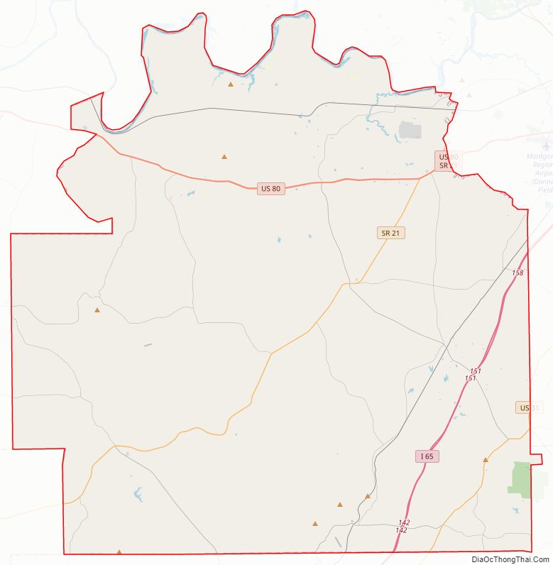
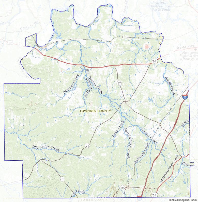
Lowndes County Road Map
Geography
According to the United States Census Bureau, the county has a total area of 725 square miles (1,880 km), of which 716 square miles (1,850 km) is land and 9.2 square miles (24 km) (1.3%) is water. The county is located in the Gulf Coastal Plain region of the state.
Major highways
- Interstate 65
- U.S. Highway 31
- U.S. Highway 80
- State Route 21
- State Route 97
- State Route 185
- State Route 263
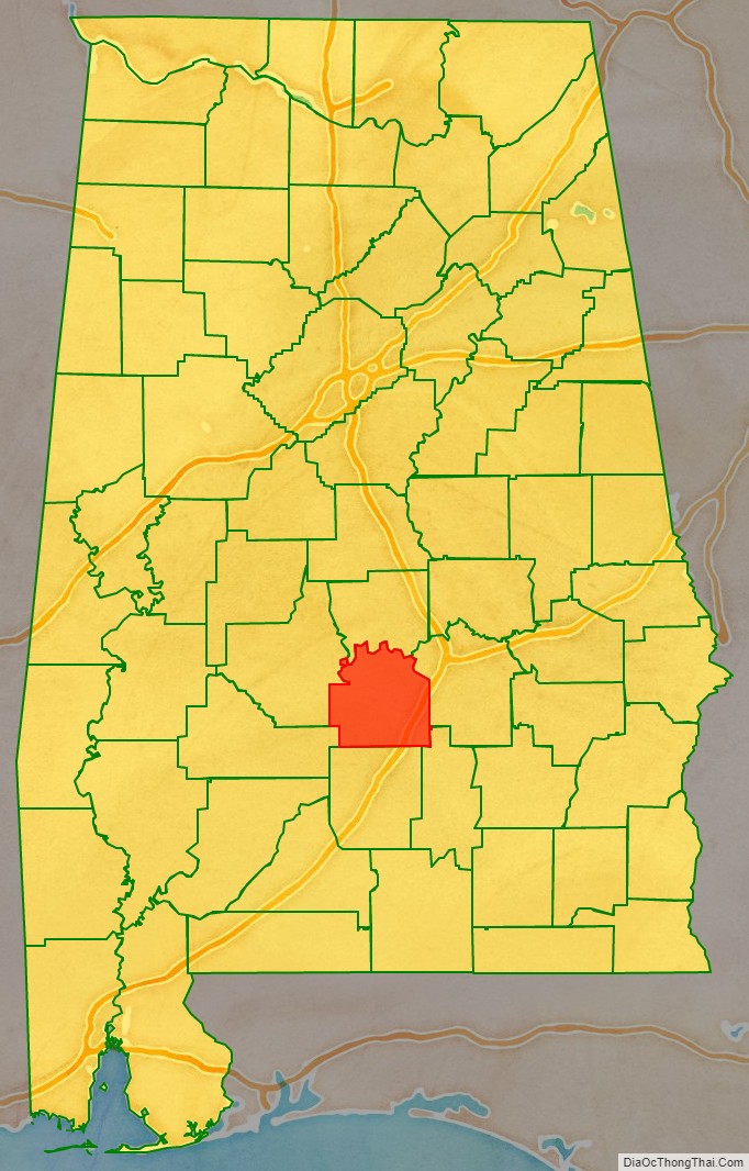
Adjacent counties
- Autauga County (north)
- Montgomery County (east)
- Crenshaw County (southeast)
- Butler County (south)
- Wilcox County (southwest)
- Dallas County (west)
National protected area
- Selma to Montgomery National Historic Trail (part)
Lowndes County Topographic Map
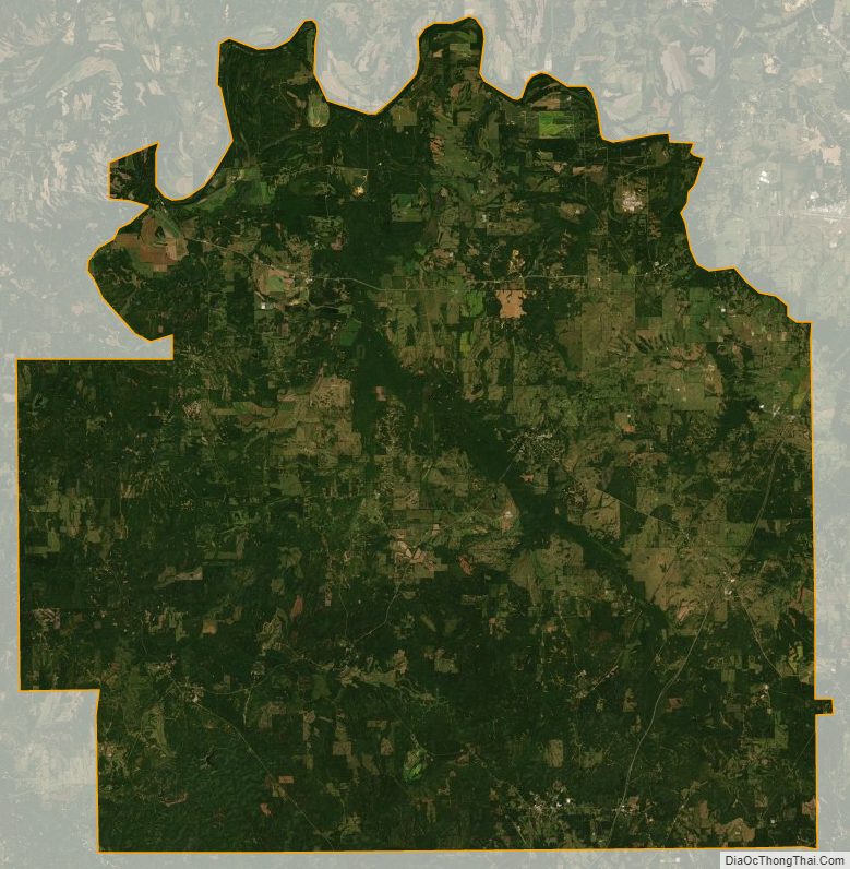
Lowndes County Satellite Map
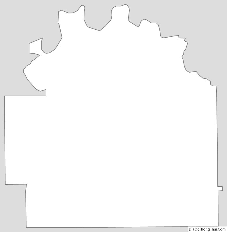
Lowndes County Outline Map
See also
Map of Alabama State and its subdivision:- Autauga
- Baldwin
- Barbour
- Bibb
- Blount
- Bullock
- Butler
- Calhoun
- Chambers
- Cherokee
- Chilton
- Choctaw
- Clarke
- Clay
- Cleburne
- Coffee
- Colbert
- Conecuh
- Coosa
- Covington
- Crenshaw
- Cullman
- Dale
- Dallas
- De Kalb
- Elmore
- Escambia
- Etowah
- Fayette
- Franklin
- Geneva
- Greene
- Hale
- Henry
- Houston
- Jackson
- Jefferson
- Lamar
- Lauderdale
- Lawrence
- Lee
- Limestone
- Lowndes
- Macon
- Madison
- Marengo
- Marion
- Marshall
- Mobile
- Monroe
- Montgomery
- Morgan
- Perry
- Pickens
- Pike
- Randolph
- Russell
- Saint Clair
- Shelby
- Sumter
- Talladega
- Tallapoosa
- Tuscaloosa
- Walker
- Washington
- Wilcox
- Winston
- Alabama
- Alaska
- Arizona
- Arkansas
- California
- Colorado
- Connecticut
- Delaware
- District of Columbia
- Florida
- Georgia
- Hawaii
- Idaho
- Illinois
- Indiana
- Iowa
- Kansas
- Kentucky
- Louisiana
- Maine
- Maryland
- Massachusetts
- Michigan
- Minnesota
- Mississippi
- Missouri
- Montana
- Nebraska
- Nevada
- New Hampshire
- New Jersey
- New Mexico
- New York
- North Carolina
- North Dakota
- Ohio
- Oklahoma
- Oregon
- Pennsylvania
- Rhode Island
- South Carolina
- South Dakota
- Tennessee
- Texas
- Utah
- Vermont
- Virginia
- Washington
- West Virginia
- Wisconsin
- Wyoming