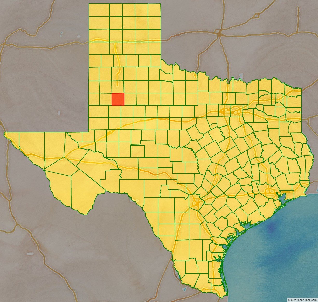
| Name: | Lynn County |
|---|---|
| FIPS code: | 48-305 |
| State: | Texas |
| Founded: | 1903 |
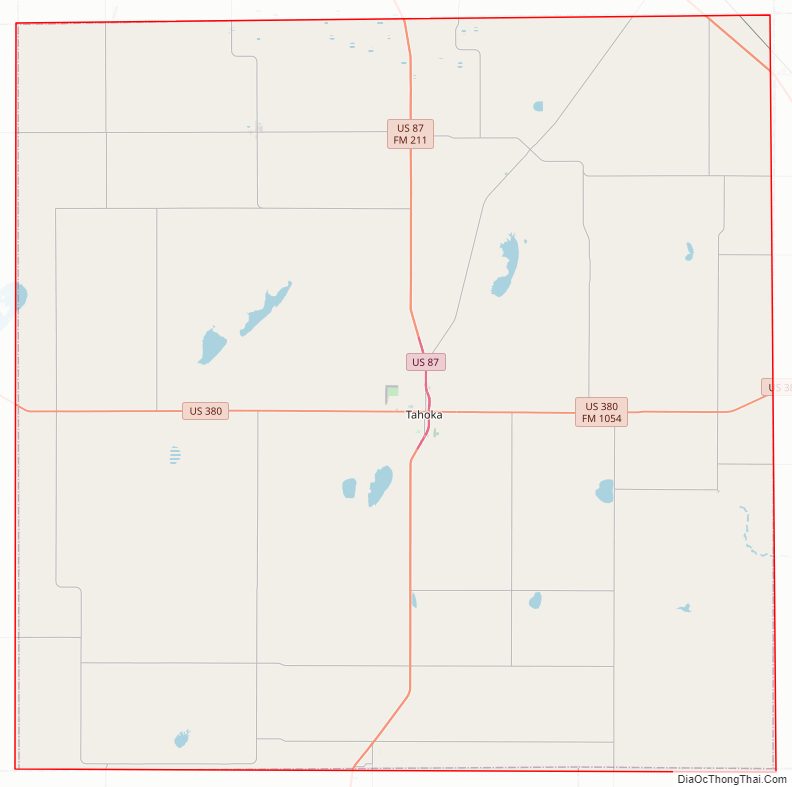
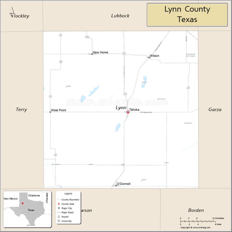
| Seat: | Tahoka |
| Largest city: | Tahoka |
| Total Area: | 893 sq mi (2,310 km²) |
| Land Area: | 892 sq mi (2,310 km²) |
| Total Population: | 5,596 |
| Population Density: | 6.3/sq mi (2.4/km²) |
| Time zone: | UTC−6 (Central) |
| Summer Time Zone (DST): | UTC−5 (CDT) |
| Website: | www.co.lynn.tx.us |
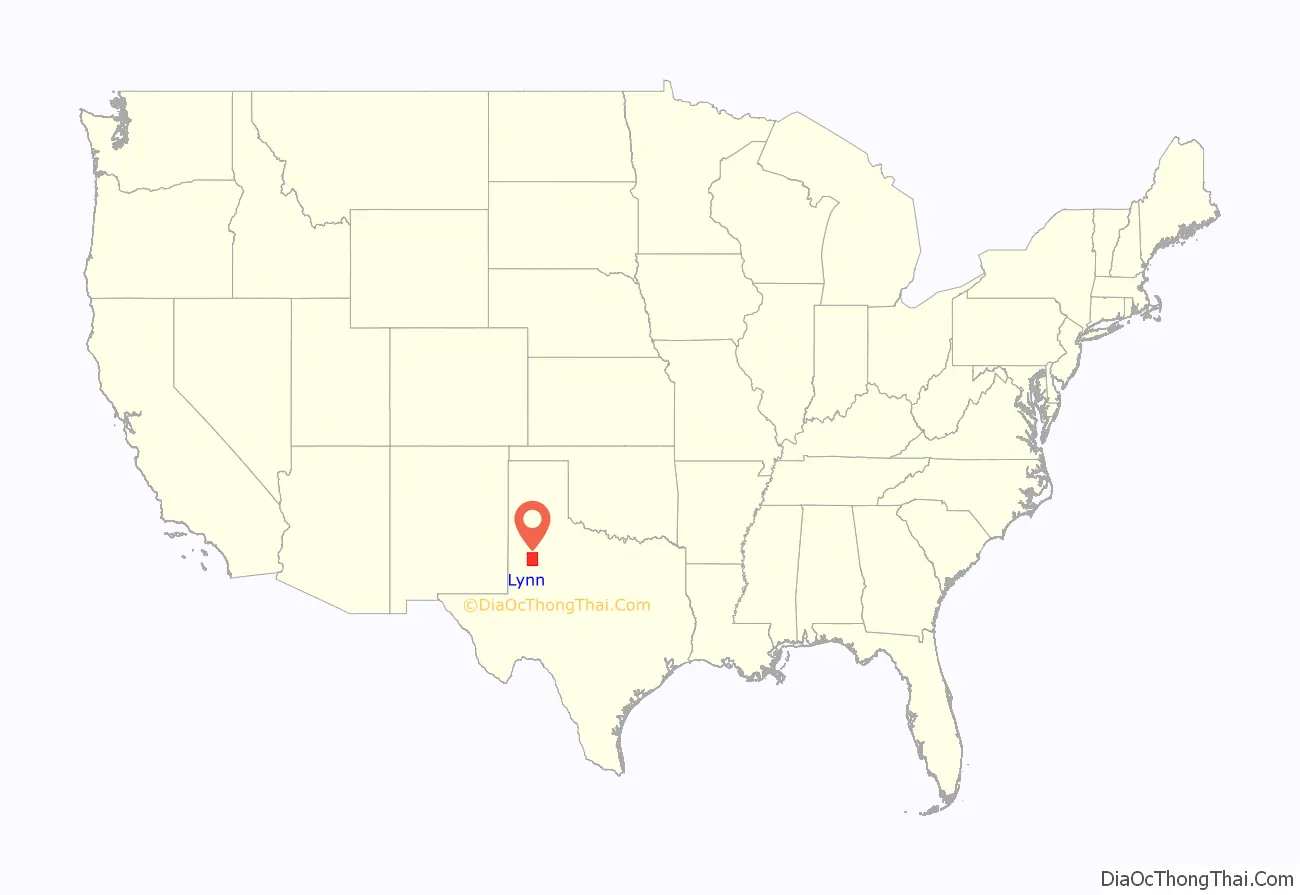
Lynn County location map. Where is Lynn County?
History
Native Americans
Apache and Comanche peoples roamed the high plains until various military expeditions of the 19th century pushed them away.
The Red River War of 1874 was a military campaign to drive out the Apaches, Comanches, and Kiowas in Texas. In 1877, the ill-fated Nolan Expedition crossed the county in search of livestock stolen by Comanche renegades. The various Indian tribes had moved on by the time of white settlement due to the depletion of the buffalo herds by hunters.
Settlers
In the early 1880s, sheep and cattle ranchers began to set up operations in the county. The situation changed as large-scale ranching spread into the county.
W C. Young of Fort Worth and Illinois Irishman Ben Galbraith established the beginnings of the Curry Comb Ranch in the northwest part of Garza County. By 1880, it spilled over into Lynn County. The Square Compass Ranch of Garza County also protruded into Lynn County.
The county remained sparsely settled ranching territory for two decades after 1880. It had no towns; the population was nine in 1880, 24 in 1890, and 17 in 1900. Farmers began to move into the county and invest in corn, grains, and cotton.
County established
Lynn County was formed in 1876 from Bexar. The county was organized in 1903, with Tahoka becoming the county seat.
New towns were founded during the early years of the 20th century. O’Donnell, named for railroad man Tom J. O’Donnell, was established in 1910 as a speculative venture based on the opening up of new farmlands in southern Lynn and northern Dawson Counties. Wilson, 13 miles (19 km) northeast of Tahoka, was established in 1912 to attract farmers to the newly opened lands of the Dixie Ranch. A large number of Central Texas Germans purchased county lands, thus beginning a small-scale migration of Germans into the county that lasted into the 1950s.
Cotton farming prospered in the early part of the 20th century. Farmers later expanded to wheat and sorghum, plus cattle, sheep, hogs, and poultry, chiefly chickens and turkeys.
Oil was discovered in the county in 1950. By 1983, the total production was 10,612,550 barrels (1,687,261 m).
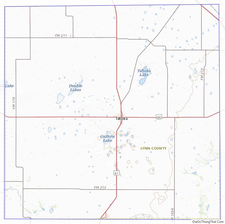
Lynn County Road Map
Geography
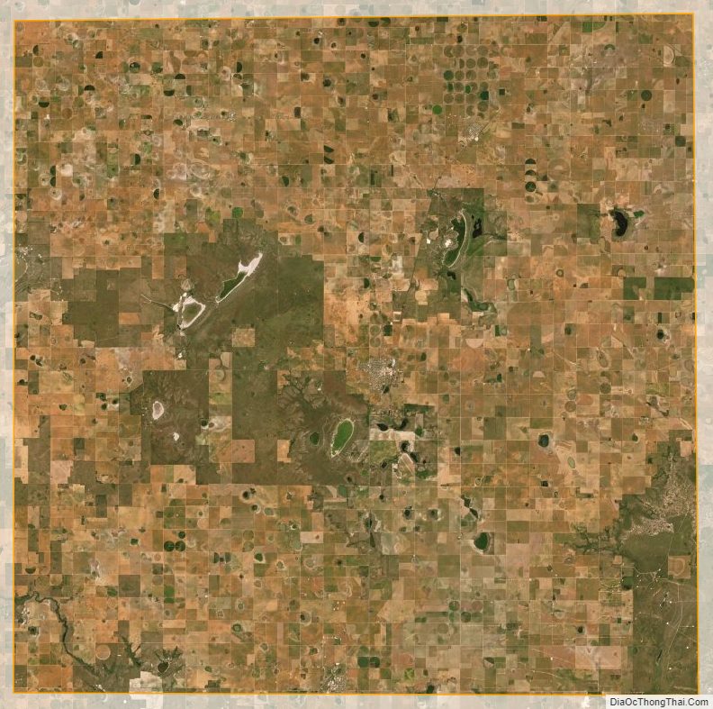
According to the U.S. Census Bureau, the county has an area of 893 square miles (2,310 km), of which 892 square miles (2,310 km) is land and 1.6 square miles (4.1 km) (0.2%) is covered by water.
Geographic features
- Caprock Escarpment, eastern edge of Lynn County
- Double Mountain Fork Brazos River, begins as a small depression between Draw, Redwine, and Grassland, Texas.
- Double Lakes, northwest of Tahoka
- Guthrie Lake, southwest of Tahoka
- Tahoka Lake, northeast of Tahoka
Major highways
- U.S. Highway 84
- U.S. Highway 87
- U.S. Highway 380
Adjacent counties
- Lubbock County (north)
- Garza County (east)
- Borden County (southeast)
- Dawson County (south)
- Terry County (west)
- Hockley County (northwest)
Lynn County Topographic Map
Lynn County Satellite Map
Lynn County Outline Map

See also
Map of Texas State and its subdivision:- Anderson
- Andrews
- Angelina
- Aransas
- Archer
- Armstrong
- Atascosa
- Austin
- Bailey
- Bandera
- Bastrop
- Baylor
- Bee
- Bell
- Bexar
- Blanco
- Borden
- Bosque
- Bowie
- Brazoria
- Brazos
- Brewster
- Briscoe
- Brooks
- Brown
- Burleson
- Burnet
- Caldwell
- Calhoun
- Callahan
- Cameron
- Camp
- Carson
- Cass
- Castro
- Chambers
- Cherokee
- Childress
- Clay
- Cochran
- Coke
- Coleman
- Collin
- Collingsworth
- Colorado
- Comal
- Comanche
- Concho
- Cooke
- Coryell
- Cottle
- Crane
- Crockett
- Crosby
- Culberson
- Dallam
- Dallas
- Dawson
- Deaf Smith
- Delta
- Denton
- Dewitt
- Dickens
- Dimmit
- Donley
- Duval
- Eastland
- Ector
- Edwards
- El Paso
- Ellis
- Erath
- Falls
- Fannin
- Fayette
- Fisher
- Floyd
- Foard
- Fort Bend
- Franklin
- Freestone
- Frio
- Gaines
- Galveston
- Garza
- Gillespie
- Glasscock
- Goliad
- Gonzales
- Gray
- Grayson
- Gregg
- Grimes
- Guadalupe
- Hale
- Hall
- Hamilton
- Hansford
- Hardeman
- Hardin
- Harris
- Harrison
- Hartley
- Haskell
- Hays
- Hemphill
- Henderson
- Hidalgo
- Hill
- Hockley
- Hood
- Hopkins
- Houston
- Howard
- Hudspeth
- Hunt
- Hutchinson
- Irion
- Jack
- Jackson
- Jasper
- Jeff Davis
- Jefferson
- Jim Hogg
- Jim Wells
- Johnson
- Jones
- Karnes
- Kaufman
- Kendall
- Kenedy
- Kent
- Kerr
- Kimble
- King
- Kinney
- Kleberg
- Knox
- La Salle
- Lamar
- Lamb
- Lampasas
- Lavaca
- Lee
- Leon
- Liberty
- Limestone
- Lipscomb
- Live Oak
- Llano
- Loving
- Lubbock
- Lynn
- Madison
- Marion
- Martin
- Mason
- Matagorda
- Maverick
- McCulloch
- McLennan
- McMullen
- Medina
- Menard
- Midland
- Milam
- Mills
- Mitchell
- Montague
- Montgomery
- Moore
- Morris
- Motley
- Nacogdoches
- Navarro
- Newton
- Nolan
- Nueces
- Ochiltree
- Oldham
- Orange
- Palo Pinto
- Panola
- Parker
- Parmer
- Pecos
- Polk
- Potter
- Presidio
- Rains
- Randall
- Reagan
- Real
- Red River
- Reeves
- Refugio
- Roberts
- Robertson
- Rockwall
- Runnels
- Rusk
- Sabine
- San Augustine
- San Jacinto
- San Patricio
- San Saba
- Schleicher
- Scurry
- Shackelford
- Shelby
- Sherman
- Smith
- Somervell
- Starr
- Stephens
- Sterling
- Stonewall
- Sutton
- Swisher
- Tarrant
- Taylor
- Terrell
- Terry
- Throckmorton
- Titus
- Tom Green
- Travis
- Trinity
- Tyler
- Upshur
- Upton
- Uvalde
- Val Verde
- Van Zandt
- Victoria
- Walker
- Waller
- Ward
- Washington
- Webb
- Wharton
- Wheeler
- Wichita
- Wilbarger
- Willacy
- Williamson
- Wilson
- Winkler
- Wise
- Wood
- Yoakum
- Young
- Zapata
- Zavala
- Alabama
- Alaska
- Arizona
- Arkansas
- California
- Colorado
- Connecticut
- Delaware
- District of Columbia
- Florida
- Georgia
- Hawaii
- Idaho
- Illinois
- Indiana
- Iowa
- Kansas
- Kentucky
- Louisiana
- Maine
- Maryland
- Massachusetts
- Michigan
- Minnesota
- Mississippi
- Missouri
- Montana
- Nebraska
- Nevada
- New Hampshire
- New Jersey
- New Mexico
- New York
- North Carolina
- North Dakota
- Ohio
- Oklahoma
- Oregon
- Pennsylvania
- Rhode Island
- South Carolina
- South Dakota
- Tennessee
- Texas
- Utah
- Vermont
- Virginia
- Washington
- West Virginia
- Wisconsin
- Wyoming