Mackinac County (/ˈmækənɔː/ MAK-ə-naw) is a county in the Upper Peninsula of the U.S. state of Michigan. As of the 2020 Census, the population was 10,834. The county seat is St. Ignace. Formerly known as Michilimackinac County, in 1818 it was one of the first counties of the Michigan Territory, as it had long been a center of French and British colonial fur trading, a Catholic church and Protestant mission, and associated settlement.
The county’s name is shortened from “Michilimackinac“, which referred to the Straits of Mackinac area as well as the French settlement at the tip of the lower peninsula.
| Name: | Mackinac County |
|---|---|
| FIPS code: | 26-097 |
| State: | Michigan |
| Founded: | October 26, 1818 organized 1849 |
| Named for: | Straits of Mackinac |
| Seat: | St. Ignace |
| Largest city: | St. Ignace |
| Total Area: | 2,101 sq mi (5,440 km²) |
| Land Area: | 1,022 sq mi (2,650 km²) |
| Total Population: | 10,834 |
| Population Density: | 11/sq mi (4/km²) |
| Time zone: | UTC−5 (Eastern) |
| Summer Time Zone (DST): | UTC−4 (EDT) |
| Website: | www.mackinaccounty.net |
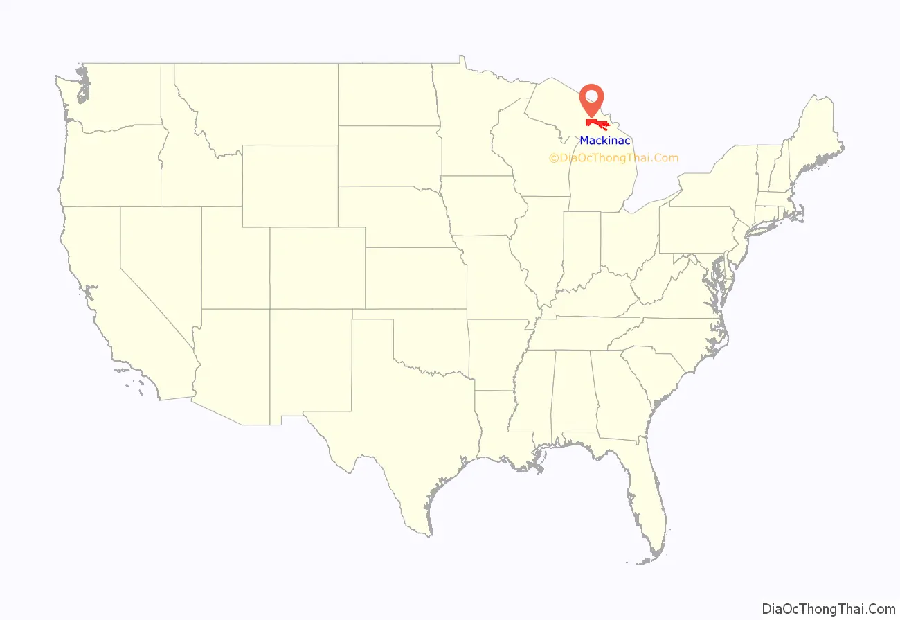
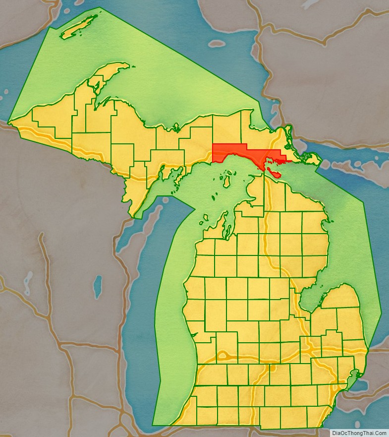
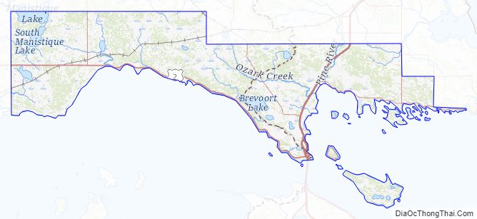
Mackinac County location map. Where is Mackinac County?
History
Michilimackinac County was created on October 26, 1818, by proclamation of territorial governor Lewis Cass. The county originally encompassed the Lower Peninsula of Michigan north of Macomb County and almost the entire present Upper Peninsula. As later counties were settled and organized, they were divided from this territory.
On March 9, 1843, Michigan divided the Upper Peninsula into six counties. At this time, the County of Michilimackinac included the portion of the Upper Peninsula closest to the Straits of Mackinac, plus several islands, but none of the Lower Peninsula.
At the time of founding, the county seat was the community of Michilimackinac Island on Michilimackinac Island, later known as Mackinac Island, Michigan. This has been an important center for fur trading before the 1830s, when European demand declined. The county was organized in 1849 as Mackinac County. In 1882 the county seat was moved from Mackinac Island to St. Ignace, Michigan, which had been founded as a French Jesuit mission village during the colonial years.
Mackinac County is home to the Mackinac Bands of Chippewa and Ottawa Indians, a Native American tribe located in St. Ignace.
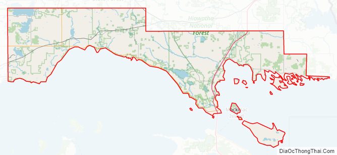
Mackinac County Road Map
Geography
According to the U.S. Census Bureau, the county has a total area of 2,101 square miles (5,440 km), of which 1,022 square miles (2,650 km) is land and 1,079 square miles (2,790 km) (51%) is water. Mackinac County lies at the boundary of Lake Huron and Lake Michigan.
St. Ignace is the northern terminus of the Mackinac Bridge. Mackinac Island is within the county.
Due to its sparse population, the county has no weather stations.
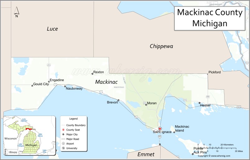
Adjacent counties
By land
- Chippewa County (northeast)
- Luce County (northwest)
- Schoolcraft County (west)
By water
- Presque Isle County (southeast)
- Cheboygan County (south)
- Emmet County (south)
- Charlevoix County (southwest)
National protected area
- Hiawatha National Forest (part)
Mackinac County Topographic Map
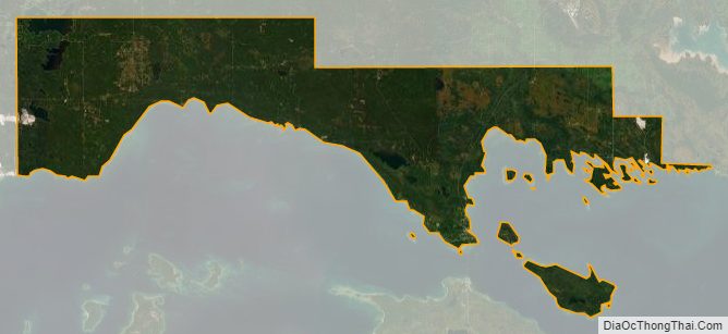
Mackinac County Satellite Map
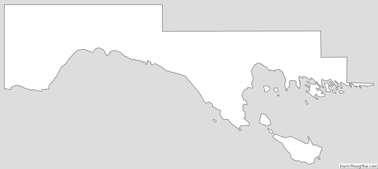
Mackinac County Outline Map
See also
Map of Michigan State and its subdivision:- Alcona
- Alger
- Allegan
- Alpena
- Antrim
- Arenac
- Baraga
- Barry
- Bay
- Benzie
- Berrien
- Branch
- Calhoun
- Cass
- Charlevoix
- Cheboygan
- Chippewa
- Clare
- Clinton
- Crawford
- Delta
- Dickinson
- Eaton
- Emmet
- Genesee
- Gladwin
- Gogebic
- Grand Traverse
- Gratiot
- Hillsdale
- Houghton
- Huron
- Ingham
- Ionia
- Iosco
- Iron
- Isabella
- Jackson
- Kalamazoo
- Kalkaska
- Kent
- Keweenaw
- Lake
- Lake Hurron
- Lake Michigan
- Lake St. Clair
- Lake Superior
- Lapeer
- Leelanau
- Lenawee
- Livingston
- Luce
- Mackinac
- Macomb
- Manistee
- Marquette
- Mason
- Mecosta
- Menominee
- Midland
- Missaukee
- Monroe
- Montcalm
- Montmorency
- Muskegon
- Newaygo
- Oakland
- Oceana
- Ogemaw
- Ontonagon
- Osceola
- Oscoda
- Otsego
- Ottawa
- Presque Isle
- Roscommon
- Saginaw
- Saint Clair
- Saint Joseph
- Sanilac
- Schoolcraft
- Shiawassee
- Tuscola
- Van Buren
- Washtenaw
- Wayne
- Wexford
- Alabama
- Alaska
- Arizona
- Arkansas
- California
- Colorado
- Connecticut
- Delaware
- District of Columbia
- Florida
- Georgia
- Hawaii
- Idaho
- Illinois
- Indiana
- Iowa
- Kansas
- Kentucky
- Louisiana
- Maine
- Maryland
- Massachusetts
- Michigan
- Minnesota
- Mississippi
- Missouri
- Montana
- Nebraska
- Nevada
- New Hampshire
- New Jersey
- New Mexico
- New York
- North Carolina
- North Dakota
- Ohio
- Oklahoma
- Oregon
- Pennsylvania
- Rhode Island
- South Carolina
- South Dakota
- Tennessee
- Texas
- Utah
- Vermont
- Virginia
- Washington
- West Virginia
- Wisconsin
- Wyoming