Macomb County (/məˈkoʊm/ mə-KOHM) is a county located in the eastern portion of the U.S. state of Michigan, bordering Lake St. Clair, and is part of northern Metro Detroit. As of the 2020 Census, the population was 881,217, making it the third-most populous county in the state. The county seat is Mt. Clemens. Macomb County is part of the Detroit-Warren-Dearborn, MI Metropolitan Statistical Area. The city of Detroit is located south of the county’s southern border. Macomb County contains 27 cities, townships and villages, including three of the top ten most-populous municipalities in Michigan as of the 2010 census: Warren (#3), Sterling Heights (#4) and Clinton Township (#10). Most of this population is concentrated south of Hall Road (M-59), one of the county’s main thoroughfares.
| Name: | Macomb County |
|---|---|
| FIPS code: | 26-099 |
| State: | Michigan |
| Founded: | January 15, 1818 |
| Named for: | Alexander Macomb |
| Seat: | Mount Clemens |
| Largest city: | Warren |
| Total Area: | 571 sq mi (1,480 km²) |
| Land Area: | 479 sq mi (1,240 km²) |
| Total Population: | 881,217 |
| Population Density: | 1,819/sq mi (702/km²) |
| Time zone: | UTC−5 (Eastern) |
| Summer Time Zone (DST): | UTC−4 (EDT) |
| Website: | macombgov.org |
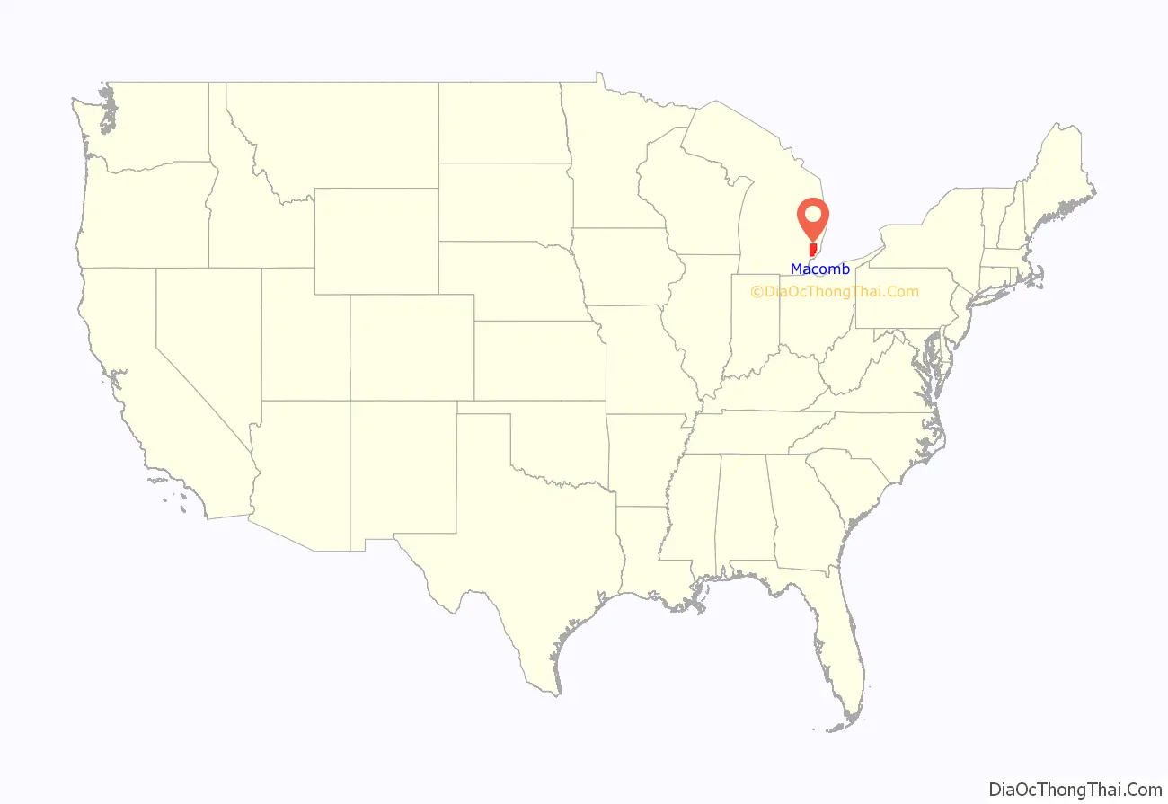
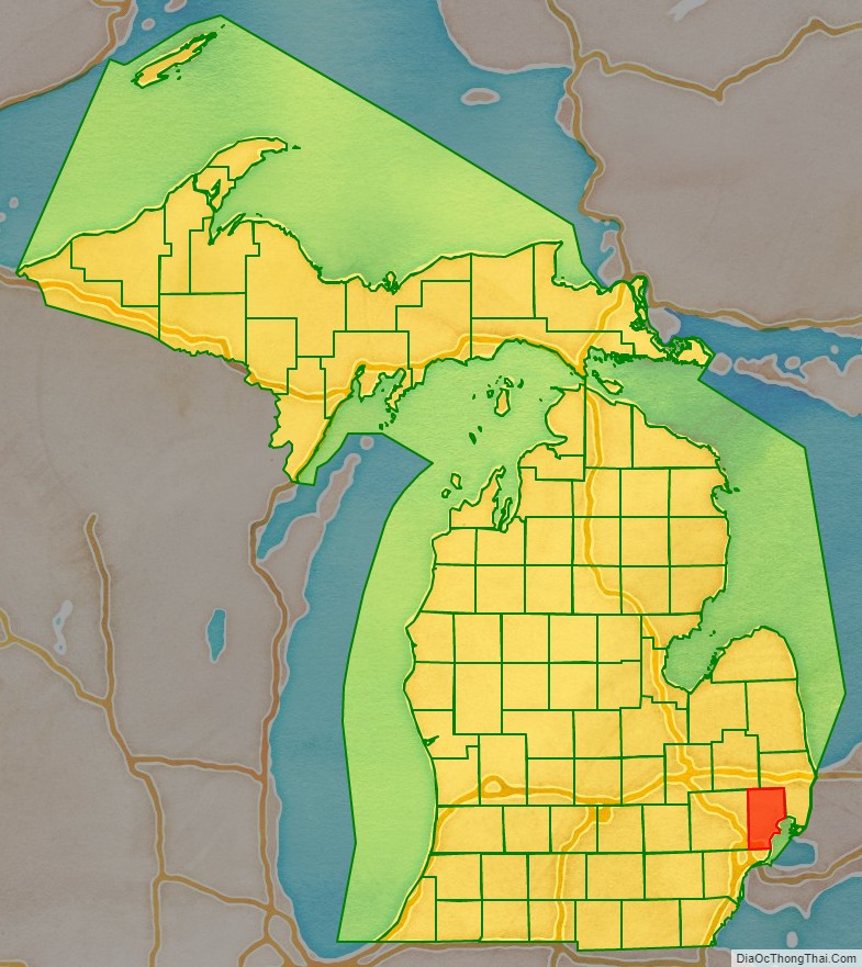
Macomb County location map. Where is Macomb County?
History
The Ojibwe lived in the area for centuries before European contact and were preceded by other cultures of ancient indigenous peoples.
The first European colonizers were French, and they arrived in the area during the 17th century. Other early settlers were French fur trappers, who sometimes married Ojibwe women, and Jesuit missionaries. A Moravian colony was established in the county in the late 18th century. In addition to the original French and English settlers, later immigrants included Germans, Belgians, and others from Europe. In the 19th century, the county received many European-American migrants from New York and New England, who were attracted to the area for land and booming jobs in the lumber and other resource industries.
Macomb County was formally organized on January 15, 1818, as the third county in the Michigan Territory. The county was named in honor of Detroit-born Alexander Macomb, Jr., a highly decorated veteran of the War of 1812 and hero of the Battle of Plattsburg. He was made Commanding General of the U.S. Army in 1828.
As was typical in development, the county at first encompassed a much larger area than at present. As population increased in the area, the state legislature removed territory in 1819 and 1820 to form the counties of Oakland, Lapeer, Genesee, and St. Clair.
In May 2008, Macomb County voters approved the inclusion of a County Executive in a new charter to be submitted to the voters by 2010. A charter commission was elected in November 2008 to draft a charter for submission to Governor Granholm, which was submitted and approved and placed on the November 2009 ballot. The Charter passed with a 60.4% to 39.6% margin.
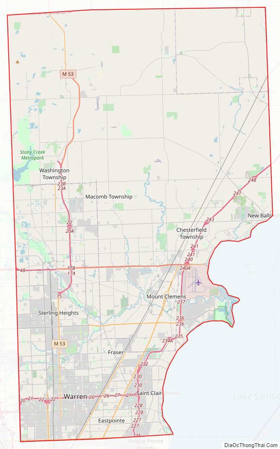
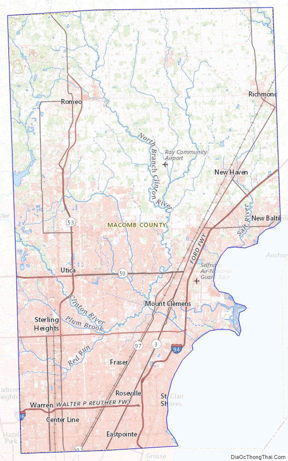
Macomb County Road Map
Geography
According to the U.S. Census Bureau, the county has a total area of 571 square miles (1,480 km), of which 479 square miles (1,240 km) is land and 92 square miles (240 km) (16%) is water. The county’s southeastern border with Canada is located across Lake St. Clair.
Lake St. Clair borders the county on the east.
Macomb County is mostly considered a part of Southeast Michigan. However, the far northern parts of the county, including Richmond and Armada, are often considered to be part of Michigan’s Thumb region.
The county comprises mostly rural/agricultural communities to the north and a mix of suburban and urban areas to the south.
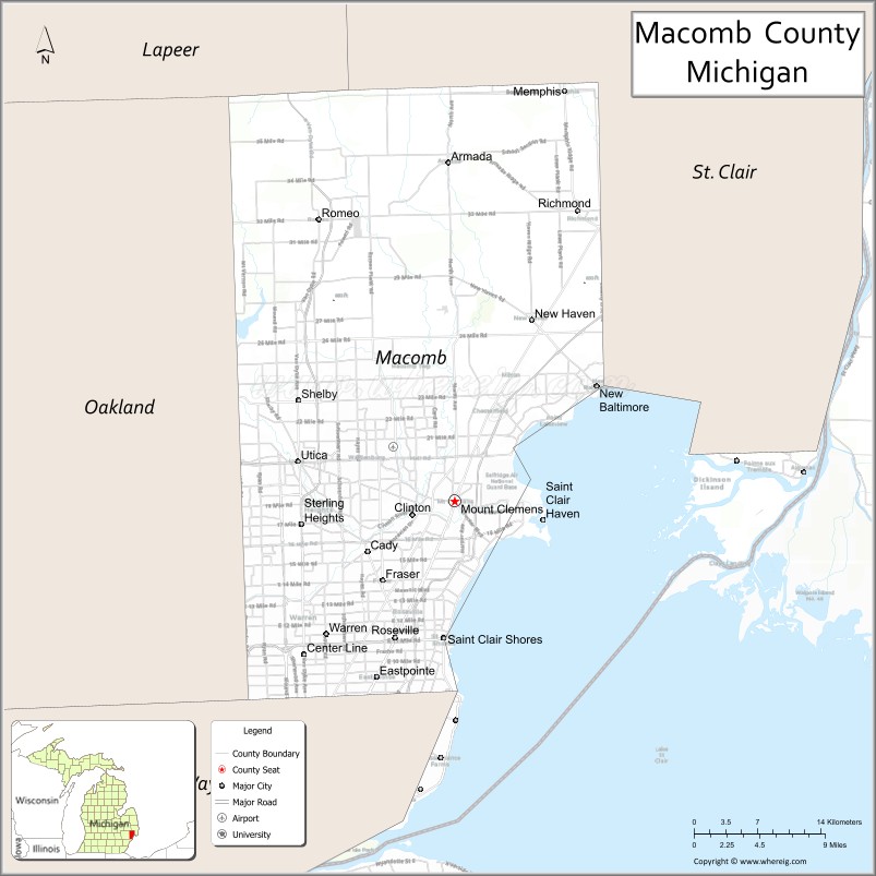
Adjacent counties
By land
- St. Clair County, Michigan – northeast
- Lapeer County, Michigan – northwest
- Oakland County, Michigan – west
- Wayne County, Michigan – south
By water
- Lambton County, Ontario, Canada – southeast
Macomb County Topographic Map
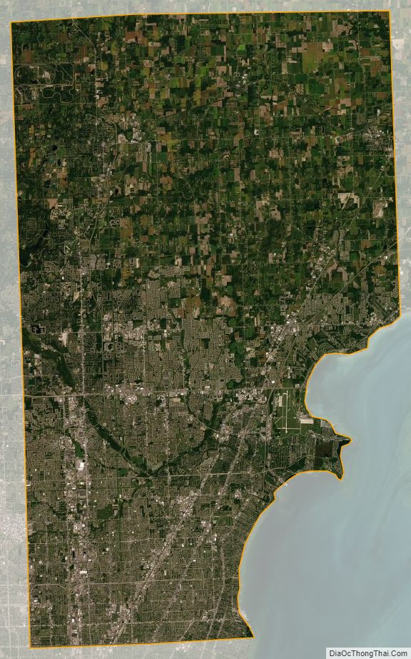
Macomb County Satellite Map
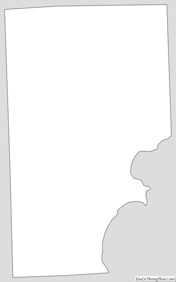
Macomb County Outline Map
See also
Map of Michigan State and its subdivision:- Alcona
- Alger
- Allegan
- Alpena
- Antrim
- Arenac
- Baraga
- Barry
- Bay
- Benzie
- Berrien
- Branch
- Calhoun
- Cass
- Charlevoix
- Cheboygan
- Chippewa
- Clare
- Clinton
- Crawford
- Delta
- Dickinson
- Eaton
- Emmet
- Genesee
- Gladwin
- Gogebic
- Grand Traverse
- Gratiot
- Hillsdale
- Houghton
- Huron
- Ingham
- Ionia
- Iosco
- Iron
- Isabella
- Jackson
- Kalamazoo
- Kalkaska
- Kent
- Keweenaw
- Lake
- Lake Hurron
- Lake Michigan
- Lake St. Clair
- Lake Superior
- Lapeer
- Leelanau
- Lenawee
- Livingston
- Luce
- Mackinac
- Macomb
- Manistee
- Marquette
- Mason
- Mecosta
- Menominee
- Midland
- Missaukee
- Monroe
- Montcalm
- Montmorency
- Muskegon
- Newaygo
- Oakland
- Oceana
- Ogemaw
- Ontonagon
- Osceola
- Oscoda
- Otsego
- Ottawa
- Presque Isle
- Roscommon
- Saginaw
- Saint Clair
- Saint Joseph
- Sanilac
- Schoolcraft
- Shiawassee
- Tuscola
- Van Buren
- Washtenaw
- Wayne
- Wexford
- Alabama
- Alaska
- Arizona
- Arkansas
- California
- Colorado
- Connecticut
- Delaware
- District of Columbia
- Florida
- Georgia
- Hawaii
- Idaho
- Illinois
- Indiana
- Iowa
- Kansas
- Kentucky
- Louisiana
- Maine
- Maryland
- Massachusetts
- Michigan
- Minnesota
- Mississippi
- Missouri
- Montana
- Nebraska
- Nevada
- New Hampshire
- New Jersey
- New Mexico
- New York
- North Carolina
- North Dakota
- Ohio
- Oklahoma
- Oregon
- Pennsylvania
- Rhode Island
- South Carolina
- South Dakota
- Tennessee
- Texas
- Utah
- Vermont
- Virginia
- Washington
- West Virginia
- Wisconsin
- Wyoming