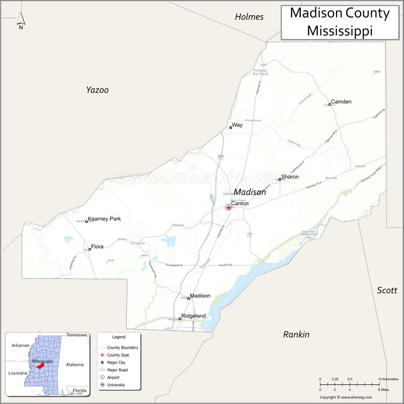
Madison County is a county located in the U.S. state of Mississippi. As of the 2020 census, the population was 109,145. The county seat is Canton. The county is named for U.S. President James Madison.
Madison County is part of the Jackson, MS Metropolitan Statistical Area.
| Name: | Madison County |
|---|---|
| FIPS code: | 28-089 |
| State: | Mississippi |
| Founded: | January 29, 1828 |
| Named for: | James Madison |
| Seat: | Canton |
| Largest city: | Madison |
| Total Area: | 742 sq mi (1,920 km²) |
| Land Area: | 715 sq mi (1,850 km²) |
| Total Population: | 109,145 |
| Population Density: | 150/sq mi (57/km²) |
| Time zone: | UTC−6 (Central) |
| Summer Time Zone (DST): | UTC−5 (CDT) |
| Website: | www.madison-co.com |
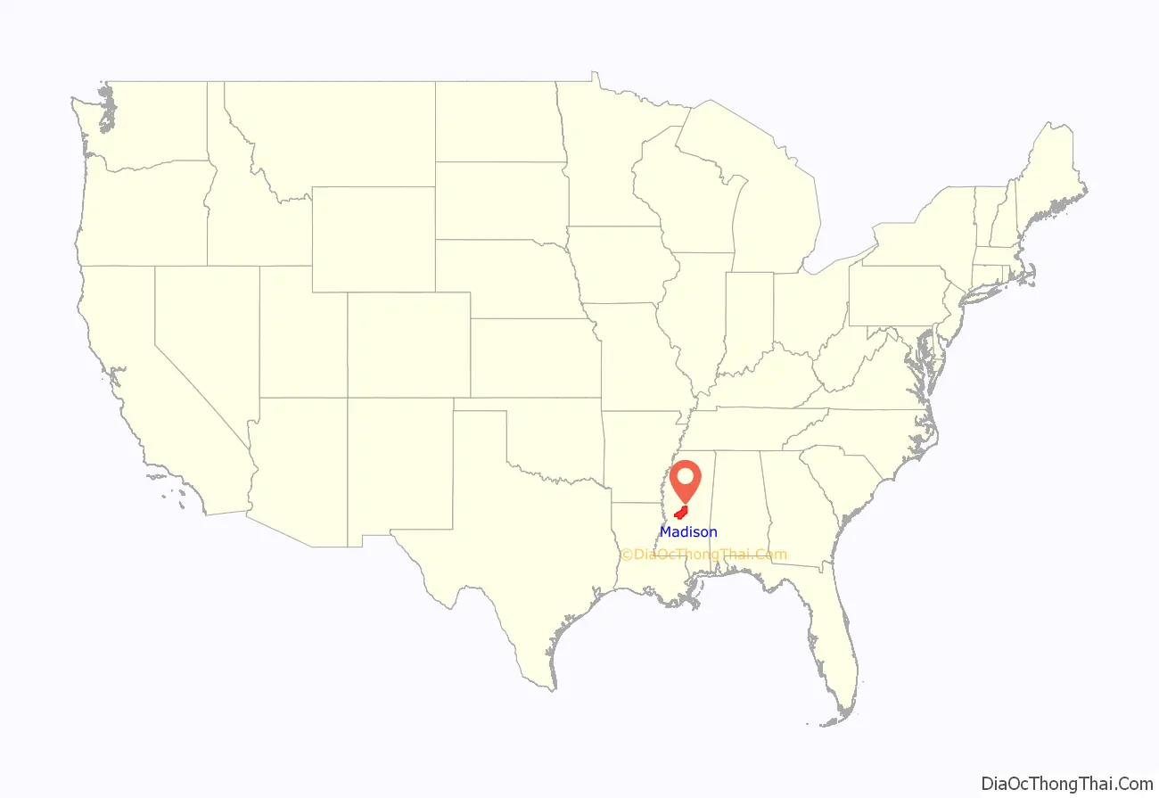
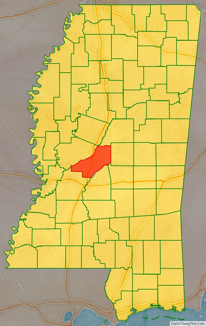
Madison County location map. Where is Madison County?
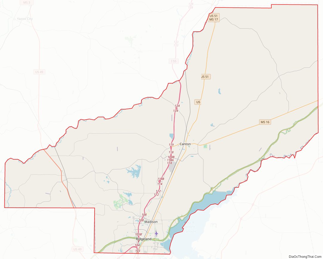
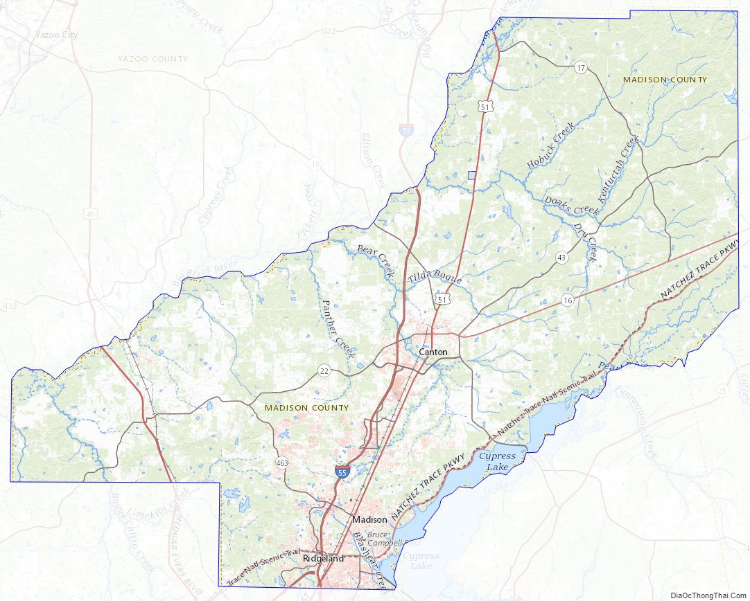
Madison County Road Map
Geography
According to the U.S. Census Bureau, the county has a total area of 742 square miles (1,920 km), of which 715 square miles (1,850 km) is land and 27 square miles (70 km) (3.7%) is water. The southeastern border of the county is defined by the old course of the Pearl River before it was dammed to create the 33,000 acres (130 km) Ross Barnett Reservoir.
The boundaries of the county are set in Mississippi Code section 19-1-89 as: Madison County is bounded by beginning at a point on Big Black River, where the same crosses the center line in township twelve, range three, east; thence east to the old Choctaw boundary line; thence north on said boundary line to the center line of township twelve, range five, east; thence through the center of said township twelve, range five, east, to the range line between townships five and six, east; thence south on said range line to Pearl River; thence down said river, with its meanderings, to the line between townships six and seven, north; thence west on said township line to the basis meridian of the Choctaw survey; thence north on said meridian line to the line between townships seven and eight, north; thence west on said township line to the line between ranges two and three, west; thence north on said range line to Big Black River; thence up said river, with its meanderings, to the beginning.
Major highways
- Interstate 55
- U.S. Highway 49
- U.S. Highway 51
- Mississippi Highway 16
- Mississippi Highway 17
- Mississippi Highway 22
- Mississippi Highway 43
- Natchez Trace Parkway
Adjacent counties
- Attala County (north)
- Leake County (east)
- Scott County (southeast)
- Rankin County (south)
- Hinds County (southwest)
- Yazoo County (west)
National protected area
- Natchez Trace Parkway (part)
Madison County Topographic Map
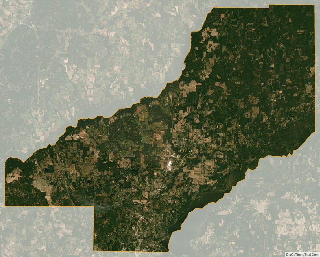
Madison County Satellite Map
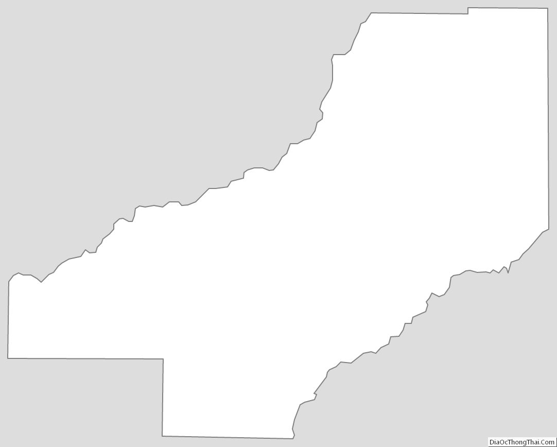
Madison County Outline Map
See also
Map of Mississippi State and its subdivision:- Adams
- Alcorn
- Amite
- Attala
- Benton
- Bolivar
- Calhoun
- Carroll
- Chickasaw
- Choctaw
- Claiborne
- Clarke
- Clay
- Coahoma
- Copiah
- Covington
- Desoto
- Forrest
- Franklin
- George
- Greene
- Grenada
- Hancock
- Harrison
- Hinds
- Holmes
- Humphreys
- Issaquena
- Itawamba
- Jackson
- Jasper
- Jefferson
- Jefferson Davis
- Jones
- Kemper
- Lafayette
- Lamar
- Lauderdale
- Lawrence
- Leake
- Lee
- Leflore
- Lincoln
- Lowndes
- Madison
- Marion
- Marshall
- Monroe
- Montgomery
- Neshoba
- Newton
- Noxubee
- Oktibbeha
- Panola
- Pearl River
- Perry
- Pike
- Pontotoc
- Prentiss
- Quitman
- Rankin
- Scott
- Sharkey
- Simpson
- Smith
- Stone
- Sunflower
- Tallahatchie
- Tate
- Tippah
- Tishomingo
- Tunica
- Union
- Walthall
- Warren
- Washington
- Wayne
- Webster
- Wilkinson
- Winston
- Yalobusha
- Yazoo
- Alabama
- Alaska
- Arizona
- Arkansas
- California
- Colorado
- Connecticut
- Delaware
- District of Columbia
- Florida
- Georgia
- Hawaii
- Idaho
- Illinois
- Indiana
- Iowa
- Kansas
- Kentucky
- Louisiana
- Maine
- Maryland
- Massachusetts
- Michigan
- Minnesota
- Mississippi
- Missouri
- Montana
- Nebraska
- Nevada
- New Hampshire
- New Jersey
- New Mexico
- New York
- North Carolina
- North Dakota
- Ohio
- Oklahoma
- Oregon
- Pennsylvania
- Rhode Island
- South Carolina
- South Dakota
- Tennessee
- Texas
- Utah
- Vermont
- Virginia
- Washington
- West Virginia
- Wisconsin
- Wyoming