Madison County is a county located in the central portion of the U.S. state of Ohio. As of the 2020 census, the population was 43,824. Its county seat is London. The county is named for James Madison, President of the United States and was established on March 1, 1810.
Madison County is part of the Columbus, OH Metropolitan Statistical Area.
In 2008, Madison County, which spans Interstates 70 and 71 as they converge on Columbus, was cited by the Ohio State Highway Patrol as leading the state for the most speeding tickets 20-mph or more over the posted limit. Despite a population of around 42,000 in 2006, over 7,700 such tickets were issued in three years. Three of Madison County’s 18 fatal crashes in 2006 and 2007 occurred on interstates. Madison County is also home to the Ohio Peace Officer Training Academy, the Ohio Bureau of Criminal Identification & Investigation, and several prison facilities.
| Name: | Madison County |
|---|---|
| FIPS code: | 39-097 |
| State: | Ohio |
| Founded: | February 16, 1810 |
| Named for: | James Madison |
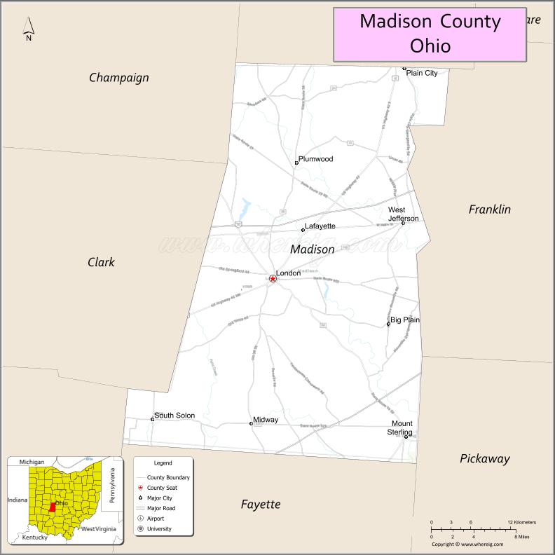
| Seat: | London |
| Largest city: | London |
| Total Area: | 467 sq mi (1,210 km²) |
| Land Area: | 466 sq mi (1,210 km²) |
| Total Population: | 43,824 |
| Population Density: | 94/sq mi (36/km²) |
| Time zone: | UTC−5 (Eastern) |
| Summer Time Zone (DST): | UTC−4 (EDT) |
| Website: | www.co.madison.oh.us |
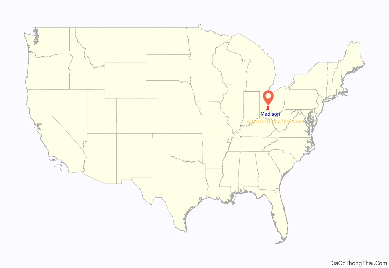
Madison County location map. Where is Madison County?

History
In 1850, Madison County contained 24 churches and one newspaper office, had a total population of 10,015, and the county’s public school system had 3838 pupils. With agriculture as the primary business, that same year the county produced 726,451 bushels of corn, 19,308 tons of hay, 120,696 pounds of wool, and 128,948 pounds of butter. In 1900, the county had a population of 20,590.
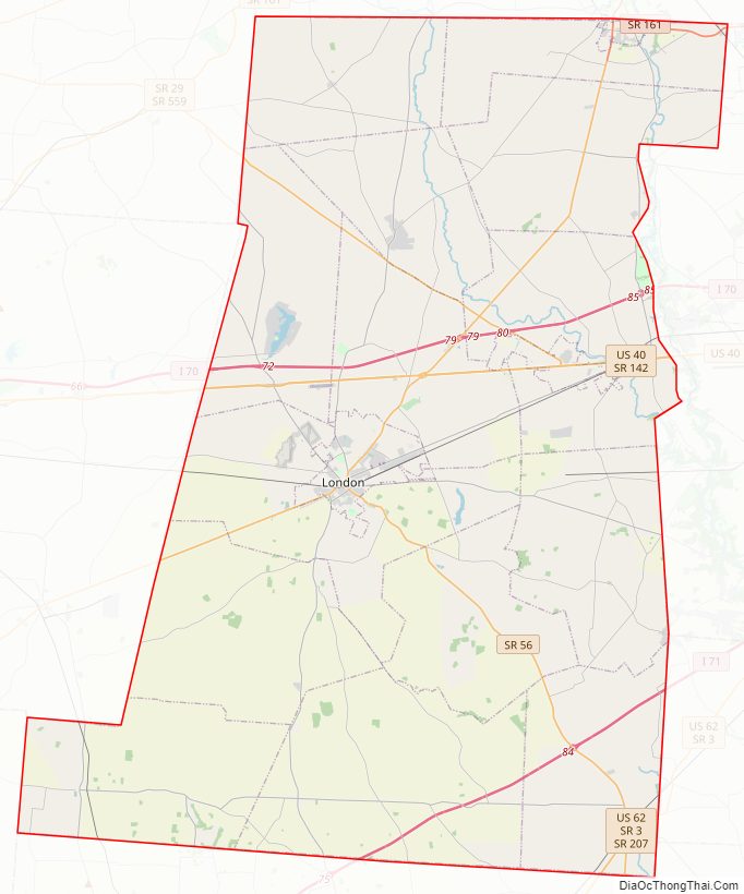
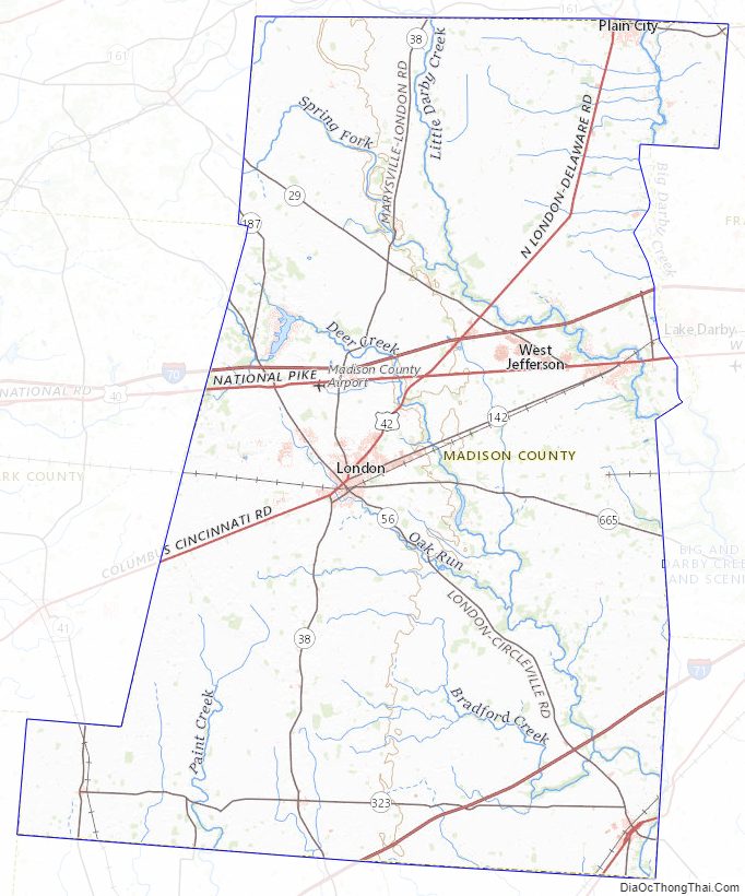
Madison County Road Map
Geography
According to the U.S. Census Bureau, the county has a total area of 467 square miles (1,210 km), of which 466 square miles (1,210 km) is land and 0.8 square miles (2.1 km) (0.2%) is water.
Adjacent counties
- Union County (north)
- Franklin County (east)
- Pickaway County (southeast)
- Fayette County (south)
- Greene County (southwest)
- Clark County (west)
- Champaign County (northwest)
Madison County Topographic Map
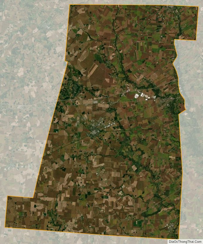
Madison County Satellite Map
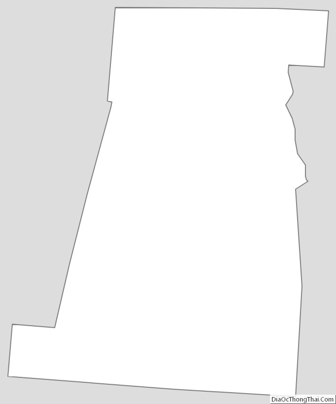
Madison County Outline Map
See also
Map of Ohio State and its subdivision:- Adams
- Allen
- Ashland
- Ashtabula
- Athens
- Auglaize
- Belmont
- Brown
- Butler
- Carroll
- Champaign
- Clark
- Clermont
- Clinton
- Columbiana
- Coshocton
- Crawford
- Cuyahoga
- Darke
- Defiance
- Delaware
- Erie
- Fairfield
- Fayette
- Franklin
- Fulton
- Gallia
- Geauga
- Greene
- Guernsey
- Hamilton
- Hancock
- Hardin
- Harrison
- Henry
- Highland
- Hocking
- Holmes
- Huron
- Jackson
- Jefferson
- Knox
- Lake
- Lake Erie
- Lawrence
- Licking
- Logan
- Lorain
- Lucas
- Madison
- Mahoning
- Marion
- Medina
- Meigs
- Mercer
- Miami
- Monroe
- Montgomery
- Morgan
- Morrow
- Muskingum
- Noble
- Ottawa
- Paulding
- Perry
- Pickaway
- Pike
- Portage
- Preble
- Putnam
- Richland
- Ross
- Sandusky
- Scioto
- Seneca
- Shelby
- Stark
- Summit
- Trumbull
- Tuscarawas
- Union
- Van Wert
- Vinton
- Warren
- Washington
- Wayne
- Williams
- Wood
- Wyandot
- Alabama
- Alaska
- Arizona
- Arkansas
- California
- Colorado
- Connecticut
- Delaware
- District of Columbia
- Florida
- Georgia
- Hawaii
- Idaho
- Illinois
- Indiana
- Iowa
- Kansas
- Kentucky
- Louisiana
- Maine
- Maryland
- Massachusetts
- Michigan
- Minnesota
- Mississippi
- Missouri
- Montana
- Nebraska
- Nevada
- New Hampshire
- New Jersey
- New Mexico
- New York
- North Carolina
- North Dakota
- Ohio
- Oklahoma
- Oregon
- Pennsylvania
- Rhode Island
- South Carolina
- South Dakota
- Tennessee
- Texas
- Utah
- Vermont
- Virginia
- Washington
- West Virginia
- Wisconsin
- Wyoming