Manatee County is a county in the U.S. state of Florida. As of the 2020 US Census, the population was 399,710. Manatee County is part of the Bradenton-Sarasota-Venice, Florida Metropolitan Statistical Area. Its county seat and largest city is Bradenton. The county was created in 1855 and named for the Florida manatee, Florida’s official marine mammal. Features of Manatee County include access to the southern part of the Tampa Bay estuary, the Sunshine Skyway Bridge, and the Manatee River.
| Name: | Manatee County |
|---|---|
| FIPS code: | 12-081 |
| State: | Florida |
| Founded: | January 9, 1855 |
| Named for: | Florida manatee |
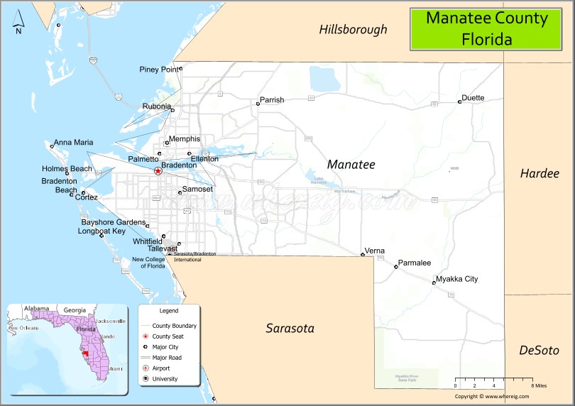
| Seat: | Bradenton |
| Largest city: | Bradenton |
| Total Area: | 893 sq mi (2,310 km²) |
| Land Area: | 743 sq mi (1,920 km²) |
| Total Population: | 399,710 |
| Population Density: | 538/sq mi (208/km²) |
| Time zone: | UTC−5 (Eastern) |
| Summer Time Zone (DST): | UTC−4 (EDT) |
| Website: | www.mymanatee.org |
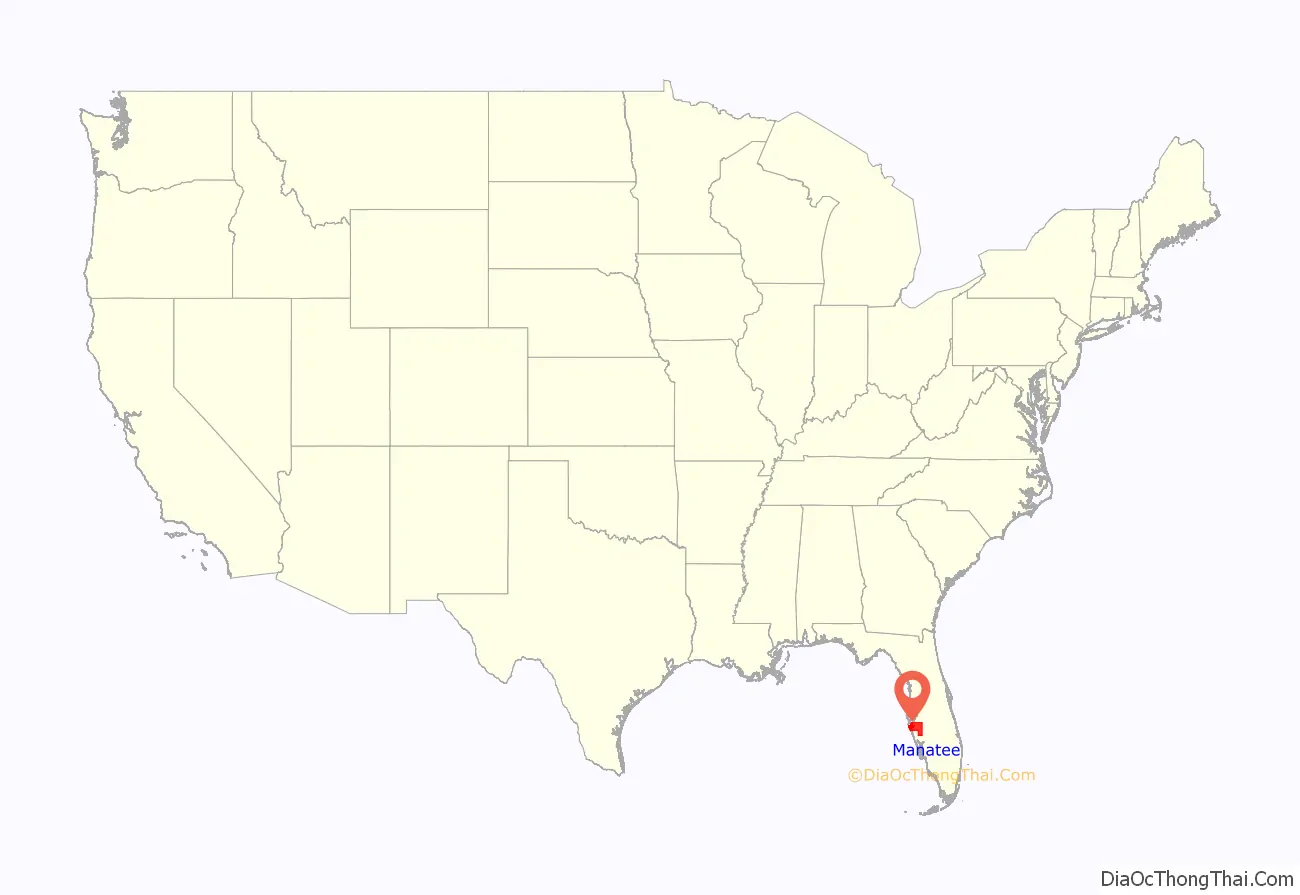
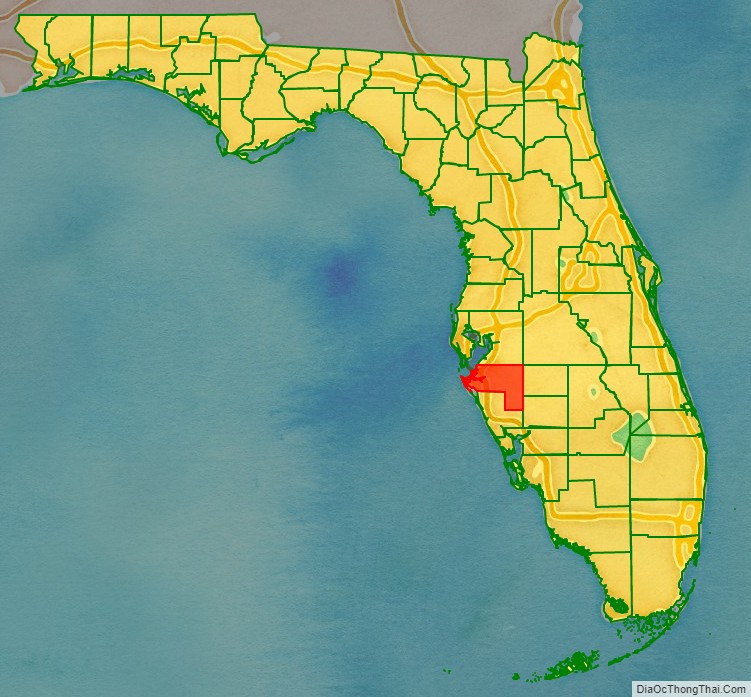
Manatee County location map. Where is Manatee County?
History
Prehistoric history
The area now known as Manatee County had been inhabited by Native Americans for thousands of years. Shell middens and other archaeological digs have been conducted throughout the county including at Terra Ceia and at Perico Island. These digs revealed materials belonging to peoples from the Woodland period.
European exploration and early settlement
Some historians have suggested that the southern mouth of the Manatee River was the landing site of the De Soto Expedition.
Due to conflict during the Patriot War and First Seminole War, many African Americans fled north Florida and some settled in modern-day Bradenton. The settlement they founded on the Manatee River was called Angola. By 1819, the population of Angola possibly reached as high as 600-700 people.
The area was opened to settlement in 1842 with the passing of the Armed Occupation Act. Early settlements included the Manatee Colony led by Colonel Samuel Reid, which numbered thirty one individuals both black and white. Other prominent early settlers were Joseph and Hector Braden who moved into an area near the Manatee River in 1842. The two had lost their land for their plantations in Northern Florida during the Panic of 1837. They were said to have heard that there was abundant land in the area. The brothers moved into a log cabin 5 miles north of the mouth of the Manatee River. Four years later Hector had drowned while trying to cross the Manatee River on his horse during a hurricane. Despite this tragic event, Joseph decided he would still build his sugar plantation, the Braden sugar mill at the mouth of the Manatee River and the Braden River. He later built a dock where Main Street was and fortified the area near his house building a stockade. A few years later in 1851, he would build the Braden Castle, which was made out of tabby and served as his residence. In Spring of 1856, the fortified home was attacked by Seminole Indians during the Third Seminole War. It would later become a popular tourist attraction in the early 1900s with Tin Can Tourists. He would only stay there for the next six years before moving to Tallahassee.
County formation and the American Civil War
When Manatee County was created in January 1855, it covered 5,000 square miles and included all of what are now Charlotte County, DeSoto County, Glades County, Hardee County, Highlands County, Sarasota County and part of Lee County. The original county seat was Manatee, a village in what is now eastern Bradenton.
Following the Seminole Wars, Manatee County continued to grow both in population and in economic output. Cattle, hogs, and some sheep were all raised, and processed sugar and molasses was produced and exported. This agricultural economy, like much of the south, was increasingly becoming reliant on slave labor. A federal census in 1860 showed that the county had a population of 601 white people and 214 enslaved black people. After the outbreak of the American Civil War, Manatee County provided supplies to the Confederate army. According to a partial list of soldiers of the Confederate States of America, the county also sent at least 100 of its citizens to fight. Some of the men from Manatee would be recruited to the 7th Florida Infantry Regiment, which fought as part of the Army of Tennessee.
Within Manatee County is the Gamble Plantation, a sugar plantation and home of Major Robert Gamble. According to some, following the Civil War, the Confederate Secretary of State, Judah P. Benjamin, took refuge at the mansion before escaping to England. In 1866, the county seat was temporarily moved from Manatee to Pine Level but was moved back in 1889. The move was reportedly done in an effort to make the county seat more centrally located but some historians also contend that it was done by the reconstructionists to punish Manatee for being a hotbed of rebel sympathies before and during the Civil War.
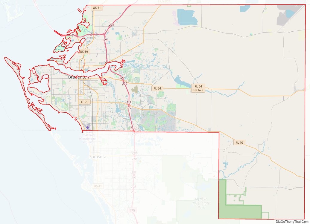
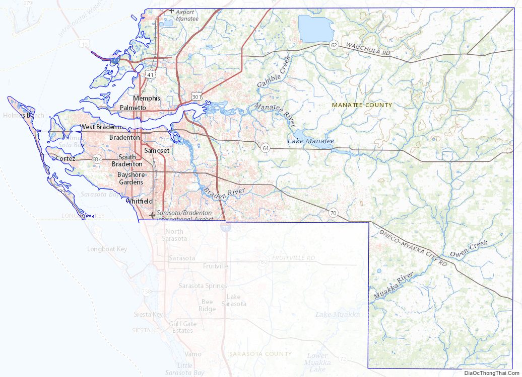
Manatee County Road Map
Geography
According to the U.S. Census Bureau, the county has a total area of 893 square miles (2,310 km), of which 743 square miles (1,920 km) is land and 150 square miles (390 km) (17%) is water.
Adjacent counties
- Hillsborough County – north
- Polk County – northeast
- Hardee County – east
- DeSoto County – southeast
- Sarasota County – south
State & Nationally protected areas
- De Soto National Memorial
- Passage Key National Wildlife Refuge
- Lake Manatee State Park
- Terra Ceia Preserve State Park
- Myakka River State Park
- Madira Bickel Mound State Archaeological Site
- Beker-Wingate Creek State Park
Rivers
- Manatee River
- Wares Creek
- Braden River
- Gamble Creek
Lakes
- Ward Lake
- Lake Parrish
- Lake Manatee
Manatee County Topographic Map
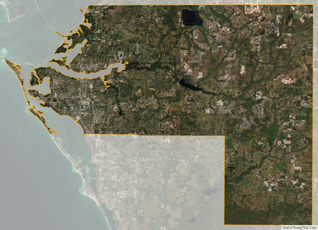
Manatee County Satellite Map
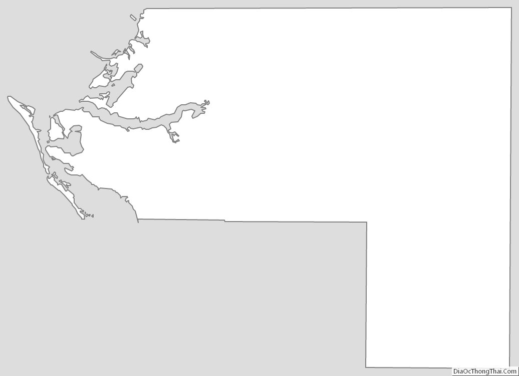
Manatee County Outline Map
See also
Map of Florida State and its subdivision:- Alachua
- Baker
- Bay
- Bradford
- Brevard
- Broward
- Calhoun
- Charlotte
- Citrus
- Clay
- Collier
- Columbia
- Desoto
- Dixie
- Duval
- Escambia
- Flagler
- Franklin
- Gadsden
- Gilchrist
- Glades
- Gulf
- Hamilton
- Hardee
- Hendry
- Hernando
- Highlands
- Hillsborough
- Holmes
- Indian River
- Jackson
- Jefferson
- Lafayette
- Lake
- Lee
- Leon
- Levy
- Liberty
- Madison
- Manatee
- Marion
- Martin
- Miami-Dade
- Monroe
- Nassau
- Okaloosa
- Okeechobee
- Orange
- Osceola
- Palm Beach
- Pasco
- Pinellas
- Polk
- Putnam
- Saint Johns
- Saint Lucie
- Santa Rosa
- Sarasota
- Seminole
- Sumter
- Suwannee
- Taylor
- Union
- Volusia
- Wakulla
- Walton
- Washington
- Alabama
- Alaska
- Arizona
- Arkansas
- California
- Colorado
- Connecticut
- Delaware
- District of Columbia
- Florida
- Georgia
- Hawaii
- Idaho
- Illinois
- Indiana
- Iowa
- Kansas
- Kentucky
- Louisiana
- Maine
- Maryland
- Massachusetts
- Michigan
- Minnesota
- Mississippi
- Missouri
- Montana
- Nebraska
- Nevada
- New Hampshire
- New Jersey
- New Mexico
- New York
- North Carolina
- North Dakota
- Ohio
- Oklahoma
- Oregon
- Pennsylvania
- Rhode Island
- South Carolina
- South Dakota
- Tennessee
- Texas
- Utah
- Vermont
- Virginia
- Washington
- West Virginia
- Wisconsin
- Wyoming