Manitowoc County /ˈmænɪtəwɔːk/ is a county in the U.S. state of Wisconsin. As of the 2020 census, the population was 81,359. Its county seat is Manitowoc. The county was created in 1836 prior to Wisconsin’s statehood and organized in 1848. Manitowoc County comprises the Manitowoc, WI Micropolitan Statistical Area.
| Name: | Manitowoc County |
|---|---|
| FIPS code: | 55-071 |
| State: | Wisconsin |
| Total Area: | 1,494 sq mi (3,870 km²) |
| Land Area: | 589 sq mi (1,530 km²) |
| Total Population: | 81,359 |
| Population Density: | 138.1/sq mi (53.3/km²) |
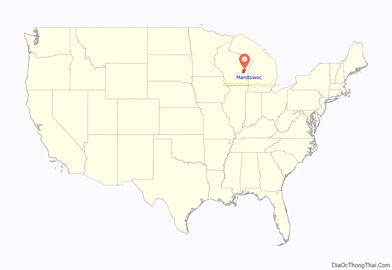
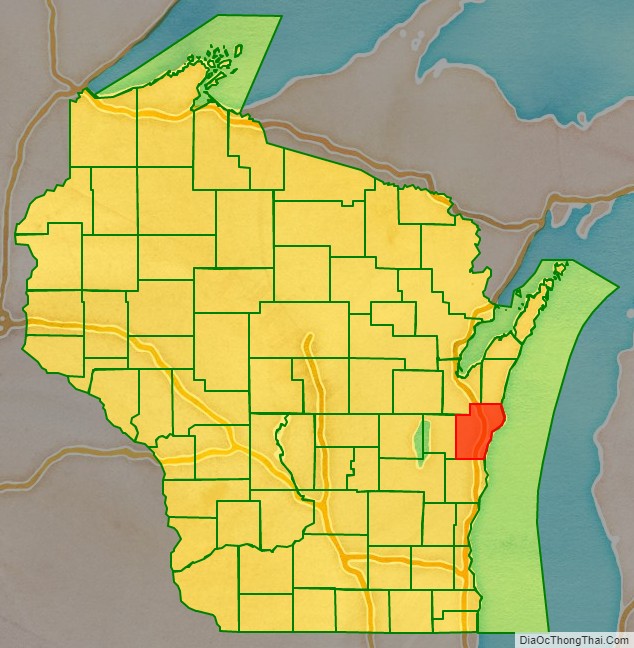
Manitowoc County location map. Where is Manitowoc County?
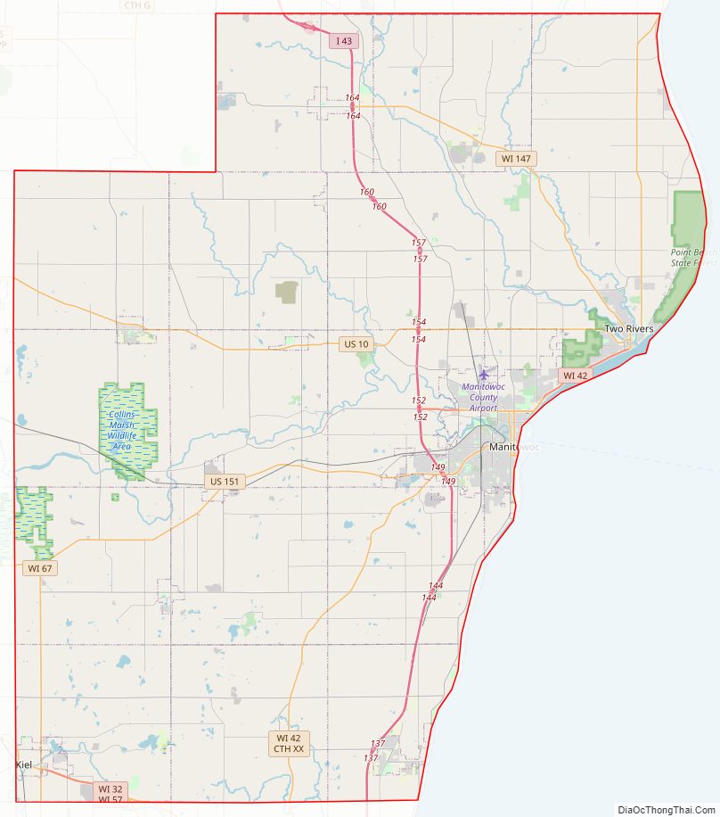
Manitowoc County Road Map
Geography
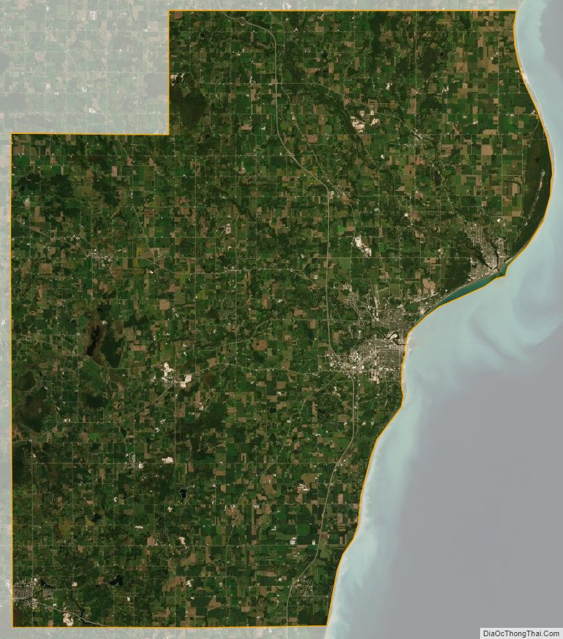
According to the U.S. Census Bureau, the county has a total area of 1,494 square miles (3,870 km), of which 589 square miles (1,530 km) is land and 905 square miles (2,340 km) (61%) is water.
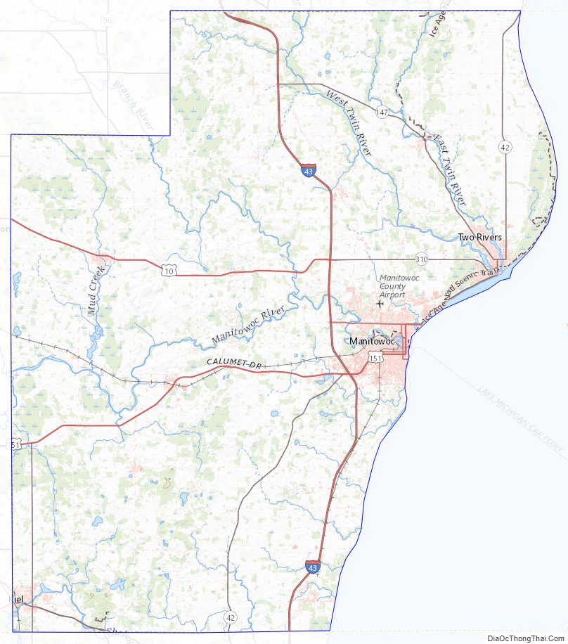
Major highways
Railroads
- Canadian National
Buses
- Maritime Metro Transit
- List of intercity bus stops in Wisconsin
Airport
Manitowoc County Airport (KMTW) serves the county and surrounding communities.
Adjacent counties
- Brown County – northwest
- Kewaunee County – northeast
- Sheboygan County – south
- Calumet County – west
- Mason County, MI – east & southeast
- Manistee County, MI – northeast
Manitowoc County Topographic Map
Manitowoc County Satellite Map
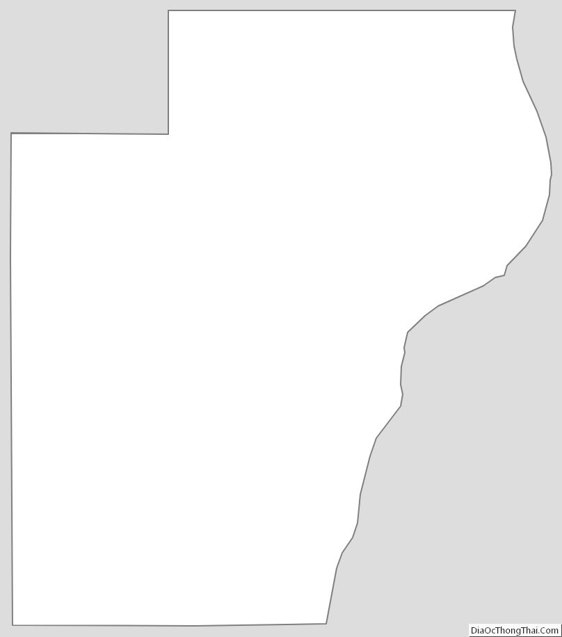
Manitowoc County Outline Map
See also
Map of Wisconsin State and its subdivision:- Adams
- Ashland
- Barron
- Bayfield
- Brown
- Buffalo
- Burnett
- Calumet
- Chippewa
- Clark
- Columbia
- Crawford
- Dane
- Dodge
- Door
- Douglas
- Dunn
- Eau Claire
- Florence
- Fond du Lac
- Forest
- Grant
- Green
- Green Lake
- Iowa
- Iron
- Jackson
- Jefferson
- Juneau
- Kenosha
- Kewaunee
- La Crosse
- Lafayette
- Lake Michigan
- Lake Superior
- Langlade
- Lincoln
- Manitowoc
- Marathon
- Marinette
- Marquette
- Menominee
- Milwaukee
- Monroe
- Oconto
- Oneida
- Outagamie
- Ozaukee
- Pepin
- Pierce
- Polk
- Portage
- Price
- Racine
- Richland
- Rock
- Rusk
- Saint Croix
- Sauk
- Sawyer
- Shawano
- Sheboygan
- Taylor
- Trempealeau
- Vernon
- Vilas
- Walworth
- Washburn
- Washington
- Waukesha
- Waupaca
- Waushara
- Winnebago
- Wood
- Alabama
- Alaska
- Arizona
- Arkansas
- California
- Colorado
- Connecticut
- Delaware
- District of Columbia
- Florida
- Georgia
- Hawaii
- Idaho
- Illinois
- Indiana
- Iowa
- Kansas
- Kentucky
- Louisiana
- Maine
- Maryland
- Massachusetts
- Michigan
- Minnesota
- Mississippi
- Missouri
- Montana
- Nebraska
- Nevada
- New Hampshire
- New Jersey
- New Mexico
- New York
- North Carolina
- North Dakota
- Ohio
- Oklahoma
- Oregon
- Pennsylvania
- Rhode Island
- South Carolina
- South Dakota
- Tennessee
- Texas
- Utah
- Vermont
- Virginia
- Washington
- West Virginia
- Wisconsin
- Wyoming