Marion County is a county located in the coastal plain of the U.S. state of South Carolina. As of the 2020 census, its population was 29,183. Its county seat is Marion. It is a majority-minority county.
Early European traders in the Carolinas settled along the Pee Dee River from the 17th century, including in an isolated area called Sandy Bluff. They did business with numerous tribes, including the Choctaw and Chickasaw to the South. Crossed by several rivers, the county was organized by European Americans in 1785 soon after the American Revolutionary War and was originally known as Liberty County. However, four years later it was renamed as Marion County, in honor of Brigadier General Francis Marion, the famous “Swamp Fox” and a hero of the American Revolutionary War. In 1910, a portion of the county was taken to be organized as adjacent Dillon County.
Marion County is included in the Myrtle Beach-Conway–North Myrtle Beach, SC–NC Metropolitan Statistical Area.
| Name: | Marion County |
|---|---|
| FIPS code: | 45-067 |
| State: | South Carolina |
| Founded: | 1798 |
| Named for: | Francis Marion |
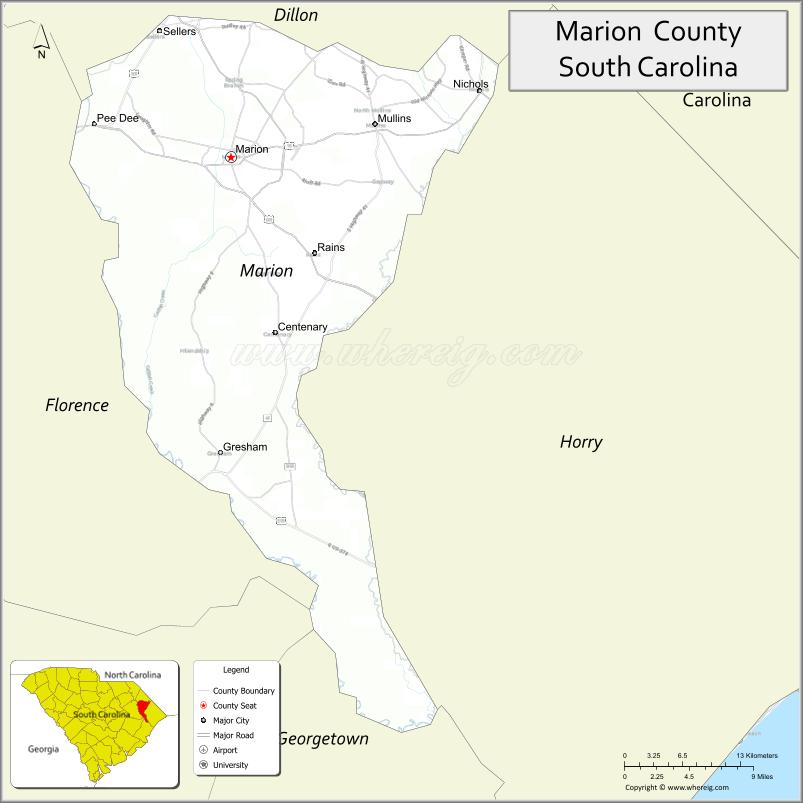
| Seat: | Marion |
| Largest city: | Marion |
| Total Area: | 494 sq mi (1,280 km²) |
| Land Area: | 489 sq mi (1,270 km²) |
| Total Population: | 29,183 |
| Population Density: | 58.9/sq mi (22.7/km²) |
| Time zone: | UTC−5 (Eastern) |
| Summer Time Zone (DST): | UTC−4 (EDT) |
| Website: | www.marionsc.org |
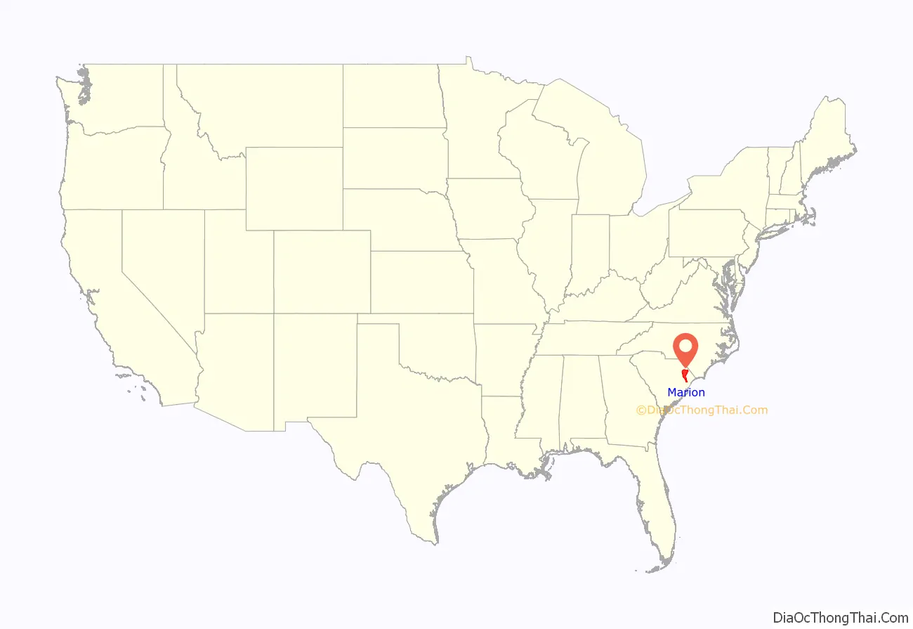
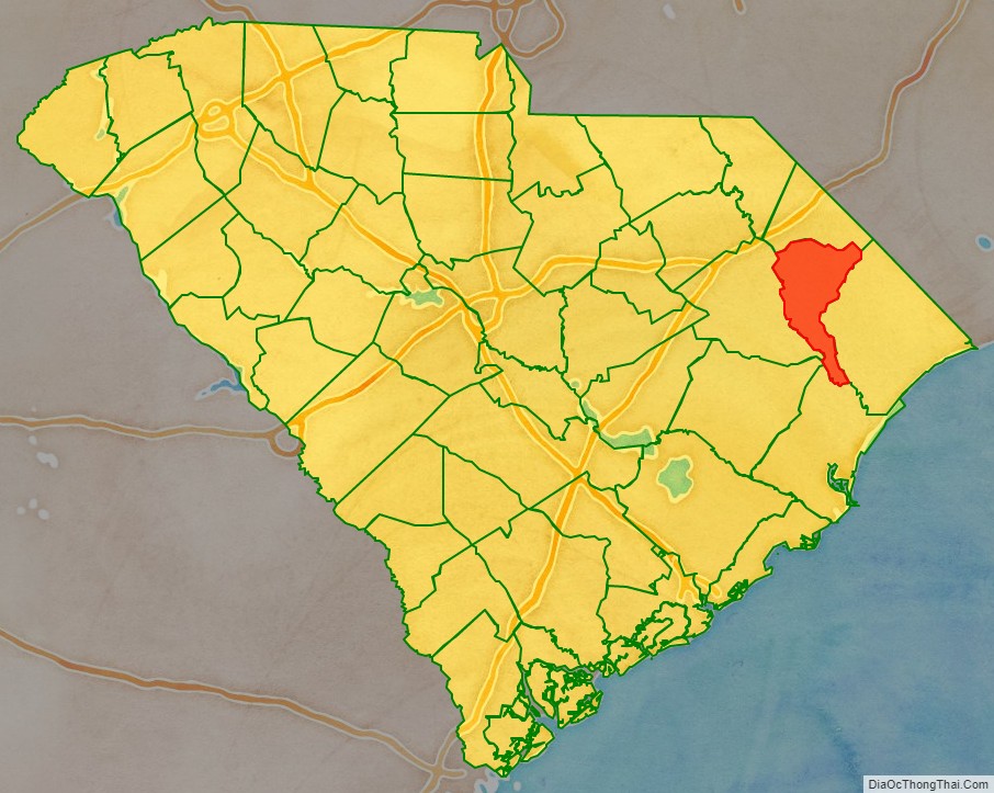
Marion County location map. Where is Marion County?
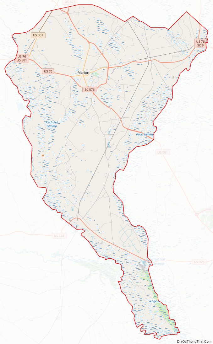
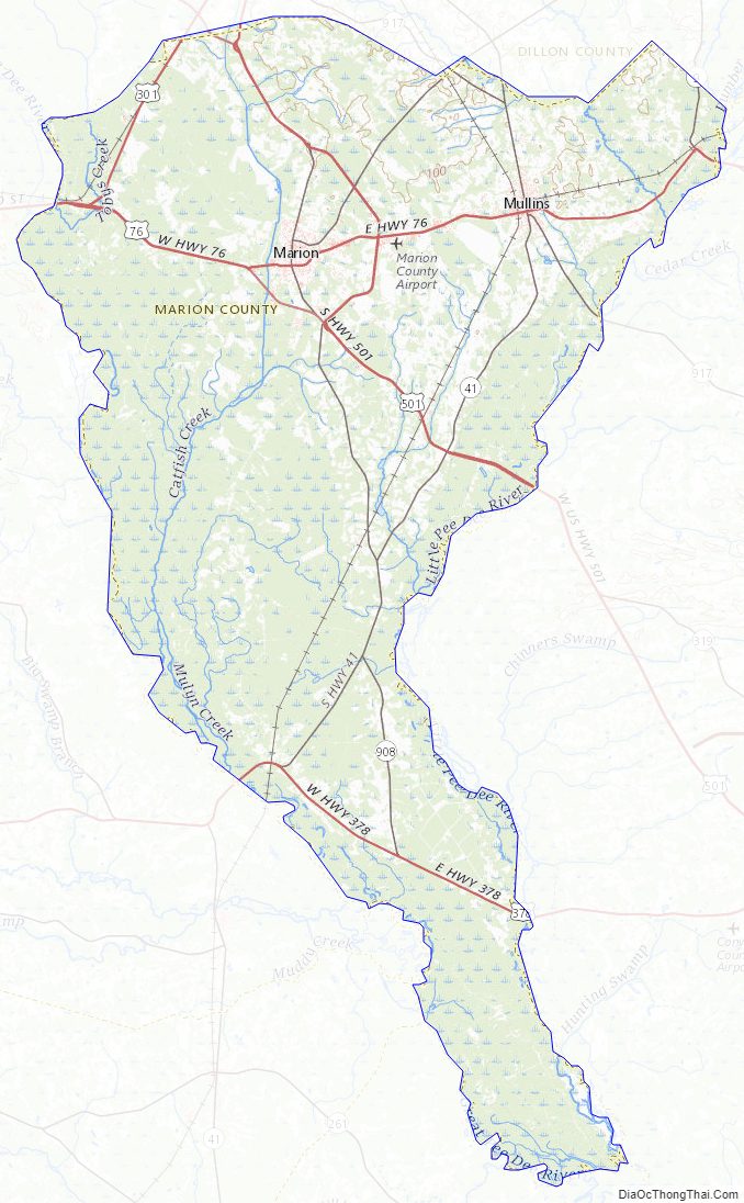
Marion County Road Map
Geography
According to the U.S. Census Bureau, the county has a total area of 494 square miles (1,280 km), of which 489 square miles (1,270 km) is land and 4.9 square miles (13 km) (1.0%) is water.
National protected area
- Waccamaw National Wildlife Refuge (part)
State and local protected areas
- Little Pee Dee Heritage Preserve
- Marsh Wildlife Management Area
Major water bodies
- Cud Swamp
- Great Pee Dee River
- Lumber River
- Maidendown Swamp
- Waccamaw River
Adjacent counties
- Dillon County – north
- Horry County – east
- Georgetown County – south
- Williamsburg County – southwest
- Florence County – west
Major highways
- Future I-73 (Concurrency with US 501)
- US 76
- US 301
- US 378
- US 501
- US 501 Bus.
- SC 9
- SC 38
- SC 41
- SC 41 Alt.
- SC 57
- SC 576
- SC 908
- SC 917
Marion County Topographic Map
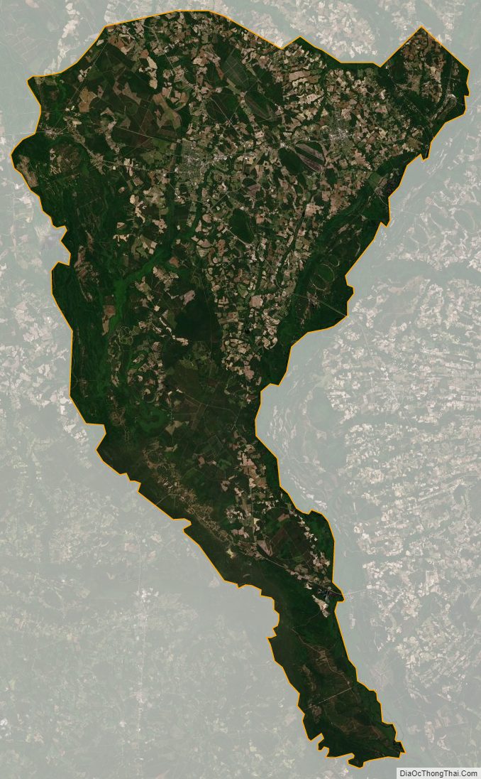
Marion County Satellite Map
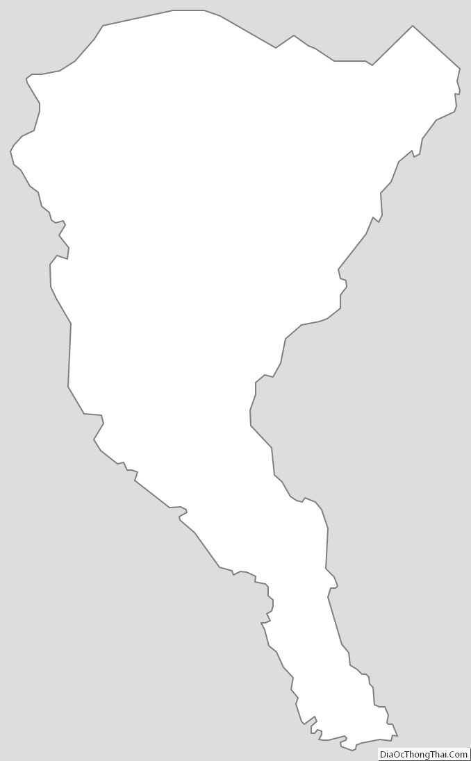
Marion County Outline Map
See also
Map of South Carolina State and its subdivision:- Abbeville
- Aiken
- Allendale
- Anderson
- Bamberg
- Barnwell
- Beaufort
- Berkeley
- Calhoun
- Charleston
- Cherokee
- Chester
- Chesterfield
- Clarendon
- Colleton
- Darlington
- Dillon
- Dorchester
- Edgefield
- Fairfield
- Florence
- Georgetown
- Greenville
- Greenwood
- Hampton
- Horry
- Jasper
- Kershaw
- Lancaster
- Laurens
- Lee
- Lexington
- Marion
- Marlboro
- McCormick
- Newberry
- Oconee
- Orangeburg
- Pickens
- Richland
- Saluda
- Spartanburg
- Sumter
- Union
- Williamsburg
- York
- Alabama
- Alaska
- Arizona
- Arkansas
- California
- Colorado
- Connecticut
- Delaware
- District of Columbia
- Florida
- Georgia
- Hawaii
- Idaho
- Illinois
- Indiana
- Iowa
- Kansas
- Kentucky
- Louisiana
- Maine
- Maryland
- Massachusetts
- Michigan
- Minnesota
- Mississippi
- Missouri
- Montana
- Nebraska
- Nevada
- New Hampshire
- New Jersey
- New Mexico
- New York
- North Carolina
- North Dakota
- Ohio
- Oklahoma
- Oregon
- Pennsylvania
- Rhode Island
- South Carolina
- South Dakota
- Tennessee
- Texas
- Utah
- Vermont
- Virginia
- Washington
- West Virginia
- Wisconsin
- Wyoming