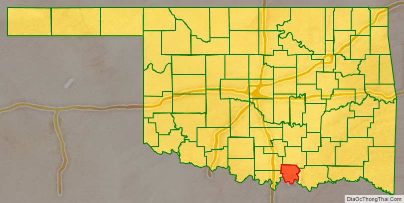
Marshall County is a county located on the south central border of Oklahoma. As of the 2010 census, the population was 15,840. Its county seat is Madill. The county was created at statehood in 1907 from the former Pickens County of the Chickasaw Nation. It was named to honor the maiden name of the mother of George Henshaw, a member of the 1906 Oklahoma Constitutional Convention. The county and its cities are part of the Texoma region.
| Name: | Marshall County |
|---|---|
| FIPS code: | 40-095 |
| State: | Oklahoma |
| Founded: | 1907 |
| Seat: | Madill |
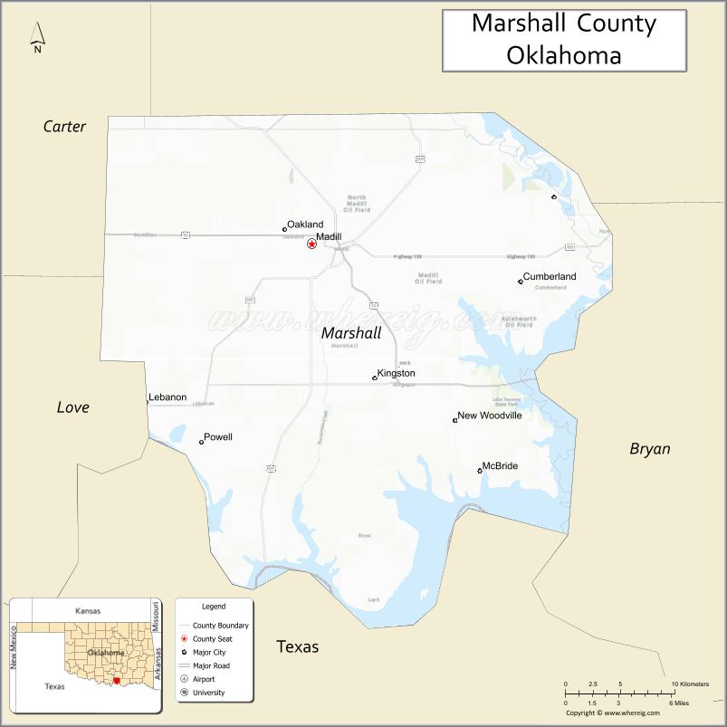
| Largest city: | Madill |
| Total Area: | 427 sq mi (1,110 km²) |
| Land Area: | 371 sq mi (960 km²) |
| Total Population: | 15,840 |
| Population Density: | 43/sq mi (17/km²) |
| Time zone: | UTC−6 (Central) |
| Summer Time Zone (DST): | UTC−5 (CDT) |
| Website: | marshall.okcounties.org |
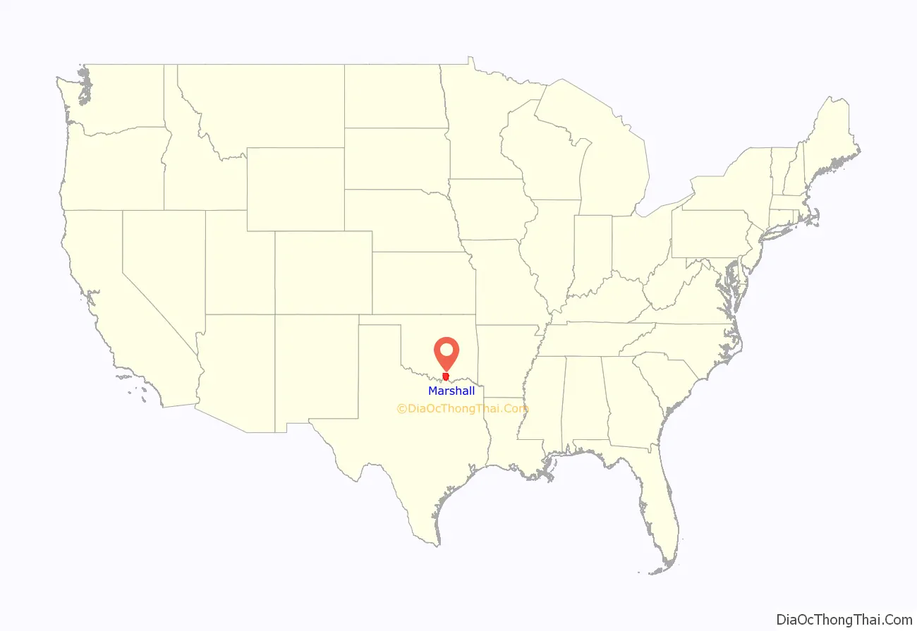
Marshall County location map. Where is Marshall County?
History
The area covered by Marshall County was part of the territory set aside by the U.S. government for resettlement of the Choctaw tribe and the closely related Chickasaw tribe from their lands in the southeastern United States. The Chickasaws began relocating to this area in 1837. The U.S. Army built Fort Washita in 1842 to protect the new arrivals from raids by other tribes. In 1857, the Chickasaw Nation formally separated from the Choctaw Nation. This area became part of Pickens County in the Chickasaw Nation.
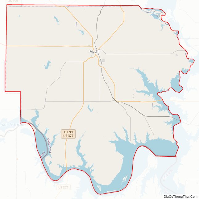
Railroads came to the present-day Marshall County in 1901, when the St. Louis, Oklahoma and Southern Railway (acquired shortly after by the St. Louis and San Francisco Railway), known as the “Frisco”, constructed a north–south line. The following year, the St. Louis, San Francisco and New Orleans Railroad (formerly the Arkansas and Choctaw Railway) laid tracks from east to west through the area. This line was sold to the Frisco in 1907. The State of Oklahoma relocated part of this line in 1941 to make way for the creation of Lake Texoma.
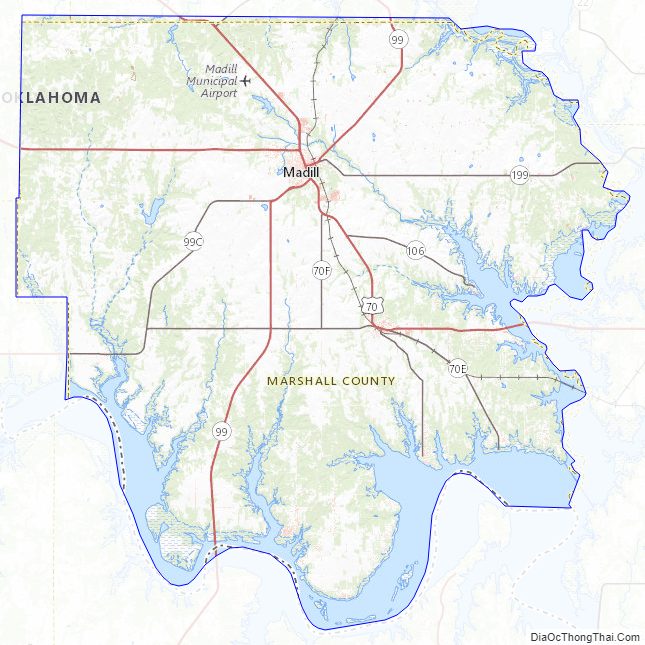
Marshall County Road Map
Geography
According to the U.S. Census Bureau, the county has a total area of 427 square miles (1,110 km), of which 371 square miles (960 km) is land and 56 square miles (150 km) (13%) is water. It is the smallest county in Oklahoma by land area and the third-smallest by total area. The Red River drains the county and formed the county’s southern boundary. Completion of the Denison Dam in 1942 created Lake Texoma which inundated part of Marshall County’s land area and forms the current southern boundary and the eastern boundary of the county as well.
Major highways
- U.S. Highway 70
- U.S. Highway 177
- U.S. Highway 377
- State Highway 32
- State Highway 99
Adjacent counties
- Johnston County (north)
- Bryan County (east)
- Grayson County, Texas (south)
- Love County (west)
- Carter County (northwest)
National protected area
- Tishomingo National Wildlife Refuge (part)
Marshall County Topographic Map
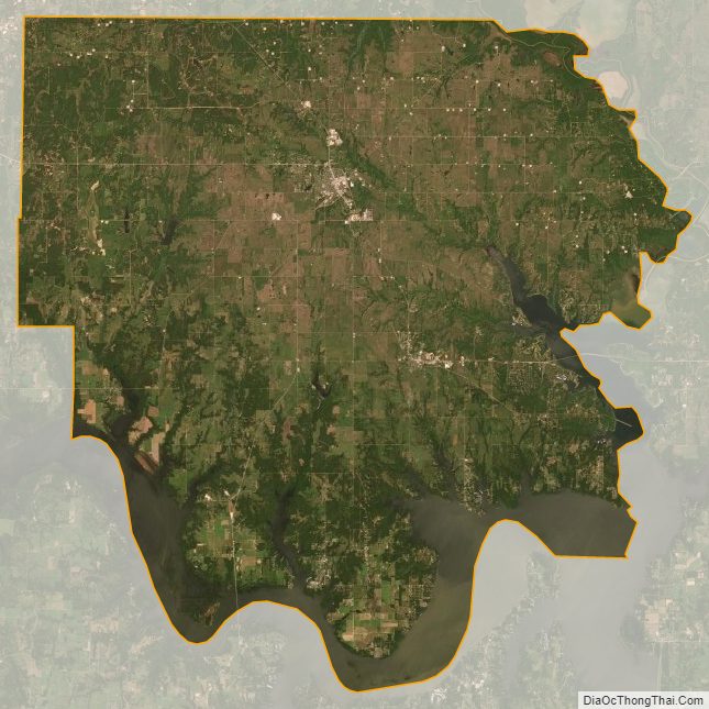
Marshall County Satellite Map
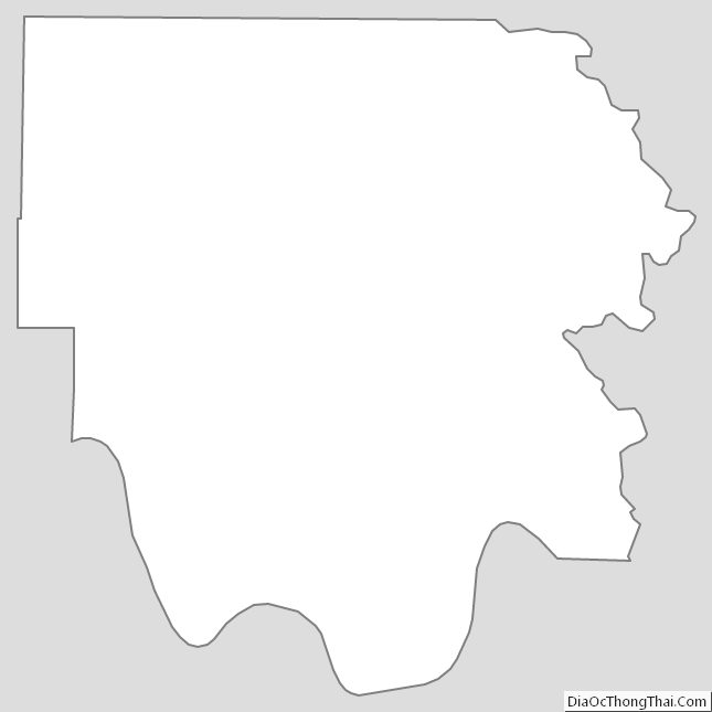
Marshall County Outline Map
See also
Map of Oklahoma State and its subdivision:- Adair
- Alfalfa
- Atoka
- Beaver
- Beckham
- Blaine
- Bryan
- Caddo
- Canadian
- Carter
- Cherokee
- Choctaw
- Cimarron
- Cleveland
- Coal
- Comanche
- Cotton
- Craig
- Creek
- Custer
- Delaware
- Dewey
- Ellis
- Garfield
- Garvin
- Grady
- Grant
- Greer
- Harmon
- Harper
- Haskell
- Hughes
- Jackson
- Jefferson
- Johnston
- Kay
- Kingfisher
- Kiowa
- Latimer
- Le Flore
- Lincoln
- Logan
- Love
- Major
- Marshall
- Mayes
- McClain
- McCurtain
- McIntosh
- Murray
- Muskogee
- Noble
- Nowata
- Okfuskee
- Oklahoma
- Okmulgee
- Osage
- Ottawa
- Pawnee
- Payne
- Pittsburg
- Pontotoc
- Pottawatomie
- Pushmataha
- Roger Mills
- Rogers
- Seminole
- Sequoyah
- Stephens
- Texas
- Tillman
- Tulsa
- Wagoner
- Washington
- Washita
- Woods
- Woodward
- Alabama
- Alaska
- Arizona
- Arkansas
- California
- Colorado
- Connecticut
- Delaware
- District of Columbia
- Florida
- Georgia
- Hawaii
- Idaho
- Illinois
- Indiana
- Iowa
- Kansas
- Kentucky
- Louisiana
- Maine
- Maryland
- Massachusetts
- Michigan
- Minnesota
- Mississippi
- Missouri
- Montana
- Nebraska
- Nevada
- New Hampshire
- New Jersey
- New Mexico
- New York
- North Carolina
- North Dakota
- Ohio
- Oklahoma
- Oregon
- Pennsylvania
- Rhode Island
- South Carolina
- South Dakota
- Tennessee
- Texas
- Utah
- Vermont
- Virginia
- Washington
- West Virginia
- Wisconsin
- Wyoming