Martin County is a county in Minnesota, United States. As of the 2020 census, the population was 20,025. Its county seat is Fairmont.
| Name: | Martin County |
|---|---|
| FIPS code: | 27-091 |
| State: | Minnesota |
| Founded: | May 23, 1857 |
| Named for: | Henry Martin |
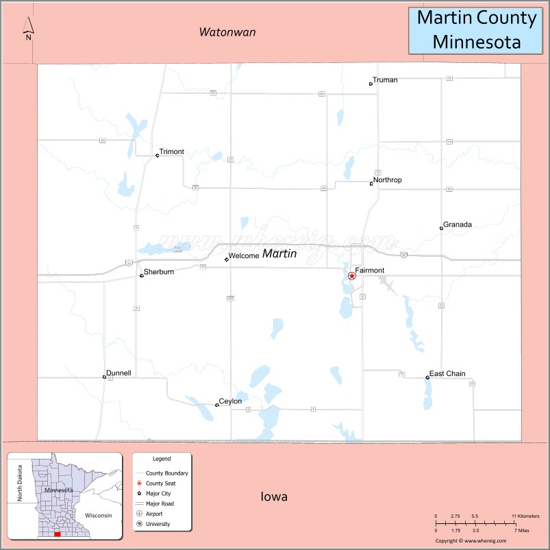
| Seat: | Fairmont |
| Largest city: | Fairmont |
| Total Area: | 730 sq mi (1,900 km²) |
| Land Area: | 712 sq mi (1,840 km²) |
| Total Population: | 20,025 |
| Population Density: | 28.1/sq mi (10.8/km²) |
| Time zone: | UTC−6 (Central) |
| Summer Time Zone (DST): | UTC−5 (CDT) |
| Website: | www.co.martin.mn.us |
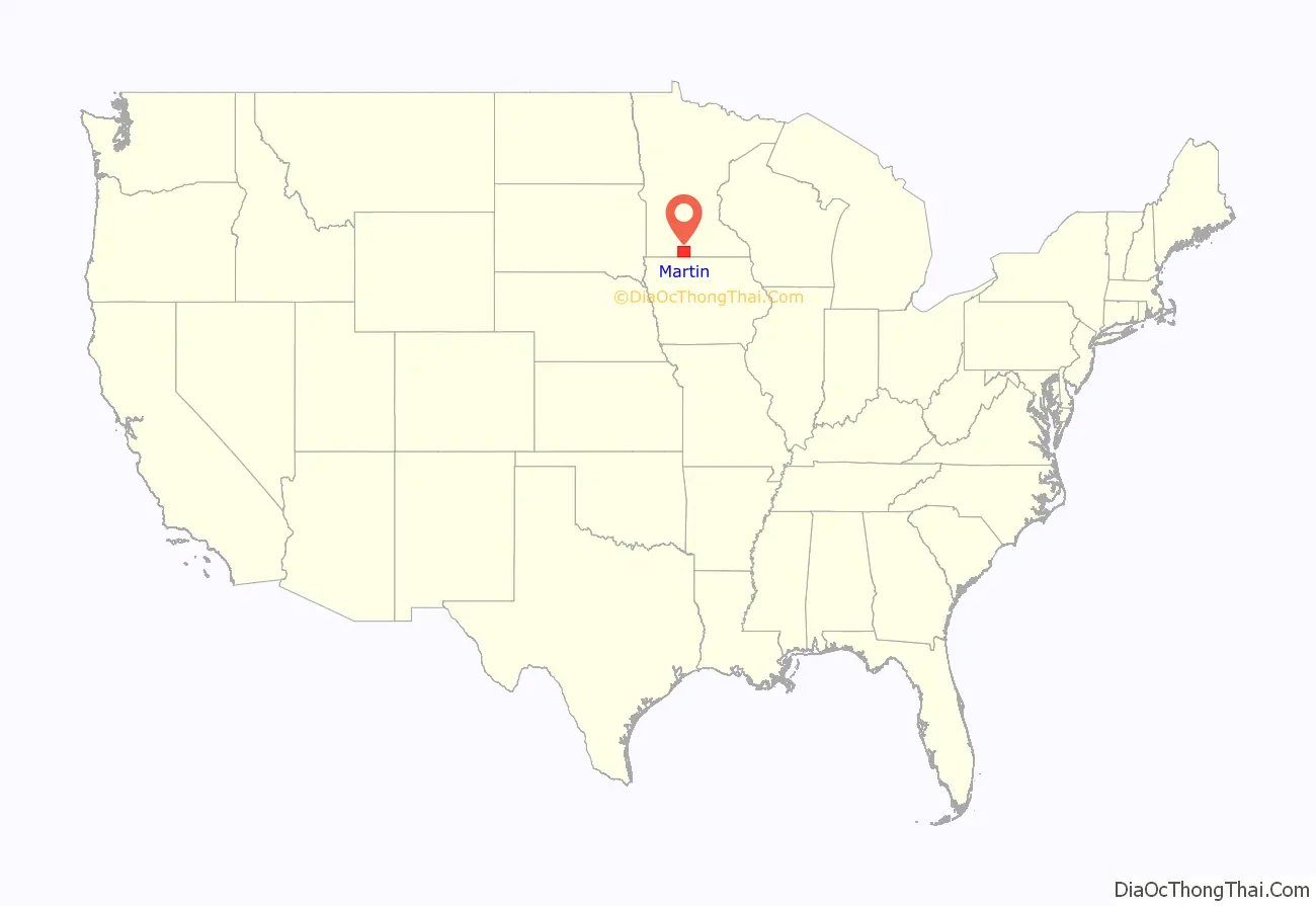
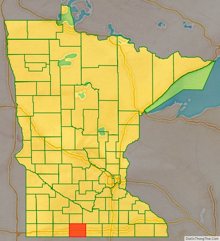
Martin County location map. Where is Martin County?
History
The county was created by the Minnesota Territory legislature on May 23, 1857, with Fair Mount (which was also platted in 1857) designated as county seat. The town’s name was later shortened to Fairmont. Two explanations have been advanced for the county’s name. A delegate to the US Congress from the Wisconsin Territory, Morgan Lewis Martin, introduced the legislative act to organize the Minnesota Territory. But in 1904 the county’s oldest residents attested that the name referred to Henry Martin, an early settler from Connecticut who ran several businesses during the pre-territory era.
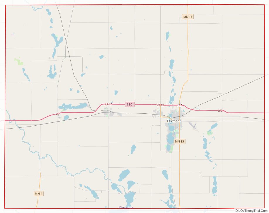
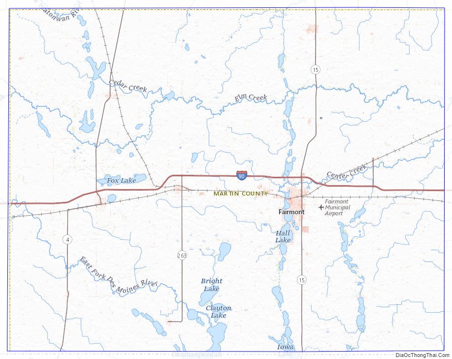
Martin County Road Map
Geography
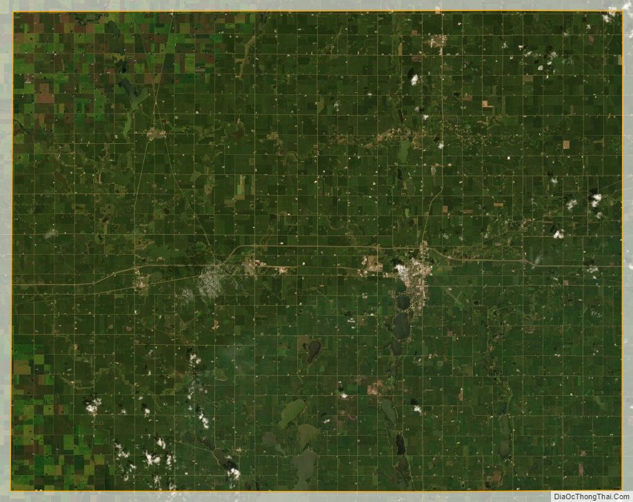
Martin County lies on Minnesota’s border with Iowa. The East Fork of the Des Moines River flows southeastward through the lower western part of the county. The county terrain consists of low rolling hills, dotted with lakes and ponds, completely devoted to agriculture where possible. The terrain slopes to the east and north, with its highest point near its southwest corner, at 1,407′ (429m) ASL. The county has an area of 730 square miles (1,900 km), of which 712 square miles (1,840 km) is land and 17 square miles (44 km) (2.4%) is water.
Major highways
- Interstate 90
- Minnesota State Highway 4
- Minnesota State Highway 15
- Minnesota State Highway 263
Airports
- Fairmont Municipal Airport (FRM)
Adjacent counties
- Watonwan County – north
- Blue Earth County – northeast
- Faribault County – east
- Kossuth County, Iowa – southeast
- Emmet County, Iowa – southwest
- Jackson County – west
Protected areas
- Ceylon State Wildlife Management Area
- Fox Lake Refuge
- Luedtke State Wildlife Management Area
- Perch Creek State Wildlife Management Area
- State Wildlife Management Area
- Truman Wildlife Area
Lakes
- Amber Lake
- Big Twin Lake
- Bright Lake
- Budd Lake
- Buffalo Lake (Cedar Township)
- Buffalo Lake (Rutland Township)
- Canright Lake
- Cedar Lake
- Clam Lake
- Clayton Lake
- Clear Lake
- Creek Lake
- Eagle Lake
- East Chain Lake
- Fish Lake (Cedar Township)
- Fish Lake (Lake Belt Township)
- Fox Lake
- Hall Lake
- High Lake
- Iowa Lake (part)
- Kiester Lake
- Lake Charlotte
- Lake George
- Lake Imogene
- Lake Seymour
- Little Hat Lake
- Little Twin Lake
- Martin Lake
- Mud Lake
- Murphy Lake
- North Lake
- North Silver Lake
- Okamanpeedan Lake (part)
- Perch Lake
- Pierce Lake
- Rose Lake
- Round Lake (Fox Lake Township)
- Round Lake (Waverly Township)
- Sager Lakes
- Sisseton Lake
- South Silver Lake
- Susan Lake
- Temperance Lake
- Tuttle Lake
- Watkins Lake
- Wilmert Lake
Martin County Topographic Map
Martin County Satellite Map
Martin County Outline Map

See also
Map of Minnesota State and its subdivision:- Aitkin
- Anoka
- Becker
- Beltrami
- Benton
- Big Stone
- Blue Earth
- Brown
- Carlton
- Carver
- Cass
- Chippewa
- Chisago
- Clay
- Clearwater
- Cook
- Cottonwood
- Crow Wing
- Dakota
- Dodge
- Douglas
- Faribault
- Fillmore
- Freeborn
- Goodhue
- Grant
- Hennepin
- Houston
- Hubbard
- Isanti
- Itasca
- Jackson
- Kanabec
- Kandiyohi
- Kittson
- Koochiching
- Lac qui Parle
- Lake
- Lake of the Woods
- Lake Superior
- Le Sueur
- Lincoln
- Lyon
- Mahnomen
- Marshall
- Martin
- McLeod
- Meeker
- Mille Lacs
- Morrison
- Mower
- Murray
- Nicollet
- Nobles
- Norman
- Olmsted
- Otter Tail
- Pennington
- Pine
- Pipestone
- Polk
- Pope
- Ramsey
- Red Lake
- Redwood
- Renville
- Rice
- Rock
- Roseau
- Saint Louis
- Scott
- Sherburne
- Sibley
- Stearns
- Steele
- Stevens
- Swift
- Todd
- Traverse
- Wabasha
- Wadena
- Waseca
- Washington
- Watonwan
- Wilkin
- Winona
- Wright
- Yellow Medicine
- Alabama
- Alaska
- Arizona
- Arkansas
- California
- Colorado
- Connecticut
- Delaware
- District of Columbia
- Florida
- Georgia
- Hawaii
- Idaho
- Illinois
- Indiana
- Iowa
- Kansas
- Kentucky
- Louisiana
- Maine
- Maryland
- Massachusetts
- Michigan
- Minnesota
- Mississippi
- Missouri
- Montana
- Nebraska
- Nevada
- New Hampshire
- New Jersey
- New Mexico
- New York
- North Carolina
- North Dakota
- Ohio
- Oklahoma
- Oregon
- Pennsylvania
- Rhode Island
- South Carolina
- South Dakota
- Tennessee
- Texas
- Utah
- Vermont
- Virginia
- Washington
- West Virginia
- Wisconsin
- Wyoming