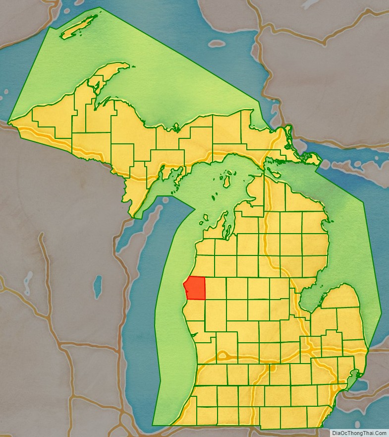
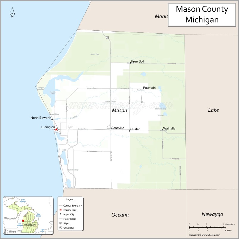
Mason County is a county located in the U.S. state of Michigan. As of the 2020 Census, the population was 29,052. The county seat is Ludington.
Mason County comprises the Ludington, MI Micropolitan Statistical Area.
| Name: | Mason County |
|---|---|
| FIPS code: | 26-105 |
| State: | Michigan |
| Founded: | 1840 |
| Named for: | Stevens T. Mason |
| Seat: | Ludington |
| Largest city: | Ludington |
| Total Area: | 1,242 sq mi (3,220 km²) |
| Land Area: | 495 sq mi (1,280 km²) |
| Total Population: | 29,052 |
| Population Density: | 58/sq mi (22/km²) |
| Time zone: | UTC−5 (Eastern) |
| Summer Time Zone (DST): | UTC−4 (EDT) |
| Website: | www.masoncounty.net |
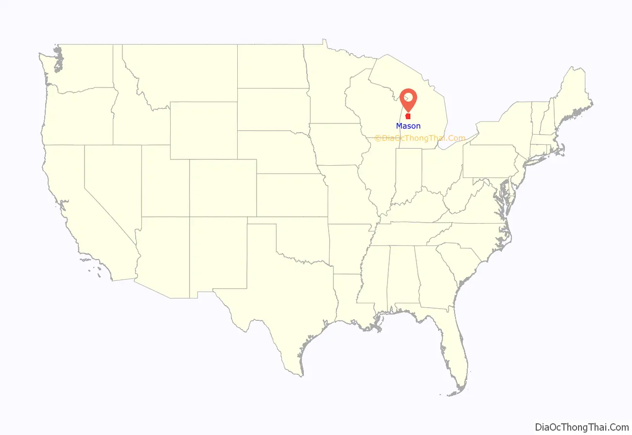
Mason County location map. Where is Mason County?
History
The county is named for Stevens T. Mason, Governor of Michigan from 1835 to 1840. It was created by the Michigan Legislature in 1840 as Notipekago County, then renamed Mason County in 1843. The county was administered by Ottawa County prior to the organization of county government in 1855.
Mason County, does not have an official flag.
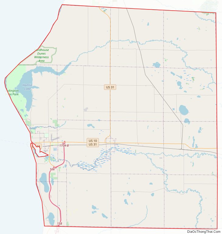
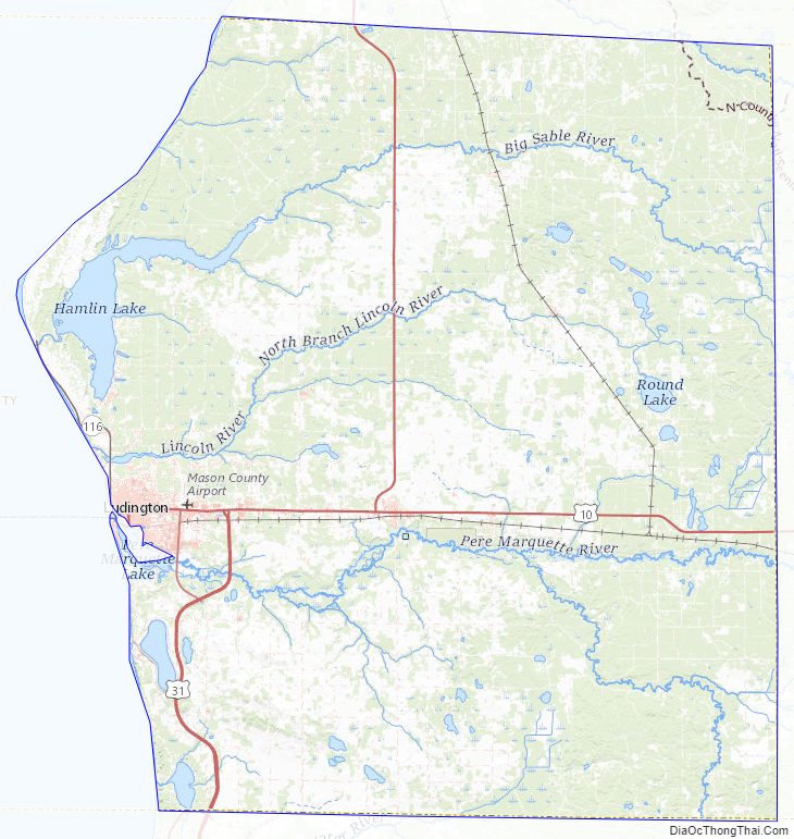
Mason County Road Map
Geography
According to the US Census Bureau, the county has a total area of 1,242 square miles (3,220 km), of which 495 square miles (1,280 km) is land and 747 square miles (1,930 km) (60%) is water.
Major highways
- US 10 – runs east–west through central part of county. Runs from Ludington through Amber, Scottville, Custer, and Branch.
- US 31 – enters Mason County at 2 miles (3.2 km) east of SW corner; runs north to intersect US-10 near Ludington. Runs concurrent with US-10 east for 5 miles (8.0 km), then runs north. Exits county at 4 miles (6.4 km) east of NW corner of county.
- M-116 – runs NW from Ludington along shoreline of Lake Michigan to Ludington State Park.
- Bus. US 31 is a business spur running east of Ludington.
U.S. Bicycle Routes
- USBR 35 enters Mason County from Pentwater; has a concurrency with USBR 20; proceeds north into Manistee County
- USBR 20 begins (until near future) at SS Badger with US 10; has a concurrency with USBR 35; goes through Freesoil; proceeds east into Lake County; proceeds east for about 310 miles to Marine City
Adjacent counties
By land
- Manistee County – north
- Lake County – east
- Newaygo County – southeast
- Oceana County – south
By water
- Sheboygan County, Wisconsin – southwest
- Manitowoc County, Wisconsin – west
National protected area
- Manistee National Forest (part)
Mason County Topographic Map
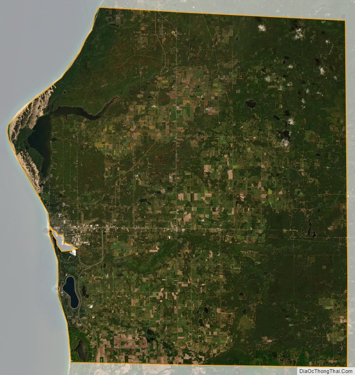
Mason County Satellite Map
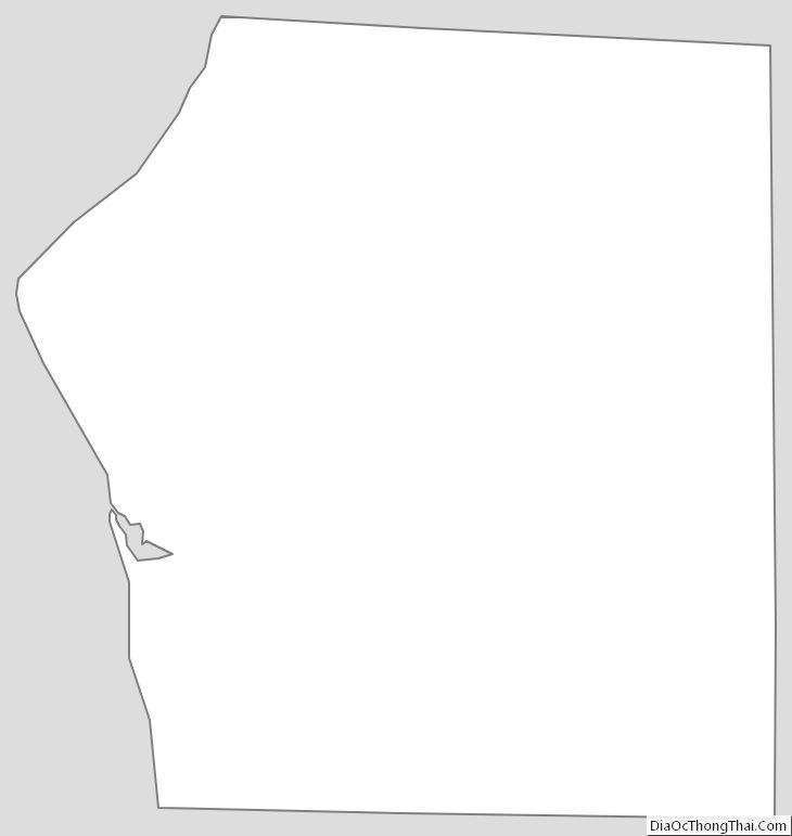
Mason County Outline Map
See also
Map of Michigan State and its subdivision:- Alcona
- Alger
- Allegan
- Alpena
- Antrim
- Arenac
- Baraga
- Barry
- Bay
- Benzie
- Berrien
- Branch
- Calhoun
- Cass
- Charlevoix
- Cheboygan
- Chippewa
- Clare
- Clinton
- Crawford
- Delta
- Dickinson
- Eaton
- Emmet
- Genesee
- Gladwin
- Gogebic
- Grand Traverse
- Gratiot
- Hillsdale
- Houghton
- Huron
- Ingham
- Ionia
- Iosco
- Iron
- Isabella
- Jackson
- Kalamazoo
- Kalkaska
- Kent
- Keweenaw
- Lake
- Lake Hurron
- Lake Michigan
- Lake St. Clair
- Lake Superior
- Lapeer
- Leelanau
- Lenawee
- Livingston
- Luce
- Mackinac
- Macomb
- Manistee
- Marquette
- Mason
- Mecosta
- Menominee
- Midland
- Missaukee
- Monroe
- Montcalm
- Montmorency
- Muskegon
- Newaygo
- Oakland
- Oceana
- Ogemaw
- Ontonagon
- Osceola
- Oscoda
- Otsego
- Ottawa
- Presque Isle
- Roscommon
- Saginaw
- Saint Clair
- Saint Joseph
- Sanilac
- Schoolcraft
- Shiawassee
- Tuscola
- Van Buren
- Washtenaw
- Wayne
- Wexford
- Alabama
- Alaska
- Arizona
- Arkansas
- California
- Colorado
- Connecticut
- Delaware
- District of Columbia
- Florida
- Georgia
- Hawaii
- Idaho
- Illinois
- Indiana
- Iowa
- Kansas
- Kentucky
- Louisiana
- Maine
- Maryland
- Massachusetts
- Michigan
- Minnesota
- Mississippi
- Missouri
- Montana
- Nebraska
- Nevada
- New Hampshire
- New Jersey
- New Mexico
- New York
- North Carolina
- North Dakota
- Ohio
- Oklahoma
- Oregon
- Pennsylvania
- Rhode Island
- South Carolina
- South Dakota
- Tennessee
- Texas
- Utah
- Vermont
- Virginia
- Washington
- West Virginia
- Wisconsin
- Wyoming