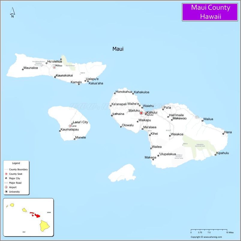
Maui County, officially the County of Maui, is a county in the U.S. state of Hawaii. It consists of the islands of Maui, Lānaʻi, Molokaʻi (except for a portion of Molokaʻi that comprises Kalawao County), Kahoʻolawe, and Molokini. The latter two are uninhabited. As of the 2020 census, the population was 164,754. The county seat is Wailuku.
Maui County is included in the Kahului-Wailuku-Lahaina, HI Metropolitan Statistical Area.
| Name: | Maui County |
|---|---|
| FIPS code: | 15-009 |
| State: | Hawaii |
| Founded: | 1905 |
| Seat: | Wailuku |
| Total Area: | 2,398 sq mi (6,210 km²) |
| Land Area: | 1,162 sq mi (3,010 km²) |
| Total Population: | 164,754 |
| Population Density: | 133/sq mi (51/km²) |
| Time zone: | UTC−10 (Hawaii–Aleutian) |
| Summer Time Zone (DST): | HADT |
| Website: | www.mauicounty.gov |
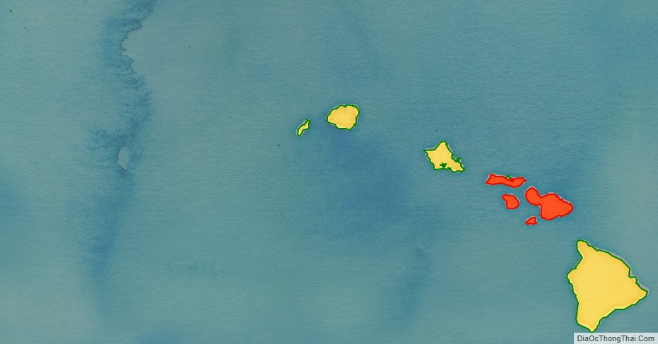
Maui County location map. Where is Maui County?
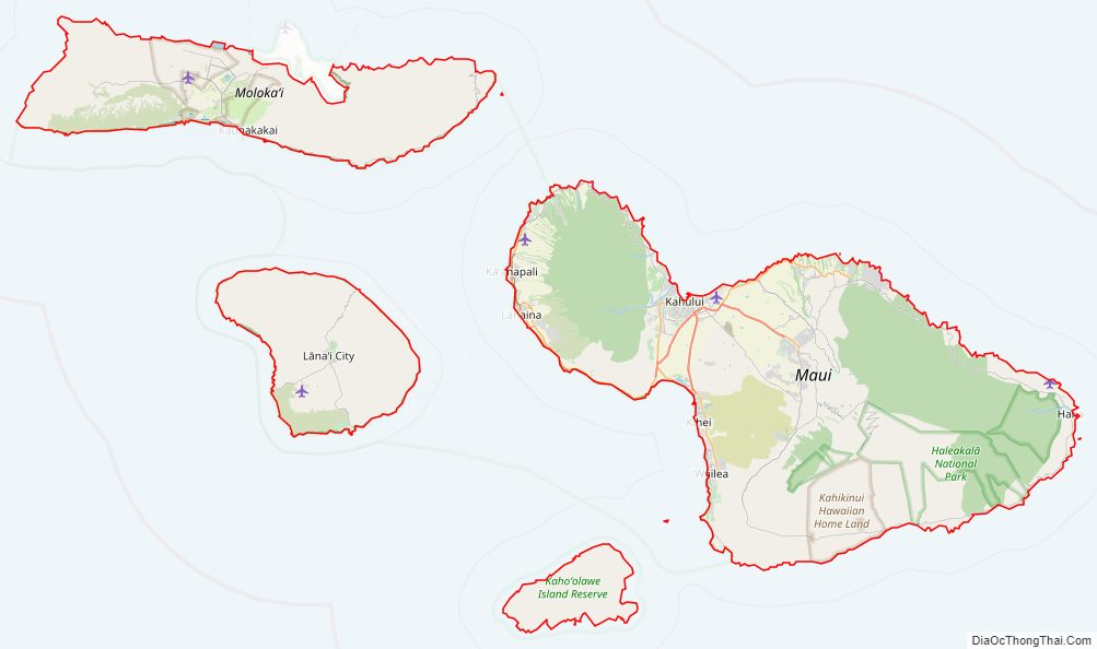
Maui County Road Map
Geography
According to the U.S. Census Bureau, the county has a total area of 2,398 square miles (6,210 km), of which 1,162 square miles (3,010 km) is land and 1,237 square miles (3,200 km) (51.6%) is water. The islands that comprise Maui County correspond to the remnants of the ancient landmass of Maui Nui. The highest point in the county is the peak of Haleakalā at 10,023 feet (3,055 m). Haleakalā is a shield volcano located on the eastern side of the island of Maui.
Adjacent counties
- Hawaiʻi County, Hawaii – southeast
- Kalawao County, Hawaii – north
- Honolulu County, Hawaii – northwest
National protected areas
- Haleakalā National Park
- Kakahaiʻa National Wildlife Refuge
- Kealia Pond National Wildlife Refuge
- Kalaupapa National Historical Park
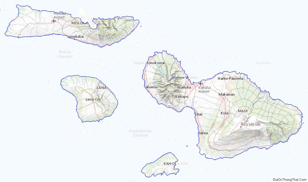
Maui County Topographic Map
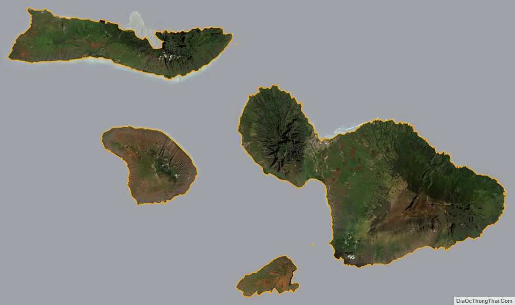
Maui County Satellite Map
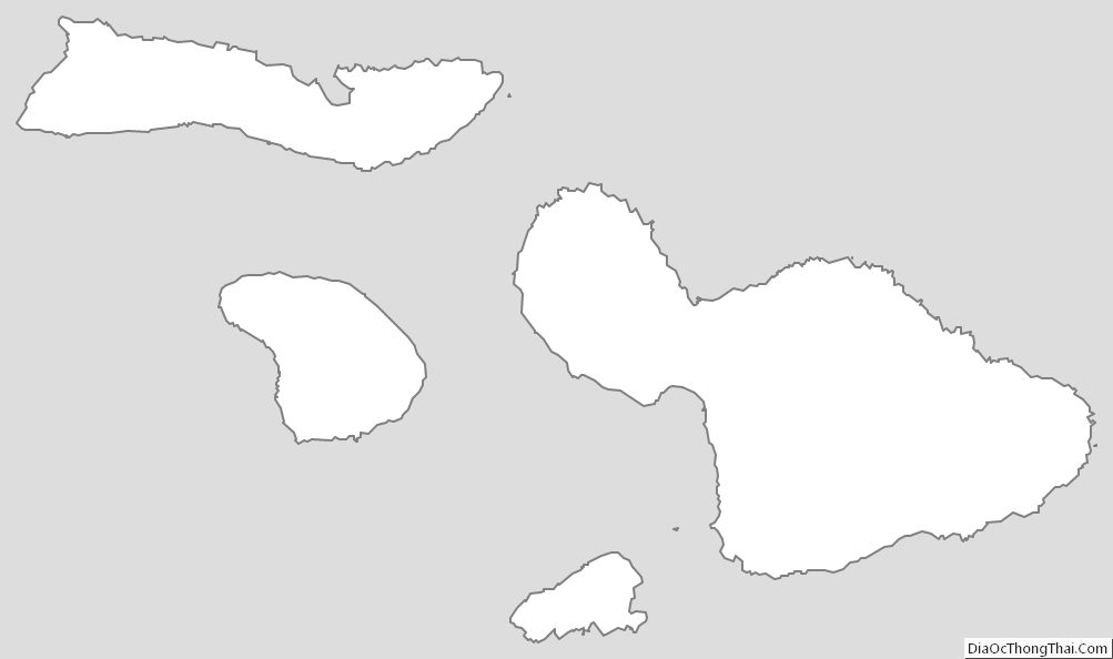
Maui County Outline Map
See also
Map of Hawaii State and its subdivision: Map of other states:- Alabama
- Alaska
- Arizona
- Arkansas
- California
- Colorado
- Connecticut
- Delaware
- District of Columbia
- Florida
- Georgia
- Hawaii
- Idaho
- Illinois
- Indiana
- Iowa
- Kansas
- Kentucky
- Louisiana
- Maine
- Maryland
- Massachusetts
- Michigan
- Minnesota
- Mississippi
- Missouri
- Montana
- Nebraska
- Nevada
- New Hampshire
- New Jersey
- New Mexico
- New York
- North Carolina
- North Dakota
- Ohio
- Oklahoma
- Oregon
- Pennsylvania
- Rhode Island
- South Carolina
- South Dakota
- Tennessee
- Texas
- Utah
- Vermont
- Virginia
- Washington
- West Virginia
- Wisconsin
- Wyoming