| Name: | McCurtain County |
|---|---|
| FIPS code: | 40-089 |
| State: | Oklahoma |
| Founded: | 1907 |
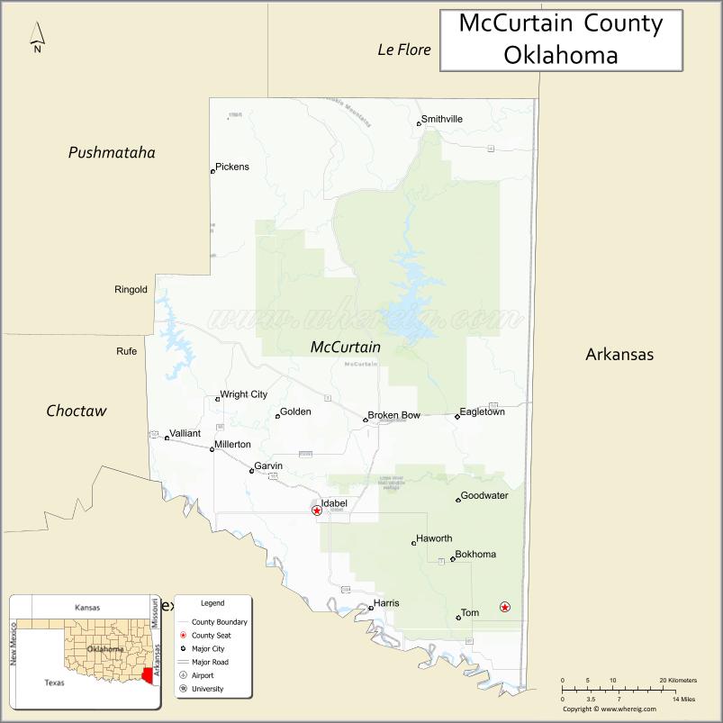
| Seat: | Idabel |
| Largest city: | Idabel |
| Total Area: | 1,902 sq mi (4,930 km²) |
| Land Area: | 1,850 sq mi (4,800 km²) |
| Total Population: | 33,151 |
| Population Density: | 18/sq mi (7/km²) |
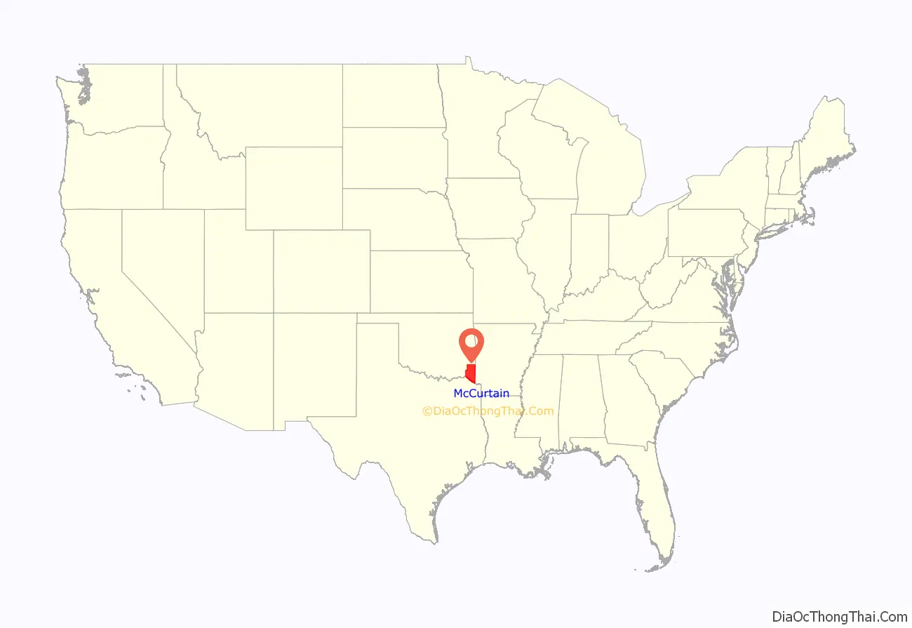
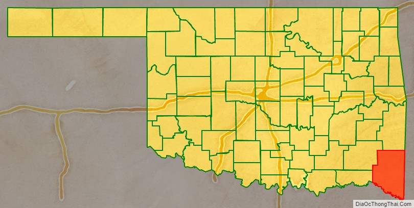
McCurtain County location map. Where is McCurtain County?
History
The area now included in McCurtain County was part of the Choctaw Nation before Oklahoma became a state. The territory of the present-day county fell within the Apukshunnubbee District, one of three administrative super-regions comprising the Choctaw Nation, and was divided among six of its counties: Bok Tuklo, Cedar, Eagle, Nashoba, Red River, and Towson counties. Previously, In the 1820s, it was a major part of Miller County, Arkansas.
The area was sparsely populated, with no roads or bridges and no towns. Post offices were established at small trading posts along the various trails. Towns began to form when the Arkansas and Choctaw Railway (later the St. Louis and San Francisco Railway) was built across the area in 1902. Between 1910 and 1921 the Choctaw Lumber Company laid tracks for the Texas, Oklahoma and Eastern Railroad from Valliant, Oklahoma, to DeQueen, Arkansas. These roads still served the area at the beginning of the 21st century.
Initially, the county experienced difficulty functioning because of lack of funds. When the Choctaws accepted their land allotments, their homesteads were not taxable for twenty-one years. No roads were built until a decade after statehood. There were no bridges, so ferries carried people and vehicles across the major streams.
Beavers Bend State Park was opened in 1937, establishing the region as a tourism destination due to the variety of recreational activities it offers.
The only F5 tornado in April in Oklahoma occurred in this county on April 2, 1982.
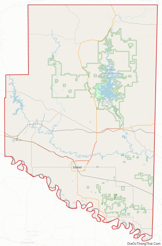
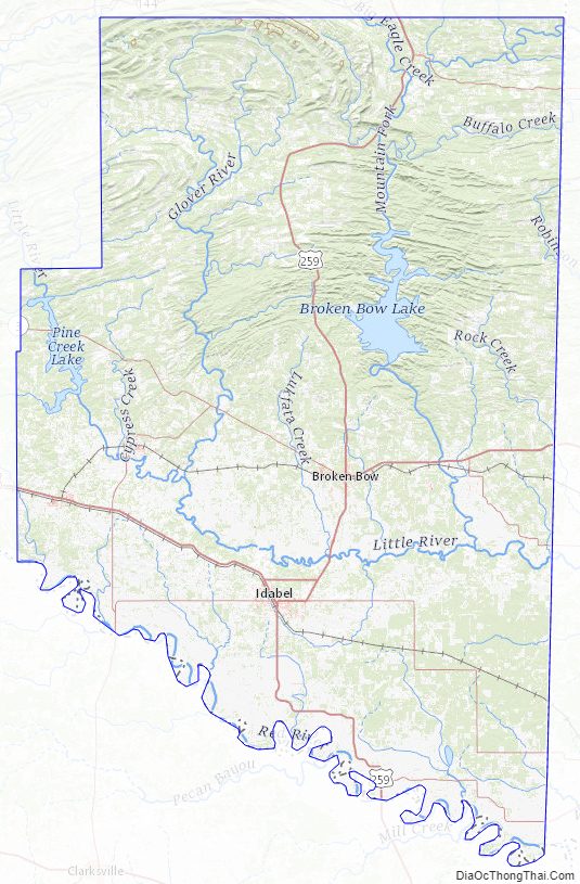
McCurtain County Road Map
Geography
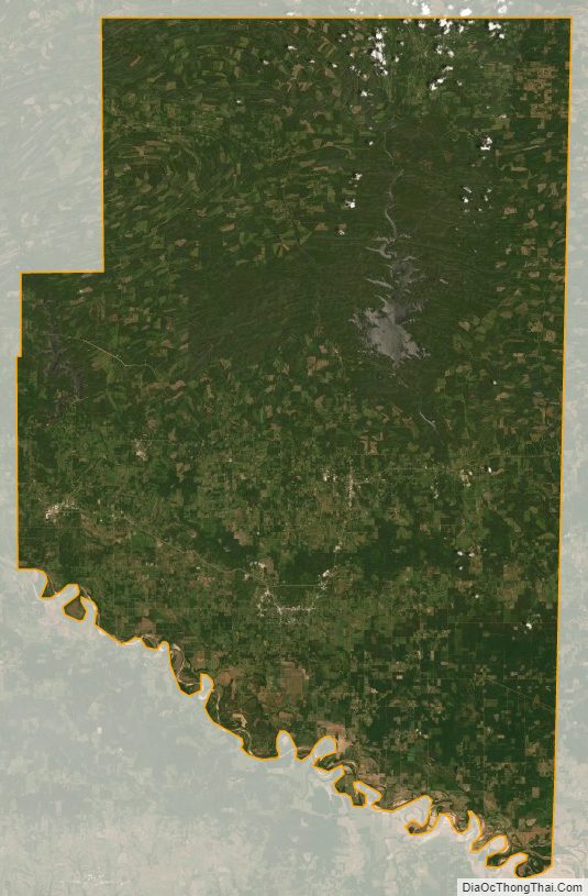
McCurtain County’s location in southeastern Oklahoma places it within a 10-county area designated for tourism purposes by the Oklahoma Department of Tourism and Recreation as Choctaw Country. According to the U.S. Census Bureau, the county has a total area of 1,902 square miles (4,930 km), of which 1,850 square miles (4,800 km) is land and 52 square miles (130 km) (2.8%) is water.
It is the third-largest county in Oklahoma by area. The terrain of McCurtain County varies from the foothills of the Ouachita Mountains in the northern part of the county, to the rich Red River bottoms of the southern part. Sections of the Mountain Fork and Little River drainages lie in McCurtain County. The Glover River originates in McCurtain County and flows 33.2 miles (53.4 km) to its confluence with the Little River southeast of Wright City. Broken Bow Lake was created in 1968 by damming the Mountain Fork River; the River is one of the two year-round trout fisheries in the state. The lowest point in the state of Oklahoma is located on the Little River in McCurtain County, where it flows out of Oklahoma and into Arkansas. McCurtain County is the only documented part of Oklahoma, together with Choctaw County, located within the natural range of the American alligator.
The county also contains the McCurtain County Wilderness Area, a 14,087-acre tract created in 1918 and managed by the Oklahoma Department of Wildlife Conservation, and the Little River National Wildlife Refuge, which is managed by the U.S. Fish and Wildlife Service.
The county contains the location (Smithville) with the highest annual average precipitation in the state, at 55.71 inches.
Major highways
- U.S. Highway 70
- U.S. Highway 259
- State Highway 3
- State Highway 4
- State Highway 37
- State Highway 87
- State Highway 98
Adjacent counties
- Le Flore County (north)
- Polk County, Arkansas (northeast)
- Sevier County, Arkansas (east)
- Little River County, Arkansas (southeast)
- Bowie County, Texas (south)
- Red River County, Texas (southwest)
- Choctaw County (west)
- Pushmataha County (northwest)
National protected areas
- Little River National Wildlife Refuge
- Ouachita National Forest (part)
McCurtain County Topographic Map
McCurtain County Satellite Map
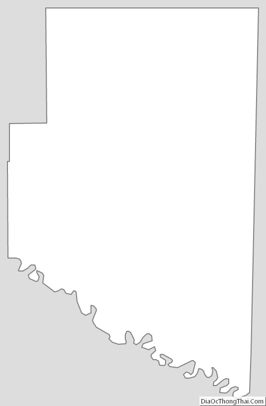
McCurtain County Outline Map
See also
Map of Oklahoma State and its subdivision:- Adair
- Alfalfa
- Atoka
- Beaver
- Beckham
- Blaine
- Bryan
- Caddo
- Canadian
- Carter
- Cherokee
- Choctaw
- Cimarron
- Cleveland
- Coal
- Comanche
- Cotton
- Craig
- Creek
- Custer
- Delaware
- Dewey
- Ellis
- Garfield
- Garvin
- Grady
- Grant
- Greer
- Harmon
- Harper
- Haskell
- Hughes
- Jackson
- Jefferson
- Johnston
- Kay
- Kingfisher
- Kiowa
- Latimer
- Le Flore
- Lincoln
- Logan
- Love
- Major
- Marshall
- Mayes
- McClain
- McCurtain
- McIntosh
- Murray
- Muskogee
- Noble
- Nowata
- Okfuskee
- Oklahoma
- Okmulgee
- Osage
- Ottawa
- Pawnee
- Payne
- Pittsburg
- Pontotoc
- Pottawatomie
- Pushmataha
- Roger Mills
- Rogers
- Seminole
- Sequoyah
- Stephens
- Texas
- Tillman
- Tulsa
- Wagoner
- Washington
- Washita
- Woods
- Woodward
- Alabama
- Alaska
- Arizona
- Arkansas
- California
- Colorado
- Connecticut
- Delaware
- District of Columbia
- Florida
- Georgia
- Hawaii
- Idaho
- Illinois
- Indiana
- Iowa
- Kansas
- Kentucky
- Louisiana
- Maine
- Maryland
- Massachusetts
- Michigan
- Minnesota
- Mississippi
- Missouri
- Montana
- Nebraska
- Nevada
- New Hampshire
- New Jersey
- New Mexico
- New York
- North Carolina
- North Dakota
- Ohio
- Oklahoma
- Oregon
- Pennsylvania
- Rhode Island
- South Carolina
- South Dakota
- Tennessee
- Texas
- Utah
- Vermont
- Virginia
- Washington
- West Virginia
- Wisconsin
- Wyoming