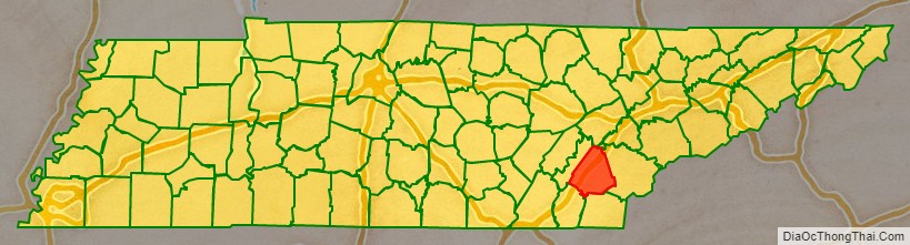
McMinn County is a county in the U.S. state of Tennessee. It is located in East Tennessee. As of the 2020 census, the population was 53,794. The county has a total area of 432 square miles (1,120 km). Most of the county is within the Ridge and Valley province of the Appalachian Mountains. Its county seat is Athens. McMinn County comprises the Athens, TN Micropolitan Statistical Area.
| Name: | McMinn County |
|---|---|
| FIPS code: | 47-107 |
| State: | Tennessee |
| Founded: | 1819 |
| Named for: | Joseph McMinn |
| Seat: | Athens |
| Largest city: | Athens |
| Total Area: | 432 sq mi (1,120 km²) |
| Land Area: | 430 sq mi (1,100 km²) |
| Total Population: | 53,794 |
| Population Density: | 125.10/sq mi (48.30/km²) |
| Time zone: | UTC−5 (Eastern) |
| Summer Time Zone (DST): | UTC−4 (EDT) |
| Website: | mcminncountytn.gov |
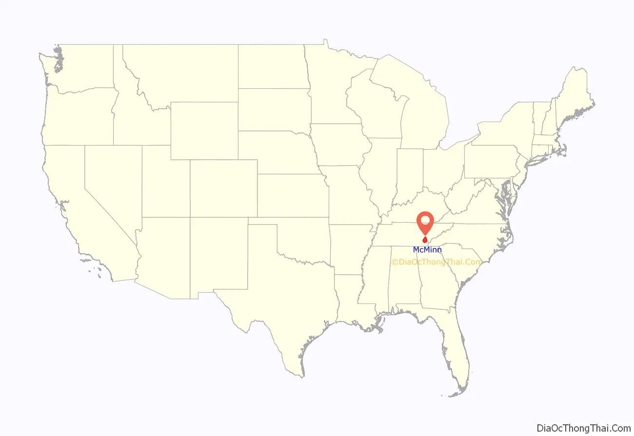
McMinn County location map. Where is McMinn County?
History
McMinn County was created in 1819 from Indian lands and was named in honor of Joseph McMinn (1758–1824). McMinn was a militia commander during the Revolutionary War, a member of the territorial legislature, speaker of the state senate, and eventually governor of the state of Tennessee. McMinn died on October 17, 1824, and is buried at Shiloh Presbyterian Cemetery in Calhoun.
The first railroad in East Tennessee, the Hiwassee Railroad, began construction in McMinn County in the late 1830s, but was halted due to financial difficulties. Work was resumed by the East Tennessee and Georgia Railroad (ET&G) in 1849, and by the mid-1850s rail lines connected Chattanooga, Knoxville, and the Tri-Cities. The ET&G was headquartered in Athens before moving to Knoxville in 1855. A train depot from this early railroad period still stands in Niota. A number of communities sprang up along the railroads in subsequent years, most notably Etowah, where the L&N built a large depot in the early 1900s, and Englewood, which developed into a textile manufacturing center in the late 19th and early 20th centuries.
Like many East Tennessee counties, McMinn was polarized by the Civil War and the issue of secession. On June 8, 1861, the county voted against secession by a margin of 1,144 to 904. The county provided 12 regiments for the Union Army and eight for the Confederate Army during the course of the war.
On August 14, 1920, in a long and bitter debate on the suffrage amendment at the Tennessee State Capitol, State Senator Hershel Candler of McMinn County denounced suffrage leader Carrie Chapman Catt on the floor of the state senate, saying Catt “would be glad to see the day when negro men could marry white women without being socially ostracized. This is the kind of woman who is trying to dictate to us. They would drag the womanhood of Tennessee down to the level of the negro woman.”
In August 1946, an uprising known as the Battle of Athens erupted when the McMinn County sheriff and several other county officials (most of whom had ties to Memphis political boss E.H. Crump) attempted to fix local elections. A group of World War II veterans launched an armed assault on the jail in Athens, where the county officials had retreated with the ballot boxes. After an exchange of gunfire, the county officials turned over the ballot boxes, and the votes were counted in a public setting.
On December 11, 1990, a crash involving 99 vehicles occurred along Interstate 75 near Calhoun in heavy fog, killing 12 and injuring 42. The accident, which occurred in an area prone to fog, was reportedly the largest motor vehicle crash in United States history at the time, in terms of the number of vehicles involved, and was blamed by some on the nearby Bowater (now Resolute Forest Products) paper mill.
McMinn County came to worldwide attention in January 2022, on International Holocaust Remembrance Day, when the county’s Board of Education voted unanimously to remove the Pulitzer Prize-winning graphic novel Maus from its curriculum over concerns about offensive words. The book, featuring Nazis as cats and Jews as mice, received a special Pulitzer Prize in 1992. Art Spiegelman wrote and illustrated the book based on his parents’ experience in Nazi-occupied Poland and later at Auschwitz.
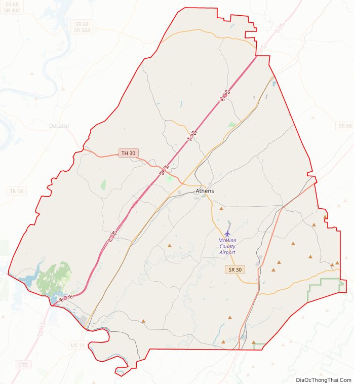
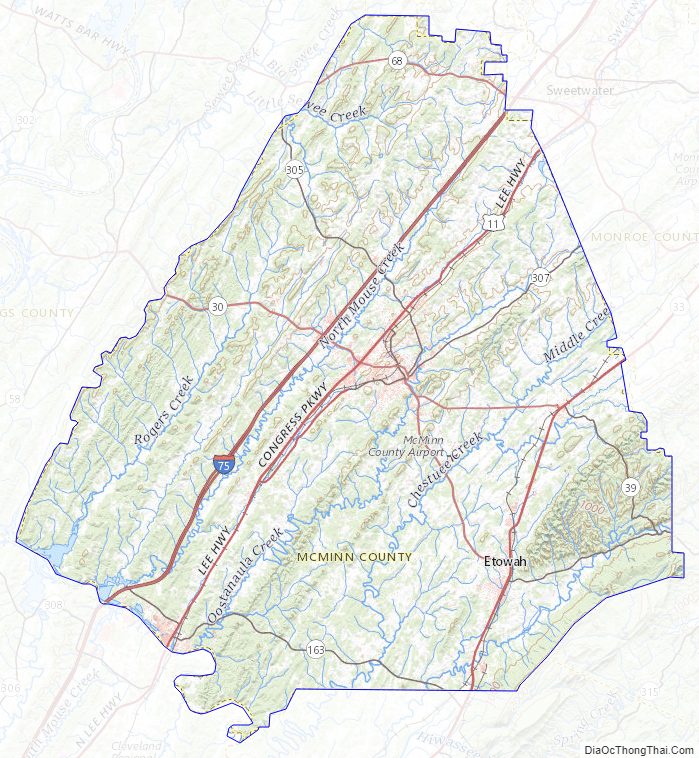
McMinn County Road Map
Geography
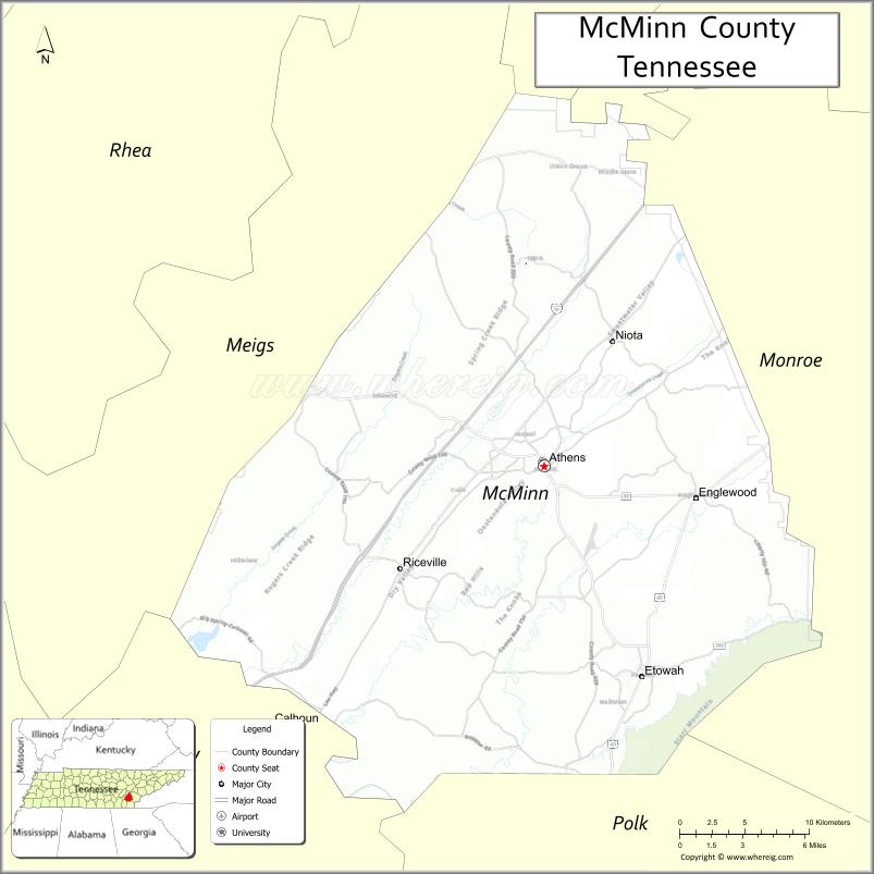
According to the U.S. Census Bureau, the county has a total area of 432 square miles (1,120 km), of which 430 square miles (1,100 km) is land and 2.1 square miles (5.4 km) (0.5%) is water. Most of the county is within the Ridge and Valley province of the Appalachian Mountains, which is characterized by a series of parallel ridges separated by valleys oriented in a northeast-to-southwest direction. The Hiwassee River forms the county’s border with Bradley County to the southwest. Starr Mountain, a large ridge in the southeastern part of the county on the edge of the Unicoi Mountains, part of the Blue Ridge Appalachian province, forms part of the county’s border with Polk County to the south and Monroe County to the north and east.
Adjacent counties
- Roane County (north)
- Loudon County (northeast)
- Monroe County (east)
- Polk County (southeast)
- Bradley County (southwest)
- Meigs County (west)
National protected area
- Cherokee National Forest (part)
State protected area
- Chickamauga Wildlife Management Area (part)
McMinn County Topographic Map
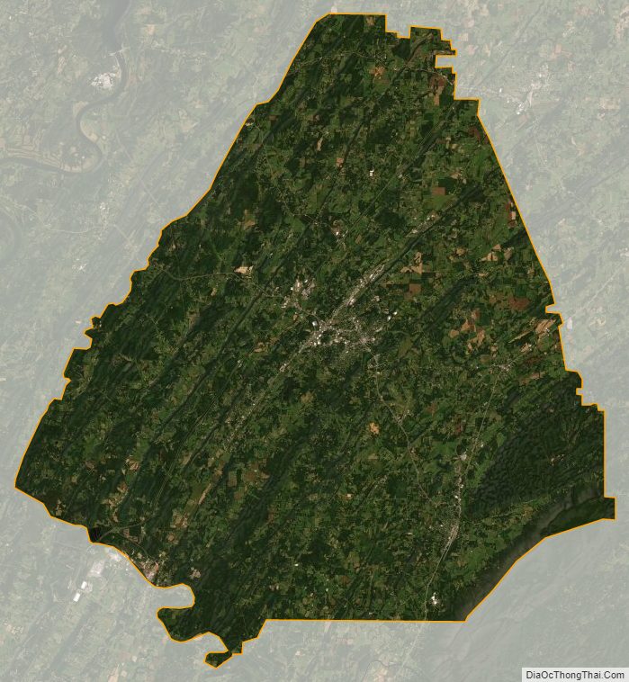
McMinn County Satellite Map
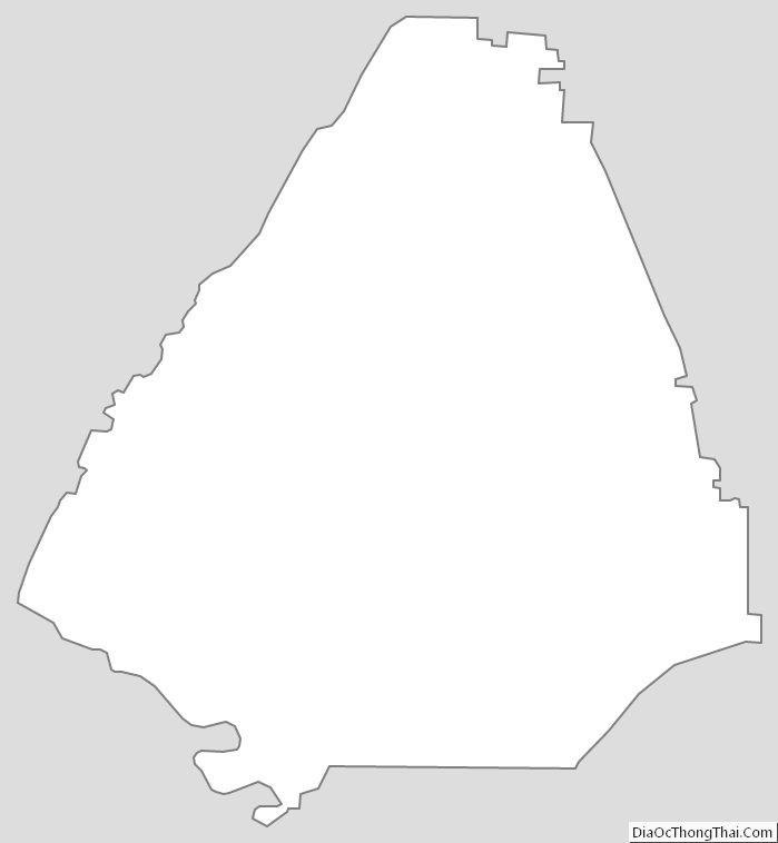
McMinn County Outline Map
See also
Map of Tennessee State and its subdivision:- Anderson
- Bedford
- Benton
- Bledsoe
- Blount
- Bradley
- Campbell
- Cannon
- Carroll
- Carter
- Cheatham
- Chester
- Claiborne
- Clay
- Cocke
- Coffee
- Crockett
- Cumberland
- Davidson
- Decatur
- DeKalb
- Dickson
- Dyer
- Fayette
- Fentress
- Franklin
- Gibson
- Giles
- Grainger
- Greene
- Grundy
- Hamblen
- Hamilton
- Hancock
- Hardeman
- Hardin
- Hawkins
- Haywood
- Henderson
- Henry
- Hickman
- Houston
- Humphreys
- Jackson
- Jefferson
- Johnson
- Knox
- Lake
- Lauderdale
- Lawrence
- Lewis
- Lincoln
- Loudon
- Macon
- Madison
- Marion
- Marshall
- Maury
- McMinn
- McNairy
- Meigs
- Monroe
- Montgomery
- Moore
- Morgan
- Obion
- Overton
- Perry
- Pickett
- Polk
- Putnam
- Rhea
- Roane
- Robertson
- Rutherford
- Scott
- Sequatchie
- Sevier
- Shelby
- Smith
- Stewart
- Sullivan
- Sumner
- Tipton
- Trousdale
- Unicoi
- Union
- Van Buren
- Warren
- Washington
- Wayne
- Weakley
- White
- Williamson
- Wilson
- Alabama
- Alaska
- Arizona
- Arkansas
- California
- Colorado
- Connecticut
- Delaware
- District of Columbia
- Florida
- Georgia
- Hawaii
- Idaho
- Illinois
- Indiana
- Iowa
- Kansas
- Kentucky
- Louisiana
- Maine
- Maryland
- Massachusetts
- Michigan
- Minnesota
- Mississippi
- Missouri
- Montana
- Nebraska
- Nevada
- New Hampshire
- New Jersey
- New Mexico
- New York
- North Carolina
- North Dakota
- Ohio
- Oklahoma
- Oregon
- Pennsylvania
- Rhode Island
- South Carolina
- South Dakota
- Tennessee
- Texas
- Utah
- Vermont
- Virginia
- Washington
- West Virginia
- Wisconsin
- Wyoming