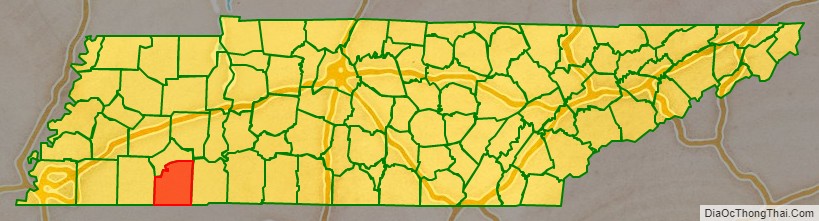
McNairy County is a county located in the U.S. state of Tennessee. As of the 2020 census, the population was 25,866. Its county seat is Selmer. McNairy County is located along Tennessee’s border with the state of Mississippi.
Sheriff Buford Pusser, whose story was told in the Walking Tall series of movies, was the sheriff of McNairy County from 1964 to 1970.
McNairy County is the location of the Coon Creek Science Center, a notable fossil site that preserves Late Cretaceous marine shells and vertebrate remains (such as mosasaurs).
The postwar musical environment of the county played a pivotal role in the development of popular music. Influential disc jockey Dewey Phillips hailed from Adamsville, Tennessee. Carl Perkins made the first recordings of his career in the home studio of Stanton Littlejohn at Eastview, Tennessee. Perkins and Elvis Presley had their first meeting at one of Presley’s earliest road performances in Bethel Springs, Tennessee.
| Name: | McNairy County |
|---|---|
| FIPS code: | 47-109 |
| State: | Tennessee |
| Founded: | October 8, 1823 |
| Named for: | John McNairy |
| Seat: | Selmer |
| Largest town: | Selmer |
| Total Area: | 564 sq mi (1,460 km²) |
| Land Area: | 563 sq mi (1,460 km²) |
| Total Population: | 25,866 |
| Population Density: | 46/sq mi (18/km²) |
| Time zone: | UTC−6 (Central) |
| Summer Time Zone (DST): | UTC−5 (CDT) |
| Website: | www.mcnairycountytn.com |
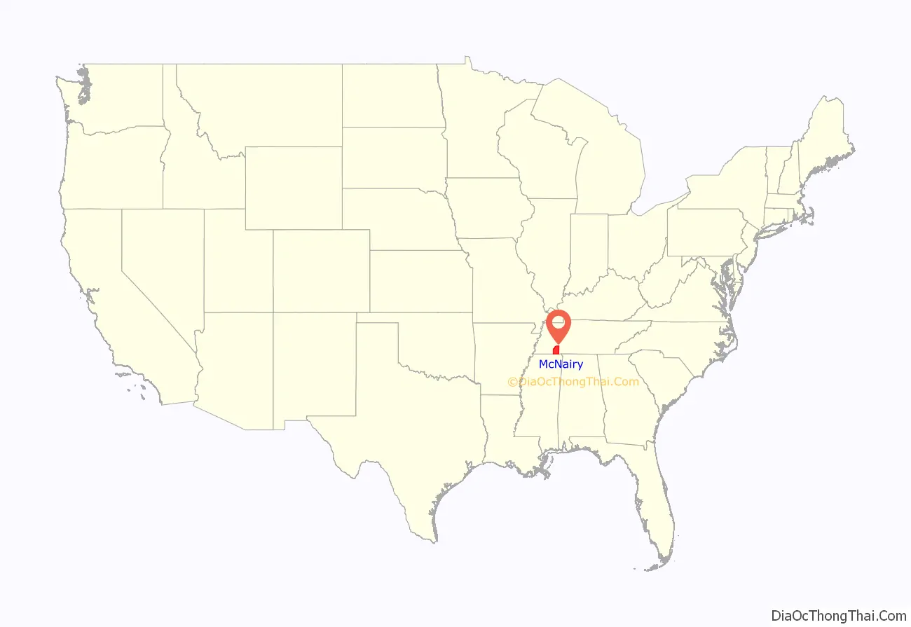
McNairy County location map. Where is McNairy County?
History
McNairy County was formed in 1823 from parts of Hardin County, and was named for Judge John McNairy.
Also, the history of McNairy County includes an almost unheard of very small school. The Trantham School was established in McNairy County, TN. It operated from 1922 through 1948; Grades we’re 1 through 8. This was a one Teacher School.
County seat
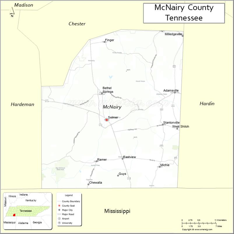
Purdy was the county seat of McNairy County until 1890. Since then, Selmer has been the county seat.
Sheriff Buford Pusser
Buford Pusser served as the sheriff of McNairy County from 1964 to 1970. The courthouse and jail in Selmer were his base of operations. He gained prominence for his fight against illegal distilleries, bootleggers, gambling establishments, and corruption in the county. His story has been made famous in the Walking Tall series of movies starring Joe Don Baker, Bo Svenson, Brian Dennehy, Dwayne Johnson, and in numerous documentaries and books.
Newspapers
The oldest existing business in McNairy County is its newspaper, the Independent Appeal, which was founded as the McNairy County Independent in 1902. It is located in Selmer.
In 2008, Tom Evans, a former reporter and photographer for the Independent Appeal, formed his own weekly newspaper, The McNairy County News.
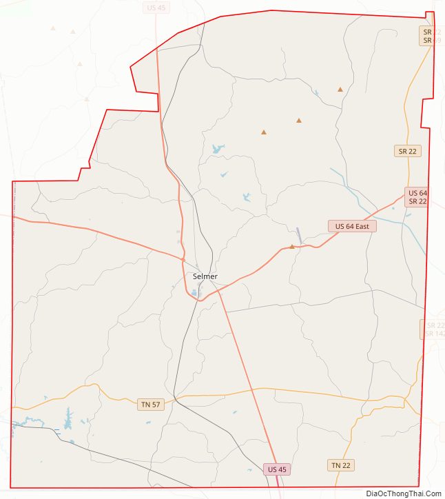
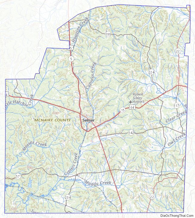
McNairy County Road Map
Geography
According to the U.S. Census Bureau, the county has a total area of 564 square miles (1,460 km), of which 563 square miles (1,460 km) is land and 0.8 square miles (2.1 km) (0.1%) is water.
The major highways U.S. Route 64 (east-west) and U.S. Route 45 (north-south) pass through McNairy County and intersect in Selmer. Between the late 1990s and mid 2010s, both highways were upgraded to four lane divided highways, giving the county quicker access to the surrounding areas. McNairy County’s position on Route 64 places it on the historic Lee Highway, which stretches from New York to San Francisco.
State Highways 22 and 57 also pass through the county. SR 22 along the eastern portion intersecting with US 64 in Adamsville, and SR 57 through the southern portion intersecting with US 45 in Eastview.
Adjacent counties
- Chester County (north)
- Hardin County (east)
- Alcorn County, Mississippi (south)
- Hardeman County (west)
State protected areas
- Big Hill Pond State Park
McNairy County Topographic Map
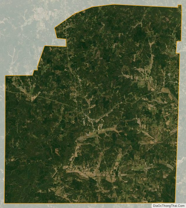
McNairy County Satellite Map
McNairy County Outline Map

See also
Map of Tennessee State and its subdivision:- Anderson
- Bedford
- Benton
- Bledsoe
- Blount
- Bradley
- Campbell
- Cannon
- Carroll
- Carter
- Cheatham
- Chester
- Claiborne
- Clay
- Cocke
- Coffee
- Crockett
- Cumberland
- Davidson
- Decatur
- DeKalb
- Dickson
- Dyer
- Fayette
- Fentress
- Franklin
- Gibson
- Giles
- Grainger
- Greene
- Grundy
- Hamblen
- Hamilton
- Hancock
- Hardeman
- Hardin
- Hawkins
- Haywood
- Henderson
- Henry
- Hickman
- Houston
- Humphreys
- Jackson
- Jefferson
- Johnson
- Knox
- Lake
- Lauderdale
- Lawrence
- Lewis
- Lincoln
- Loudon
- Macon
- Madison
- Marion
- Marshall
- Maury
- McMinn
- McNairy
- Meigs
- Monroe
- Montgomery
- Moore
- Morgan
- Obion
- Overton
- Perry
- Pickett
- Polk
- Putnam
- Rhea
- Roane
- Robertson
- Rutherford
- Scott
- Sequatchie
- Sevier
- Shelby
- Smith
- Stewart
- Sullivan
- Sumner
- Tipton
- Trousdale
- Unicoi
- Union
- Van Buren
- Warren
- Washington
- Wayne
- Weakley
- White
- Williamson
- Wilson
- Alabama
- Alaska
- Arizona
- Arkansas
- California
- Colorado
- Connecticut
- Delaware
- District of Columbia
- Florida
- Georgia
- Hawaii
- Idaho
- Illinois
- Indiana
- Iowa
- Kansas
- Kentucky
- Louisiana
- Maine
- Maryland
- Massachusetts
- Michigan
- Minnesota
- Mississippi
- Missouri
- Montana
- Nebraska
- Nevada
- New Hampshire
- New Jersey
- New Mexico
- New York
- North Carolina
- North Dakota
- Ohio
- Oklahoma
- Oregon
- Pennsylvania
- Rhode Island
- South Carolina
- South Dakota
- Tennessee
- Texas
- Utah
- Vermont
- Virginia
- Washington
- West Virginia
- Wisconsin
- Wyoming