Mellette County is a county in the U.S. state of South Dakota. As of the 2020 census, the population was 1,918. Its county seat is White River. The county was created in 1909, and was organized in 1911. It was named for Arthur C. Mellette, the last Governor of the Dakota Territory and the first Governor of the state of South Dakota.
Historically territory of the Sioux/Lakota peoples, 33.35 percent of the county’s land is trust land associated with the Rosebud Indian Reservation in the neighboring county to the south. According to the 2000 United States Census, 52.2% of the population is Native American, mostly the federally recognized Sicangu Oyate (Upper Brulé Sioux) and the Rosebud Sioux Tribe, a branch of the Lakota people.
| Name: | Mellette County |
|---|---|
| FIPS code: | 46-095 |
| State: | South Dakota |
| Founded: | 1909 |
| Named for: | Arthur C. Mellette |
| Seat: | White River |
| Largest city: | White River |
| Total Area: | 1,311 sq mi (3,400 km²) |
| Land Area: | 1,307 sq mi (3,390 km²) |
| Total Population: | 1,918 |
| Population Density: | 1.5/sq mi (0.56/km²) |
| Time zone: | UTC−6 (Central) |
| Summer Time Zone (DST): | UTC−5 (CDT) |
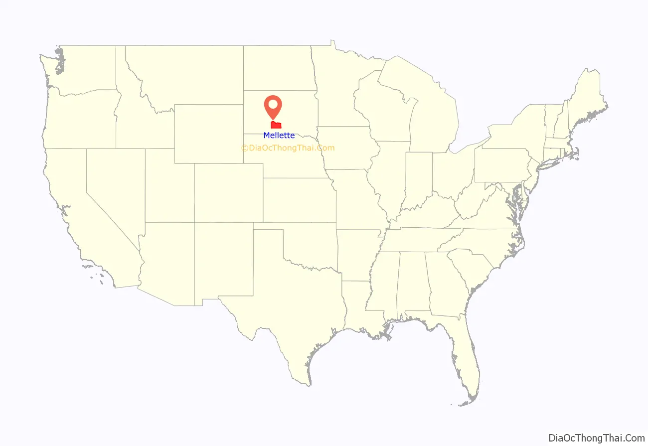
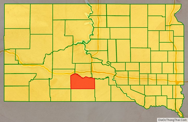
Mellette County location map. Where is Mellette County?
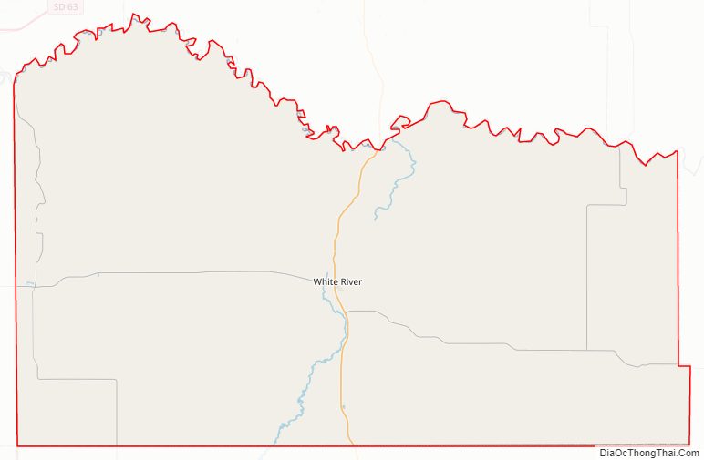
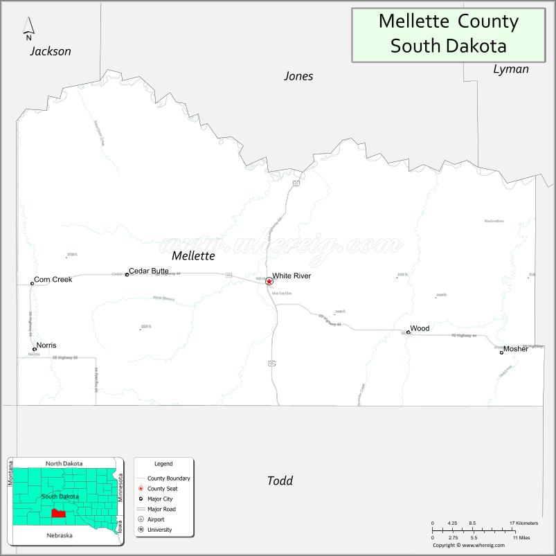
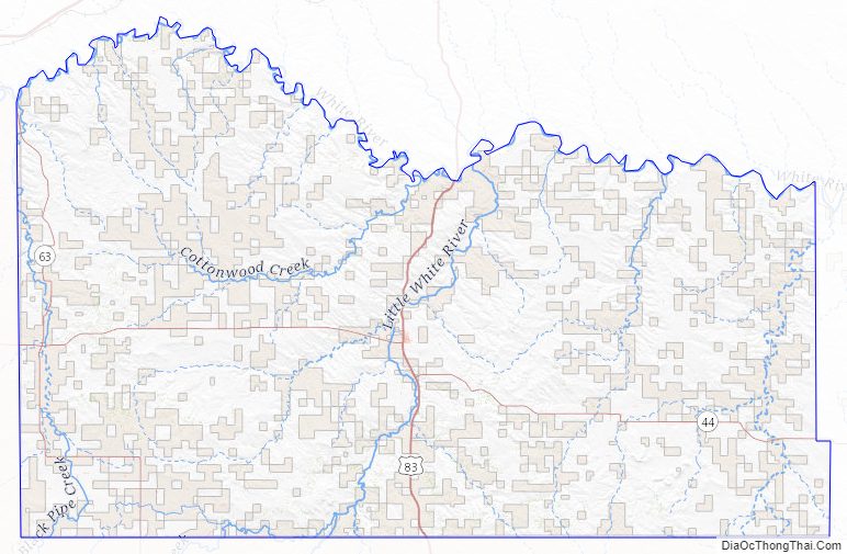
Mellette County Road Map
Geography
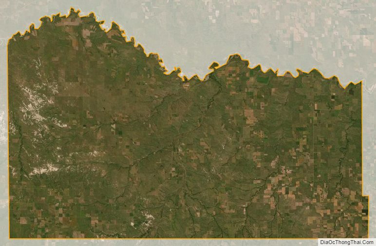
The White River flows eastward along the north boundary line of Mellette County. The Little White River flows northward through central Mellette County, discharging into White River. The terrain consists of semi-arid rolling hills, the northern portion dotted with ponds and small lakes. The area is mostly devoted to agriculture. The terrain slopes to the northeast; its highest point is the SW corner at 2,779′ (847m) ASL. The county has a total area of 1,311 square miles (3,400 km), of which 1,307 square miles (3,390 km) is land and 3.6 square miles (9.3 km) (0.3%) is water.
The eastern portion of South Dakota’s counties (48 of 66) observe Central Time; the western counties (18 of 66) observe Mountain Time. Mellette County is the westernmost of the SD counties to observe Central Time.
Major highways
- U.S. Highway 83
- South Dakota Highway 44
- South Dakota Highway 53
- South Dakota Highway 63
Adjacent counties
- Jones County – north
- Lyman County – northeast
- Tripp County – east
- Todd County – south
- Bennett County – southwest (observes Mountain Time)
- Jackson County – west (observes Mountain Time)
Mellette County Topographic Map
Mellette County Satellite Map
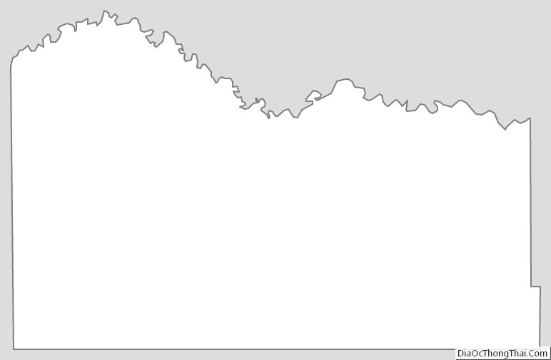
Mellette County Outline Map
See also
Map of South Dakota State and its subdivision:- Aurora
- Beadle
- Bennett
- Bon Homme
- Brookings
- Brown
- Brule
- Buffalo
- Butte
- Campbell
- Charles Mix
- Clark
- Clay
- Codington
- Corson
- Custer
- Davison
- Day
- Deuel
- Dewey
- Douglas
- Edmunds
- Fall River
- Faulk
- Grant
- Gregory
- Haakon
- Hamlin
- Hand
- Hanson
- Harding
- Hughes
- Hutchinson
- Hyde
- Jackson
- Jerauld
- Jones
- Kingsbury
- Lake
- Lawrence
- Lincoln
- Lyman
- Marshall
- McCook
- McPherson
- Meade
- Mellette
- Miner
- Minnehaha
- Moody
- Pennington
- Perkins
- Potter
- Roberts
- Sanborn
- Shannon
- Spink
- Stanley
- Sully
- Todd
- Tripp
- Turner
- Union
- Walworth
- Yankton
- Ziebach
- Alabama
- Alaska
- Arizona
- Arkansas
- California
- Colorado
- Connecticut
- Delaware
- District of Columbia
- Florida
- Georgia
- Hawaii
- Idaho
- Illinois
- Indiana
- Iowa
- Kansas
- Kentucky
- Louisiana
- Maine
- Maryland
- Massachusetts
- Michigan
- Minnesota
- Mississippi
- Missouri
- Montana
- Nebraska
- Nevada
- New Hampshire
- New Jersey
- New Mexico
- New York
- North Carolina
- North Dakota
- Ohio
- Oklahoma
- Oregon
- Pennsylvania
- Rhode Island
- South Carolina
- South Dakota
- Tennessee
- Texas
- Utah
- Vermont
- Virginia
- Washington
- West Virginia
- Wisconsin
- Wyoming