| Name: | Mercer County |
|---|---|
| FIPS code: | 39-107 |
| State: | Ohio |
| Founded: | January 2, 1824 |
| Named for: | Hugh Mercer |
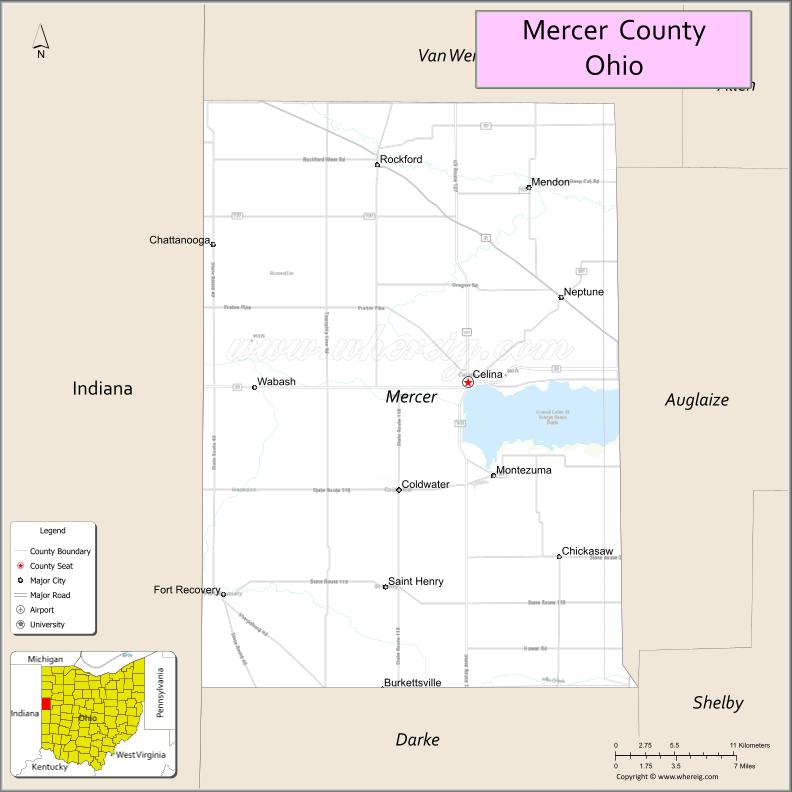
| Seat: | Celina |
| Largest city: | Celina |
| Total Area: | 473 sq mi (1,230 km²) |
| Land Area: | 462 sq mi (1,200 km²) |
| Total Population: | 42,528 |
| Population Density: | 90/sq mi (30/km²) |
| Time zone: | UTC−5 (Eastern) |
| Summer Time Zone (DST): | UTC−4 (EDT) |
| Website: | www.mercercountyohio.org |
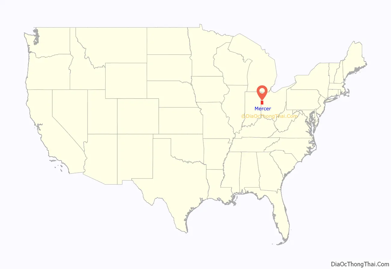
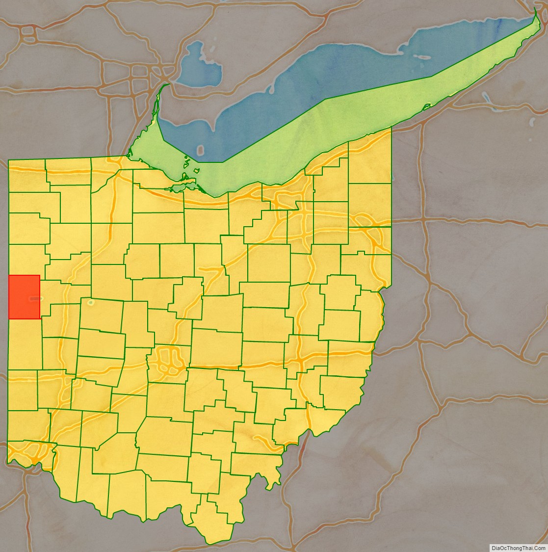
Mercer County location map. Where is Mercer County?
History
Mercer County was founded in 1820 which set it apart from Darke County. Land south of the Greenville Treaty Line was still part of Darke County. An act establishing Mercer County took place on January 2, 1824. In 1837 Van Wert County was detached and the county line established is the current northern border of Mercer County. In 1839 Celina was established as the capital of Mercer County, St. Marys, Ohio was the previous capital. In 1848 the area south of the Greenville Treaty Line to the current southern county line, was attached. When Auglaize County, Ohio was formed, Mercer County’s eastern border was moved 6 miles west with the exception of the area south of the Greenville Treaty line. This created the sharp point at Mercer County’s south-east corner and was the last county line modification.
In the mid to late 1800s Mercer county became home to many German immigrants, most of whom became farmers in the new world. Many of these German immigrants migrated from northwestern Germany.
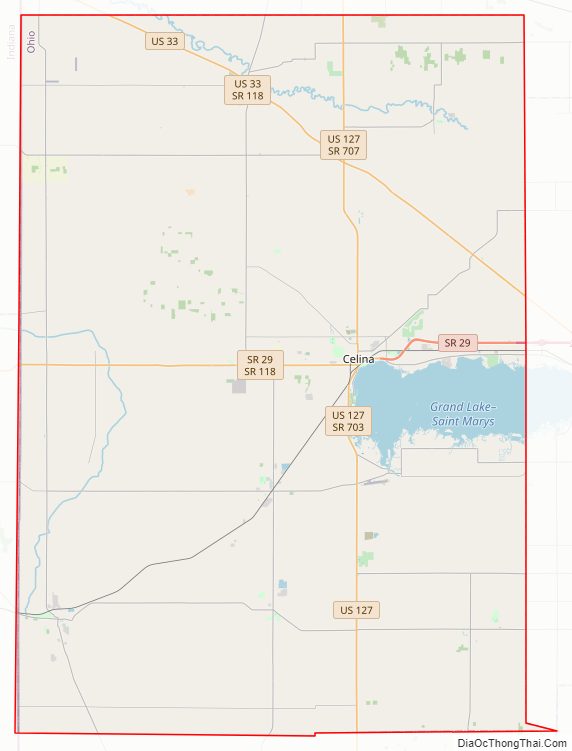
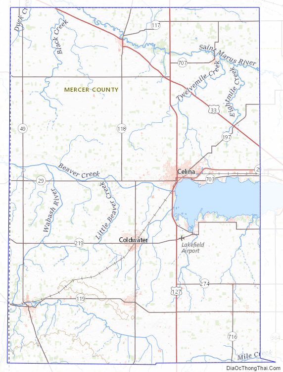
Mercer County Road Map
Geography
According to the U.S. Census Bureau, the county has a total area of 473 square miles (1,230 km), of which 462 square miles (1,200 km) is land and 11 square miles (28 km) (2.3%) is water. The entire county has an elevation difference of less than 300 feet. The highest point is on the southern county line at 1071 feet above sea level. This is in proximity to the head waters for the Wabash River. The lowest point in the county is 780 feet above sea level. This point is located on the northern county line where the St. Marys River crosses over.
Drainage basins
Mercer County has two rivers running through it; the Wabash and the St. Marys. The Wabash watershed is part of the Gulf of Mexico’s watershed. The St. Marys watershed is part of Lake Erie’s watershed. Creeks between these two watersheds are within a mile of each other at some places in Mercer County. This area/line that divides the drainage basins is known as the St. Lawrence Continental Divide
Beaver Creek is the longest and largest creek in Mercer County. It stretches 19.7 miles and has two sections. The first section begins in southern farmland in the county and flows through the town of Montezuma, Ohio and into Grand Lake St. Marys. The other section of the creek begins as a spillway and empties into the Wabash River. Beaver Creek was originally one piece, but was split into two sections after the construction of Grand Lake. The creeks’ spillway, and last section, has been the subject of controversy and multimillion-dollar lawsuits. Farmers along Beaver Creek claim their land floods because of the spillway that was put up in 1997, replacing the previous spillway, built in 1913.
Mercer County Topographic Map
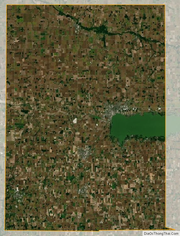
Mercer County Satellite Map
Mercer County Outline Map

See also
Map of Ohio State and its subdivision:- Adams
- Allen
- Ashland
- Ashtabula
- Athens
- Auglaize
- Belmont
- Brown
- Butler
- Carroll
- Champaign
- Clark
- Clermont
- Clinton
- Columbiana
- Coshocton
- Crawford
- Cuyahoga
- Darke
- Defiance
- Delaware
- Erie
- Fairfield
- Fayette
- Franklin
- Fulton
- Gallia
- Geauga
- Greene
- Guernsey
- Hamilton
- Hancock
- Hardin
- Harrison
- Henry
- Highland
- Hocking
- Holmes
- Huron
- Jackson
- Jefferson
- Knox
- Lake
- Lake Erie
- Lawrence
- Licking
- Logan
- Lorain
- Lucas
- Madison
- Mahoning
- Marion
- Medina
- Meigs
- Mercer
- Miami
- Monroe
- Montgomery
- Morgan
- Morrow
- Muskingum
- Noble
- Ottawa
- Paulding
- Perry
- Pickaway
- Pike
- Portage
- Preble
- Putnam
- Richland
- Ross
- Sandusky
- Scioto
- Seneca
- Shelby
- Stark
- Summit
- Trumbull
- Tuscarawas
- Union
- Van Wert
- Vinton
- Warren
- Washington
- Wayne
- Williams
- Wood
- Wyandot
- Alabama
- Alaska
- Arizona
- Arkansas
- California
- Colorado
- Connecticut
- Delaware
- District of Columbia
- Florida
- Georgia
- Hawaii
- Idaho
- Illinois
- Indiana
- Iowa
- Kansas
- Kentucky
- Louisiana
- Maine
- Maryland
- Massachusetts
- Michigan
- Minnesota
- Mississippi
- Missouri
- Montana
- Nebraska
- Nevada
- New Hampshire
- New Jersey
- New Mexico
- New York
- North Carolina
- North Dakota
- Ohio
- Oklahoma
- Oregon
- Pennsylvania
- Rhode Island
- South Carolina
- South Dakota
- Tennessee
- Texas
- Utah
- Vermont
- Virginia
- Washington
- West Virginia
- Wisconsin
- Wyoming