Mille Lacs County (/ˌmɪl ˈlæks/ mil LAKS) is a county in the East Central part of the U.S. state of Minnesota. As of the 2020 census, the population was 26,459. Its county seat is Milaca. The county was founded in 1857, and its boundary was expanded in 1860.
Mille Lacs County is included in the Minneapolis–St. Paul Metropolitan Statistical Area.
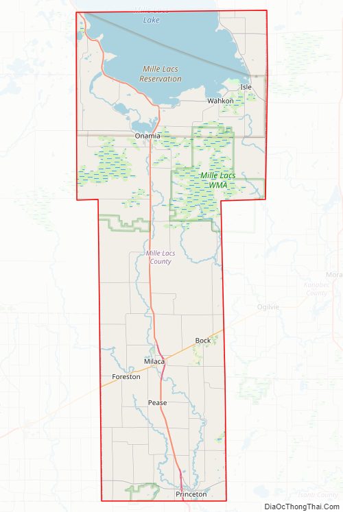
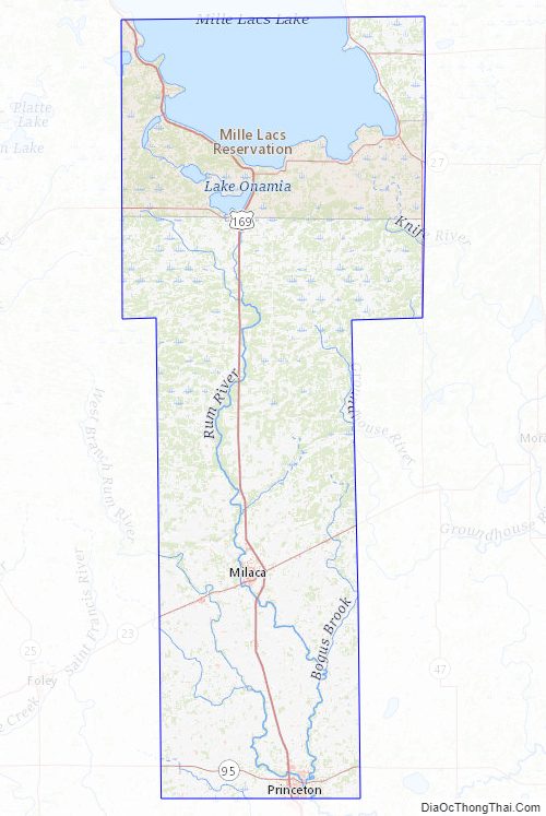
A portion of the Mille Lacs Indian Reservation is in the county.
| Name: | Mille Lacs County |
|---|---|
| FIPS code: | 27-095 |
| State: | Minnesota |
| Founded: | May 23, 1857 |
| Named for: | Mille Lacs Lake |
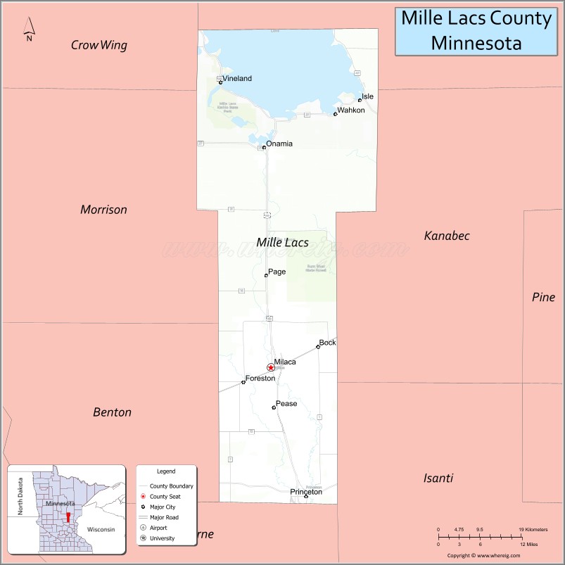
| Seat: | Milaca |
| Largest city: | Princeton |
| Total Area: | 682 sq mi (1,770 km²) |
| Land Area: | 572 sq mi (1,480 km²) |
| Total Population: | 26,459 |
| Population Density: | 46.3/sq mi (17.9/km²) |
| Time zone: | UTC−6 (Central) |
| Summer Time Zone (DST): | UTC−5 (CDT) |
| Website: | www.co.mille-lacs.mn.us |
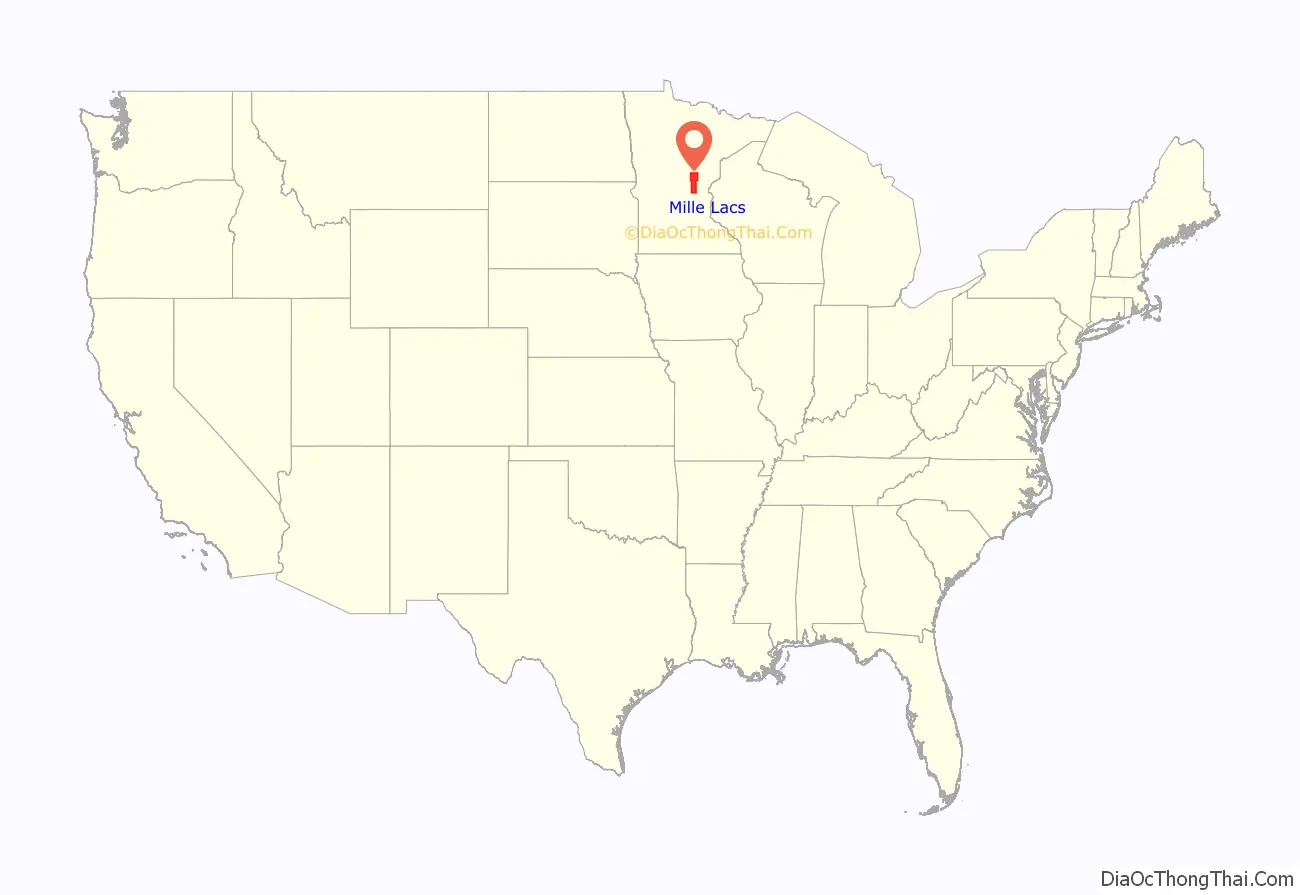
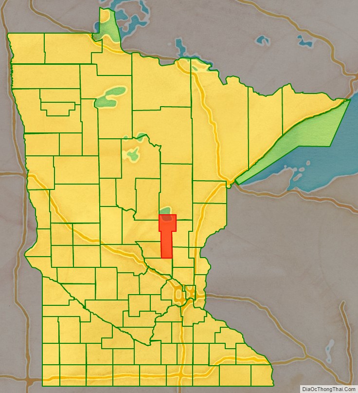
Mille Lacs County location map. Where is Mille Lacs County?
History
The US legislature established the Wisconsin Territory effective July 3, 1836. It existed until its eastern portion was granted statehood (as Wisconsin) in 1848. The federal government set up the Minnesota Territory from the remaining territory effective March 3, 1849. The newly organized territorial legislature created nine counties across the territory in October of that year. On May 23, 1857, one of those original counties, Benton, had its eastern portion partitioned off to create Mille Lacs County. The original county consisted of the portion of the contemporary Mille Lacs County east of the west branch of the Rum River and two townships now part of Isanti County, adjacent to Mille Lacs County. In 1858 the 12 townships forming the contemporary southern 10 townships of Mille Lacs County and the two northwestern townships in Isanti County were organized apart from Benton and Mille Lacs Counties to form Monroe County, leaving the northern “Square Top-knot” as Mille Lacs County. In 1860, Monroe and Mille Lacs Counties merged. Shortly thereafter, the two southeastern townships were transferred to Isanti County, forming the county’s present boundaries.
Mille Lacs County Road Map
Geography
The Rum River flows south through the county, originating from Mille Lacs Lake. It is joined by the West Branch of the Rum River, which rises in northwest Mille Lacs County and flows south-southeast to its confluence with the Rum at Princeton. The county terrain consists of wooded rolling hills, carved by drainages, with open areas devoted to agriculture. The terrain slopes to the south and east, with its highest point at one mile (1.6 km) from the southwest shoreline of Mille Lacs Lake, in Mille Lacs Kathio State Park. A hill there measures 1,371′ (418m) ASL.
According to the United States Census Bureau, the county has a total area of 682 square miles (1,770 km), of which 572 square miles (1,480 km) is land and 109 square miles (280 km) (16%) is water.
Major highways
- U.S. Highway 169
- Minnesota State Highway 18
- Minnesota State Highway 23
- Minnesota State Highway 27
- Minnesota State Highway 47
- Minnesota State Highway 95
Airports
- Milaca Municipal Airport (18Y) – northeast of Milaca
- Princeton Municipal Airport (PNM) – southwest of Princeton
Adjacent counties
- Aitkin County – north
- Kanabec County – northeast
- Isanti County – southeast
- Sherburne County – south
- Benton County – southwest
- Morrison County – west
- Crow Wing County – northwest
Protected areas
- Father Hennepin State Park
- Four Brooks State Wildlife Management Area (part)
- Kunkel State Wildlife Management Area
- Mille Lacs Kathio State Park
- Mille Lacs National Wildlife Refuge
- Mille Lacs State Wildlife Management Area
- Rum River State Forest
- Solana State Forest (part)
Mille Lacs County Topographic Map
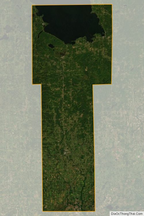
Mille Lacs County Satellite Map
Mille Lacs County Outline Map

See also
Map of Minnesota State and its subdivision:- Aitkin
- Anoka
- Becker
- Beltrami
- Benton
- Big Stone
- Blue Earth
- Brown
- Carlton
- Carver
- Cass
- Chippewa
- Chisago
- Clay
- Clearwater
- Cook
- Cottonwood
- Crow Wing
- Dakota
- Dodge
- Douglas
- Faribault
- Fillmore
- Freeborn
- Goodhue
- Grant
- Hennepin
- Houston
- Hubbard
- Isanti
- Itasca
- Jackson
- Kanabec
- Kandiyohi
- Kittson
- Koochiching
- Lac qui Parle
- Lake
- Lake of the Woods
- Lake Superior
- Le Sueur
- Lincoln
- Lyon
- Mahnomen
- Marshall
- Martin
- McLeod
- Meeker
- Mille Lacs
- Morrison
- Mower
- Murray
- Nicollet
- Nobles
- Norman
- Olmsted
- Otter Tail
- Pennington
- Pine
- Pipestone
- Polk
- Pope
- Ramsey
- Red Lake
- Redwood
- Renville
- Rice
- Rock
- Roseau
- Saint Louis
- Scott
- Sherburne
- Sibley
- Stearns
- Steele
- Stevens
- Swift
- Todd
- Traverse
- Wabasha
- Wadena
- Waseca
- Washington
- Watonwan
- Wilkin
- Winona
- Wright
- Yellow Medicine
- Alabama
- Alaska
- Arizona
- Arkansas
- California
- Colorado
- Connecticut
- Delaware
- District of Columbia
- Florida
- Georgia
- Hawaii
- Idaho
- Illinois
- Indiana
- Iowa
- Kansas
- Kentucky
- Louisiana
- Maine
- Maryland
- Massachusetts
- Michigan
- Minnesota
- Mississippi
- Missouri
- Montana
- Nebraska
- Nevada
- New Hampshire
- New Jersey
- New Mexico
- New York
- North Carolina
- North Dakota
- Ohio
- Oklahoma
- Oregon
- Pennsylvania
- Rhode Island
- South Carolina
- South Dakota
- Tennessee
- Texas
- Utah
- Vermont
- Virginia
- Washington
- West Virginia
- Wisconsin
- Wyoming