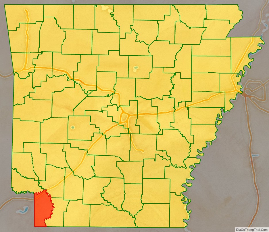
Miller County is a county located in the southwestern corner of the U.S. state of Arkansas. As of the 2020 census, the population was 42,600. The county seat is Texarkana.
Miller County is part of the Texarkana, TX-AR, Metropolitan Statistical Area.
When first formed, Miller County was Arkansas’s sixth county, established on April 1, 1820, and named for James Miller, the first governor of the Arkansas Territory. Additionally, Miller County was the first of the state’s counties to be formed upon the creation of the Arkansas Territory. The first five — Arkansas, Lawrence, Clark, Hempstead and Pulaski — were formed during Arkansas’s days as part of the Missouri Territory. This county was abolished in 1838.
During the Reconstruction era, it was organized again on December 22, 1874, from a portion of neighboring Lafayette County.
| Name: | Miller County |
|---|---|
| FIPS code: | 05-091 |
| State: | Arkansas |
| Founded: | April 1, 1820; recreated December 22, 1874, following abolishment in 1838 |
| Named for: | James Miller |
| Seat: | Texarkana |
| Largest city: | Texarkana |
| Total Area: | 637.48 sq mi (1,651.1 km²) |
| Land Area: | 623.98 sq mi (1,616.1 km²) |
| Total Population: | 42,600 |
| Population Density: | 67/sq mi (26/km²) |
| Time zone: | UTC−6 (Central) |
| Summer Time Zone (DST): | UTC−5 (CDT) |
| Website: | www.millercountyar.com |
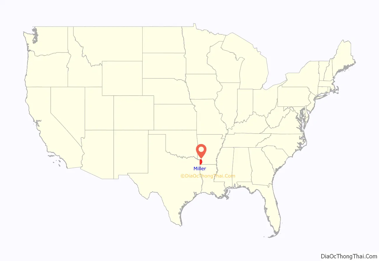
Miller County location map. Where is Miller County?
History
When created in 1820, Miller County included most of the current Miller County, as well as several present-day Texas counties. In 1831 the county seat was located what is the current day Clarksville, Texas.
When Arkansas achieved statehood the same year as Texas declared itself an independent republic in 1836, a dispute arose over their common border, with the area in Miller County having representation in both the Arkansas legislature and the Texas congress. In 1837 and 1838, Texas organized Red River and Fannin counties, respectively, in the area. Arkansas attempted to counter by making it a misdemeanor for Miller County residents to hold office in Texas, and then by establishing a county court in Fannin. The attempts were ultimately unsuccessful. In 1845 Texas agreed to annexation by the United States, settling the boundary between Texas and Arkansas. As much of Miller County was lost to Texas, the county was dissolved, with the remaining territory returning to Lafayette County.
The modern Miller County was re-created in 1874 from the parts of Lafayette County lying west and south of the Red River.
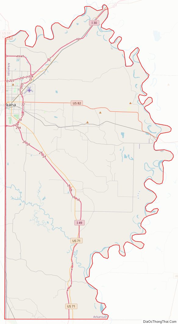
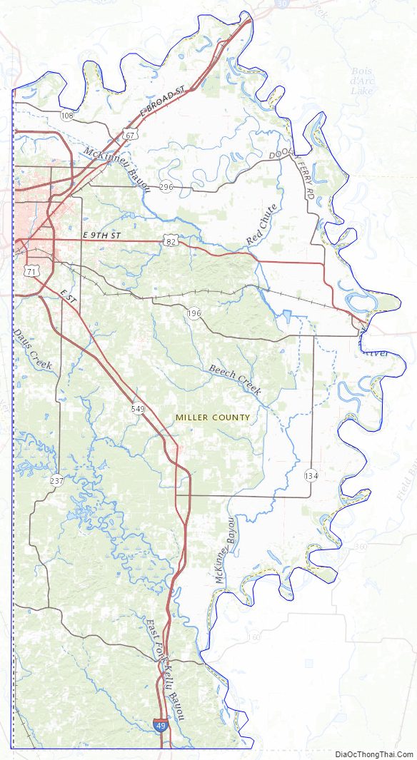
Miller County Road Map
Geography
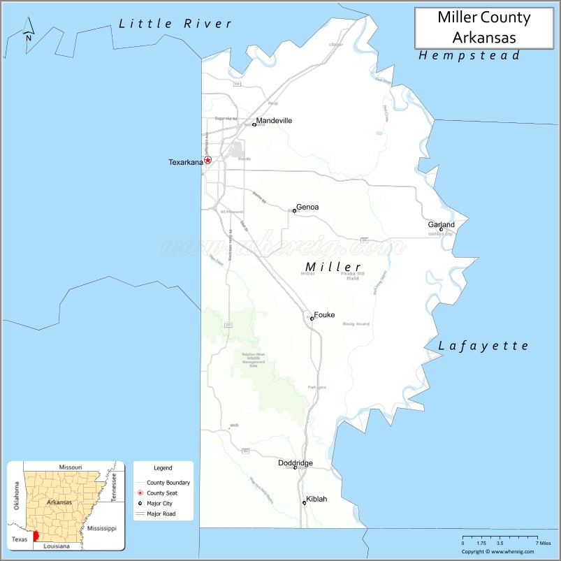
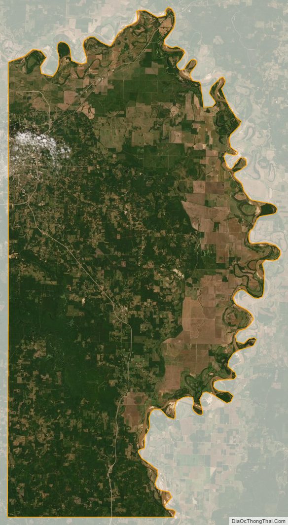
Miller County is located in the southwest corner of Arkansas in the Piney Woods, a temperate coniferous forest. The forests of pine trees initially formed a logging and silviculture industry, though many fields have been cleared from the forest to grow rice, soybeans, corn, and vegetables. The county is also within the Ark-La-Tex region, sharing a tripoint with Texas and Louisiana. The Ark-La-Tex is an economic region anchored by Shreveport, Louisiana, Tyler, Texas, Longview, Texas, and Texarkana. The Red River serves as the northern and eastern boundary of the county, though the watercourse has shifted since the county’s reestablishment in 1874. The original Red River continues to serve as the county line between Little River, Hempstead, and Lafayette counties in Arkansas. According to the U.S. Census Bureau, Miller County has a total area of 637.48 square miles (1,651.1 km), of which 623.98 square miles (1,616.1 km) is land and 13.50 square miles (35.0 km) (2.1%) is water.
The county is located approximately 143 miles (230 km) southwest of Little Rock, 73 miles (117 km) north of Shreveport, Louisiana, and 204 miles (328 km) east of the Dallas–Fort Worth metroplex (DFW) in Texas. Miller County is surrounded by three Arkansas counties: Little River County to the north, Hempstead County to the northeast, Lafayette County to the east; two Louisiana parishes: Bossier Parish to the southeast and Caddo Parish, to the south; and two Texas counties to the west: Cass and Bowie.
Ecology
Miller County is within the South Central Plains Level III ecoregion designated by the Environmental Protection Agency. Within the region, the county contains parts of four different Level IV ecoregions. Throughout the South Central Plains, forests are mostly swamp – southern floodplain forest, unlike the oak–hickory–pine forest of higher, better drained forests in adjacent eco-regions.
Along the north and eastern county boundary, the Red River Bottomlands follows the Red River. This eco-region contains floodplains, low terraces, oxbow lakes, meander scars, backswamps, natural levees, and the meandering Red River. Natural vegetation is southern floodplain forest unlike the oak–hickory– pine forest of higher, better drained compared to adjacent forests. However, the region has widely been cleared and drained for agriculture. The Red River is almost continuously turbid; suspended sediment concentrations are usually much higher than in the Saline River or Ouachita River due to land cover, land use, and upstream lithology differences.
South of Texarkana, the Floodplains and Low Terraces eco-region follows the Sulphur River. It contains frequently flooded forested wetlands, natural levees, swales, oxbow lakes, and meander scars. Longitudinal channel gradients are low and are less than in the Ouachita Mountains. North of the low terraces, a small strip of Pleistocene Fluvial Terraces ecoregion contains level, poorly-drained, periodically wet soils underlain by Pleistocene unconsolidated terrace deposits. Loblolly pine and oaks are common and are adapted to the prevailing hydroxeric regime; pastureland and hayland are less extensive. A vertical sequence of terraces occurs. The lowest terrace is nearly flat, clayey, and has extensive hardwood wetlands. Higher terraces become progressively older and more dissected; they are dominated by pine flatwoods, pine savanna, or prairie; flatwood wetlands are less extensive than on the lowest terrace. The mid-level terrace is veneered with windblown silt deposits (loess). Streams tend to be mildly acidic and stained by organic matter. They have more suspended solids, greater turbidity, and higher hardness values than the Tertiary Uplands.
Hydrology
Miller County is within the Red River watershed. The historic channel of the Red River defines the northern and eastern boundary of Miller County. The Sulphur River, McKinney Bayou, and Bois D’Arc Creek are also important water courses in the county; all tributary to the Red River. Swamps and bayous along the Sulphur River drain much of the western part of Miller County. A levee in the eastern part of Miller County delineates the border between the McKinney Bayou watershed, with everything east of the levee within the Red River floodplain. Areas within the levee are frequently subject to inundation by the Red, including a town evacuation of Garland City in 2015.
Protected areas
Miller County contains two protected areas: the Sandhills Natural Area owned by the Arkansas Natural Heritage Commission (ANHC), and the Sulphur River Wildlife Management Areas (WMA), owned by the Arkansas Game and Fish Commission (AGFC). The Sandhills Natural Area preserves 274 acres (111 ha) of undisturbed sandhill vegetation along rolling hills and sandy soils. It is a home to at least 40 rare species of plants, the most of any ANHC Natural Area. The Sulphur River WMA preserves 16,520 acres (6,690 ha) of bottomland hardwood forest, cypress breaks, oxbow lakes, and bayous along the Red River Valley. Established in the 1950s, the area is open to birding, camping, hunting, fishing, and hiking. Within the WMA, 500 acres (200 ha) is maintained as the Henry Moore Waterfowl Rest Area.
Miller County Topographic Map
Miller County Satellite Map
Miller County Outline Map
See also
Map of Arkansas State and its subdivision:- Arkansas
- Ashley
- Baxter
- Benton
- Boone
- Bradley
- Calhoun
- Carroll
- Chicot
- Clark
- Clay
- Cleburne
- Cleveland
- Columbia
- Conway
- Craighead
- Crawford
- Crittenden
- Cross
- Dallas
- Desha
- Drew
- Faulkner
- Franklin
- Fulton
- Garland
- Grant
- Greene
- Hempstead
- Hot Spring
- Howard
- Independence
- Izard
- Jackson
- Jefferson
- Johnson
- Lafayette
- Lawrence
- Lee
- Lincoln
- Little River
- Logan
- Lonoke
- Madison
- Marion
- Miller
- Mississippi
- Monroe
- Montgomery
- Nevada
- Newton
- Ouachita
- Perry
- Phillips
- Pike
- Poinsett
- Polk
- Pope
- Prairie
- Pulaski
- Randolph
- Saint Francis
- Saline
- Scott
- Searcy
- Sebastian
- Sevier
- Sharp
- Stone
- Union
- Van Buren
- Washington
- White
- Woodruff
- Yell
- Alabama
- Alaska
- Arizona
- Arkansas
- California
- Colorado
- Connecticut
- Delaware
- District of Columbia
- Florida
- Georgia
- Hawaii
- Idaho
- Illinois
- Indiana
- Iowa
- Kansas
- Kentucky
- Louisiana
- Maine
- Maryland
- Massachusetts
- Michigan
- Minnesota
- Mississippi
- Missouri
- Montana
- Nebraska
- Nevada
- New Hampshire
- New Jersey
- New Mexico
- New York
- North Carolina
- North Dakota
- Ohio
- Oklahoma
- Oregon
- Pennsylvania
- Rhode Island
- South Carolina
- South Dakota
- Tennessee
- Texas
- Utah
- Vermont
- Virginia
- Washington
- West Virginia
- Wisconsin
- Wyoming