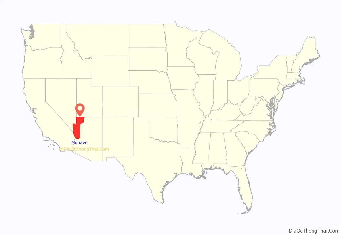
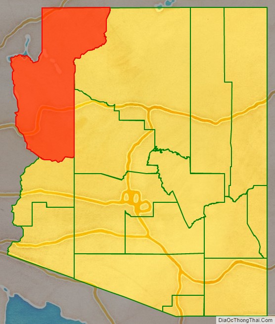
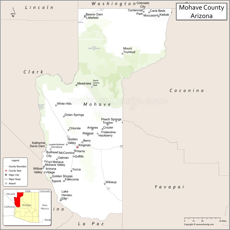
Mohave County is in the northwestern corner of the U.S. state of Arizona. As of the 2020 census, its population was 213,267. The county seat is Kingman, and the largest city is Lake Havasu City. It is the fifth largest county in the United States (by area).
Mohave County includes the Lake Havasu City–Kingman, Arizona Metropolitan Statistical Area, which is also included in the Las Vegas–Henderson, Nevada-Arizona Combined Statistical Area.
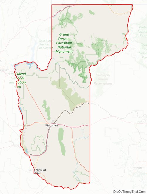
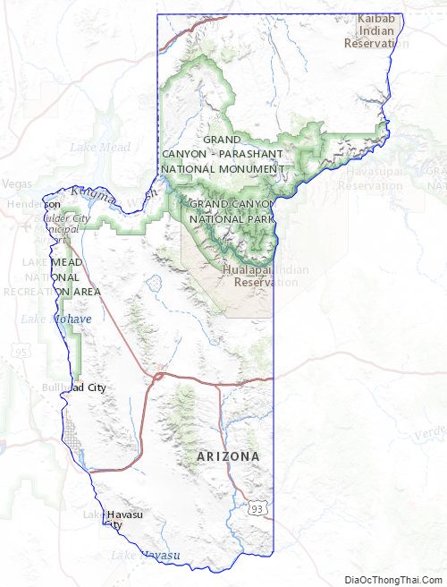
Mohave County contains parts of Grand Canyon National Park and Lake Mead National Recreation Area and all of the Grand Canyon–Parashant National Monument. The Kaibab, Fort Mojave and Hualapai Indian Reservations also lie within the county.
| Name: | Mohave County |
|---|---|
| FIPS code: | 04-015 |
| State: | Arizona |
| Founded: | November 9, 1864 |
| Named for: | Fort Mohave |
| Seat: | Kingman |
| Largest city: | Lake Havasu City |
| Total Area: | 13,461 sq mi (34,860 km²) |
| Land Area: | 13,311 sq mi (34,480 km²) |
| Total Population: | 213,267 |
| Population Density: | 16/sq mi (6.1/km²) |
| Time zone: | UTC−7 (Mountain) |
| Website: | www.mohave.gov |
Mohave County location map. Where is Mohave County?
History
Mohave County was the one of four original Arizona Counties created by the 1st Arizona Territorial Legislature. The county territory was originally defined as being west of longitude 113° 20′ and north of the Bill Williams River. Pah-Ute County was created from it in 1865 and was merged back into Mohave County in 1871 when much of its territory was ceded to Nevada in 1866. The county’s present boundaries were established in 1881. The county is also notable for being home to a large polygamous Fundamentalist Church of Jesus Christ of Latter-Day Saints sect located in Colorado City.
Mohave County has had five county seats: Mohave City (1864–1867), Hardyville (1867–1873), Cerbat (1873–1877), Mineral Park (1877–1887), and Kingman (1887–present).
Mohave County Road Map
Geography
According to the United States Census Bureau, the county has a total area of 13,461 square miles (34,860 km), of which 13,311 square miles (34,480 km) is land and 150 square miles (390 km) (1.1%) is water. It is the second-largest county by area in Arizona and the fifth-largest in the contiguous United States.
The county consists of two sections divided by the Grand Canyon, with no direct land communication between them. The northern section, smaller and less populated, forms the western part of the Arizona Strip, bordering Utah and Nevada. The larger southern section borders Nevada and California across the Colorado River, which forms most of the county’s western boundary. The southern section includes Kingman, the county seat, and other cities, as well as part of the Mojave Desert.
Adjacent counties
- Washington County, Utah – north
- Kane County, Utah – northeast
- Coconino County – east
- Yavapai County – east
- La Paz County – south
- San Bernardino County, California – southwest
- Clark County, Nevada – west
- Lincoln County, Nevada – northwest
Mohave County and its adjacent counties form the largest such block of counties outside of Alaska. Their combined land area is 89,567.34 square miles (231,978.3 km), or larger than that of the state of Idaho. They include the #1 (San Bernardino), #2 (Coconino), #5 (Mohave), and #7 (Lincoln) largest counties outside of Alaska. If Nye County, Nevada– which is #3 for total county area that does not border Mohave but borders neighboring Lincoln and Clark counties is included, then the combined land area would be 107,726.34 squard miles or larger than the state of Colorado.
National protected areas
- Bill Williams River National Wildlife Refuge (part)
- Grand Canyon National Park (part)
- Grand Canyon–Parashant National Monument
- Havasu National Wildlife Refuge (part)
- Kaibab National Forest (part)
- Lake Mead National Recreation Area (part)
- Pipe Spring National Monument
There are 18 official wilderness areas in Mohave County that are part of the National Wilderness Preservation System. Most of these are managed by the Bureau of Land Management, but some are integral parts of the preceding protected areas, or have shared jurisdiction with the BLM. Some extend into neighboring counties (as indicated below) All wilderness areas within Grand Canyon–Parashant National Monument are managed by BLM, although the National Monument shares management with the National Park Service:
- Arrastra Mountain Wilderness (BLM) partly in Yavapai County, Arizona, and La Paz County, Arizona
- Aubrey Peak Wilderness (BLM)
- Beaver Dam Mountains Wilderness (BLM) partly in Washington County, Utah
- Cottonwood Point Wilderness (BLM)
- Grand Wash Cliffs Wilderness (Grand Canyon–Parashant NM) managed by BLM
- Havasu Wilderness (Havasu NWR) partly in San Bernardino County, California
- Kanab Creek Wilderness (Kaibab NF / BLM) mostly in Coconino County, Arizona
- Mount Logan Wilderness (Grand Canyon–Parashant NM) managed by BLM
- Mount Nutt Wilderness (BLM)
- Mount Tipton Wilderness (BLM)
- Mount Trumbull Wilderness (Grand Canyon–Parashant NM) managed by BLM
- Mount Wilson Wilderness (BLM)
- Paiute Wilderness (partly in Grand Canyon–Parashant NM) managed by BLM
- Rawhide Mountains Wilderness (BLM) mostly in La Paz County, Arizona
- Swansea Wilderness (BLM) mostly in La Paz County, Arizona
- Upper Burro Creek Wilderness (BLM) mostly in Yavapai County, Arizona
- Wabayuma Peak Wilderness (BLM)
- Warm Springs Wilderness (BLM)
Mohave County Topographic Map
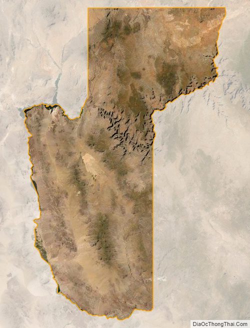
Mohave County Satellite Map
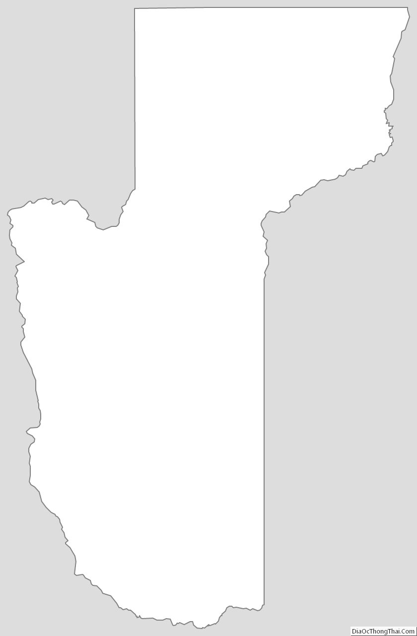
Mohave County Outline Map
See also
Map of Arizona State and its subdivision: Map of other states:- Alabama
- Alaska
- Arizona
- Arkansas
- California
- Colorado
- Connecticut
- Delaware
- District of Columbia
- Florida
- Georgia
- Hawaii
- Idaho
- Illinois
- Indiana
- Iowa
- Kansas
- Kentucky
- Louisiana
- Maine
- Maryland
- Massachusetts
- Michigan
- Minnesota
- Mississippi
- Missouri
- Montana
- Nebraska
- Nevada
- New Hampshire
- New Jersey
- New Mexico
- New York
- North Carolina
- North Dakota
- Ohio
- Oklahoma
- Oregon
- Pennsylvania
- Rhode Island
- South Carolina
- South Dakota
- Tennessee
- Texas
- Utah
- Vermont
- Virginia
- Washington
- West Virginia
- Wisconsin
- Wyoming