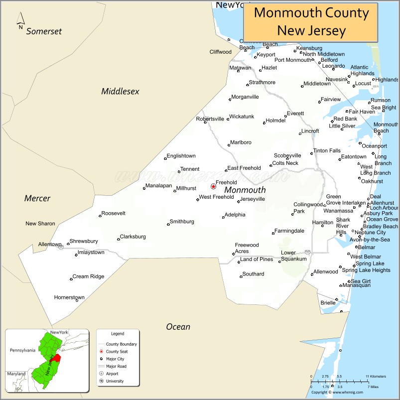
| Name: | Monmouth County |
|---|---|
| FIPS code: | 34-025 |
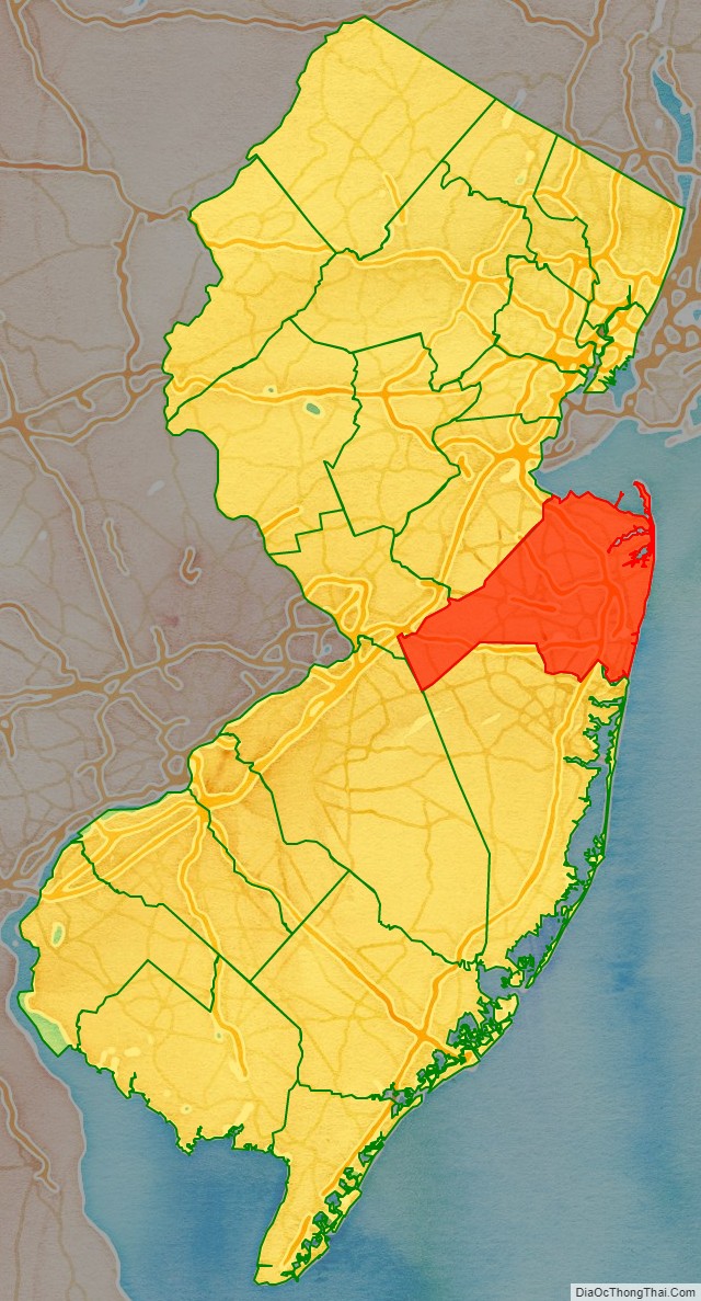
| State: | New Jersey |
| Founded: | 1683 |
| Named for: | Monmouthshire |
| Seat: | Freehold Borough |
| Largest city: | Middletown Township (population) Howell Township (area) |
| Total Area: | 665.32 sq mi (1,723.2 km²) |
| Land Area: | 468.79 sq mi (1,214.2 km²) |
| Total Population: | 643,615 |
| Population Density: | 1,372.9/sq mi (530.1/km²) |
| Website: | www.co.monmouth.nj.us |
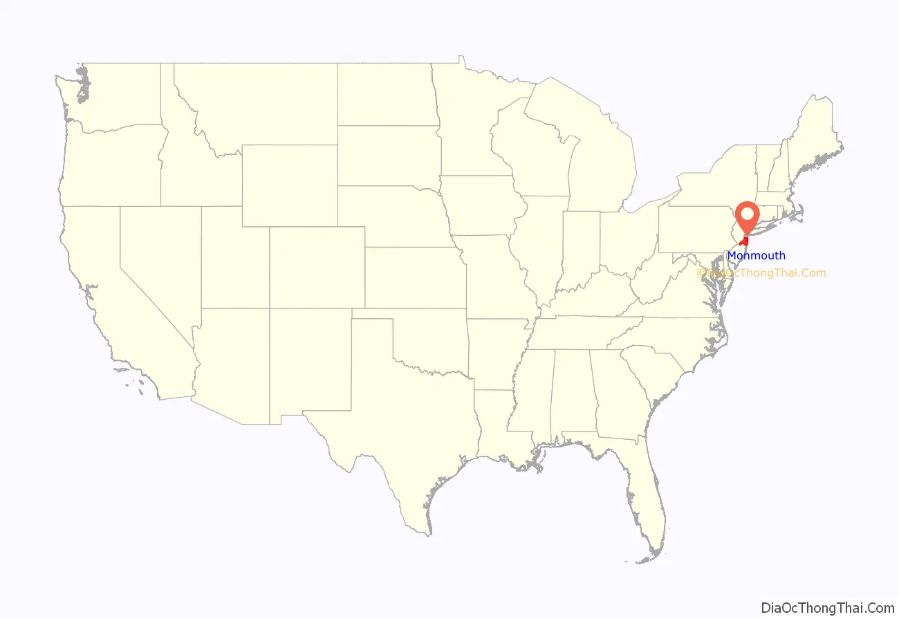
Monmouth County location map. Where is Monmouth County?
History
Etymology
The naming of Monmouth County has different historical theories. It is thought that the county received its name from the Rhode Island Monmouth Society. This is likely, due to many of the county’s earliest settlers originating from Rhode Island. Another plausible theory, is from a suggestion from Colonel Lewis Morris that the county should be named after Monmouthshire in Wales, Great Britain. Other suggestions include that it was named for James Scott, 1st Duke of Monmouth (1649–1685), who had many allies among the East Jersey leadership.
Indigenous history
See also Lenape people Around the year 1000, the area of Monmouth County began to be inhabited by the Lenape Native Americans prior to the arrival of European settlers. They came from the Mississippi River area. They lived along the vicinity of the Jersey Shore, the Raritan Bay, the Raritan River and other areas in the northeastern United States. The Lenape were a hunter-gatherer society. They were largely sedentary, changing campsites seasonally. They were prolific hunters of small game and birds. They were also skilled fisherman, and were known to harvest vast amounts of clams from the bays and inlets on the Jersey Shore. They also practiced some agriculture to augment their food supply. During this time, an important crossroad of two major Lenape trails was located in the area of Freehold in western Monmouth County.
Dutch and English colonization
See also Monmouth Tract In 1609, the English navigator, Henry Hudson, and his crew aboard the Dutch vessel Half Moon spotted land in what is now Monmouth County, most likely off Sandy Hook; however, some historical accounts credit this landing to present-day Keansburg. Among the first European settlers and majority landowners in the area were Richard and Penelope Stout. Penelope “miraculously” survived her wounds from a native attack in Sandy Hook and further lived to the age of 110. Additionally, a group of Quaker families from Long Island settled the Monmouth Tract, an early land grant from Richard Nicolls issued in 1665. They were followed by a group of Scottish settlers who inhabited Freehold Township in about 1682–1885, followed several years later by Dutch settlers. As they arrived in this area, they were greeted by Lenape people, who lived in scattered small family bands and developed a largely amicable relationship with the new arrivals. Enslaved Africans were present in the area from at least 1680, and by 1726 made up 9% of the total population of the county.
Monmouth County was established on March 7, 1683, while part of the province of East Jersey. On October 31, 1693, the county was partitioned into the townships of Freehold, Middletown and Shrewsbury.
At the June 28, 1778, Battle of Monmouth, near Freehold Township, General George Washington’s soldiers battled the British under Sir Henry Clinton, in the longest land battle of the American Revolutionary War. It was at Monmouth that the tactics and training from Friedrich Wilhelm von Steuben developed at Valley Forge during the winter encampment were first implemented on a large scale.
At independence, Monmouth’s population included 1,640 slaves, as well as an undetermined number of free African Americans. The number of enslaved persons fell steeply after 1820, though a small number remained until at least 1850. Monmouth’s free African American population climbed from 353 in 1790 to 2,658 in 1860. There was a small African-American middle class consisting of freedmen present in Monmouth County by the 1840s and 1850s.
Ocean County was carved out of Monmouth County in 1850.
In 1790 Monmouth County’s population was 16,918, of whom roughly 6,600 were of English descent and the remainder were Welsh, Dutch and Swedish, as well as small amounts of African Americans and Northern Irish Protestants. By the year 2010 Monmouth County’s population was 628,112 of whom 40,489 were of English descent. Between 1890 and 1907 nearly 18 million European immigrants came to America. At the same time the region underwent massive and not unrelated economic changes, this process led to places like Monmouth County, New Jersey becoming significantly more diverse and somewhat less rural.
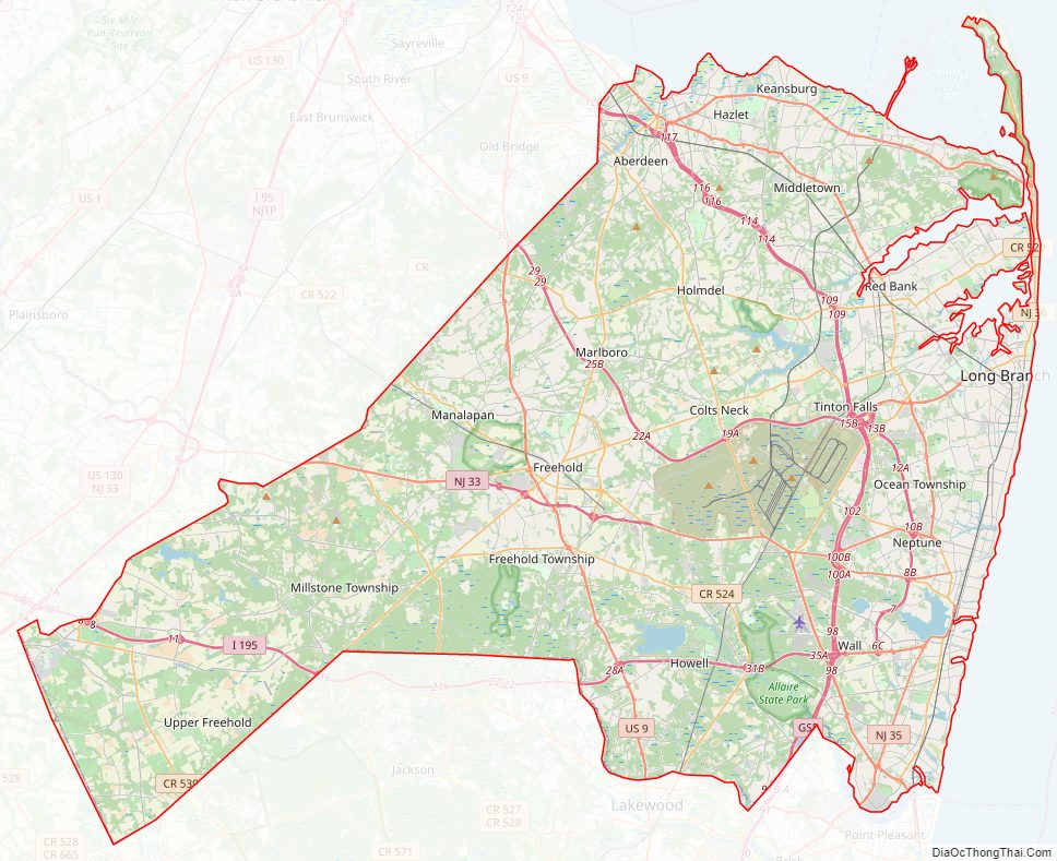
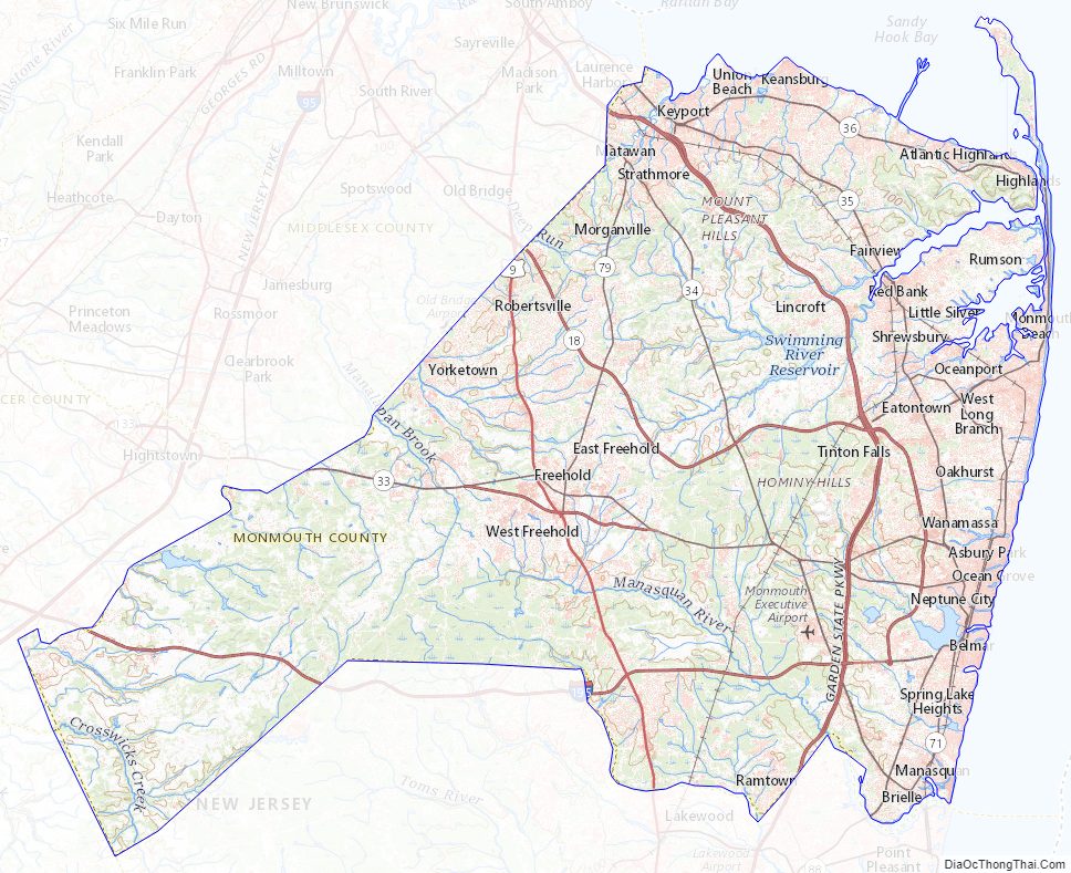
Monmouth County Road Map
Geography
According to the 2010 census, the county had a total area of 665.32 square miles (1,723.2 km), including 468.79 square miles (1,214.2 km) of land (70.5%) and 196.53 square miles (509.0 km) of water (29.5%).
Much of Monmouth County remains flat and low-lying even far inland. However, there are some low hills in and around Holmdel Township, and one of them, Crawford Hill, the former site of a radar facility, is the county’s highest point, variously listed at 380 to 391 feet (116 to 119 m) above sea level. The top portion of the hill is owned by Alcatel-Lucent and houses a research laboratory of Bell Laboratories. The northeastern portion of the county, in the Locust section of Middletown Township and the boroughs of Highlands and Atlantic Highlands, are also very hilly. The lowest point is sea level.
Along with adjacent Middlesex and Ocean counties, Monmouth County is a mecca for boating and fishing. Its waterways include several tributaries that flow from the more agrarian regions of western Monmouth County into the Raritan River, and various rivers and inlets that flow from the more densely populated region of the Raritan Bayshore of northern Monmouth County into the Raritan Bay and the Lower New York Bay, before finally draining out into the Atlantic Ocean. The Manasquan Inlet is located in the county, which connects the Atlantic Ocean with the estuary of the Manasquan River, a bay-like body of saltwater that serves as the starting point of the Intracoastal Waterway, which attracts as many as 1,600 boats each weekend during the peak season.
Climate and weather
Much of Monmouth County has a humid subtropical climate (Cfa), while some inland areas have a hot-summer humid continental climate (Dfa). In recent years, average temperatures in the county seat of Freehold Borough have ranged from a low of 22 °F (−6 °C) in January to a high of 86 °F (30 °C) in July, although a record low of −13 °F (−25 °C) was recorded in January 1984 and a record high of 106 °F (41 °C) was recorded in July 2011. Average monthly precipitation ranged from 2.98 inches (76 mm) in February to 5.08 inches (129 mm) in July.
Average monthly temperatures in Asbury Park range from 32.5 °F in January to 75.0 °F in July, while in Allentown, NJ they range from 32.1 °F in January to 75.5 °F in July. [3]
On October 29, 2012, Hurricane Sandy caused catastrophic damage to coastal areas of Monmouth County. As Sandy’s surge arrived in Monmouth County, flood levels of 13.31 feet (4.06 m) above normal were measured at Sandy Hook shortly before the destruction of the tidal station, breaking all previous local records. The surge caused waves as high as 32.5 feet (9.9 m), measured where the Sandy Hook Bay meets the New York Bay.
Adjacent counties
- Middlesex County – northwest
- Ocean County – south
- Mercer County – west
- Burlington County – southwest
- Richmond County, New York – north
- Long Island (Kings County and Queens County, New York) – northeast
National protected areas
- Gateway National Recreation Area (part)
Monmouth County Topographic Map
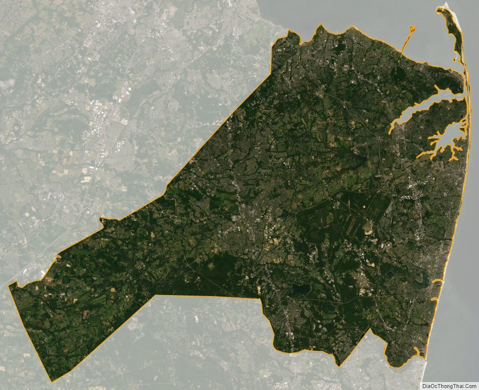
Monmouth County Satellite Map
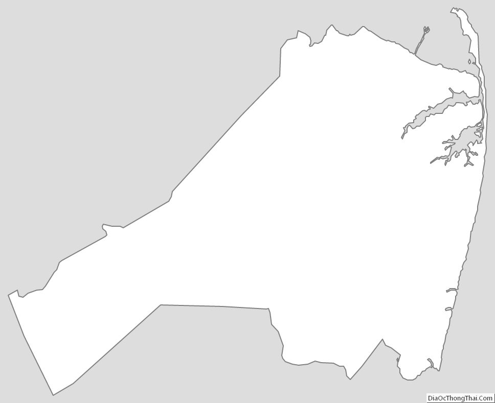
Monmouth County Outline Map
See also
Map of New Jersey State and its subdivision: Map of other states:- Alabama
- Alaska
- Arizona
- Arkansas
- California
- Colorado
- Connecticut
- Delaware
- District of Columbia
- Florida
- Georgia
- Hawaii
- Idaho
- Illinois
- Indiana
- Iowa
- Kansas
- Kentucky
- Louisiana
- Maine
- Maryland
- Massachusetts
- Michigan
- Minnesota
- Mississippi
- Missouri
- Montana
- Nebraska
- Nevada
- New Hampshire
- New Jersey
- New Mexico
- New York
- North Carolina
- North Dakota
- Ohio
- Oklahoma
- Oregon
- Pennsylvania
- Rhode Island
- South Carolina
- South Dakota
- Tennessee
- Texas
- Utah
- Vermont
- Virginia
- Washington
- West Virginia
- Wisconsin
- Wyoming