Monroe County is a county located on the eastern border of the U.S. state of Ohio, across the Ohio River from West Virginia. As of the 2020 census, the population was 13,385, making it the second-least populous county in Ohio. Its county seat is Woodsfield. The county was created in 1813 and later organized in 1815.
| Name: | Monroe County |
|---|---|
| FIPS code: | 39-111 |
| State: | Ohio |
| Founded: | March 1, 1815 |
| Named for: | James Monroe |
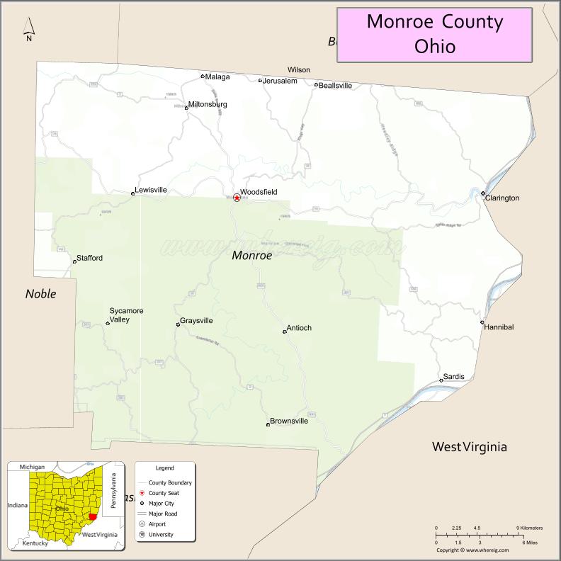
| Seat: | Woodsfield |
| Total Area: | 457 sq mi (1,180 km²) |
| Land Area: | 456 sq mi (1,180 km²) |
| Total Population: | 13,385 |
| Population Density: | 29/sq mi (11/km²) |
| Time zone: | UTC−5 (Eastern) |
| Summer Time Zone (DST): | UTC−4 (EDT) |
| Website: | www.monroecountyohio.net |
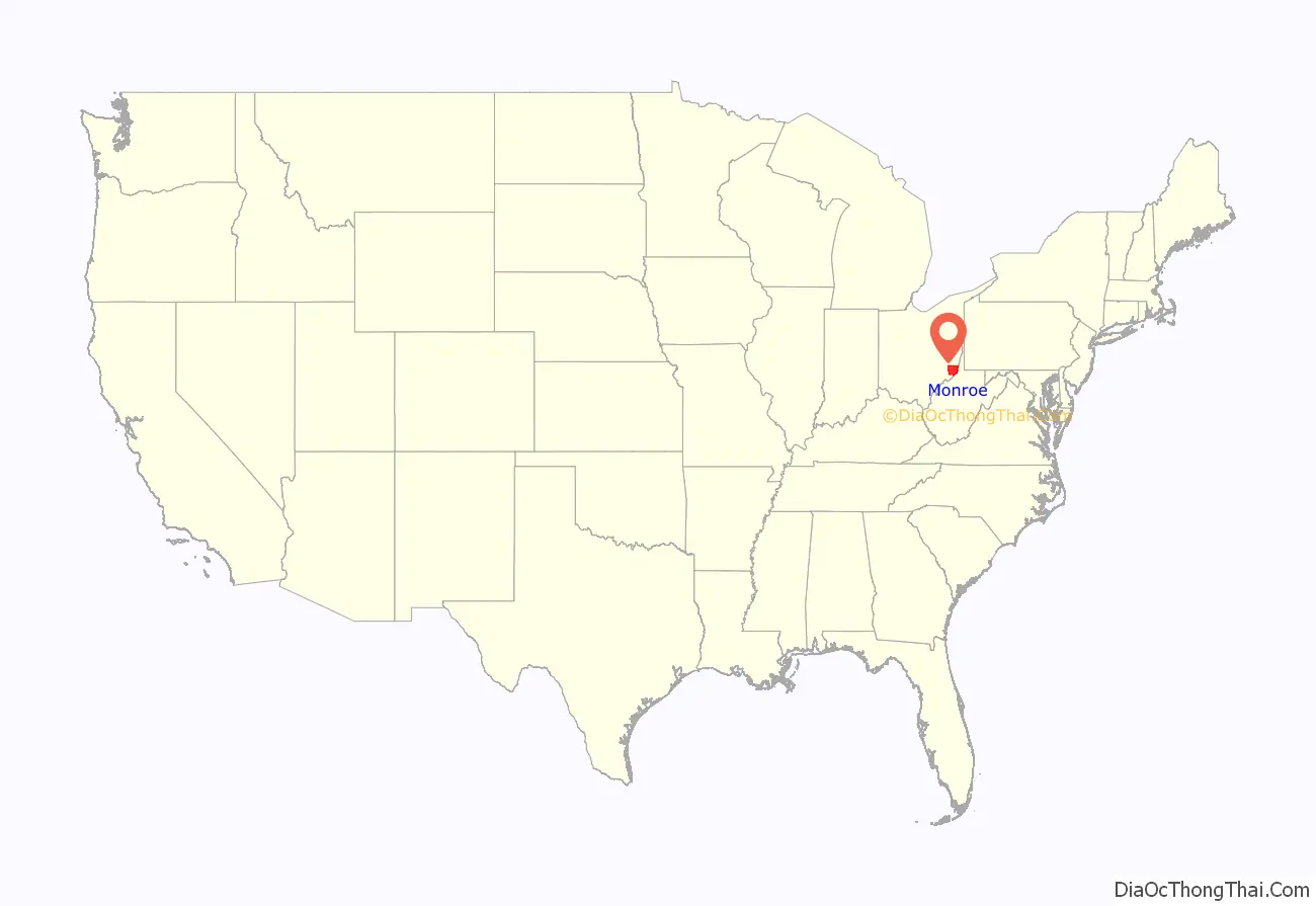
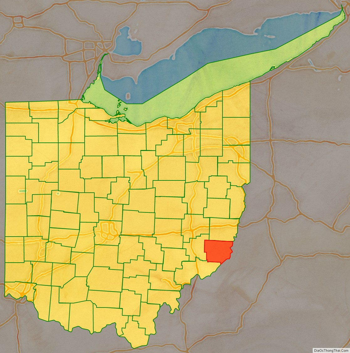
Monroe County location map. Where is Monroe County?
History
Monroe County was formed on January 28, 1813, from portions of Belmont, Guernsey and Washington counties. It was named after James Monroe, the U.S. Secretary of State when the county was formed, and later fifth President of the United States. When organized, the county’s eastern border was with the state of Virginia. This portion of the state seceded from Virginia during the American Civil War, being admitted to the Union as the state of West Virginia. The largely rural county reached its peak of population in the 19th century, before urbanization drew people into and near cities for work and other opportunities. It is still a center of Amish population and farms.
In 1891, West Virginia’s Sistersville Field was discovered to extend into Monroe County. By 1901, 300 wells near Woodsfield, Ohio, were producing 55,000 barrels of oil a month.
On or about December 20, 2011, ExxonMobil, a New Jersey petroleum company, via its subsidiary XTO Energy, acquired 20,056 acres of Monroe County Utica Shale gas leases from Beck Energy.
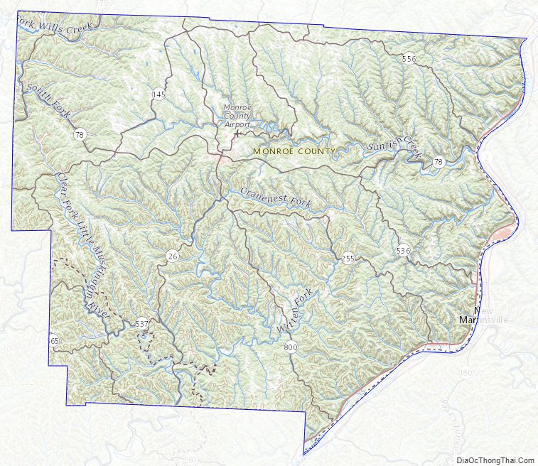
Monroe County Road Map
Geography
According to the United States Census Bureau, the county has a total area of 457 square miles (1,180 km), of which 456 square miles (1,180 km) is land and 1.7 square miles (4.4 km) (0.4%) is water. It is bordered by the Ohio River to the east. The terrain is hilly in this area, with waterways cutting through some hills of the Appalachian Plateau, which extends from Lake Erie to the Ohio River, which flows southwest to the south of this county.
Adjacent counties
- Belmont County (north)
- Marshall County, West Virginia (northeast)
- Wetzel County, West Virginia (east)
- Tyler County, West Virginia (southeast)
- Washington County (south)
- Noble County (west)
Major highways
- SR 7
- SR 26
- SR 78
- SR 145
- SR 255
- SR 260
- SR 379
- SR 536
- SR 537
- SR 556
- SR 565
- SR 800
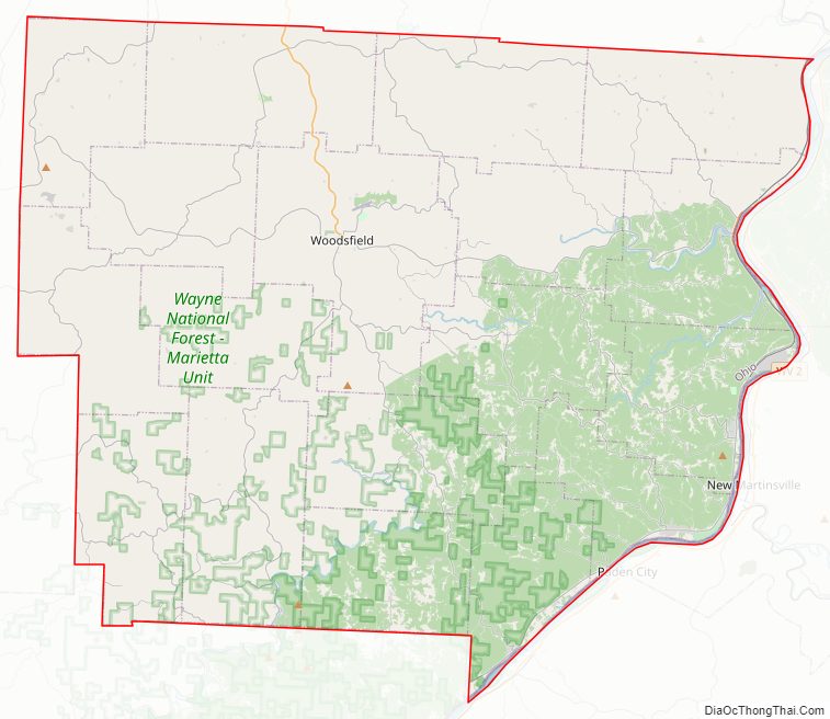
National protected area
- Wayne National Forest (part)
Monroe County Topographic Map
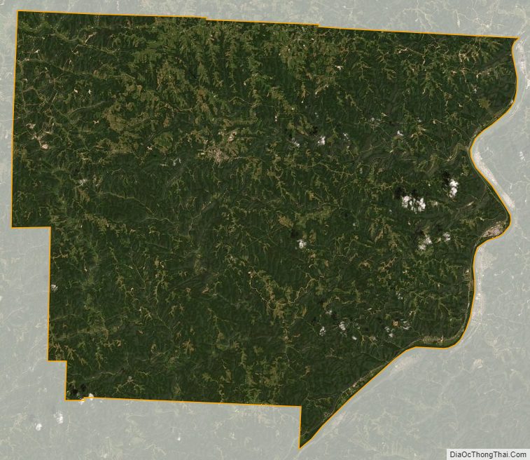
Monroe County Satellite Map
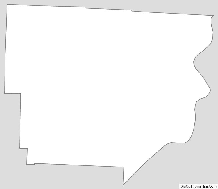
Monroe County Outline Map
See also
Map of Ohio State and its subdivision:- Adams
- Allen
- Ashland
- Ashtabula
- Athens
- Auglaize
- Belmont
- Brown
- Butler
- Carroll
- Champaign
- Clark
- Clermont
- Clinton
- Columbiana
- Coshocton
- Crawford
- Cuyahoga
- Darke
- Defiance
- Delaware
- Erie
- Fairfield
- Fayette
- Franklin
- Fulton
- Gallia
- Geauga
- Greene
- Guernsey
- Hamilton
- Hancock
- Hardin
- Harrison
- Henry
- Highland
- Hocking
- Holmes
- Huron
- Jackson
- Jefferson
- Knox
- Lake
- Lake Erie
- Lawrence
- Licking
- Logan
- Lorain
- Lucas
- Madison
- Mahoning
- Marion
- Medina
- Meigs
- Mercer
- Miami
- Monroe
- Montgomery
- Morgan
- Morrow
- Muskingum
- Noble
- Ottawa
- Paulding
- Perry
- Pickaway
- Pike
- Portage
- Preble
- Putnam
- Richland
- Ross
- Sandusky
- Scioto
- Seneca
- Shelby
- Stark
- Summit
- Trumbull
- Tuscarawas
- Union
- Van Wert
- Vinton
- Warren
- Washington
- Wayne
- Williams
- Wood
- Wyandot
- Alabama
- Alaska
- Arizona
- Arkansas
- California
- Colorado
- Connecticut
- Delaware
- District of Columbia
- Florida
- Georgia
- Hawaii
- Idaho
- Illinois
- Indiana
- Iowa
- Kansas
- Kentucky
- Louisiana
- Maine
- Maryland
- Massachusetts
- Michigan
- Minnesota
- Mississippi
- Missouri
- Montana
- Nebraska
- Nevada
- New Hampshire
- New Jersey
- New Mexico
- New York
- North Carolina
- North Dakota
- Ohio
- Oklahoma
- Oregon
- Pennsylvania
- Rhode Island
- South Carolina
- South Dakota
- Tennessee
- Texas
- Utah
- Vermont
- Virginia
- Washington
- West Virginia
- Wisconsin
- Wyoming