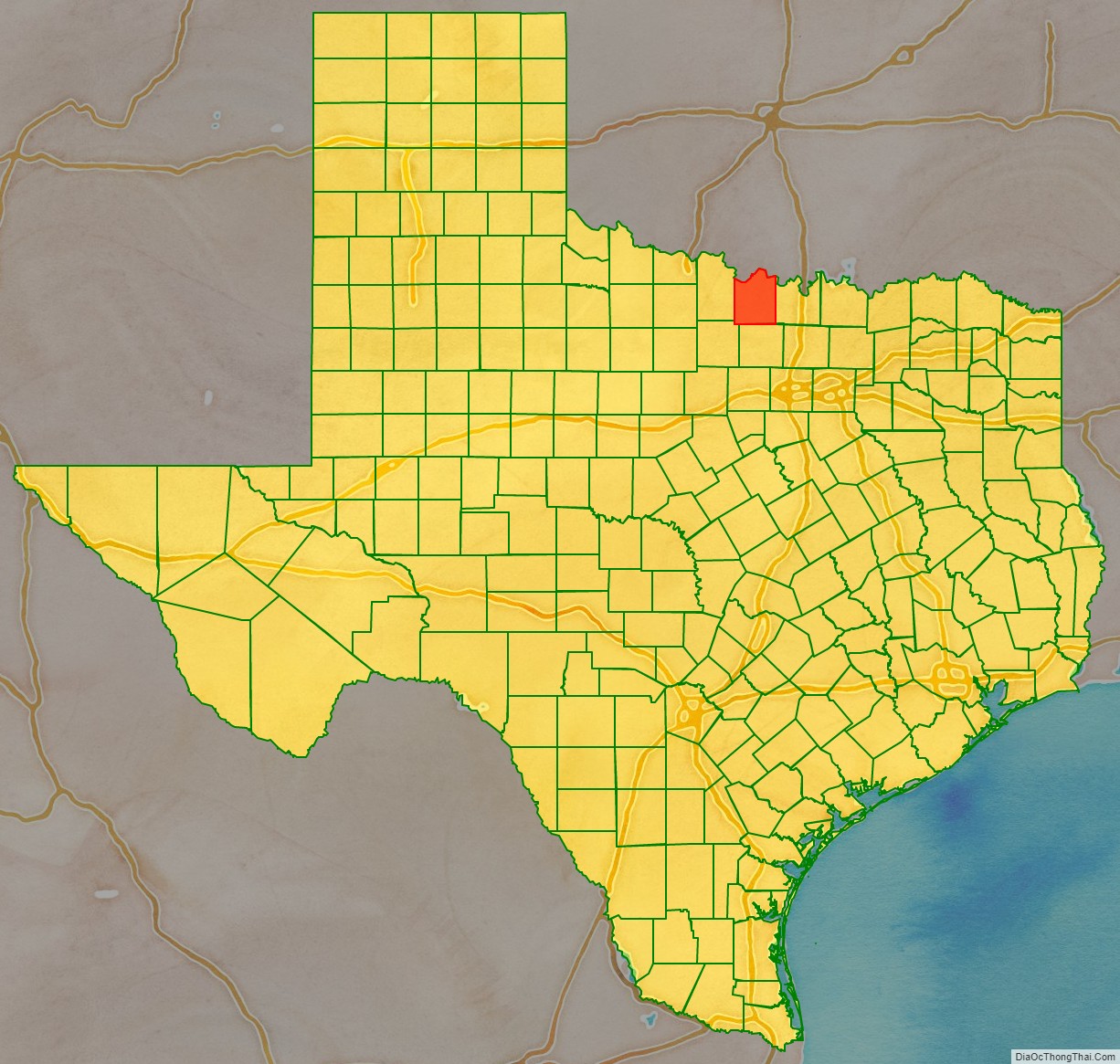
Montague County (/ˈmɒnteɪɡ/ MAHN-tayg) is a county located in the U.S. state of Texas, established in 1857. As of the 2020 census, its population was 19,965. The county seat is Montague. The county was created in 1857 and organized the next year. It is named for Daniel Montague, a surveyor and soldier in the Mexican–American War.
| Name: | Montague County |
|---|---|
| FIPS code: | 48-337 |
| State: | Texas |
| Founded: | 1858 |
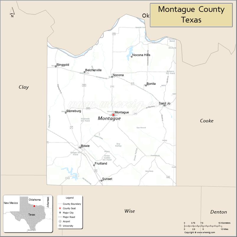
| Seat: | Montague |
| Largest city: | Bowie |
| Total Area: | 938 sq mi (2,430 km²) |
| Land Area: | 931 sq mi (2,410 km²) |
| Total Population: | 19,965 |
| Population Density: | 21/sq mi (8.2/km²) |
| Time zone: | UTC−6 (Central) |
| Summer Time Zone (DST): | UTC−5 (CDT) |
| Website: | www.co.montague.tx.us |
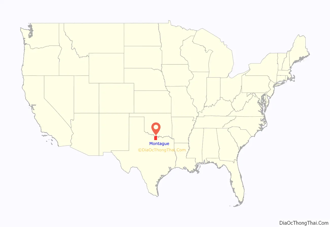
Montague County location map. Where is Montague County?
History
In the mid- to late 19th century, the county was the site of the trading post known as Red River Station, established near the river of the same name by Jesse Chisholm, a Cherokee merchant who also served as an important interpreter for the Republic of Texas and the United States. Together with Black Bear, a Lenape guide, he had scouted and developed what became known as the Chisholm Trail north through Indian Territory, where he had more trading posts, and into Kansas.
In the post-Civil War period, ranchers suffered from low prices for their beef cattle, as overproduction had occurred during the war, when their regular markets were cut off. Learning about high prices and demand in the East, they began to have their cattle driven to railheads in Kansas for shipment to the east. Red River Station became the southern terminus for the Chisholm Trail, and the gathering place for thousands of Texas Longhorns during annual cattle drives to railheads in Kansas. Over the years, an estimated five million cattle were driven north to Kansas. The cattle were gathered by cowboys from ranches in East and West Texas; the cattle were then driven overland north to Kansas. They were shipped east, where they could command much higher prices. After railroads were constructed into Texas, the cattle drives to Kansas ended.
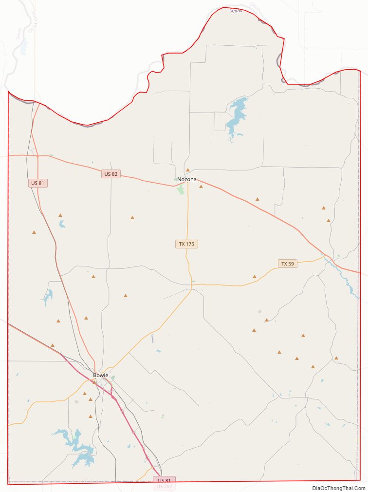
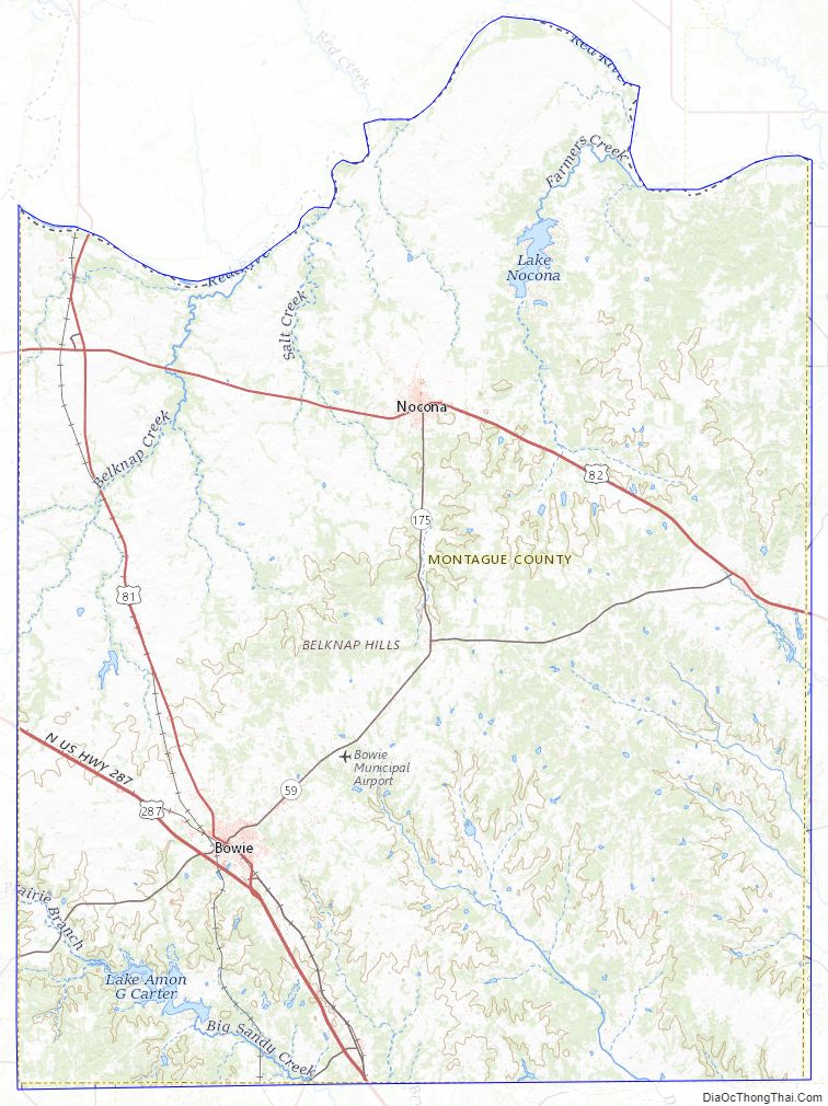
Montague County Road Map
Geography
According to the U.S. Census Bureau, the county has a total area of 938 sq mi (2,430 km), of which 931 sq mi (2,410 km) are land and 7.4 sq mi (19 km) (0.8%) are covered by water.
Adjacent counties
- Jefferson County, Oklahoma (north)
- Love County, Oklahoma (northeast)
- Cooke County (east)
- Wise County (south)
- Jack County (southwest)
- Clay County (west)
National protected area
- Lyndon B. Johnson National Grassland (part)
Montague County Topographic Map
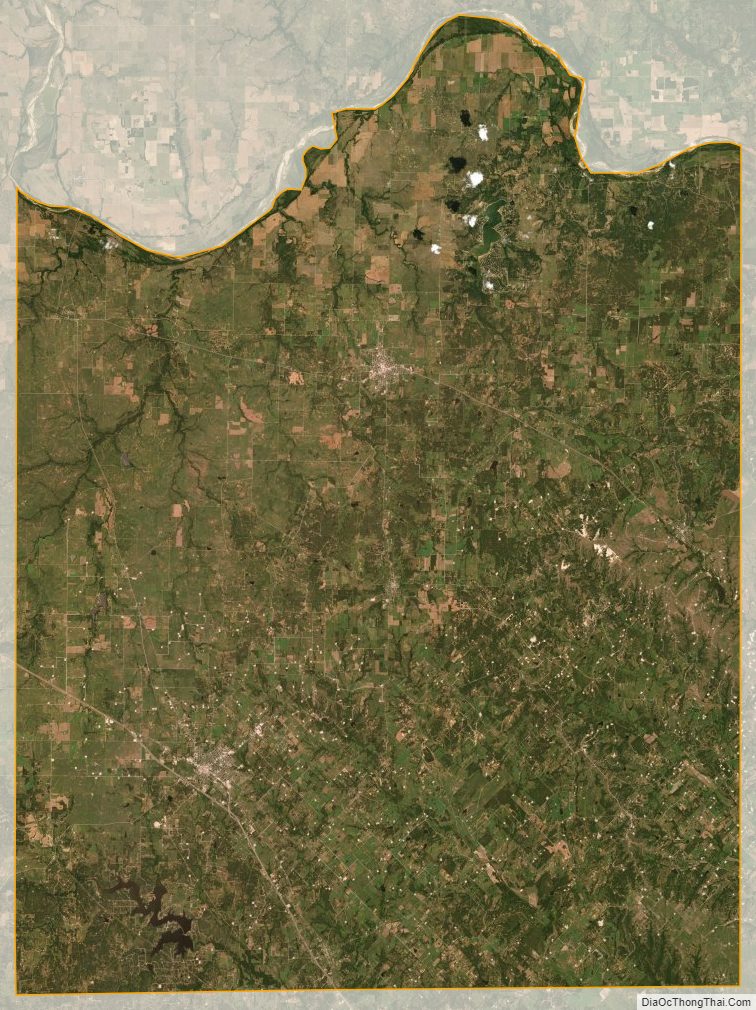
Montague County Satellite Map
Montague County Outline Map

See also
Map of Texas State and its subdivision:- Anderson
- Andrews
- Angelina
- Aransas
- Archer
- Armstrong
- Atascosa
- Austin
- Bailey
- Bandera
- Bastrop
- Baylor
- Bee
- Bell
- Bexar
- Blanco
- Borden
- Bosque
- Bowie
- Brazoria
- Brazos
- Brewster
- Briscoe
- Brooks
- Brown
- Burleson
- Burnet
- Caldwell
- Calhoun
- Callahan
- Cameron
- Camp
- Carson
- Cass
- Castro
- Chambers
- Cherokee
- Childress
- Clay
- Cochran
- Coke
- Coleman
- Collin
- Collingsworth
- Colorado
- Comal
- Comanche
- Concho
- Cooke
- Coryell
- Cottle
- Crane
- Crockett
- Crosby
- Culberson
- Dallam
- Dallas
- Dawson
- Deaf Smith
- Delta
- Denton
- Dewitt
- Dickens
- Dimmit
- Donley
- Duval
- Eastland
- Ector
- Edwards
- El Paso
- Ellis
- Erath
- Falls
- Fannin
- Fayette
- Fisher
- Floyd
- Foard
- Fort Bend
- Franklin
- Freestone
- Frio
- Gaines
- Galveston
- Garza
- Gillespie
- Glasscock
- Goliad
- Gonzales
- Gray
- Grayson
- Gregg
- Grimes
- Guadalupe
- Hale
- Hall
- Hamilton
- Hansford
- Hardeman
- Hardin
- Harris
- Harrison
- Hartley
- Haskell
- Hays
- Hemphill
- Henderson
- Hidalgo
- Hill
- Hockley
- Hood
- Hopkins
- Houston
- Howard
- Hudspeth
- Hunt
- Hutchinson
- Irion
- Jack
- Jackson
- Jasper
- Jeff Davis
- Jefferson
- Jim Hogg
- Jim Wells
- Johnson
- Jones
- Karnes
- Kaufman
- Kendall
- Kenedy
- Kent
- Kerr
- Kimble
- King
- Kinney
- Kleberg
- Knox
- La Salle
- Lamar
- Lamb
- Lampasas
- Lavaca
- Lee
- Leon
- Liberty
- Limestone
- Lipscomb
- Live Oak
- Llano
- Loving
- Lubbock
- Lynn
- Madison
- Marion
- Martin
- Mason
- Matagorda
- Maverick
- McCulloch
- McLennan
- McMullen
- Medina
- Menard
- Midland
- Milam
- Mills
- Mitchell
- Montague
- Montgomery
- Moore
- Morris
- Motley
- Nacogdoches
- Navarro
- Newton
- Nolan
- Nueces
- Ochiltree
- Oldham
- Orange
- Palo Pinto
- Panola
- Parker
- Parmer
- Pecos
- Polk
- Potter
- Presidio
- Rains
- Randall
- Reagan
- Real
- Red River
- Reeves
- Refugio
- Roberts
- Robertson
- Rockwall
- Runnels
- Rusk
- Sabine
- San Augustine
- San Jacinto
- San Patricio
- San Saba
- Schleicher
- Scurry
- Shackelford
- Shelby
- Sherman
- Smith
- Somervell
- Starr
- Stephens
- Sterling
- Stonewall
- Sutton
- Swisher
- Tarrant
- Taylor
- Terrell
- Terry
- Throckmorton
- Titus
- Tom Green
- Travis
- Trinity
- Tyler
- Upshur
- Upton
- Uvalde
- Val Verde
- Van Zandt
- Victoria
- Walker
- Waller
- Ward
- Washington
- Webb
- Wharton
- Wheeler
- Wichita
- Wilbarger
- Willacy
- Williamson
- Wilson
- Winkler
- Wise
- Wood
- Yoakum
- Young
- Zapata
- Zavala
- Alabama
- Alaska
- Arizona
- Arkansas
- California
- Colorado
- Connecticut
- Delaware
- District of Columbia
- Florida
- Georgia
- Hawaii
- Idaho
- Illinois
- Indiana
- Iowa
- Kansas
- Kentucky
- Louisiana
- Maine
- Maryland
- Massachusetts
- Michigan
- Minnesota
- Mississippi
- Missouri
- Montana
- Nebraska
- Nevada
- New Hampshire
- New Jersey
- New Mexico
- New York
- North Carolina
- North Dakota
- Ohio
- Oklahoma
- Oregon
- Pennsylvania
- Rhode Island
- South Carolina
- South Dakota
- Tennessee
- Texas
- Utah
- Vermont
- Virginia
- Washington
- West Virginia
- Wisconsin
- Wyoming