| Name: | Montgomery County |
|---|---|
| FIPS code: | 42-091 |
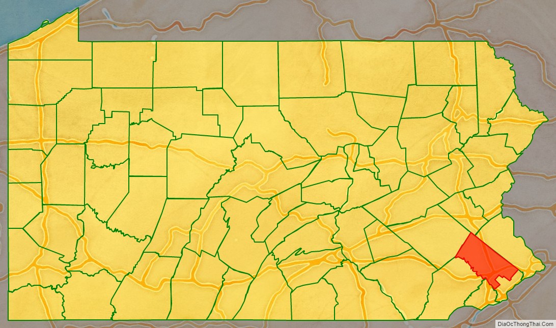
| State: | Pennsylvania |
| Founded: | September 10, 1784 |
| Named for: | Richard Montgomery or Montgomeryshire |
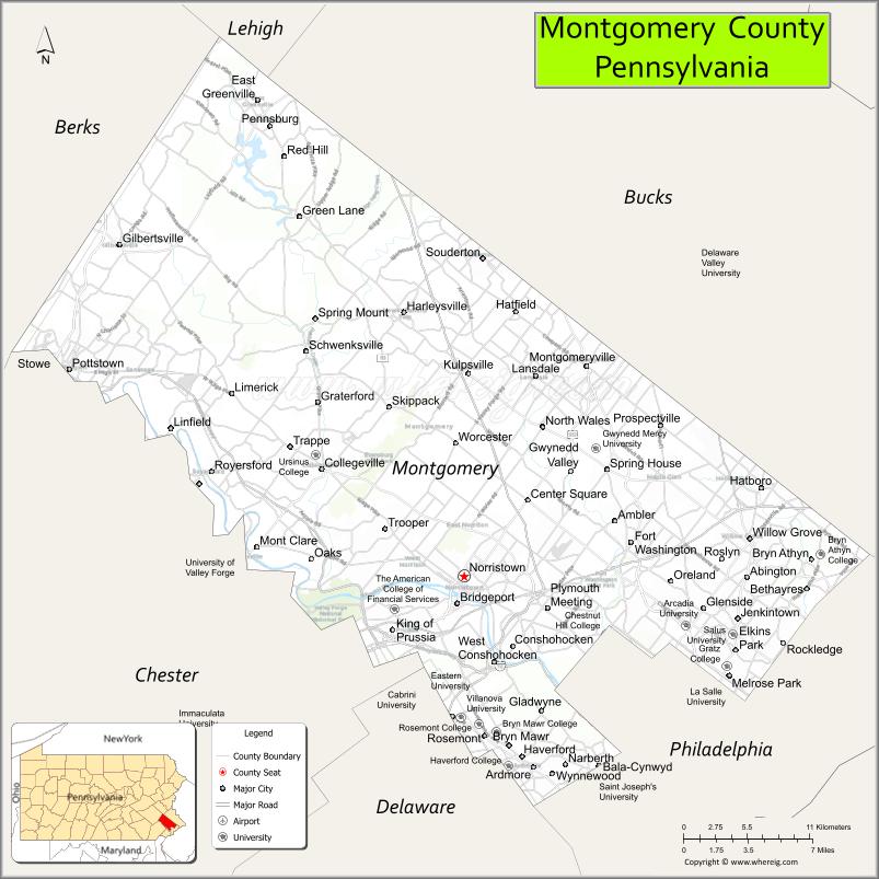
| Seat: | Norristown |
| Total Area: | 487 sq mi (1,260 km²) |
| Land Area: | 483 sq mi (1,250 km²) |
| Total Population: | 856,553 |
| Population Density: | 1,773/sq mi (685/km²) |
| Time zone: | UTC−5 (Eastern) |
| Summer Time Zone (DST): | UTC−4 (EDT) |
| Website: | www.montcopa.org |
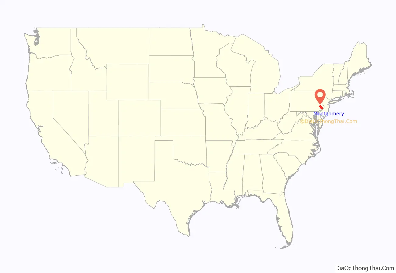
Montgomery County location map. Where is Montgomery County?
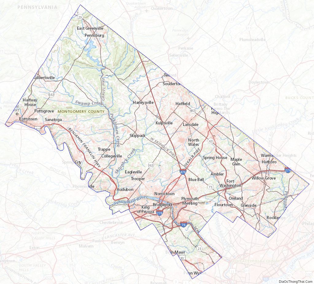
Montgomery County Road Map
Geography
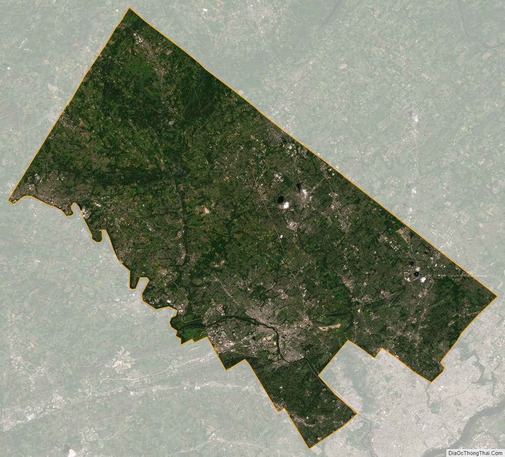
According to the U.S. Census Bureau, the county has a total area of 487 square miles (1,260 km), of which 483 square miles (1,250 km) was land and 4.2 square miles (11 km) (0.9%) was water.
Major roads and highways
- I-76
- I-276 / Penna Turnpike
- I-476 / Penna Turnpike NE Extension
- US 1
- US 30
- US 202
- US 202 Bus.
- US 422
- PA 23
- PA 29
- PA 63
- PA 73
- PA 100
- PA 113
- PA 152
- PA 232
- PA 252
- PA 263
- PA 309
- PA 320
- PA 332
- PA 363
- PA 463
- PA 563
- PA 611
- PA 663
Adjacent counties
- Lehigh County (north)
- Bucks County (northeast)
- Philadelphia County (southeast)
- Delaware County (southwest)
- Chester County (west)
- Berks County (northwest)
National protected area
- Valley Forge National Historical Park (part)
County Owned Parks
Montgomery County Topographic Map
Montgomery County Satellite Map
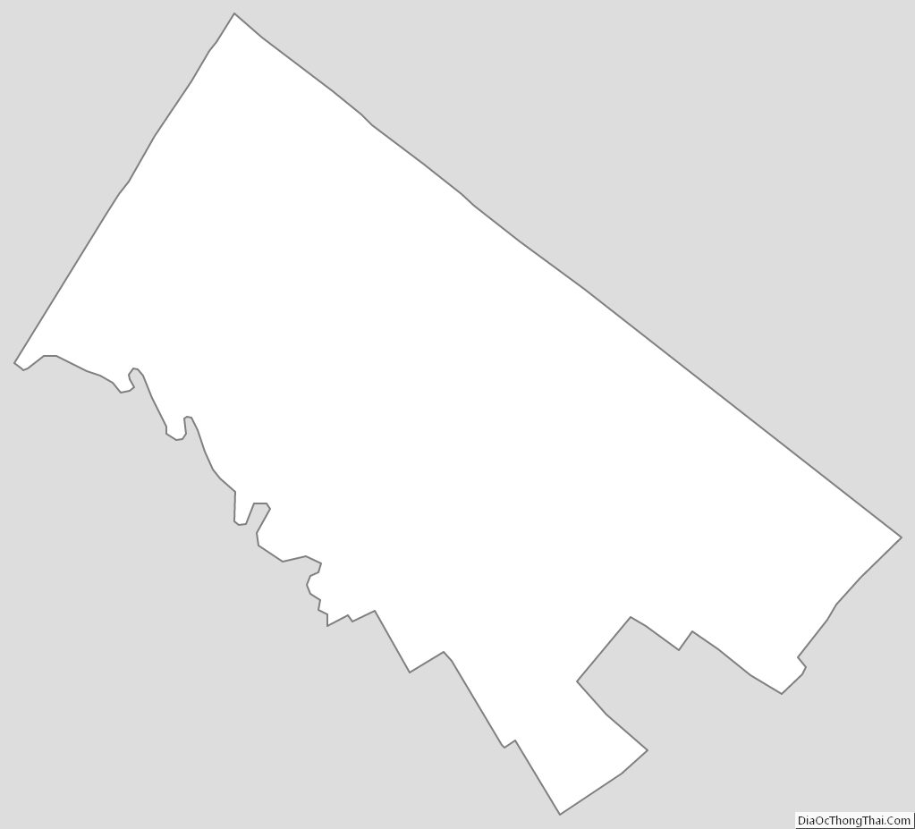
Montgomery County Outline Map
See also
Map of Pennsylvania State and its subdivision:- Adams
- Allegheny
- Armstrong
- Beaver
- Bedford
- Berks
- Blair
- Bradford
- Bucks
- Butler
- Cambria
- Cameron
- Carbon
- Centre
- Chester
- Clarion
- Clearfield
- Clinton
- Columbia
- Crawford
- Cumberland
- Dauphin
- Delaware
- Elk
- Erie
- Fayette
- Forest
- Franklin
- Fulton
- Greene
- Huntingdon
- Indiana
- Jefferson
- Juniata
- Lackawanna
- Lancaster
- Lawrence
- Lebanon
- Lehigh
- Luzerne
- Lycoming
- Mc Kean
- Mercer
- Mifflin
- Monroe
- Montgomery
- Montour
- Northampton
- Northumberland
- Perry
- Philadelphia
- Pike
- Potter
- Schuylkill
- Snyder
- Somerset
- Sullivan
- Susquehanna
- Tioga
- Union
- Venango
- Warren
- Washington
- Wayne
- Westmoreland
- Wyoming
- York
- Alabama
- Alaska
- Arizona
- Arkansas
- California
- Colorado
- Connecticut
- Delaware
- District of Columbia
- Florida
- Georgia
- Hawaii
- Idaho
- Illinois
- Indiana
- Iowa
- Kansas
- Kentucky
- Louisiana
- Maine
- Maryland
- Massachusetts
- Michigan
- Minnesota
- Mississippi
- Missouri
- Montana
- Nebraska
- Nevada
- New Hampshire
- New Jersey
- New Mexico
- New York
- North Carolina
- North Dakota
- Ohio
- Oklahoma
- Oregon
- Pennsylvania
- Rhode Island
- South Carolina
- South Dakota
- Tennessee
- Texas
- Utah
- Vermont
- Virginia
- Washington
- West Virginia
- Wisconsin
- Wyoming