Morrill County is a county in the U.S. state of Nebraska. As of the 2010 United States Census, the population was 5,042. Its county seat is Bridgeport.
In the Nebraska license plate system, Morrill County is represented by the prefix 64 (it had the 64th-largest number of vehicles registered in the state when the license plate system was established in 1922).
| Name: | Morrill County |
|---|---|
| FIPS code: | 31-123 |
| State: | Nebraska |
| Founded: | 1908 |
| Named for: | Charles Henry Morrill |
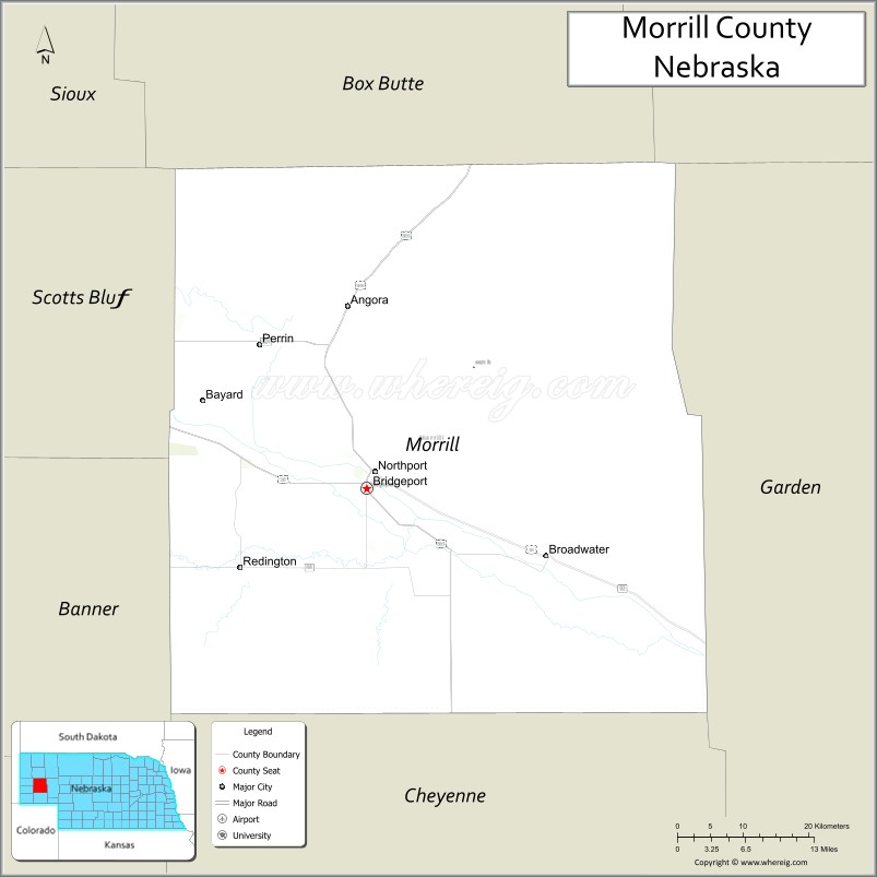
| Seat: | Bridgeport |
| Largest city: | Bridgeport |
| Total Area: | 1,430 sq mi (3,700 km²) |
| Land Area: | 1,424 sq mi (3,690 km²) |
| Total Population: | 4,574 |
| Population Density: | 3.4/sq mi (1.3/km²) |
| Time zone: | UTC−7 (Mountain) |
| Summer Time Zone (DST): | UTC−6 (MDT) |
| Website: | www.morrillcountyne.gov |
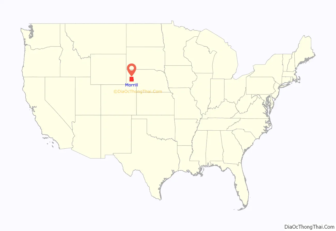
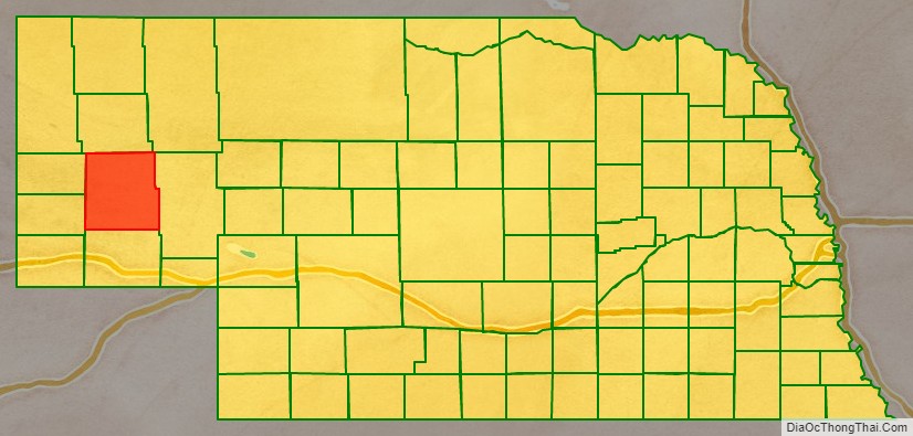
Morrill County location map. Where is Morrill County?
History
The Battle of Mud Springs and the Battle of Rush Creek between the US Army and Cheyenne, Lakota Sioux, and Arapaho occurred in 1865 within what would become Morrill County.
On 3 November 1908, voters in Cheyenne County passed a measure calling for the division of that county. Accordingly, the Nebraska State Legislature passed an act providing for the division of Cheyenne County, the line of division running east–west, south of the town of Bridgeport. The northern portion so divided was to be called Morrill County. In December of that year, another election determined Bridgeport to be the seat of the new county, and the new county’s officials were determined. The county was named for Charles Henry Morrill, a president of the Lincoln Land Company.
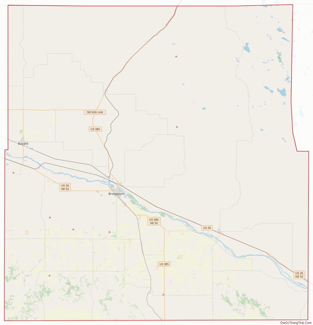
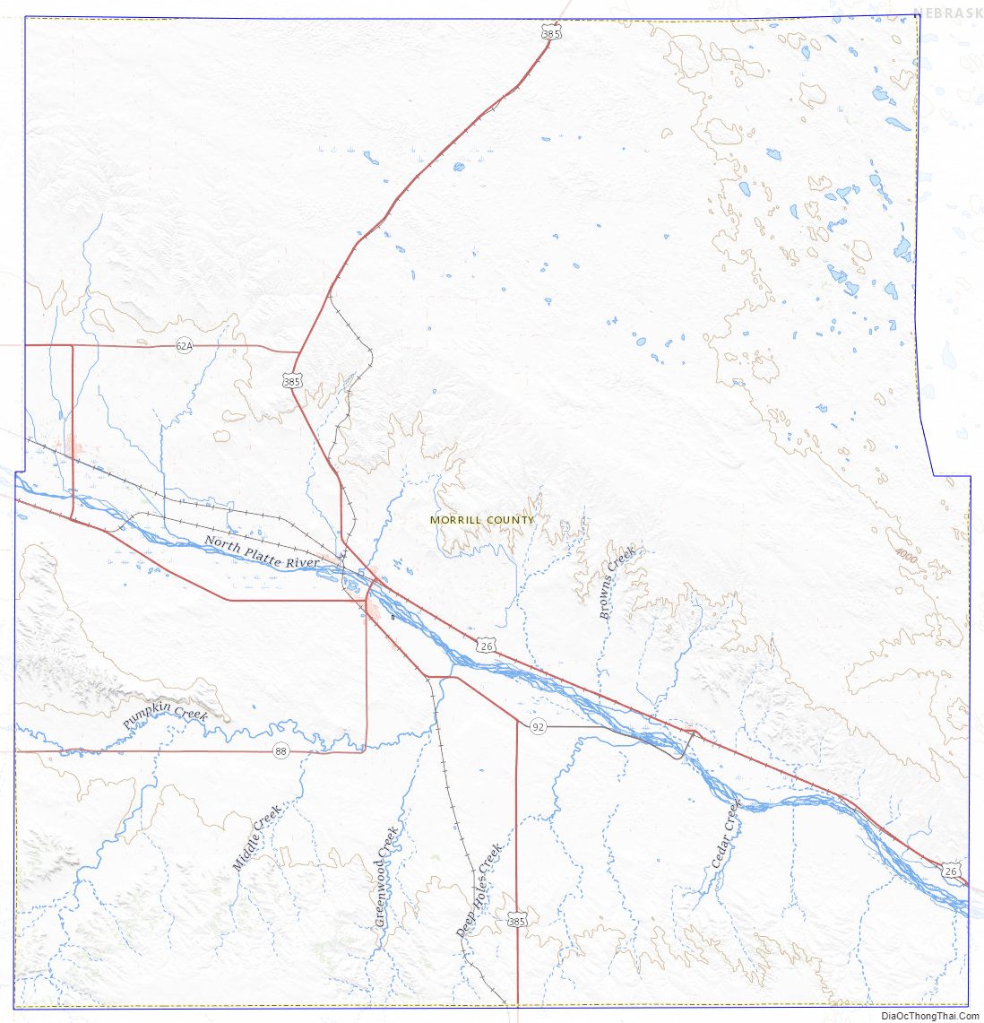
Morrill County Road Map
Geography
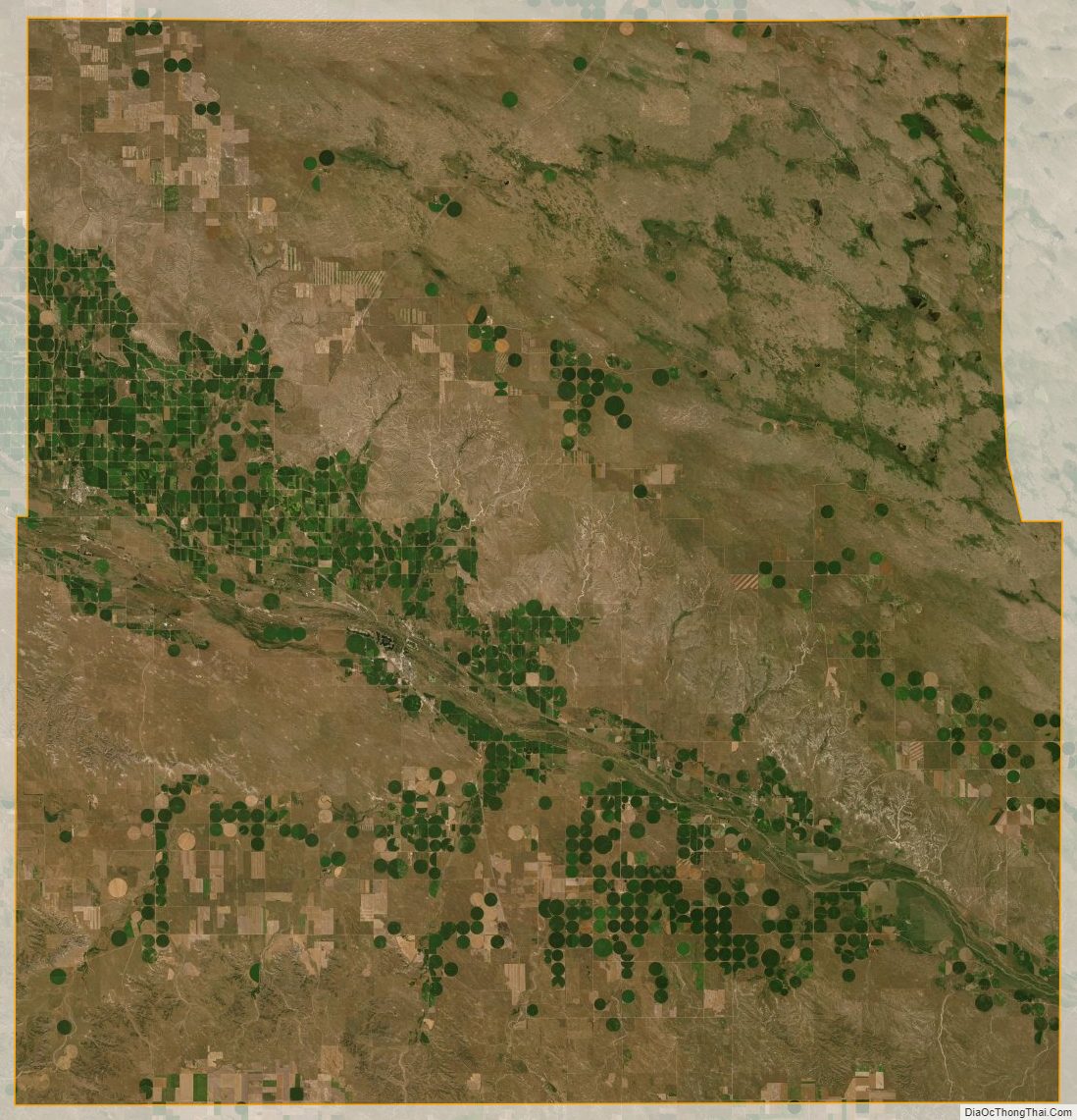
The terrain of Morrill County consists of low rolling hills. A portion of the area is used for agriculture, including some center pivot irrigation. The North Platte River flows east-southeastward through the south-central part of the county, passing Bridgeport before exiting the county some 4 mi (6 km) above the southeast county corner. The county has a total area of 1,430 square miles (3,700 km), of which 1,424 square miles (3,690 km) are land and 6.0 square miles (16 km) (0.4%) are covered by water.
Chimney Rock, a rock formation 325 feet (99 m) tall with a 120-foot (37 m) spire, lies about 4 mi (6 km) south of Bayard, in western Morrill County. The rock was a prominent landmark on the Oregon Trail, and has become a symbol of Nebraska, appearing on the state’s license plates and on its commemorative quarter.
Adjacent counties
- Box Butte County – north
- Sheridan County – northeast
- Garden County – east
- Cheyenne County – south
- Banner County – southwest
- Scotts Bluff County – northwest
Main highways
- US 385 – runs north and south through the county
- US 26 – runs northwest–southeast along the north side of the North Platte River
- Nebraska Highway 92– runs southeast from the western border to its intersection with US 26 near Broadwater
- Nebraska Highway 88 – runs east from a point north of the southwest corner of the county; turns north to its intersection with US 385 in Bridgeport
Morrill County Topographic Map
Morrill County Satellite Map
Morrill County Outline Map

See also
Map of Nebraska State and its subdivision:- Adams
- Antelope
- Arthur
- Banner
- Blaine
- Boone
- Box Butte
- Boyd
- Brown
- Buffalo
- Burt
- Butler
- Cass
- Cedar
- Chase
- Cherry
- Cheyenne
- Clay
- Colfax
- Cuming
- Custer
- Dakota
- Dawes
- Dawson
- Deuel
- Dixon
- Dodge
- Douglas
- Dundy
- Fillmore
- Franklin
- Frontier
- Furnas
- Gage
- Garden
- Garfield
- Gosper
- Grant
- Greeley
- Hall
- Hamilton
- Harlan
- Hayes
- Hitchcock
- Holt
- Hooker
- Howard
- Jefferson
- Johnson
- Kearney
- Keith
- Keya Paha
- Kimball
- Knox
- Lancaster
- Lincoln
- Logan
- Loup
- Madison
- McPherson
- Merrick
- Morrill
- Nance
- Nemaha
- Nuckolls
- Otoe
- Pawnee
- Perkins
- Phelps
- Pierce
- Platte
- Polk
- Red Willow
- Richardson
- Rock
- Saline
- Sarpy
- Saunders
- Scotts Bluff
- Seward
- Sheridan
- Sherman
- Sioux
- Stanton
- Thayer
- Thomas
- Thurston
- Valley
- Washington
- Wayne
- Webster
- Wheeler
- York
- Alabama
- Alaska
- Arizona
- Arkansas
- California
- Colorado
- Connecticut
- Delaware
- District of Columbia
- Florida
- Georgia
- Hawaii
- Idaho
- Illinois
- Indiana
- Iowa
- Kansas
- Kentucky
- Louisiana
- Maine
- Maryland
- Massachusetts
- Michigan
- Minnesota
- Mississippi
- Missouri
- Montana
- Nebraska
- Nevada
- New Hampshire
- New Jersey
- New Mexico
- New York
- North Carolina
- North Dakota
- Ohio
- Oklahoma
- Oregon
- Pennsylvania
- Rhode Island
- South Carolina
- South Dakota
- Tennessee
- Texas
- Utah
- Vermont
- Virginia
- Washington
- West Virginia
- Wisconsin
- Wyoming