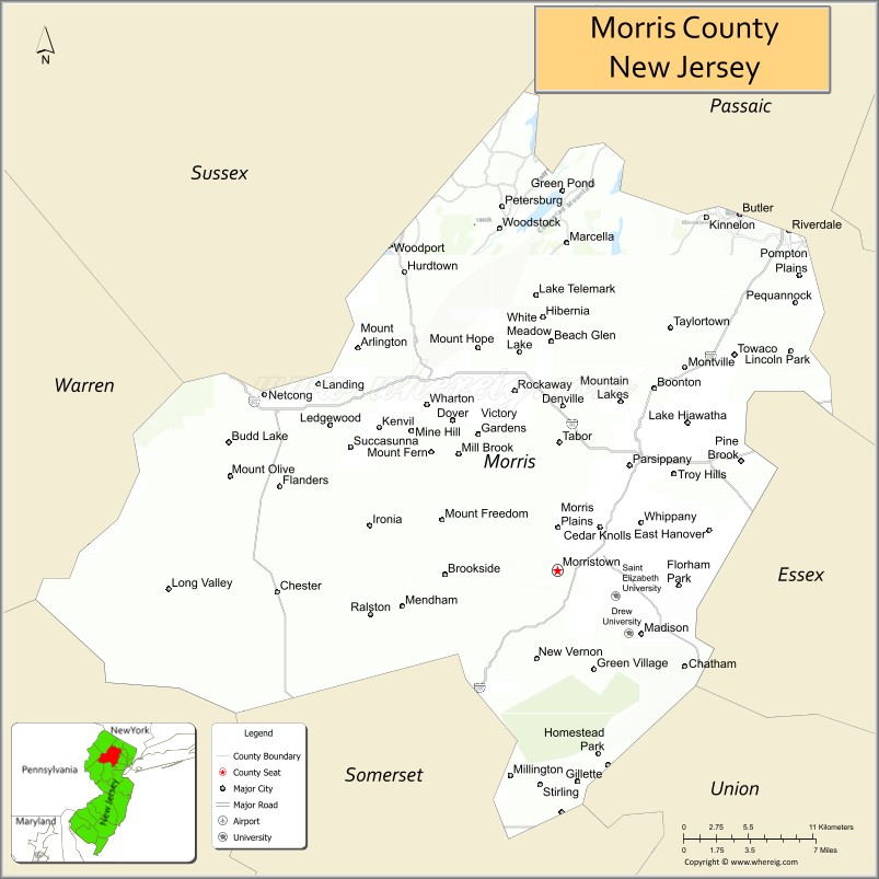
| Name: | Morris County |
|---|---|
| FIPS code: | 34-027 |
| State: | New Jersey |
| Founded: | March 15, 1739 |
| Named for: | Colonial governor Lewis Morris |
| Seat: | Morristown |
| Largest town: | Parsippany-Troy Hills Township (population) Rockaway Township (area) |
| Total Area: | 481.62 sq mi (1,247.4 km²) |
| Land Area: | 460.18 sq mi (1,191.9 km²) |
| Total Population: | 509,285 |
| Population Density: | 1,104.8/sq mi (426.6/km²) |
| Website: | www.co.morris.nj.us |
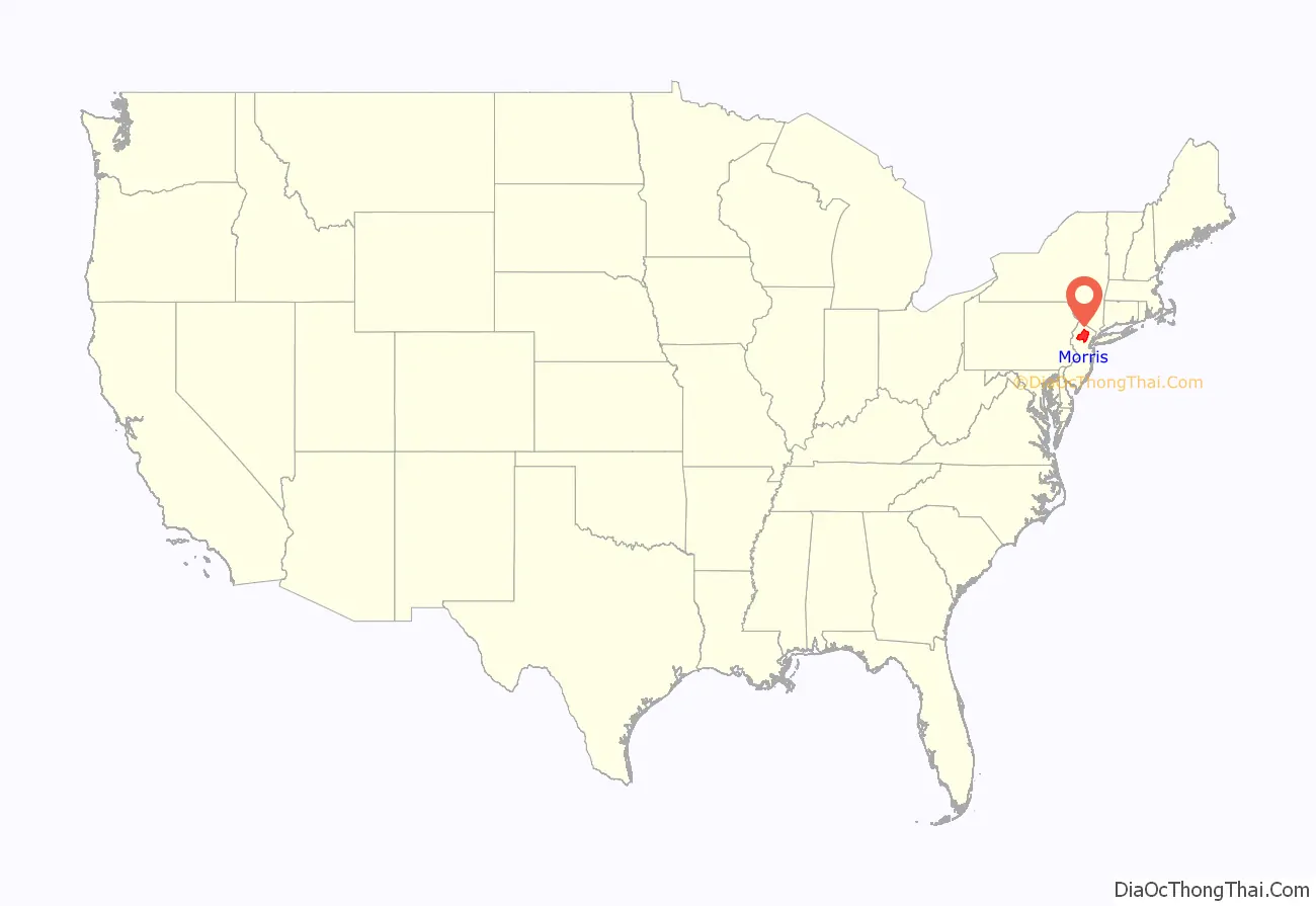
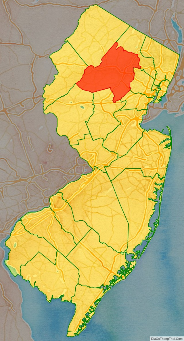
Morris County location map. Where is Morris County?
History
Etymology
Morris County was named after Colonel Lewis Morris, governor of New Jersey in 1738-39, the year the county was named.
Paleo Indians and Native Americans
The Wisconsin Glacier covered the northern section of Morris County from about 23,000 B.C. to 13,000 B.C.
After the Wisconsin Glacier melted around 13,000 B.C., Paleo Indians moved into the area from the south in search of big and small game as well as plants. The area was first tundra with grasses growing. Rabbits and fox moved into the area from the south.
Around the year 1000, the area of Morris County was inhabited by the Lenape Native Americans prior to the arrival of European settlers. They came from the Mississippi River area. They lived along the rivers and hunted game, fished, collected plants and nuts.
Dutch and English colonization
Henry Hudson explored the Hudson River area in 1609, and later the Dutch did surveys of the area.
From 1611 to 1614, the Dutch established the colony of New Netherland, which claimed territory between the 40th and 45th parallel north, a zone which included northern New Jersey. Dutch forts were established along the Hudson River beginning in 1613. As the years went by, more forts were established to trade with Native Americans.
The Native Americans traded furs and food with the Dutch for various goods. In return the Dutch gave the Native Americans metal pots, knives, guns, axes, and blankets. Trading with the Native Americans occurred until 1643 when a series of wars broke out between the Dutch and Native Americans.
There were hostile relations between the Dutch and Native Americans between 1643 and 1660. This prevented colonization by the Dutch of the Morris County region which was technically included in their claimed “New Netherland”.
On August 27, 1664, three English ships approached Fort Amsterdam and the fort was surrendered to the English. The English now controlled New Netherland and Morris County was now under control of the colony of New York. Relations with the Native Americans improved for a while.
There was a war with the Dutch ten years later. The Dutch re-took control of New Amsterdam but after a year returned it to the English. Relations with the Native Americans and English improved for a while.
European settlements began in the early 18th century while the area was known as Hunterdon County. Native Americans were still in the area at that time. Land was purchased from the Native Americans for various things such as blankets, shirts, rum, guns, knives, pots and gunpowder. European colonization occurred along the Atlantic coast and moved inland.
The first European settlement in the area today known as Morris County occurred in Pompton Plains by the Dutch in 1695. From 1710 to 1730, various iron mines and forges were established. The first was in Whippany in 1710 and then in Succasunna in 1713.
By 1750, nearly all Native Americans had left New Jersey. This was due to land purchases from the Native Americans, diseases that the Native Americans contracted from Europeans, and due to starvation from the Little Ice Age, during which Native American corn crops failed and rivers froze, preventing fishing. Snow storms sent game into semi-hibernation or made them difficult to find. Nut crops such as oak, hickory, beech, walnut, chestnut and butternut failed some years due to late frosts in spring. Many of the Morris County Native Americans went to eastern Canada and others went to the Ohio Valley. The Walking Purchase in September 1737, prevented Native Americans from going to eastern Pennsylvania. At that time, European settlement grew swiftly as there was now land to be farmed and settled.
Morris County was originally part of Burlington County which had been established in 1694. It then became part of Hunterdon County, which separated from Burlington County in 1714.
Morris County was created on March 15, 1739, from portions of Hunterdon County. The county was named for the Governor of the Province of New Jersey, Colonel Lewis Morris. In later years Sussex County (on June 8, 1753) and, after the revolution, Warren County (on November 20, 1824, from portions of Sussex County) were carved out of what had been the original area of Morris County under English rule.
The county was the site of the winter camp of the Continental Army after the Battles of Trenton and Princeton during the winter of 1777, as well as another winter camp at Jockey Hollow during an extremely cold winter of 1779–80.
In the 1880s, Dover was the center of iron ore mining with the 132 mines producing 700,000 tons of ore annually. The mines were mostly worked by Cornish miners, with the bulk of the population in Dover and Port Oram of Cornish extraction. At that time the Cornish had kept their customs and dialect, were deeply religious and predominantly Methodists.
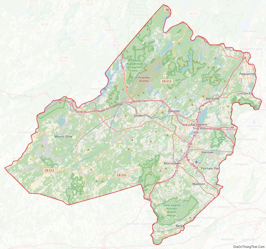
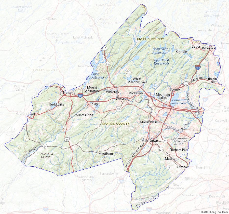
Morris County Road Map
Geography
According to the 2010 census, the county had a total area of 481.62 square miles (1,247.4 km), including 460.18 square miles (1,191.9 km) of land (95.5%) and 21.45 square miles (55.6 km) of water (4.5%).
The county rises in elevation and relief from east to west, with only the more developed eastern suburbs in the Passaic River valley being relatively level. The highest point is at 1,395 feet (425 m) above sea level on a mountain south of Pine Swamp in western Jefferson Township. The second-highest point is on a mountain just north of Riker Lake at 1,358 feet (414 m). The lowest point is about 160 feet (49 m) in elevation, at Two Bridges, the confluence of the Passaic and Pompton rivers.
The county is drained by several rivers. The Rockaway River drains 125 square miles (320 km), of the northern section of the county. The Whippany River drains 69 square miles (180 km) of the middle of the county. The South Branch of the Raritan River and the Black River drain the western area.
Most of the county’s borders are rivers. The Pequannock River drains the northern boundary area. The Pompton River drains the eastern section. The Passaic River also drains the eastern border area. The western border is drained by the Musconetcong River. There are several large lakes in Morris County; among them are Lake Hopatcong, Budd Lake, Lake Parsippany, and the Boonton Reservoir, also known as the Jersey City Reservoir.
Climate
Morris has a humid continental climate (Dfa/Dfb) and the hardiness zones are 6a and 6b.
Weather
In recent years, average temperatures in the county seat of Morristown have ranged from a low of 18 to 23 °F (−8 to −5 °C) in January to a high of 83 to 85 °F (28 to 29 °C) in July, although a record low of −26 °F (−32 °C) was recorded in February 1934 and a record high of 104 °F (40 °C) was recorded in August 2001. Average monthly precipitation ranged from 3.12 inches (79 mm) in February to 5.33 inches (135 mm) in September.
Geology
Around 500 million years ago, a chain of volcanic islands shaped like an arc collided with proto-North America. The islands rode over top of the North American plate. This created the highlands in western Morris County and the eastern section of Morris County.
Around 400 million years ago, a small continent long and narrow collided with proto-North America. This created folding and faulting, as compression occurred. Then around 350 million years ago, the African plate collided with North America creating the folding and faulting in the Appalachians. But when the African plate pulled away from North America, an aborted rift valley was created. This half graben, starts east of Boonton and goes through the middle of Parsippany, south to Morristown, to the south end of Great Swamp. From Parsippany and the Boonton area the half graben goes east to the western side of Paterson, where there was another fault by the lava flows. East of the Ramapo Fault is where there is this aborted rift valley.
The Ramapo fault goes through the county on a northeast-southwest axis. The fault separates the Highlands from the Piedmont, also known as the Newark Basin. This is an active fault. The last major earthquake occurred in 1884, with a strength measured at 5.3 on the Richter scale.
Around 21,000 BCE., the Wisconsin Glacier covered about half of Morris County. The terminal moraine went from Hackettstown east to north of Budd Lake, east to Rockaway and Denville, then southeast to Morristown then south to the south end of Great Swamp. When the glacier melted around 13,000 B.C. the melt water created Glacial Lake Passaic. The lake extended from what is now Pompton Lakes through Parsippany south to the south end of Great Swamp. From Parsippany the lake went east to the lava flows of western Paterson. This lake was 30 miles (48 km) long and 10 miles (16 km) miles wide and the depth was about 200 feet (61 m). When the Wisconsin glacier covered Morris County, the ice sheet was about 300 metres (980 ft) deep. Due to debris from the glacier, the lake was unable to drain through the Watchung Mountains near Short Hills. Instead, it drained through Moggy Hollow at the southwestern end of the lake. But when the glacier melted and receded to the New York State line, the lake drained though the Little Falls area, as this was lower in elevation than Moggy Hollow. And thus the Passaic River formed.
The swamps of the Great Piece Meadows, Hatfield Swamp, Troy Meadows, Lee Meadows and Great Swamp were all under the Lake Passaic until it drained, and then these areas were created.
Morris County Topographic Map
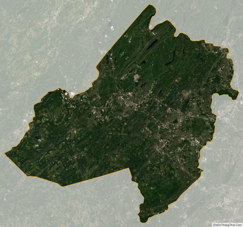
Morris County Satellite Map
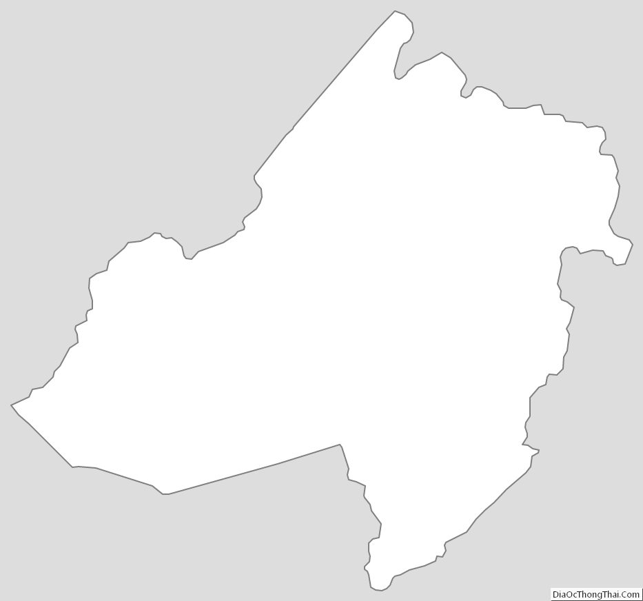
Morris County Outline Map
See also
Map of New Jersey State and its subdivision: Map of other states:- Alabama
- Alaska
- Arizona
- Arkansas
- California
- Colorado
- Connecticut
- Delaware
- District of Columbia
- Florida
- Georgia
- Hawaii
- Idaho
- Illinois
- Indiana
- Iowa
- Kansas
- Kentucky
- Louisiana
- Maine
- Maryland
- Massachusetts
- Michigan
- Minnesota
- Mississippi
- Missouri
- Montana
- Nebraska
- Nevada
- New Hampshire
- New Jersey
- New Mexico
- New York
- North Carolina
- North Dakota
- Ohio
- Oklahoma
- Oregon
- Pennsylvania
- Rhode Island
- South Carolina
- South Dakota
- Tennessee
- Texas
- Utah
- Vermont
- Virginia
- Washington
- West Virginia
- Wisconsin
- Wyoming