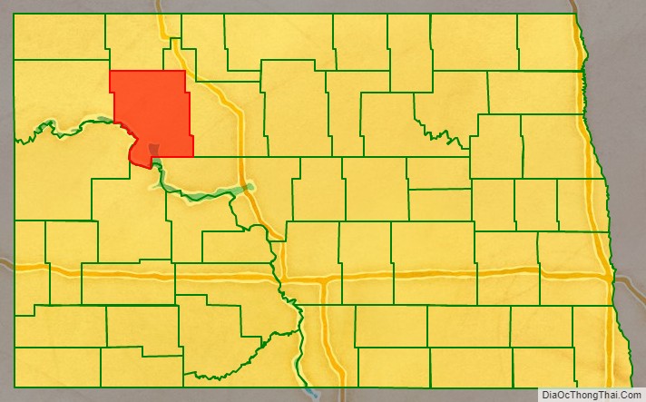
Mountrail County is a county in the northwestern part of North Dakota, United States. As of the 2020 census, the population was 9,809. Its county seat is Stanley. The county was originally created in 1873, then removed in 1892, annexed by Ward County. It was re-created and organized in 1909.
| Name: | Mountrail County |
|---|---|
| FIPS code: | 38-061 |
| State: | North Dakota |
| Founded: | 1873 |
| Seat: | Stanley |
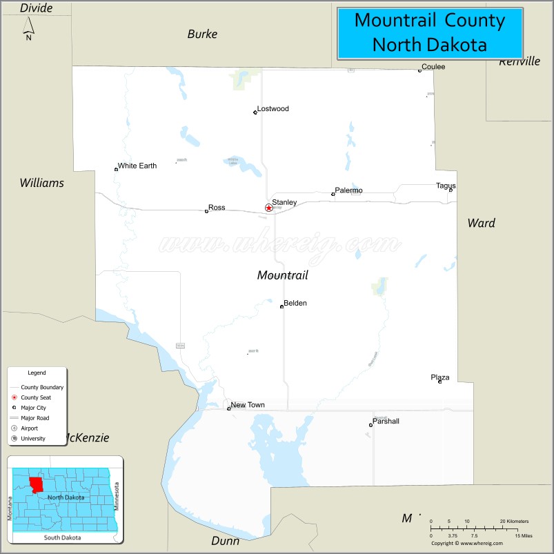
| Largest city: | New Town |
| Total Area: | 1,942 sq mi (5,030 km²) |
| Land Area: | 1,825 sq mi (4,730 km²) |
| Total Population: | 9,809 |
| Population Density: | 5.1/sq mi (2.0/km²) |
| Time zone: | UTC−6 (Central) |
| Summer Time Zone (DST): | UTC−5 (CDT) |
| Website: | www.co.mountrail.nd.us |
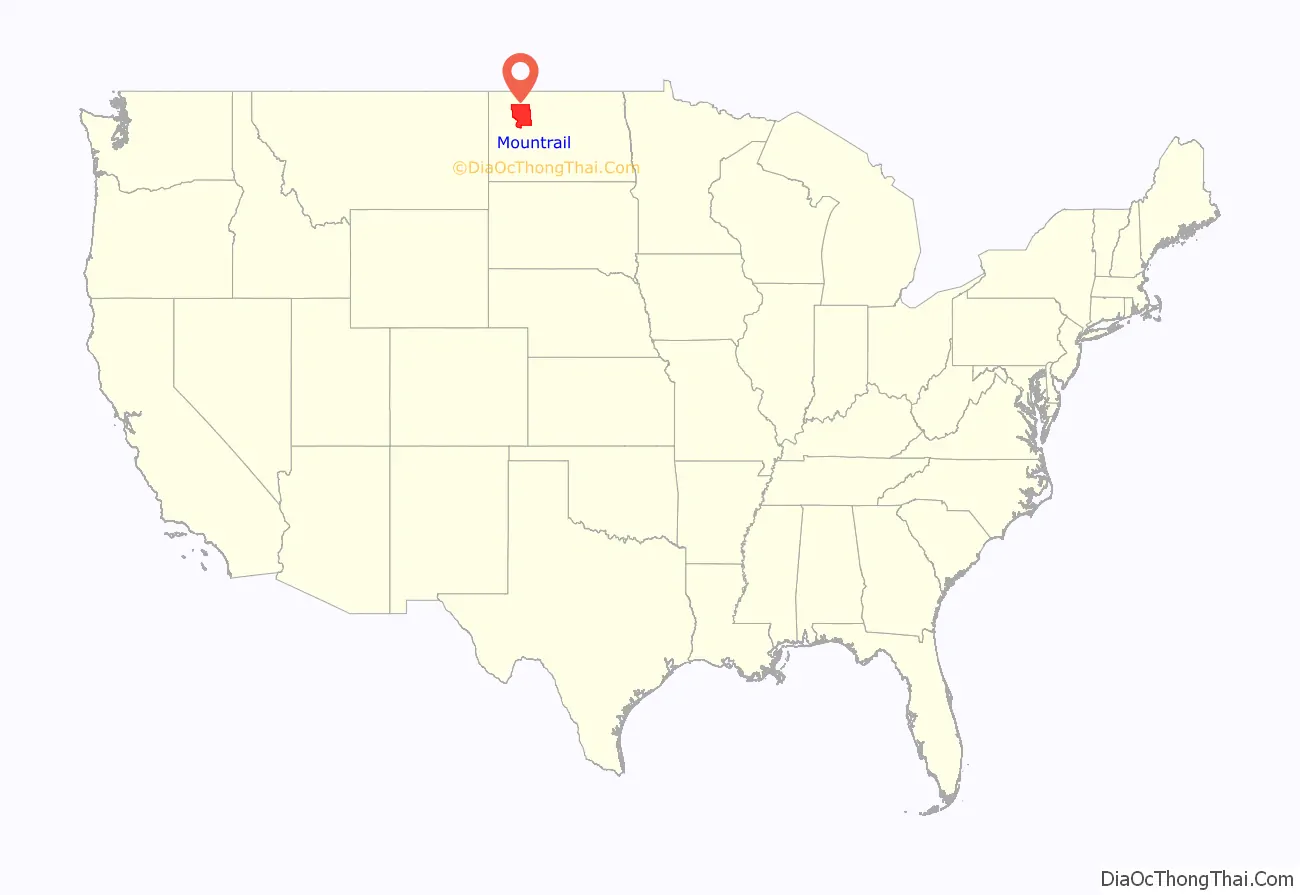
Mountrail County location map. Where is Mountrail County?
History
The Dakota Territory legislature created the county (as Mountraille County) on January 4, 1873, with area annexed from Buffalo County. It was not organized at that time, nor was it attached to another county for administrative or judicial purposes. The new county lost territory in 1885 when a portion was annexed off to create Garfield County (now extinct). This situation continued until February 21, 1891, when Mountrail County was attached to Ward County, for “judicial and other purposes”. The following year (November 8, 1892), the North Dakota legislature voted to dissolve the county and have its territory absorbed by Ward County.
An election held in Ward County on November 3, 1908, authorized the re-creation of Mountrail County, although with different boundaries than the previous county proposal. The countywide vote totals were 4207 to 4024, but the result was contested in court. On January 16, 1909, the state Supreme Court upheld the vote, so the county government was organized on January 29 of that year.
Oil production from the Bakken formation in the early 21st century attracted workers and reversed decades of population decline in the county. From 2010 to 2015, especially, population markedly increased, creating its own strains.
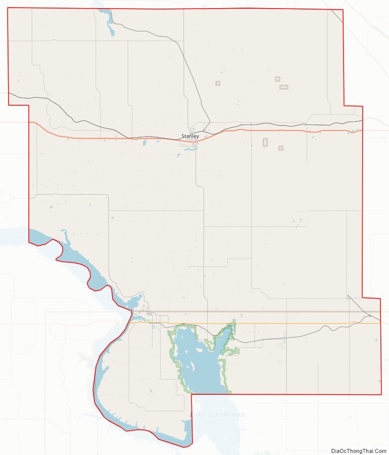
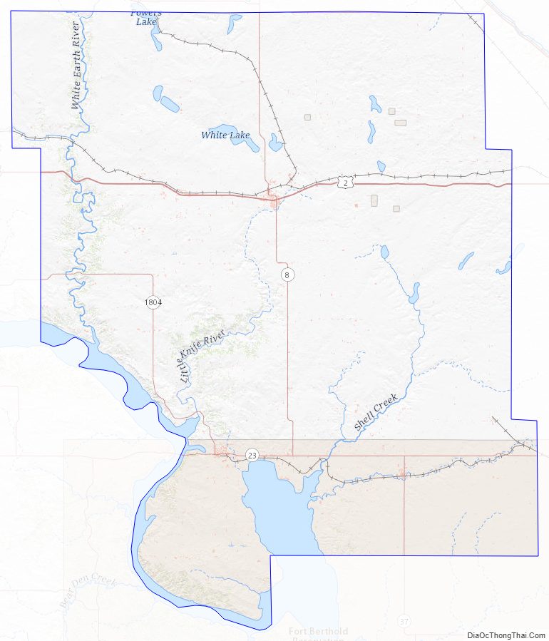
Mountrail County Road Map
Geography
The Missouri River flows southeastward along the SW boundary line of Mountrail County, and Shell Creek drains the lower central part of the county into the Missouri, discharging at Shell Creek Bay. The terrain consists of rolling hills, largely devoted to agriculture. Its NE portion is dotted with ponds and lakes. The Laurentian Divide runs east–west through the central part of the county, with the northern areas sloping to the north and the southern areas sloping to the south. Its highest point is on the upper west boundary line, at 2,480′ (756m) ASL. The county has a total area of 1,942 square miles (5,030 km), of which 1,825 square miles (4,730 km) is land and 116 square miles (300 km) (6.0%) is water.
Mountrail County is one of several western North Dakota counties with significant exposure to the Bakken Formation in the Williston Basin.
Major highways
- U.S. Highway 2
- North Dakota Highway 8
- North Dakota Highway 23
- North Dakota Highway 37
- North Dakota Highway 1804
Adjacent counties
- Burke County – north
- Ward County – east
- McLean County – southeast
- Dunn County – south
- McKenzie County – southwest
- Williams County – west
Protected areas
- Crow Flies High Butte
- Lostwood National Wildlife Refuge (part)
- Palermo State Game Management Area
- Reunion Point Public Use Area
- Shell Lake National Wildlife Refuge
- Van Hook State Game Management Area
- Van Hook State Wildlife Management Area
Lakes
- Cottonwood Lake
- Lake Sakakawea
- Powers Lake (part)
- Rat Lake
- Robinson Lake
- Shell Lake
- Van Hook Arm
- White Lake
Mountrail County Topographic Map
Mountrail County Satellite Map
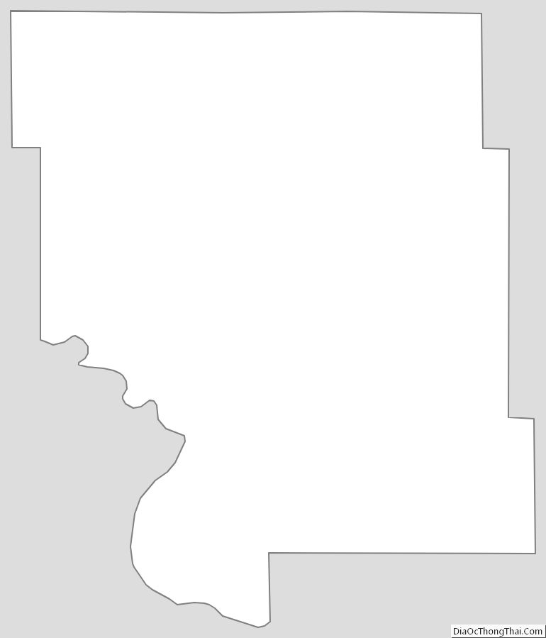
Mountrail County Outline Map
See also
Map of North Dakota State and its subdivision:- Adams
- Barnes
- Benson
- Billings
- Bottineau
- Bowman
- Burke
- Burleigh
- Cass
- Cavalier
- Dickey
- Divide
- Dunn
- Eddy
- Emmons
- Foster
- Golden Valley
- Grand Forks
- Grant
- Griggs
- Hettinger
- Kidder
- Lamoure
- Logan
- McHenry
- McIntosh
- McKenzie
- McLean
- Mercer
- Morton
- Mountrail
- Nelson
- Oliver
- Pembina
- Pierce
- Ramsey
- Ransom
- Renville
- Richland
- Rolette
- Sargent
- Sheridan
- Sioux
- Slope
- Stark
- Steele
- Stutsman
- Towner
- Traill
- Walsh
- Ward
- Wells
- Williams
- Alabama
- Alaska
- Arizona
- Arkansas
- California
- Colorado
- Connecticut
- Delaware
- District of Columbia
- Florida
- Georgia
- Hawaii
- Idaho
- Illinois
- Indiana
- Iowa
- Kansas
- Kentucky
- Louisiana
- Maine
- Maryland
- Massachusetts
- Michigan
- Minnesota
- Mississippi
- Missouri
- Montana
- Nebraska
- Nevada
- New Hampshire
- New Jersey
- New Mexico
- New York
- North Carolina
- North Dakota
- Ohio
- Oklahoma
- Oregon
- Pennsylvania
- Rhode Island
- South Carolina
- South Dakota
- Tennessee
- Texas
- Utah
- Vermont
- Virginia
- Washington
- West Virginia
- Wisconsin
- Wyoming