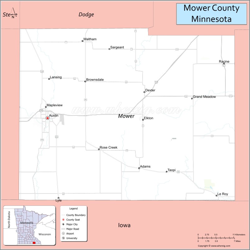
Mower County (/ˈmaʊ.ər/) is a county in the U.S. state of Minnesota. As of the 2020 census, the population was 40,029. The county seat is Austin. Mower County comprises the Austin Micropolitan Statistical Area and is included in the Rochester-Austin Combined Statistical Area. Lake Louise State Park is in southeastern Mower County, near Le Roy.
| Name: | Mower County |
|---|---|
| FIPS code: | 27-099 |
| State: | Minnesota |
| Founded: | 1855 |
| Named for: | John Edward Mower |
| Seat: | Austin |
| Largest city: | Austin |
| Total Area: | 711.5 sq mi (1,843 km²) |
| Land Area: | 711.3 sq mi (1,842 km²) |
| Total Population: | 40,029 |
| Population Density: | 56.3/sq mi (21.7/km²) |
| Time zone: | UTC−6 (Central) |
| Summer Time Zone (DST): | UTC−5 (CDT) |
| Website: | www.co.mower.mn.us |
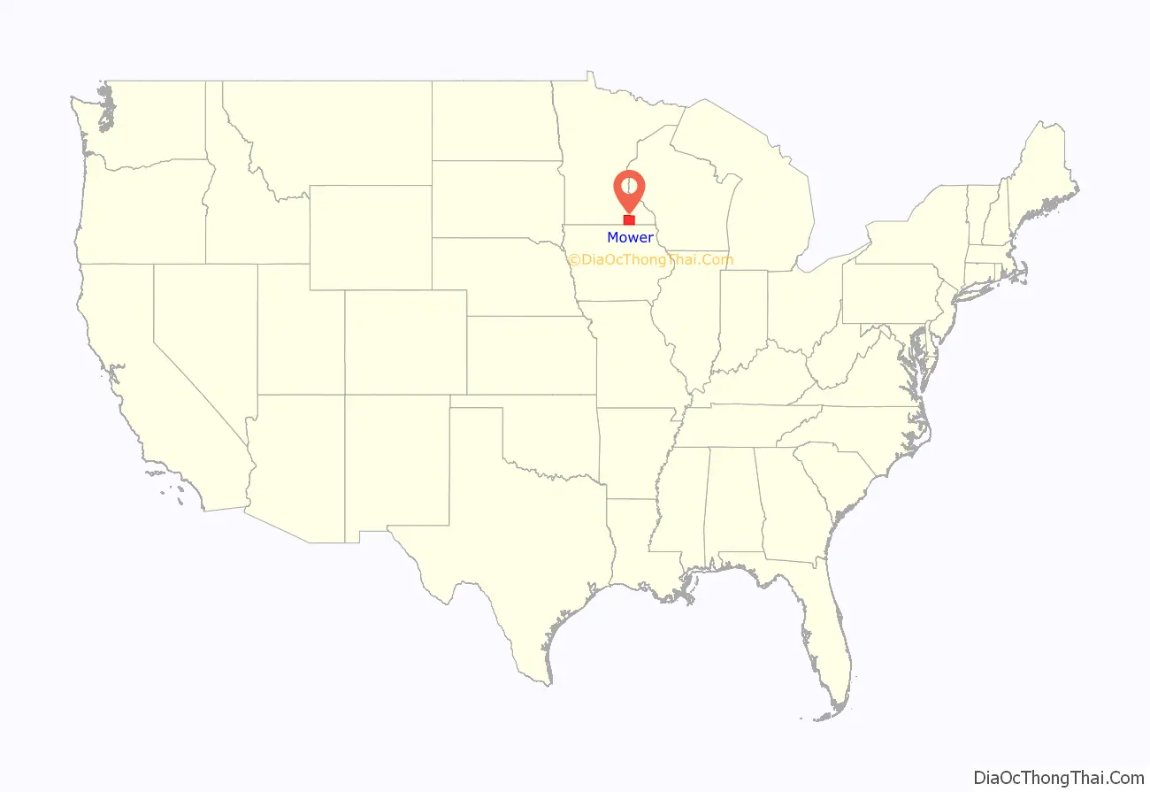
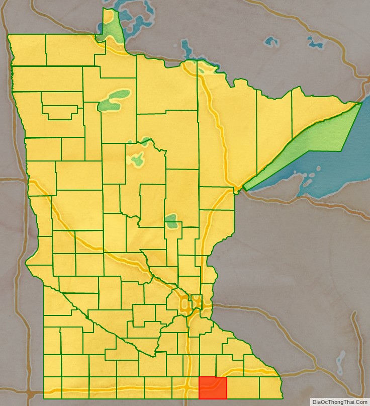
Mower County location map. Where is Mower County?
History
The federal government established Wisconsin Territory effective July 3, 1836, and included what is now Minnesota, until its eastern portion was granted statehood (as Wisconsin) in 1848.
Congress established the Minnesota Territory effective March 3, 1849. The newly organized territorial legislature created nine counties across the territory in October of that year. Two of the original counties, Dakota and Wabashaw (later Wabasha), had portions reassigned on March 5, 1853, to create Rice County.
In 1852, Jacob McQuillin’s family settled in southern Rice County, beginning a settlement movement that rapidly grew. On February 20, 1855, the territorial legislature created the present county from the southernmost part of Rice County. The new county was named for John Edward Mower, a member of the territorial legislature.
On March 1, 1856, Territorial Governor Willis A. Gorman signed the legislative act that organized the county. He appointed three commissioners, who first met in Frankford Township. In January 1857 those commissioners designated the permanent seat in Austin Township. In July 1857 the location within Austin Township was further defined, within Austin village, which had been platted during the spring of 1856.
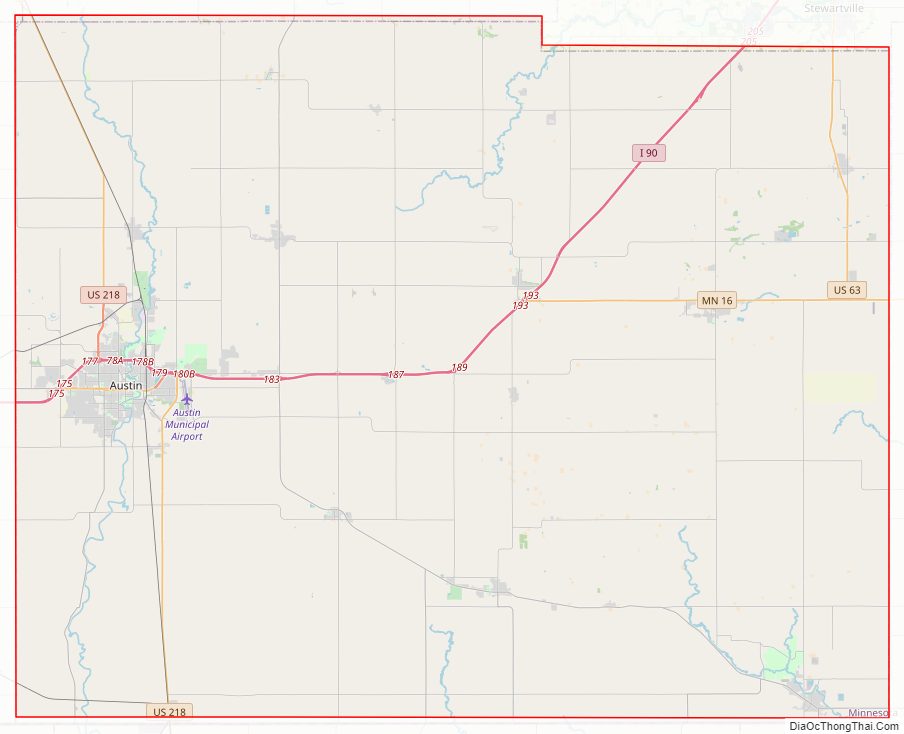
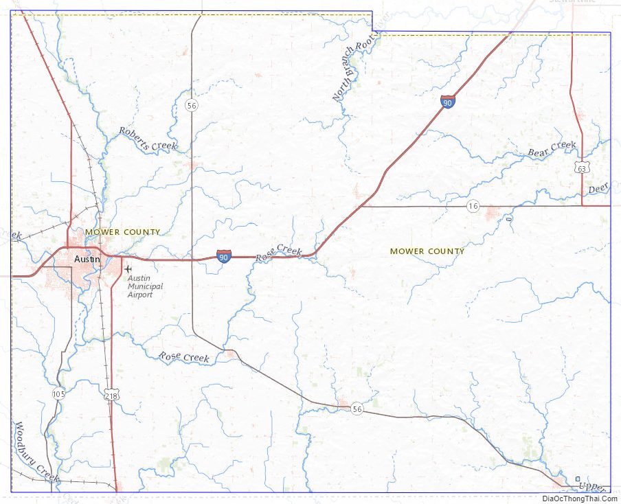
Mower County Road Map
Geography
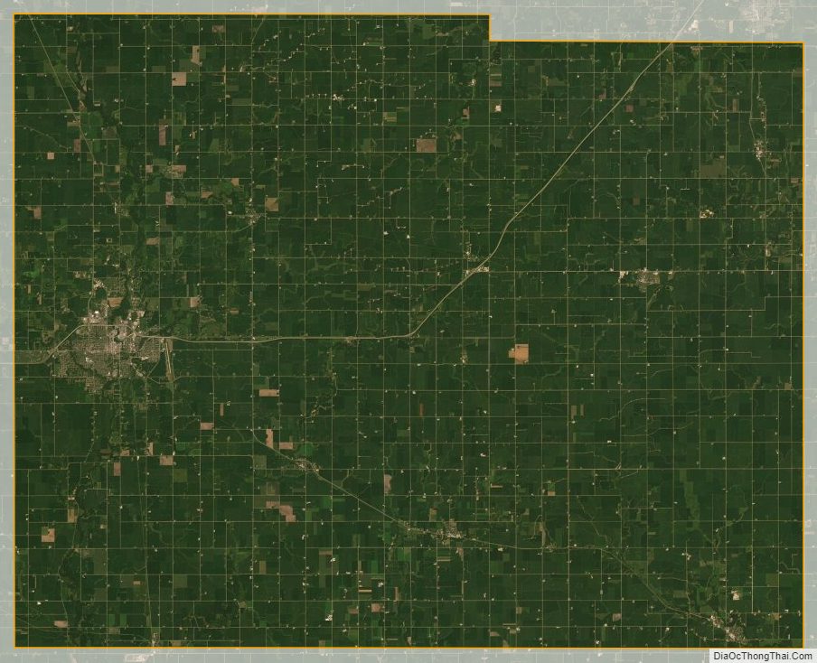
Mower County lies on Minnesota’s border with Iowa. The Cedar River flows south through the western part of the county, into Mitchell County, Iowa. The Upper Iowa River rises in Mower County. Its branches, the Little Iowa and Upper Branch Upper Iowa, merge near Le Roy and flow east-southeast out of the county’s southeast corner into Mitchell County, Iowa. Deer Creek drains the southeastern part of the county, flowing northeast into Fillmore County. Bear Creek drains the northern part of the county, flowing east into Fillmore County. Carey Creek drains the northeastern part of the county, flowing northeast into Olmsted County. The county terrain consists of low rolling hills, etched with drainages and gullies. The area is devoted to agriculture where possible. The terrain slopes to the east and south from an elevated center ridge running west–east, with its highest point 1.6 mile (2.6 km) east of Elkton, at 1,440′ (439m) ASL. The county has an area of 712 square miles (1,840 km), of which 711 square miles (1,840 km) is land and 0.2 square miles (0.52 km) (0.03%) is water.
Lakes
One of only four counties in Minnesota without any natural lakes (along with Olmsted, Pipestone, and Rock), Mower County does have four small ponds and lakes created by dams:
- East Side Lake: in the northeast quadrant of Austin
- Lake Louise: in Lake Louise State Park near Le Roy
- Mill Pond: in downtown Austin near the Hormel plant
- Ramsey Mill Pond: in Ramsey Golf Course, near the unincorporated settlement of Ramsey
The Cedar River (sometimes called the Red Cedar River) flows south into the county from its source in Dodge County and continues through the county into Mitchell County, Iowa. It flows through Mower County’s four westernmost townships: Udolpho, Lansing, Austin, and Lyle.
Major highways
- I-90
- I-90 BL
- US 63
- US 218
- Minnesota State Highway 16
- Minnesota State Highway 56
- Minnesota State Highway 105
- Minnesota State Highway 251
Airports
- Austin Municipal Airport (AUM) – east of Austin
Adjacent counties
- Dodge County – north
- Olmsted County – northeast
- Fillmore County – east
- Howard County, Iowa – southeast
- Mitchell County, Iowa – south
- Worth County, Iowa – southwest
- Freeborn County – west
- Steele County – northwest
Protected areas
- Lake Louise State Park
- Larson State Wildlife Management Area
- Red Cedar State Wildlife Management Area
- Rose State Wildlife Management Area
Mower County Topographic Map
Mower County Satellite Map
Mower County Outline Map

See also
Map of Minnesota State and its subdivision:- Aitkin
- Anoka
- Becker
- Beltrami
- Benton
- Big Stone
- Blue Earth
- Brown
- Carlton
- Carver
- Cass
- Chippewa
- Chisago
- Clay
- Clearwater
- Cook
- Cottonwood
- Crow Wing
- Dakota
- Dodge
- Douglas
- Faribault
- Fillmore
- Freeborn
- Goodhue
- Grant
- Hennepin
- Houston
- Hubbard
- Isanti
- Itasca
- Jackson
- Kanabec
- Kandiyohi
- Kittson
- Koochiching
- Lac qui Parle
- Lake
- Lake of the Woods
- Lake Superior
- Le Sueur
- Lincoln
- Lyon
- Mahnomen
- Marshall
- Martin
- McLeod
- Meeker
- Mille Lacs
- Morrison
- Mower
- Murray
- Nicollet
- Nobles
- Norman
- Olmsted
- Otter Tail
- Pennington
- Pine
- Pipestone
- Polk
- Pope
- Ramsey
- Red Lake
- Redwood
- Renville
- Rice
- Rock
- Roseau
- Saint Louis
- Scott
- Sherburne
- Sibley
- Stearns
- Steele
- Stevens
- Swift
- Todd
- Traverse
- Wabasha
- Wadena
- Waseca
- Washington
- Watonwan
- Wilkin
- Winona
- Wright
- Yellow Medicine
- Alabama
- Alaska
- Arizona
- Arkansas
- California
- Colorado
- Connecticut
- Delaware
- District of Columbia
- Florida
- Georgia
- Hawaii
- Idaho
- Illinois
- Indiana
- Iowa
- Kansas
- Kentucky
- Louisiana
- Maine
- Maryland
- Massachusetts
- Michigan
- Minnesota
- Mississippi
- Missouri
- Montana
- Nebraska
- Nevada
- New Hampshire
- New Jersey
- New Mexico
- New York
- North Carolina
- North Dakota
- Ohio
- Oklahoma
- Oregon
- Pennsylvania
- Rhode Island
- South Carolina
- South Dakota
- Tennessee
- Texas
- Utah
- Vermont
- Virginia
- Washington
- West Virginia
- Wisconsin
- Wyoming