Neshoba County is located in the central part of the U.S. state of Mississippi. As of the 2020 census, the population was 29,087. Its county seat is Philadelphia. It was named after Nashoba, a Choctaw chief. His name means “wolf” in the Choctaw language.
The county is known for the Neshoba County Fair and harness horse races. It is home of the Williams Brothers Store, which has been in operation since the early 1900s.
In June 1964, civil rights workers James Chaney, Andrew Goodman, and Michael Schwerner were chased down, tortured, and murdered by members of the Ku Klux Klan. They were buried in an earthen dam on private property off of Highway 21; Goodman was still alive. Initially treated as a missing persons case, their disappearance provoked national outrage and contributed significantly to the July enactment of the Civil Rights Act by President Johnson.
The Mississippi Band of Choctaw Indians (MBCI), a federally recognized tribe, is based here and has developed one of the largest casino complexes in the state on their reservation, the Pearl River Resort.
| Name: | Neshoba County |
|---|---|
| FIPS code: | 28-099 |
| State: | Mississippi |
| Founded: | 1833 |
| Named for: | Choctaw for “wolf” |
| Seat: | Philadelphia |
| Largest city: | Philadelphia |
| Total Area: | 572 sq mi (1,480 km²) |
| Land Area: | 570 sq mi (1,500 km²) |
| Total Population: | 29,087 |
| Population Density: | 51/sq mi (20/km²) |
| Time zone: | UTC−6 (Central) |
| Summer Time Zone (DST): | UTC−5 (CDT) |
| Website: | www.neshobacounty.net |
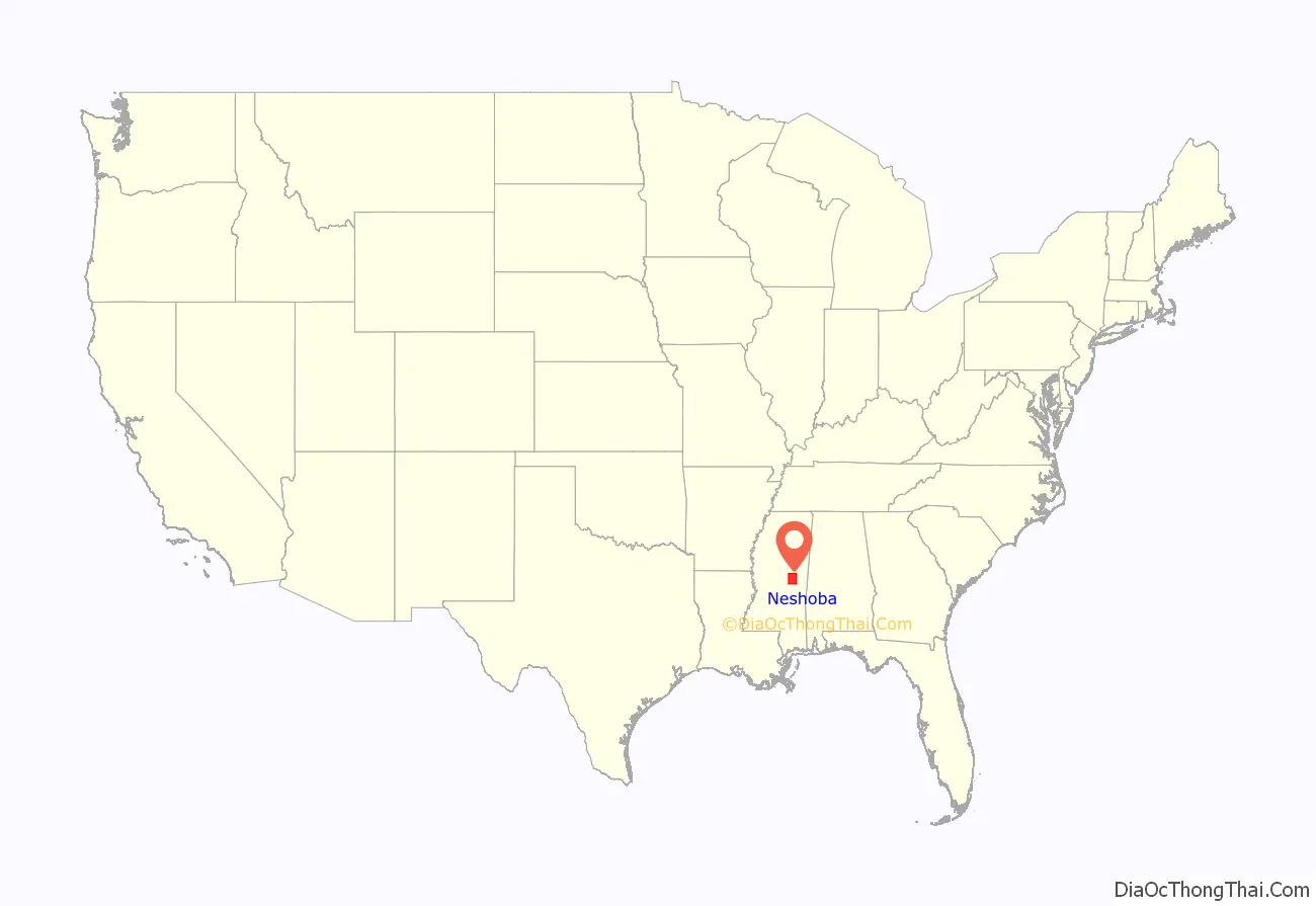
Neshoba County location map. Where is Neshoba County?
History
At the time of European encounter, this was part of the territory of the historic Choctaw people, who occupied most of what later was defined as Mississippi. Under President Andrew Jackson, the United States conducted Indian removal in the 1830s in the Southeast, and most of the Choctaw were removed to west of the Mississippi River, to land in Indian Territory, now part of Oklahoma.
Neshoba was founded by European American settlers in 1833. They named it after a Choctaw chief, whose name in the Choctaw language meant “wolf”.
Descendants of the Choctaw who remained in the state continued to identify as Choctaw. They lived in relatively distinct communities and reorganized in the 1930s, gaining federal recognition as the Mississippi Band of Choctaw Indians. Even in the 1970s, eighty percent of their people continued to speak Choctaw.
Late 19th century to present
The white-dominated state legislature passed a new constitution in 1890, that effectively disenfranchised most freedmen and other non-whites, such as Native Americans. This exclusion was maintained well into the 20th century, but activists in the 1960s increasingly worked to restore voting rights throughout the state.
At various times, 76 post offices were established within the county. Around the turn of the 20th century, 40 small post offices were operating at the same time. By 1971, only the post offices in Philadelphia and Neshoba were still operational. Today, only the one in Philadelphia remains.
Neshoba County is known as the site of the lynching murder of three young activists in July 1964 during Freedom Summer in Mississippi, a period of education and a voter registration drive to prepare African Americans for voting. The three young men, two from the North, disappeared at a time of heightened violence, and they became the subjects of a state and FBI search. White supremacists were found to have murdered three civil rights activists: James Cheney, Andrew Goodman and Michael Schwerner near Philadelphia, the county seat. During the investigation, searchers found the bodies of eight other young black men in nearby locations. Deputy Sheriff Cecil Price was implicated and charged with being part of the group that lynched the three young men and buried them in an earthen dam 15 miles northeast of Philadelphia. Outrage over the crime contributed to congressional passage of the Civil Rights Act of 1964 and Voting Rights Act of 1965. The crime and decades-long legal aftermath of investigation and trials inspired the 1988 movie Mississippi Burning.
In 1980, Ronald Reagan launched his presidential campaign at the Neshoba County Fair to deliver a speech on economic policy and refer to states’ rights. He was believed by some to be referring to southern conservative values, in an area associated with the 1964 murders and at a time when the Republican Party was attracting more white conservatives from the Democratic Party.
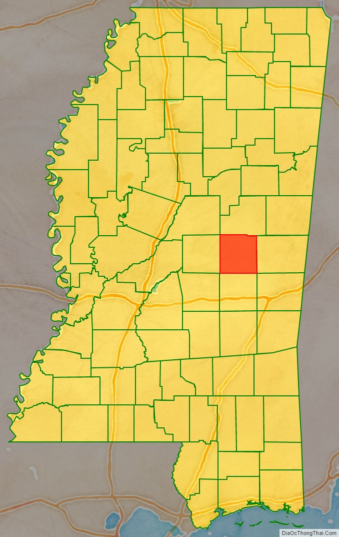
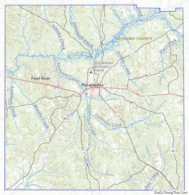
Neshoba County Road Map
Geography
According to the U.S. Census Bureau, the county has a total area of 572 square miles (1,480 km), of which 570 square miles (1,500 km) is land and 1.5 square miles (3.9 km) (0.3%) is water.
Major highways
- Mississippi Highway 15
- Mississippi Highway 16
- Mississippi Highway 19
- Mississippi Highway 21
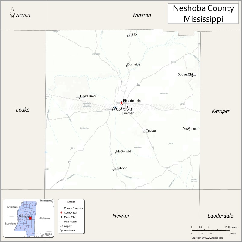
Adjacent counties
- Winston County (north)
- Kemper County (east)
- Newton County (south)
- Leake County (west)
Neshoba County Topographic Map
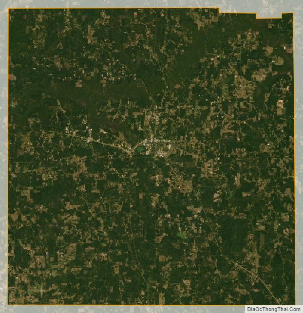
Neshoba County Satellite Map
Neshoba County Outline Map

See also
Map of Mississippi State and its subdivision:- Adams
- Alcorn
- Amite
- Attala
- Benton
- Bolivar
- Calhoun
- Carroll
- Chickasaw
- Choctaw
- Claiborne
- Clarke
- Clay
- Coahoma
- Copiah
- Covington
- Desoto
- Forrest
- Franklin
- George
- Greene
- Grenada
- Hancock
- Harrison
- Hinds
- Holmes
- Humphreys
- Issaquena
- Itawamba
- Jackson
- Jasper
- Jefferson
- Jefferson Davis
- Jones
- Kemper
- Lafayette
- Lamar
- Lauderdale
- Lawrence
- Leake
- Lee
- Leflore
- Lincoln
- Lowndes
- Madison
- Marion
- Marshall
- Monroe
- Montgomery
- Neshoba
- Newton
- Noxubee
- Oktibbeha
- Panola
- Pearl River
- Perry
- Pike
- Pontotoc
- Prentiss
- Quitman
- Rankin
- Scott
- Sharkey
- Simpson
- Smith
- Stone
- Sunflower
- Tallahatchie
- Tate
- Tippah
- Tishomingo
- Tunica
- Union
- Walthall
- Warren
- Washington
- Wayne
- Webster
- Wilkinson
- Winston
- Yalobusha
- Yazoo
- Alabama
- Alaska
- Arizona
- Arkansas
- California
- Colorado
- Connecticut
- Delaware
- District of Columbia
- Florida
- Georgia
- Hawaii
- Idaho
- Illinois
- Indiana
- Iowa
- Kansas
- Kentucky
- Louisiana
- Maine
- Maryland
- Massachusetts
- Michigan
- Minnesota
- Mississippi
- Missouri
- Montana
- Nebraska
- Nevada
- New Hampshire
- New Jersey
- New Mexico
- New York
- North Carolina
- North Dakota
- Ohio
- Oklahoma
- Oregon
- Pennsylvania
- Rhode Island
- South Carolina
- South Dakota
- Tennessee
- Texas
- Utah
- Vermont
- Virginia
- Washington
- West Virginia
- Wisconsin
- Wyoming