Nevada County (/nɪˈvædə/ (listen)) is a county located in the U.S. state of California, in the Sierra Nevada. As of the 2020 census, its population was 102,241. The county seat is Nevada City. Nevada County comprises the Truckee–Grass Valley micropolitan statistical area, which is also included in the Sacramento–Roseville combined statistical area, part of the Mother Lode Country.
| Name: | Nevada County |
|---|---|
| FIPS code: | 06-057 |
| State: | California |
| Founded: | 1851 |
| Named for: | Nevada City, which is named after the Spanish word for “snow-covered” |
| Seat: | Nevada City |
| Largest town: | Truckee |
| Total Area: | 974 sq mi (2,520 km²) |
| Land Area: | 958 sq mi (2,480 km²) |
| Total Population: | 102,241 |
| Population Density: | 100/sq mi (41/km²) |
| Time zone: | UTC-8 (Pacific Time Zone) |
| Summer Time Zone (DST): | UTC-7 (Pacific Daylight Time) |
| Website: | www.mynevadacounty.com |
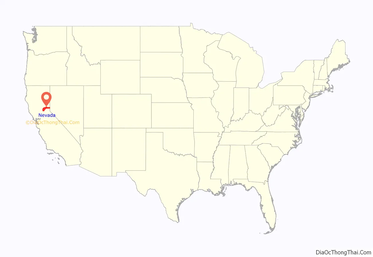
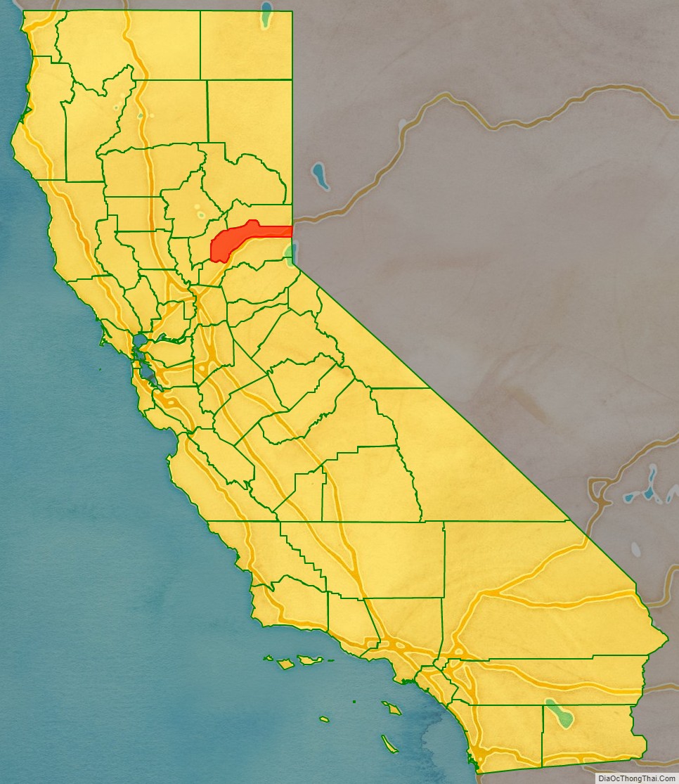
Nevada County location map. Where is Nevada County?
History
Created in 1851, from portions of Yuba County, Nevada County was named after the mining town of Nevada City, a name derived from the Sierra Nevada Mountains. The word nevada is Spanish for “snowy” or “snow-covered.” Charles Marsh was one of the first settlers in what became Nevada City, and ts perhaps the one who named the town. He went on to build extensive water flumes/ditches/canals in the area, and was influential in the building of the first transcontinental railroad and the Nevada County Narrow Gauge Railroad.
Nevada City was the first to use the word “Nevada” in its name. In 1851, the newly formed Nevada County used the same name as the county seat. The bordering state of Nevada used the same name in 1864. The region came to life in the Gold Rush of 1849. Many historical sites remain to mark the birth of this important region in California’s formative years. Among them are the Nevada Theatre in Nevada City, the oldest theater built in California in 1865. It operates to this day and once hosted Mark Twain, among other historical figures. The Old 5 Mile House stagecoach stop, built in 1890, also operates to this day as a provider of hospitality spanning three centuries. This historical site still features “The stagecoach safe” that is on display outside the present-day restaurant and is the source of many legends of stagecoach robbers and notorious highwaymen in the California gold rush era. The gold industry in Nevada County thrived into the post-WWII days.
The county had many firsts and historic technological moments. The first long-distance telephone in the world, built in 1877 by the Ridge Telephone Company, connected French Corral with French Lake, 58 miles (93 km) away. It was operated by the Milton Mining Company from a building on this site that had been erected about 1853. The Pelton wheel, designed to power gold mines, still drives hydroelectric generators today. Nevada City and Grass Valley were among the first California towns with electric lights. The Olympics, NASA, and virtually every television station around the country uses video/broadcasting equipment designed and manufactured by Grass Valley Group, founded in Grass Valley.
The Nevada County Narrow Gauge Railroad, built in 1876, was the only railroad in the West that was never robbed, though its primary freight was gold. (Builder-owner John Flint Kidder’s reputation made it clear that he would personally hunt down and kill anyone who tried.) The rail line closed in 1942 and was torn up for scrap.
In Grass Valley, the historic Holbrooke Hotel opened in 1851 and housed Mark Twain, Bret Harte, and four U.S. Presidents (Ulysses S. Grant, Grover Cleveland, Benjamin Harrison, and James A. Garfield).
The community of Rough and Ready seceded from the Union for a time and became the Great Republic of Rough and Ready.
Nevada County is home to the Empire Mine State Historic Park, which is the site of one of the oldest, deepest, and richest gold mines in California. The park is in Grass Valley at 10791 East Empire Street. In operation for more than 100 years, the mine extracted 5.8 million ounces of gold before it closed in 1956.
In 1988, the 49er Fire was accidentally started by a homeless and schizophrenic local man near Highway 49. The fire went on to burn well over 100 homes and more than 33,000 acres in Nevada County.
The 2001 Nevada County shootings occurred on January 10, 2001, in which Scott Harlan Thorpe murdered three people in a shooting spree. Two of the victims were murdered in Nevada City and a third victim was killed in Grass Valley. Thorpe was arrested and declared not guilty by reason of insanity. He currently resides in Napa State Hospital.
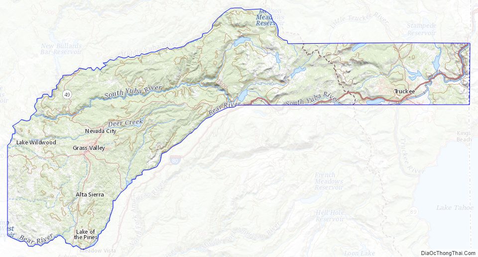
Nevada County Road Map
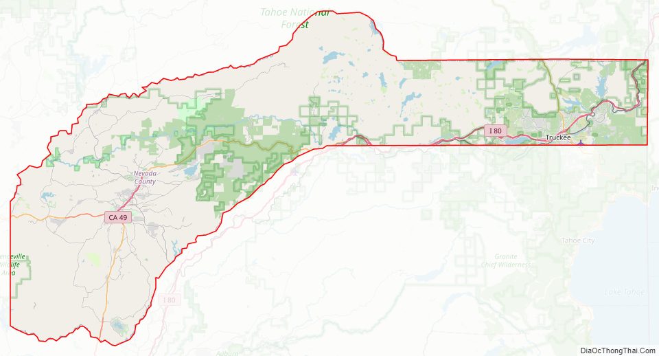
Geography
According to the U.S. Census Bureau, the county has a total area of 974 square miles (2,520 km), of 16 square miles (41 km) (1.6%) are covered by water. The county is drained by Middle and South Yuba Rivers.
The western part of the county is defined by the course of several rivers and the irregular boundaries of adjoining counties. When the county was created, the founders wanted to include access to the transcontinental railroad, so a rectangular section was added that includes the railroad town of Truckee.
Nevada County is one of four counties in the United States to border a state with which it shares the same name (the other three counties are Texas County, Oklahoma; Delaware County, Pennsylvania; and Ohio County, West Virginia).
Ecology
The county has substantial areas of forest, grassland, savanna, riparian area, and other ecosystems. Forests include both coniferous- and oak-dominated woodland types. Also, numerous understory forbs and wildflowers occur, including the yellow mariposa lily (Calochortus luteus).
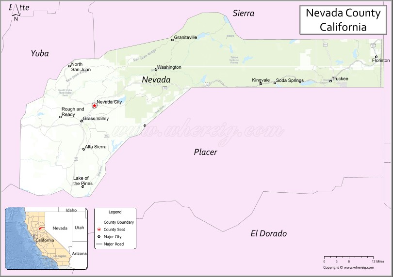
Adjacent counties
- Sierra County – north
- Washoe County, Nevada – east
- Placer County – south
- Yuba County – west
National protected areas
- Tahoe National Forest (part)
- Toiyabe National Forest (part)
Nevada County Topographic Map
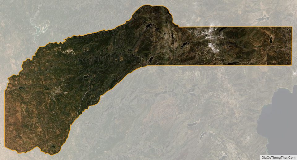
Nevada County Satellite Map
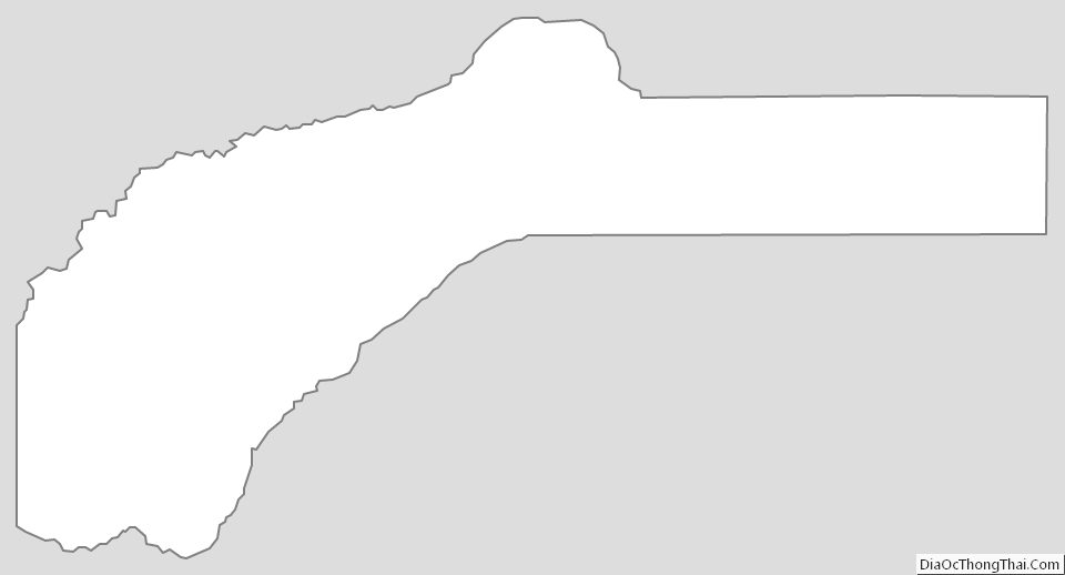
Nevada County Outline Map
See also
Map of California State and its subdivision:- Alameda
- Alpine
- Amador
- Butte
- Calaveras
- Colusa
- Contra Costa
- Del Norte
- El Dorado
- Fresno
- Glenn
- Humboldt
- Imperial
- Inyo
- Kern
- Kings
- Lake
- Lassen
- Los Angeles
- Madera
- Marin
- Mariposa
- Mendocino
- Merced
- Modoc
- Mono
- Monterey
- Napa
- Nevada
- Orange
- Placer
- Plumas
- Riverside
- Sacramento
- San Benito
- San Bernardino
- San Diego
- San Francisco
- San Joaquin
- San Luis Obispo
- San Mateo
- Santa Barbara
- Santa Clara
- Santa Cruz
- Shasta
- Sierra
- Siskiyou
- Solano
- Sonoma
- Stanislaus
- Sutter
- Tehama
- Trinity
- Tulare
- Tuolumne
- Ventura
- Yolo
- Yuba
- Alabama
- Alaska
- Arizona
- Arkansas
- California
- Colorado
- Connecticut
- Delaware
- District of Columbia
- Florida
- Georgia
- Hawaii
- Idaho
- Illinois
- Indiana
- Iowa
- Kansas
- Kentucky
- Louisiana
- Maine
- Maryland
- Massachusetts
- Michigan
- Minnesota
- Mississippi
- Missouri
- Montana
- Nebraska
- Nevada
- New Hampshire
- New Jersey
- New Mexico
- New York
- North Carolina
- North Dakota
- Ohio
- Oklahoma
- Oregon
- Pennsylvania
- Rhode Island
- South Carolina
- South Dakota
- Tennessee
- Texas
- Utah
- Vermont
- Virginia
- Washington
- West Virginia
- Wisconsin
- Wyoming