Northampton County is a county located in the U.S. state of North Carolina. As of the 2020 census, the population was 17,471. Its county seat is Jackson.
Northampton County is part of the Roanoke Rapids, NC Micropolitan Statistical Area, which is also included in the Rocky Mount–Wilson-Roanoke Rapids, NC Combined Statistical Area.
| Name: | Northampton County |
|---|---|
| FIPS code: | 37-131 |
| State: | North Carolina |
| Founded: | 1741 |
| Named for: | James Compton, 5th Earl of Northampton |
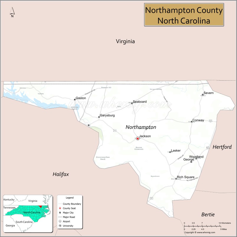
| Seat: | Jackson |
| Largest town: | Gaston |
| Total Area: | 551 sq mi (1,430 km²) |
| Land Area: | 537 sq mi (1,390 km²) |
| Total Population: | 17,471 |
| Population Density: | 32/sq mi (12/km²) |
| Time zone: | UTC−5 (Eastern) |
| Summer Time Zone (DST): | UTC−4 (EDT) |
| Website: | www.northamptonnc.com |
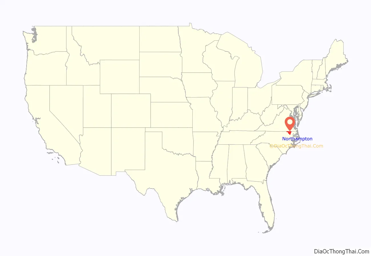
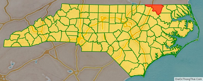
Northampton County location map. Where is Northampton County?
History
The county was formed in 1741 from Bertie County. It was named for James Compton, 5th Earl of Northampton. In 1759 parts of Northampton County, Bertie County, and Chowan County were combined to form Hertford County.
In 1959, the county went to the U.S. Supreme Court to defend the use of a literacy test as a requirement to vote. In Lassiter v. Northampton County Board of Elections, the court held that, provided the tests were applied equally to all races and were not “merely a device to make racial discrimination easy,” they were allowable. Congress subsequently prohibited use of such tests under the National Voting Rights Act of 1965.
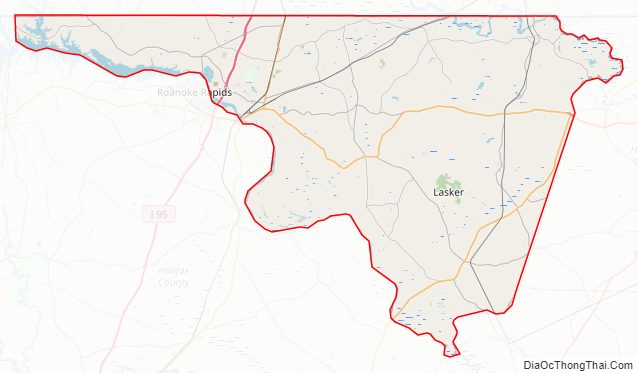
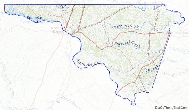
Northampton County Road Map
Geography
According to the U.S. Census Bureau, the county has a total area of 551 square miles (1,430 km), of which 537 square miles (1,390 km) is land and 14 square miles (36 km) (2.5%) is water.
State and local protected areas
- Lake Gaston Public Recreation Area (part)
- Roanoke Rapids Lake Day Use Area (part)
- Tillery Game Land (part)
Major water bodies
- Bull Neck Swamp
- Corduroy Swamp
- Doolittle Millpond
- Gumberry Swamp
- Lake Gaston
- Meherrin River
- Occoneechee Creek
- Paddys Delight Creek
- Potecasi Creek
- Ramsey Creek
- Roanoke Rapids Lake
- Roanoke River
- Taylors Millpond
- Urahaw Swamp
Adjacent counties
- Greensville County, Virginia – north
- Southampton County, Virginia – northeast
- Hertford County – east
- Bertie County – southeast
- Halifax County – southwest
- Warren County – northwest
- Brunswick County, Virginia – north-northwest
Major highways
- I-95
- US 158
- US 158 Byp. (Bypass of Garysburg)
- US 258
- US 301
- NC 35
- NC 46
- NC 48
- NC 186
- NC 305
- NC 308
- NC 561
Northampton County Topographic Map
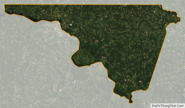
Northampton County Satellite Map
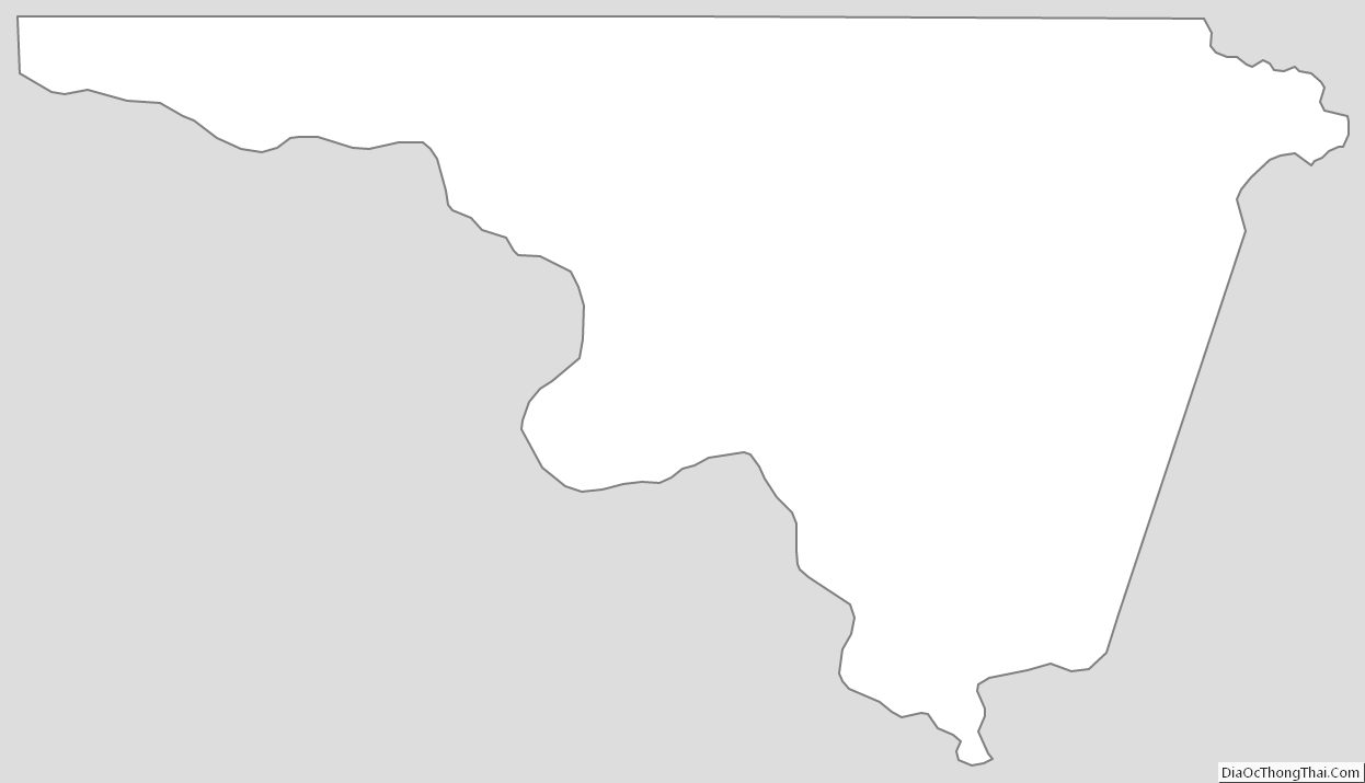
Northampton County Outline Map
See also
Map of North Carolina State and its subdivision:- Alamance
- Alexander
- Alleghany
- Anson
- Ashe
- Avery
- Beaufort
- Bertie
- Bladen
- Brunswick
- Buncombe
- Burke
- Cabarrus
- Caldwell
- Camden
- Carteret
- Caswell
- Catawba
- Chatham
- Cherokee
- Chowan
- Clay
- Cleveland
- Columbus
- Craven
- Cumberland
- Currituck
- Dare
- Davidson
- Davie
- Duplin
- Durham
- Edgecombe
- Forsyth
- Franklin
- Gaston
- Gates
- Graham
- Granville
- Greene
- Guilford
- Halifax
- Harnett
- Haywood
- Henderson
- Hertford
- Hoke
- Hyde
- Iredell
- Jackson
- Johnston
- Jones
- Lee
- Lenoir
- Lincoln
- Macon
- Madison
- Martin
- McDowell
- Mecklenburg
- Mitchell
- Montgomery
- Moore
- Nash
- New Hanover
- Northampton
- Onslow
- Orange
- Pamlico
- Pasquotank
- Pender
- Perquimans
- Person
- Pitt
- Polk
- Randolph
- Richmond
- Robeson
- Rockingham
- Rowan
- Rutherford
- Sampson
- Scotland
- Stanly
- Stokes
- Surry
- Swain
- Transylvania
- Tyrrell
- Union
- Vance
- Wake
- Warren
- Washington
- Watauga
- Wayne
- Wilkes
- Wilson
- Yadkin
- Yancey
- Alabama
- Alaska
- Arizona
- Arkansas
- California
- Colorado
- Connecticut
- Delaware
- District of Columbia
- Florida
- Georgia
- Hawaii
- Idaho
- Illinois
- Indiana
- Iowa
- Kansas
- Kentucky
- Louisiana
- Maine
- Maryland
- Massachusetts
- Michigan
- Minnesota
- Mississippi
- Missouri
- Montana
- Nebraska
- Nevada
- New Hampshire
- New Jersey
- New Mexico
- New York
- North Carolina
- North Dakota
- Ohio
- Oklahoma
- Oregon
- Pennsylvania
- Rhode Island
- South Carolina
- South Dakota
- Tennessee
- Texas
- Utah
- Vermont
- Virginia
- Washington
- West Virginia
- Wisconsin
- Wyoming