Nowata County is a county located in northeastern Oklahoma, United States, on the Kansas border. As of the 2010 census, its population is 10,536. Its county seat is Nowata. Their name is derived from a Delaware word, no-we-ata, meaning “come here” or “welcome”.
| Name: | Nowata County |
|---|---|
| FIPS code: | 40-105 |
| State: | Oklahoma |
| Founded: | 1907 |
| Seat: | Nowata |
| Largest city: | Nowata |
| Total Area: | 581 sq mi (1,500 km²) |
| Land Area: | 566 sq mi (1,470 km²) |
| Total Population: | 10,536 |
| Population Density: | 19/sq mi (7/km²) |
| Website: | nowata.com |
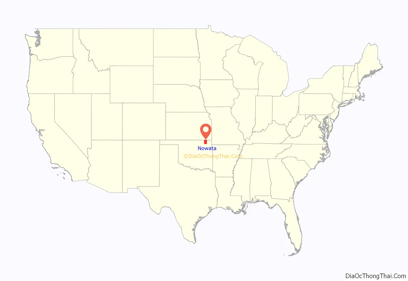
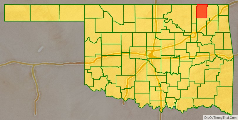
Nowata County location map. Where is Nowata County?
History
For millennia, the land now known as Oklahoma was inhabited by Native Americans. The Encyclopedia of Oklahoma History and Culture states that archaeological evidence indicates that humans first lived in this area in the Verdigris River valley over six thousand years ago. In the 17th century, white trappers first visiting the area found it occupied mostly by the Osage and Quapaw tribes. It was recognized as Osage territory by the time United States secured it as part of the Louisiana Purchase in 1803. In 1819, the Arkansas Territory was organized, then was split in 1824 and 1828. An 1828 treaty with the Cherokee Nation assigned the area of Nowata County to the Cherokees, who included it in 1856 in their newly created Cooweescoowee District. The Cherokees and the Delaware signed a treaty in 1867 that resulted in Delaware settlements near the present towns of Delaware, Lenapah and Nowata, Oklahoma.
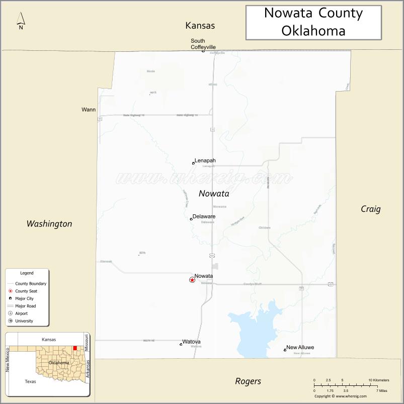
The state of Oklahoma and Nowata County was established in 1907, and the county had a population of 10,453. The town of Nowata was named as county seat. The exact origin is unknown, but the two most common stories are that railroad surveyors used the Delaware word noweta for welcome or that a sign was posted indicating that local springs had no water: No wata.
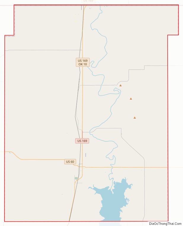
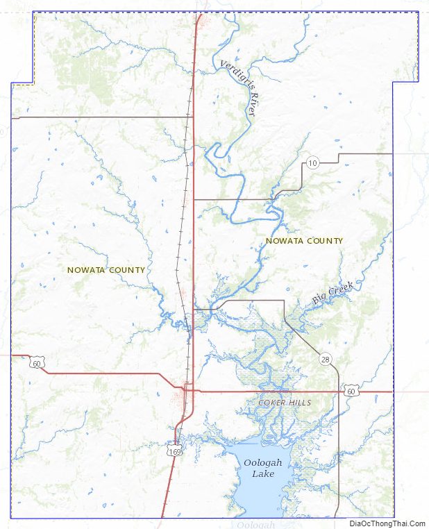
Nowata County Road Map
Geography
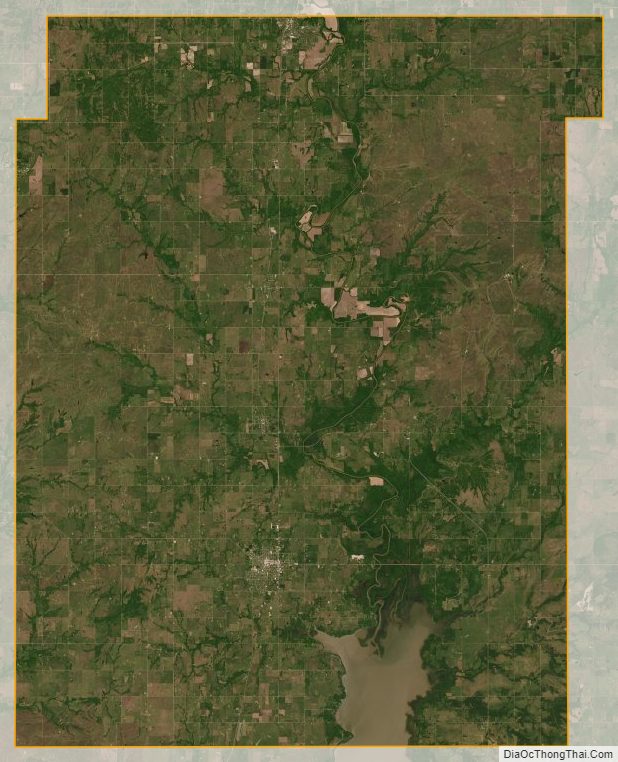
According to the U.S. Census Bureau, the county has a total area of 581 square miles (1,500 km), of which 566 square miles (1,470 km) is land and 15 square miles (39 km) (2.6%) is water.
The Verdigris River divides the county into eastern and western halves. Creeks in the extreme western part of the county drain into the Caney River. All other creeks drain into the Verdigris River. Lake Oologah lies partly in this county.
Major highways
- U.S. Highway 60
- U.S. Highway 169
- State Highway 10
- State Highway 28
Adjacent counties
- Montgomery County, Kansas (north)
- Labette County, Kansas (northeast)
- Craig County (east)
- Rogers County (south)
- Washington County (west)
Nowata County Topographic Map
Nowata County Satellite Map
Nowata County Outline Map

See also
Map of Oklahoma State and its subdivision:- Adair
- Alfalfa
- Atoka
- Beaver
- Beckham
- Blaine
- Bryan
- Caddo
- Canadian
- Carter
- Cherokee
- Choctaw
- Cimarron
- Cleveland
- Coal
- Comanche
- Cotton
- Craig
- Creek
- Custer
- Delaware
- Dewey
- Ellis
- Garfield
- Garvin
- Grady
- Grant
- Greer
- Harmon
- Harper
- Haskell
- Hughes
- Jackson
- Jefferson
- Johnston
- Kay
- Kingfisher
- Kiowa
- Latimer
- Le Flore
- Lincoln
- Logan
- Love
- Major
- Marshall
- Mayes
- McClain
- McCurtain
- McIntosh
- Murray
- Muskogee
- Noble
- Nowata
- Okfuskee
- Oklahoma
- Okmulgee
- Osage
- Ottawa
- Pawnee
- Payne
- Pittsburg
- Pontotoc
- Pottawatomie
- Pushmataha
- Roger Mills
- Rogers
- Seminole
- Sequoyah
- Stephens
- Texas
- Tillman
- Tulsa
- Wagoner
- Washington
- Washita
- Woods
- Woodward
- Alabama
- Alaska
- Arizona
- Arkansas
- California
- Colorado
- Connecticut
- Delaware
- District of Columbia
- Florida
- Georgia
- Hawaii
- Idaho
- Illinois
- Indiana
- Iowa
- Kansas
- Kentucky
- Louisiana
- Maine
- Maryland
- Massachusetts
- Michigan
- Minnesota
- Mississippi
- Missouri
- Montana
- Nebraska
- Nevada
- New Hampshire
- New Jersey
- New Mexico
- New York
- North Carolina
- North Dakota
- Ohio
- Oklahoma
- Oregon
- Pennsylvania
- Rhode Island
- South Carolina
- South Dakota
- Tennessee
- Texas
- Utah
- Vermont
- Virginia
- Washington
- West Virginia
- Wisconsin
- Wyoming