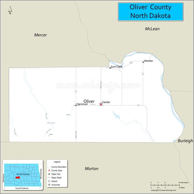
Oliver County is a county located in the U.S. state of North Dakota. As of the 2020 census, the population was 1,877. Its county seat and only city is Center.
| Name: | Oliver County |
|---|---|
| FIPS code: | 38-065 |
| State: | North Dakota |
| Founded: | 1885 |
| Named for: | Harry S. Oliver |
| Seat: | Center |
| Largest city: | Center |
| Total Area: | 731 sq mi (1,890 km²) |
| Land Area: | 723 sq mi (1,870 km²) |
| Total Population: | 1,877 |
| Population Density: | 2.6/sq mi (0.99/km²) |
| Time zone: | UTC−6 (Central) |
| Summer Time Zone (DST): | UTC−5 (CDT) |
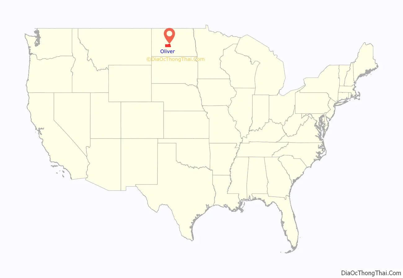
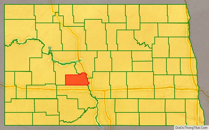
Oliver County location map. Where is Oliver County?
History
The Dakota Territory legislature created the county on April 14, 1885, with territory partitioned from Mercer County. It was named for Harry S. Oliver of Lisbon, North Dakota, a Republican politician and member of the Dakota Territory House of Representatives at the time. The county government was organized on May 18, with Sanger (then known as “Bentley”) as county seat. The seat was moved to Center in 1902.
Oliver County is included in the Bismarck, North Dakota Metropolitan Statistical Area.
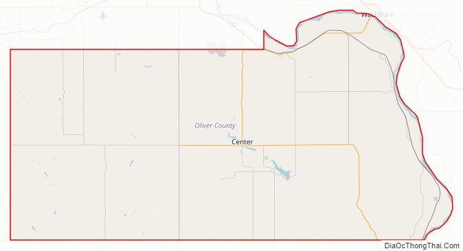
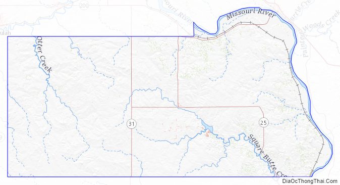
Oliver County Road Map
Geography
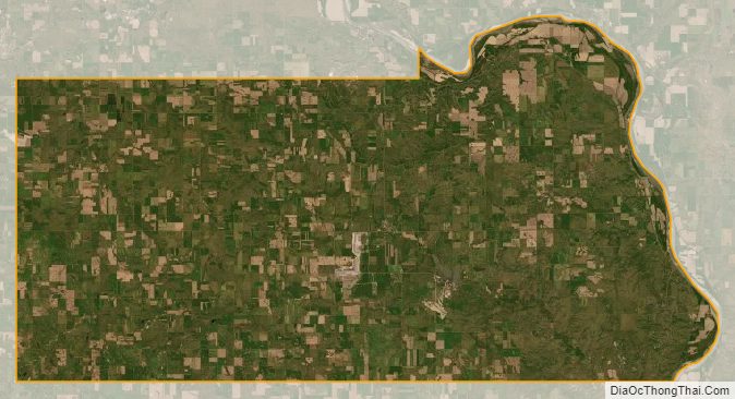
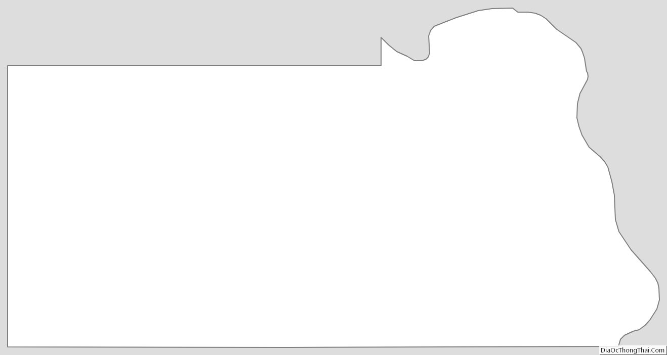
The northeastern/eastern boundary of Oliver County is delineated by the Missouri River as it flows southeastward after leaving Lake Sakakawea. The county terrain consists of rolling hills, mostly devoted to agriculture. The terrain slopes to the east, with the highest point a hill near its southwestern corner, at 2,382′ (726m) ASL. The county has a total area of 731 square miles (1,890 km), of which 723 square miles (1,870 km) is land and 8.7 square miles (23 km) (1.2%) is water. It is the fifth-smallest county in North Dakota by area.
By sheer coincidence, the county seat, Center, named for being near the geographical center of the county, has also been calculated to be the geographic center of North America.
Major highways
- North Dakota Route 25
- North Dakota Route 31
- North Dakota Route 48
- North Dakota Route 1806
- North Dakota Route 200A
Adjacent counties
- McLean County – northeast
- Burleigh County – east
- Morton County – south
- Mercer County – northwest
Protected areas
- Cross Ranch State Park
Lakes
- Mandan Lake
- Nelson Lake
Oliver County Topographic Map
Oliver County Satellite Map
Oliver County Outline Map
See also
Map of North Dakota State and its subdivision:- Adams
- Barnes
- Benson
- Billings
- Bottineau
- Bowman
- Burke
- Burleigh
- Cass
- Cavalier
- Dickey
- Divide
- Dunn
- Eddy
- Emmons
- Foster
- Golden Valley
- Grand Forks
- Grant
- Griggs
- Hettinger
- Kidder
- Lamoure
- Logan
- McHenry
- McIntosh
- McKenzie
- McLean
- Mercer
- Morton
- Mountrail
- Nelson
- Oliver
- Pembina
- Pierce
- Ramsey
- Ransom
- Renville
- Richland
- Rolette
- Sargent
- Sheridan
- Sioux
- Slope
- Stark
- Steele
- Stutsman
- Towner
- Traill
- Walsh
- Ward
- Wells
- Williams
- Alabama
- Alaska
- Arizona
- Arkansas
- California
- Colorado
- Connecticut
- Delaware
- District of Columbia
- Florida
- Georgia
- Hawaii
- Idaho
- Illinois
- Indiana
- Iowa
- Kansas
- Kentucky
- Louisiana
- Maine
- Maryland
- Massachusetts
- Michigan
- Minnesota
- Mississippi
- Missouri
- Montana
- Nebraska
- Nevada
- New Hampshire
- New Jersey
- New Mexico
- New York
- North Carolina
- North Dakota
- Ohio
- Oklahoma
- Oregon
- Pennsylvania
- Rhode Island
- South Carolina
- South Dakota
- Tennessee
- Texas
- Utah
- Vermont
- Virginia
- Washington
- West Virginia
- Wisconsin
- Wyoming