Ottawa County is a county located in the northwestern part of the U.S. state of Ohio. As of the 2020 census, the population was 40,364. Its county seat is Port Clinton. The county is named either for the Ottawa (Odawa) Indigenous peoples who lived there, or for an Indigenous word meaning “trader”.
Ottawa County comprises the Port Clinton, OH Micropolitan Statistical Area, which is also included in the Toledo-Port Clinton, OH Combined Statistical Area.
| Name: | Ottawa County |
|---|---|
| FIPS code: | 39-123 |
| State: | Ohio |
| Founded: | March 6, 1840 |
| Named for: | the Ottawa tribe or a word meaning “trader” |
| Seat: | Port Clinton |
| Largest city: | Port Clinton |
| Total Area: | 585 sq mi (1,520 km²) |
| Land Area: | 255 sq mi (660 km²) |
| Total Population: | 40,364 |
| Population Density: | 158/sq mi (61/km²) |
| Time zone: | UTC−5 (Eastern) |
| Summer Time Zone (DST): | UTC−4 (EDT) |
| Website: | www.co.ottawa.oh.us |
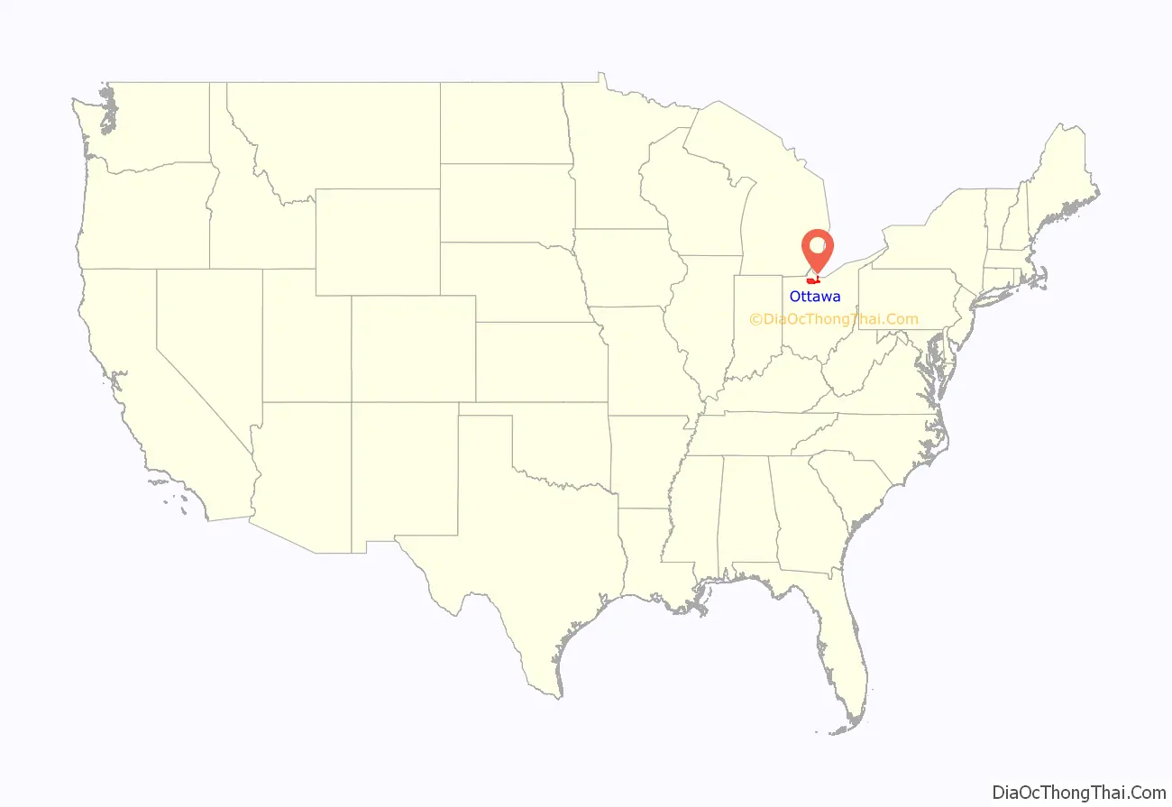
Ottawa County location map. Where is Ottawa County?
History
On September 10, 1813, during the War of 1812, nine vessels of the United States Navy under Commodore Oliver Hazard Perry, decisively defeated six vessels of Great Britain’s Royal Navy in the Battle of Lake Erie near Put-in-Bay. This action was one of the major battles of the war.
Ottawa County was formed on March 6, 1840, from portions of Erie, Lucas and Sandusky counties. It was named after the North American Indigenous tribe of the Ottawa (Odawa).
In 1974, the County Courthouse was listed on the National Register of Historic Places.
The county is notable in presidential politics for being a recent bellwether, having continuously voted for the winning candidate for thirteen elections from 1964 to 2016.
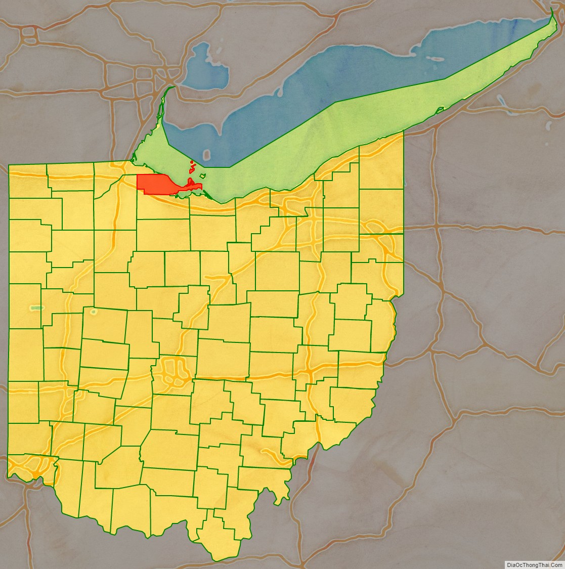
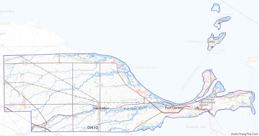
Ottawa County Road Map
Geography
According to the U.S. Census Bureau, the county has a total area of 585 square miles (1,520 km), of which 255 square miles (660 km) is land and 330 square miles (850 km) (56%) is water. It is the third-smallest county in Ohio by land area. It borders Ontario across Lake Erie.
Adjacent counties
- Essex County, Ontario, Canada (northeast)
- Erie County (southeast)
- Sandusky County (south)
- Wood County (west)
- Lucas County (northwest)
National protected areas
- Ottawa National Wildlife Refuge (part)
- Perry’s Victory and International Peace Memorial
Ottawa County Topographic Map
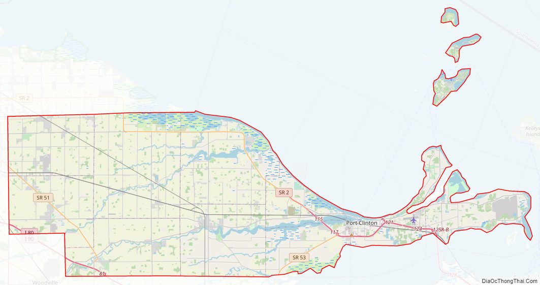
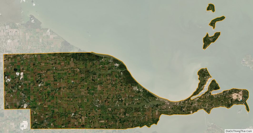
Ottawa County Satellite Map
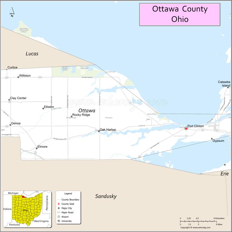
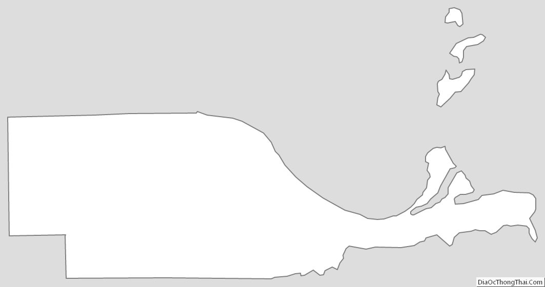
Ottawa County Outline Map
See also
Map of Ohio State and its subdivision:- Adams
- Allen
- Ashland
- Ashtabula
- Athens
- Auglaize
- Belmont
- Brown
- Butler
- Carroll
- Champaign
- Clark
- Clermont
- Clinton
- Columbiana
- Coshocton
- Crawford
- Cuyahoga
- Darke
- Defiance
- Delaware
- Erie
- Fairfield
- Fayette
- Franklin
- Fulton
- Gallia
- Geauga
- Greene
- Guernsey
- Hamilton
- Hancock
- Hardin
- Harrison
- Henry
- Highland
- Hocking
- Holmes
- Huron
- Jackson
- Jefferson
- Knox
- Lake
- Lake Erie
- Lawrence
- Licking
- Logan
- Lorain
- Lucas
- Madison
- Mahoning
- Marion
- Medina
- Meigs
- Mercer
- Miami
- Monroe
- Montgomery
- Morgan
- Morrow
- Muskingum
- Noble
- Ottawa
- Paulding
- Perry
- Pickaway
- Pike
- Portage
- Preble
- Putnam
- Richland
- Ross
- Sandusky
- Scioto
- Seneca
- Shelby
- Stark
- Summit
- Trumbull
- Tuscarawas
- Union
- Van Wert
- Vinton
- Warren
- Washington
- Wayne
- Williams
- Wood
- Wyandot
- Alabama
- Alaska
- Arizona
- Arkansas
- California
- Colorado
- Connecticut
- Delaware
- District of Columbia
- Florida
- Georgia
- Hawaii
- Idaho
- Illinois
- Indiana
- Iowa
- Kansas
- Kentucky
- Louisiana
- Maine
- Maryland
- Massachusetts
- Michigan
- Minnesota
- Mississippi
- Missouri
- Montana
- Nebraska
- Nevada
- New Hampshire
- New Jersey
- New Mexico
- New York
- North Carolina
- North Dakota
- Ohio
- Oklahoma
- Oregon
- Pennsylvania
- Rhode Island
- South Carolina
- South Dakota
- Tennessee
- Texas
- Utah
- Vermont
- Virginia
- Washington
- West Virginia
- Wisconsin
- Wyoming