Pacific County is a county in the U.S. state of Washington. As of the 2020 census, the population was 23,365. Its county seat is South Bend, and its largest city is Raymond. The county was formed by the government of Oregon Territory in February 1851 and is named for the Pacific Ocean.
Pacific County is centered on Willapa Bay, a region that provides twenty-five percent of the United States oyster harvest, although forestry, fishing, and tourism are also significant elements of the county’s economy.
| Name: | Pacific County |
|---|---|
| FIPS code: | 53-049 |
| State: | Washington |
| Founded: | February 4, 1851 |
| Named for: | Pacific Ocean |
| Seat: | South Bend |
| Largest city: | Raymond |
| Total Area: | 1,223 sq mi (3,170 km²) |
| Land Area: | 933 sq mi (2,420 km²) |
| Total Population: | 23,365 |
| Population Density: | 19/sq mi (7/km²) |
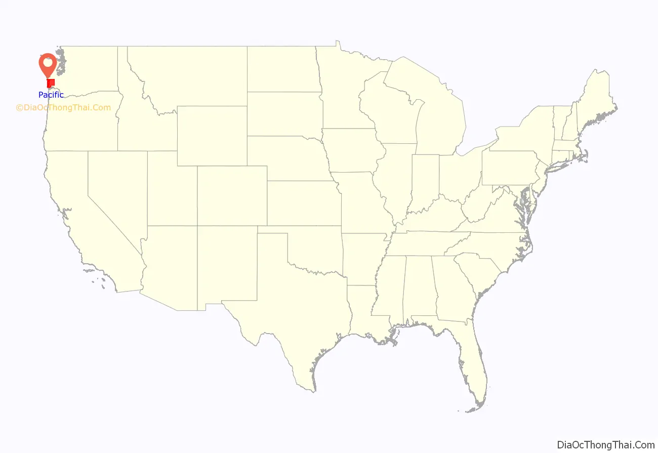
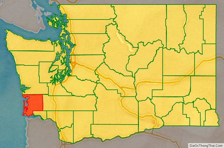
Pacific County location map. Where is Pacific County?
History
The area that is now Pacific County was part of Oregon Territory in the first part of the nineteenth century. On December 19, 1845, the Provisional Government of Oregon created two counties (Vancouver and Clark) in its northern portion (which is now the state of Washington). In 1849, the name of Vancouver County was changed to Lewis County, and on February 4, 1851, a portion of Lewis County was partitioned off to become Pacific County. The county’s boundaries have not changed since its creation. The unincorporated community of Oysterville, established in 1852, was the first county seat. The county records were stolen from Oysterville and ferried across Willapa Harbor by residents of South Bend, resulting in that town becoming the new county seat in 1893.
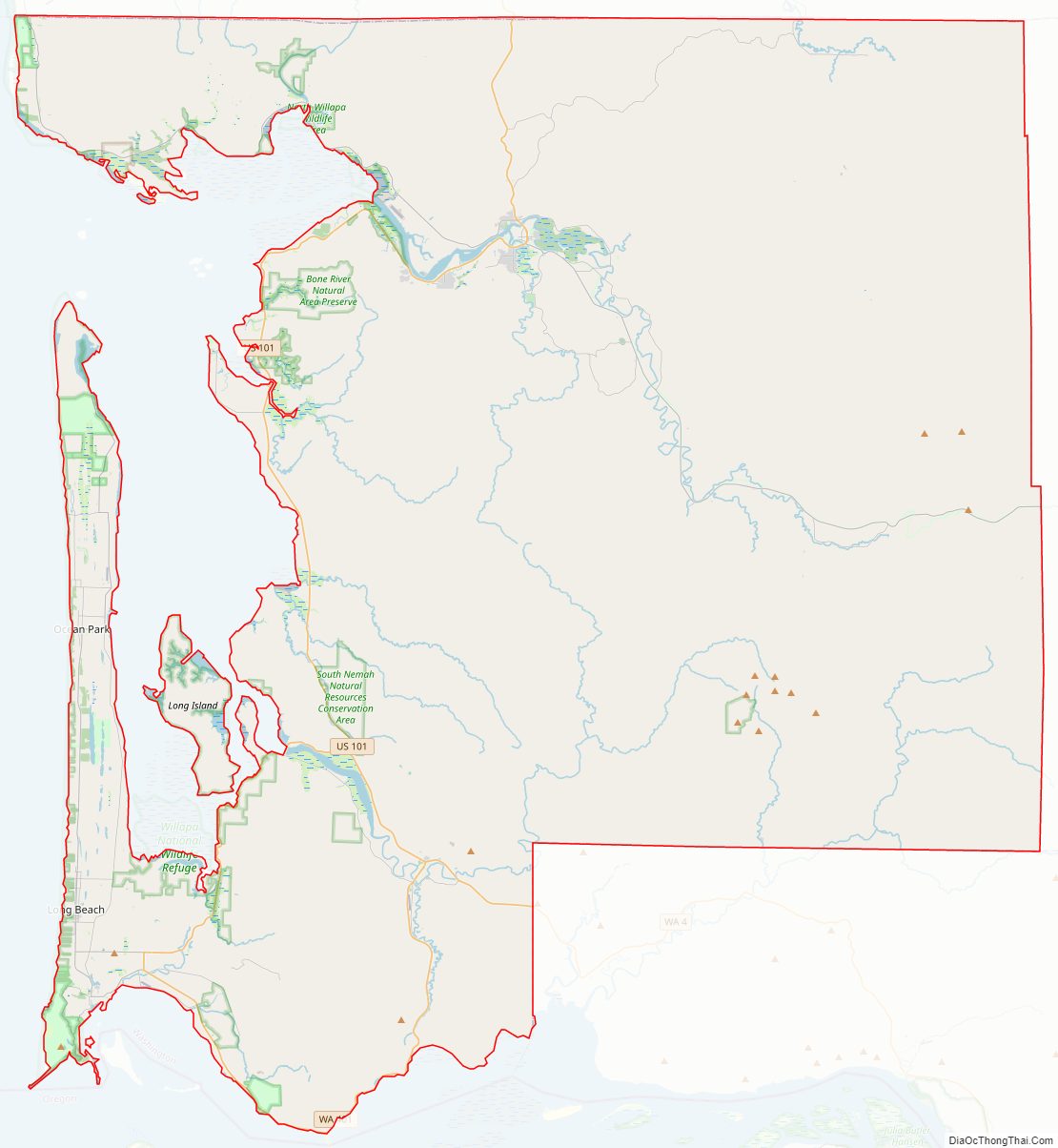
Pacific County Road Map
Geography
According to the United States Census Bureau, the county has an area of 1,223 square miles (3,170 km), of which 933 square miles (2,420 km) is land and 291 square miles (750 km) (24%) is water.
Geographic features
- Cape Disappointment
- Columbia River
- Long Beach Peninsula
- Long Island
- Willapa Bay
Major highways
- U.S. Route 101
- State Route 6
Adjacent counties
- Grays Harbor County – north
- Lewis County – east
- Wahkiakum County – southeast
- Clatsop County, Oregon – south
National protected areas
- Lewis and Clark National Historical Park (part)
- Willapa National Wildlife Refuge
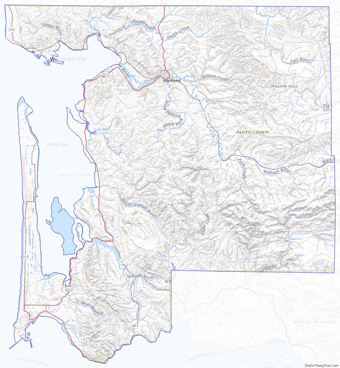
Pacific County Topographic Map
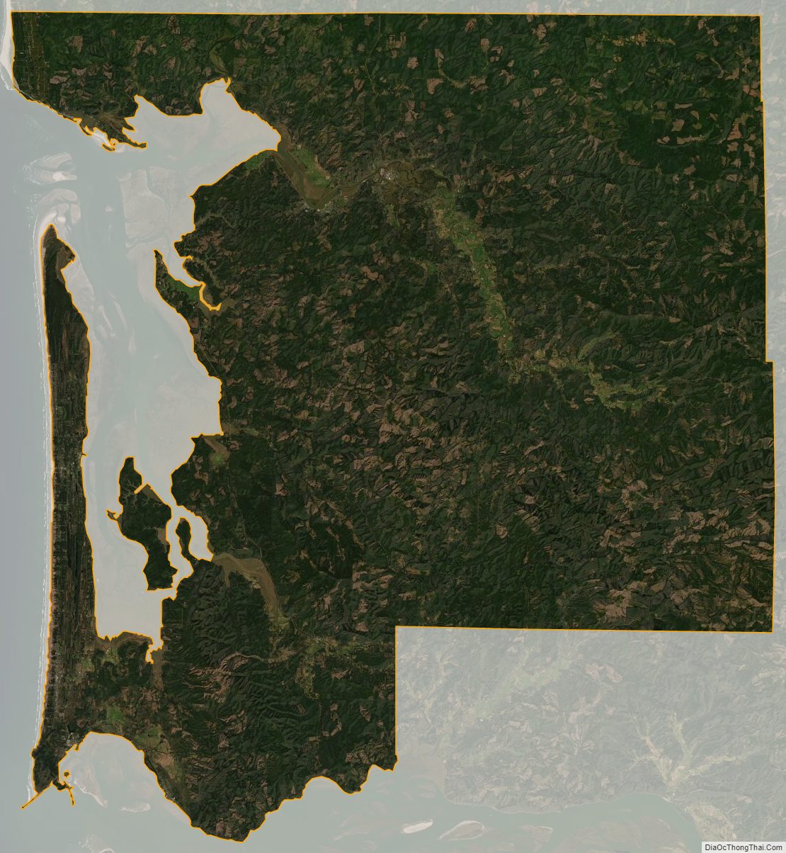
Pacific County Satellite Map
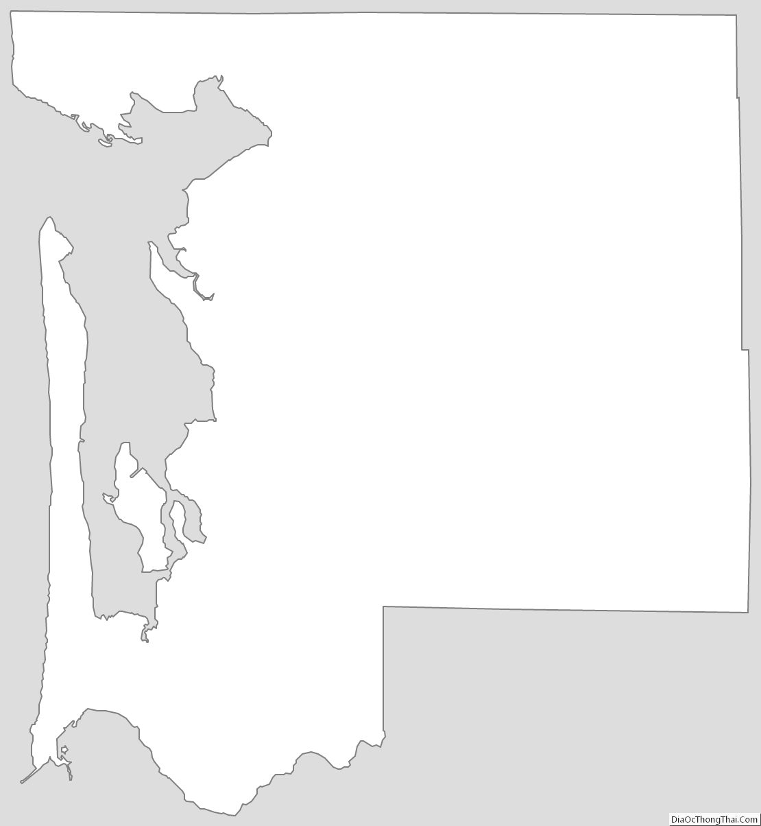
Pacific County Outline Map
See also
Map of Washington State and its subdivision:- Adams
- Asotin
- Benton
- Chelan
- Clallam
- Clark
- Columbia
- Cowlitz
- Douglas
- Ferry
- Franklin
- Garfield
- Grant
- Grays Harbor
- Island
- Jefferson
- King
- Kitsap
- Kittitas
- Klickitat
- Lewis
- Lincoln
- Mason
- Okanogan
- Pacific
- Pend Oreille
- Pierce
- San Juan
- Skagit
- Skamania
- Snohomish
- Spokane
- Stevens
- Thurston
- Wahkiakum
- Walla Walla
- Whatcom
- Whitman
- Yakima
- Alabama
- Alaska
- Arizona
- Arkansas
- California
- Colorado
- Connecticut
- Delaware
- District of Columbia
- Florida
- Georgia
- Hawaii
- Idaho
- Illinois
- Indiana
- Iowa
- Kansas
- Kentucky
- Louisiana
- Maine
- Maryland
- Massachusetts
- Michigan
- Minnesota
- Mississippi
- Missouri
- Montana
- Nebraska
- Nevada
- New Hampshire
- New Jersey
- New Mexico
- New York
- North Carolina
- North Dakota
- Ohio
- Oklahoma
- Oregon
- Pennsylvania
- Rhode Island
- South Carolina
- South Dakota
- Tennessee
- Texas
- Utah
- Vermont
- Virginia
- Washington
- West Virginia
- Wisconsin
- Wyoming