Page County is a county located in the U.S. state of Iowa. As of the 2020 census, the population was 15,211. The county seat is Clarinda. The county is named in honor of Captain John Page of the 4th U.S. Infantry, who was mortally wounded in the Battle of Palo Alto.
| Name: | Page County |
|---|---|
| FIPS code: | 19-145 |
| State: | Iowa |
| Founded: | February 24, 1847 |
| Named for: | John Page |
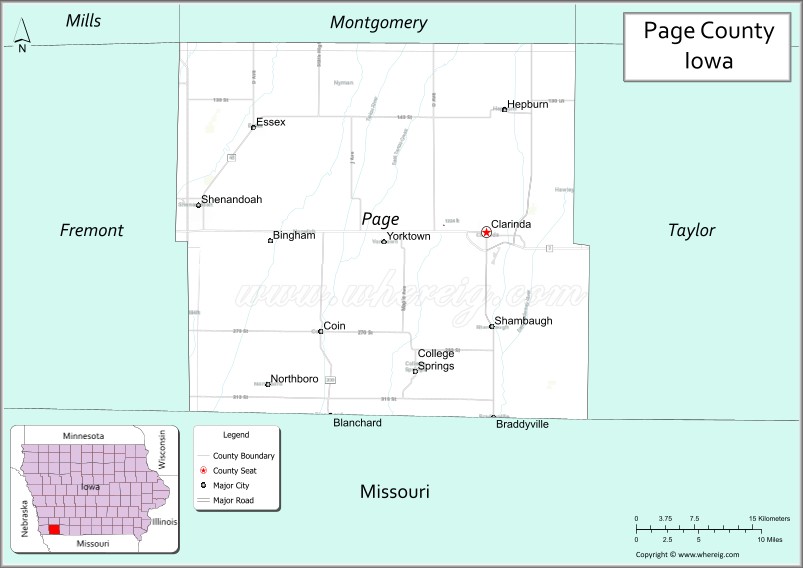
| Seat: | Clarinda |
| Largest city: | Clarinda |
| Total Area: | 535 sq mi (1,390 km²) |
| Land Area: | 535 sq mi (1,390 km²) |
| Total Population: | 15,211 |
| Population Density: | 28/sq mi (11/km²) |
| Time zone: | UTC−6 (Central) |
| Summer Time Zone (DST): | UTC−5 (CDT) |
| Website: | pagecounty.iowa.gov |
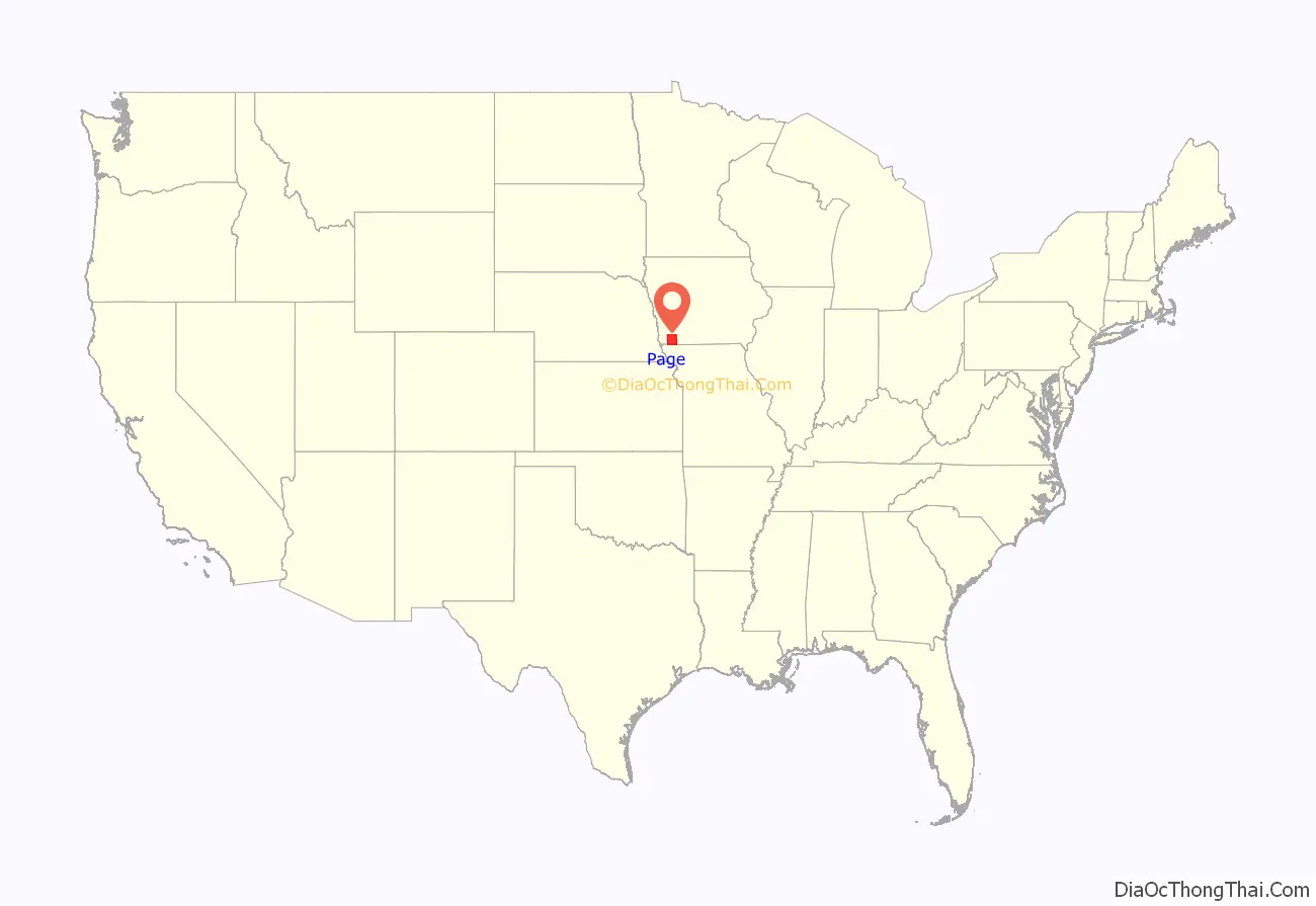
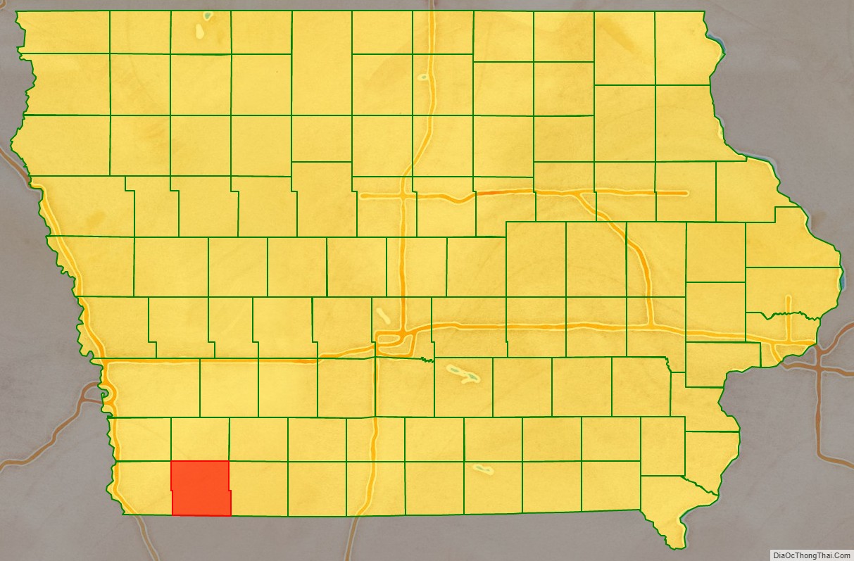
Page County location map. Where is Page County?
History
A fire on December 11, 1991, heavily damaged the Page County Courthouse. The fire was believed to have started in the attic and spread throughout much of the building. Multiple area fire departments fought the blaze and saved the structure. Court services were relocated to several buildings in Clarinda and other areas of Page County as repairs were made to the courthouse. After 2+1⁄2 years of work, the courthouse was re-occupied in March 1994.
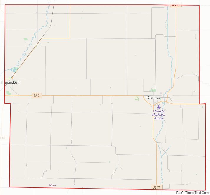
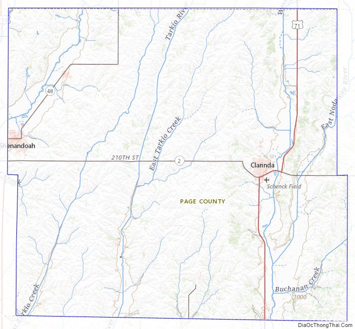
Page County Road Map
Geography
According to the U.S. Census Bureau, the county has a total area of 535 square miles (1,390 km), of which 535 square miles (1,390 km) is land and 0.5 square miles (1.3 km) (0.1%) is water.
Major highways
- U.S. Highway 59
- U.S. Highway 71
- Iowa Highway 2
- Iowa Highway 48
Transit
- List of intercity bus stops in Iowa
Adjacent counties
- Montgomery County (north)
- Taylor County (east)
- Nodaway County, Missouri (southeast)
- Atchison County, Missouri (southwest)
- Fremont County (west)
Page County Topographic Map
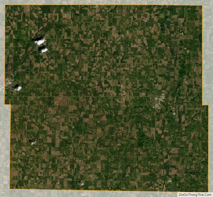
Page County Satellite Map
Page County Outline Map

See also
Map of Iowa State and its subdivision:- Adair
- Adams
- Allamakee
- Appanoose
- Audubon
- Benton
- Black Hawk
- Boone
- Bremer
- Buchanan
- Buena Vista
- Butler
- Calhoun
- Carroll
- Cass
- Cedar
- Cerro Gordo
- Cherokee
- Chickasaw
- Clarke
- Clay
- Clayton
- Clinton
- Crawford
- Dallas
- Davis
- Decatur
- Delaware
- Des Moines
- Dickinson
- Dubuque
- Emmet
- Fayette
- Floyd
- Franklin
- Fremont
- Greene
- Grundy
- Guthrie
- Hamilton
- Hancock
- Hardin
- Harrison
- Henry
- Howard
- Humboldt
- Ida
- Iowa
- Jackson
- Jasper
- Jefferson
- Johnson
- Jones
- Keokuk
- Kossuth
- Lee
- Linn
- Louisa
- Lucas
- Lyon
- Madison
- Mahaska
- Marion
- Marshall
- Mills
- Mitchell
- Monona
- Monroe
- Montgomery
- Muscatine
- O'Brien
- Osceola
- Page
- Palo Alto
- Plymouth
- Pocahontas
- Polk
- Pottawattamie
- Poweshiek
- Ringgold
- Sac
- Scott
- Shelby
- Sioux
- Story
- Tama
- Taylor
- Union
- Van Buren
- Wapello
- Warren
- Washington
- Wayne
- Webster
- Winnebago
- Winneshiek
- Woodbury
- Worth
- Wright
- Alabama
- Alaska
- Arizona
- Arkansas
- California
- Colorado
- Connecticut
- Delaware
- District of Columbia
- Florida
- Georgia
- Hawaii
- Idaho
- Illinois
- Indiana
- Iowa
- Kansas
- Kentucky
- Louisiana
- Maine
- Maryland
- Massachusetts
- Michigan
- Minnesota
- Mississippi
- Missouri
- Montana
- Nebraska
- Nevada
- New Hampshire
- New Jersey
- New Mexico
- New York
- North Carolina
- North Dakota
- Ohio
- Oklahoma
- Oregon
- Pennsylvania
- Rhode Island
- South Carolina
- South Dakota
- Tennessee
- Texas
- Utah
- Vermont
- Virginia
- Washington
- West Virginia
- Wisconsin
- Wyoming