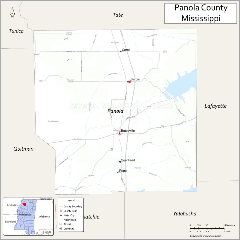
Panola County is a county located in the U.S. state of Mississippi. As of the 2020 census, the population was 33,208. Its county seats are Sardis and Batesville. The county is located just east of the Mississippi Delta in the northern part of the state. It is bisected by the Tallahatchie River flowing to the southwest; travel difficulties because of the river resulted in two county seats being established.
Panola is the anglicization of ponolo, a word meaning “thread” in both old Choctaw and Chickasaw and “cotton” in modern Choctaw. This was one of twelve large counties organized from the Chickasaw Cession of 1832.
| Name: | Panola County |
|---|---|
| FIPS code: | 28-107 |
| State: | Mississippi |
| Founded: | February 9, 1836 |
| Named for: | name of Cotton in the Choctaw language |
| Seat: | Batesville and Sardis |
| Largest city: | Batesville |
| Total Area: | 705 sq mi (1,830 km²) |
| Land Area: | 685 sq mi (1,770 km²) |
| Total Population: | 33,208 |
| Population Density: | 47/sq mi (18/km²) |
| Time zone: | UTC−6 (Central) |
| Summer Time Zone (DST): | UTC−5 (CDT) |
| Website: | www.panolacoms.com |
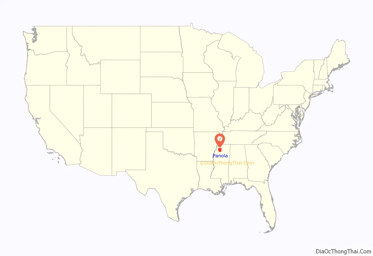
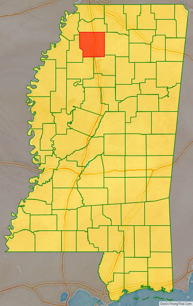
Panola County location map. Where is Panola County?
History
Following forced removal of most of the historic Chickasaw tribe to territory west of the Mississippi River, Panola County was established February 9, 1836 by the state legislature. It is one of the twelve large northern Mississippi counties created that year from the territory of the Chickasaw Cession of 1832. The original act defined its limits as follows:
On February 1, 1877, when Quitman County was organized by the legislature, it took a small fraction of Panola’s southwestern area, reducing Panola from an area of 756 square miles (1,960 km) to its present land surface of 705 square miles (1,830 km). By 1920 the county had a population of 27,845. Its inhabitants gradually increased in numbers from 1850 to 1910, from 11,444 to 31,274, reaching a peak of population in 1940. Through this period the area was based on agriculture. From then until 1980, population declined markedly, as many African Americans moved west and north in the second wave of the Great Migration, to take jobs on the West Coast in the burgeoning defense industry. Whites also left the rural area. In 2020, the county was 48.3% African American and 47.1% white.
Starting in 1803, sixteenth sections in each township in Mississippi were established for school purposes. These sections of land were to be used exclusively for school projects. In essence, schools were later founded on land that had been Chickasaw territory.
Two of the oldest settlements in Panola County were at Belmont and Panola, which were a few miles apart and located on opposite sides of the Tallahatchie River. For several years there was a spirited contest between these two towns to gain the county court of Panola County.
With the advent of the Mississippi and Tennessee (now the Illinois Central railroad), Belmont was absorbed by Sardis, and Panola was absorbed by Batesville. The legislature authorized two judicial districts for the county, with Sardis designated as the seat of justice for the first judicial district, and Batesville for the second judicial district.
Early education
During the early period of county formation, most education was done at home. There was no public education, and only wealthier families hired tutors or sent their sons to seminaries or academies. The informal education consisted of basic math, basic reading, and study of biblical concepts. Through the antebellum period, the state generally forbade education of slaves and free people of color.
By 1840 four small private schools with a combined student population of 92 pupils were operating in the county. Documentation has not survived about these schools. During the early 1840s, the first school‑related advertisements were published r in the county newspapers. The ads attempted to present the virtues of these early schools.
During this period, Judge James S.B. Thacher, a highly educated Bostonian, devised a popular educational program for the state of Mississippi. The proposed scheme received considerable discussion and was finally incorporated by the state legislature (4 March 1846) into “An Act to establish a System of Common Schools.”
The act “provided for a board of five school commissioners in each county, to license teachers and have charge of schools, lease the school lands and have charge of the school funds in each county.” To a large degree, this act was passed because A.G. Brown, a candidate for Mississippi governor, decided to make the establishment of a general school system a campaign issue. By 1846, Governor Brown (1844‑48), succeeded in getting the Act passed.
Schools established under this rule “had no uniformity since they differed as the counties differed in wealth and efficiency of management.”
Although the Act had proved to be of little assistance in Panola County, progress was being made for wealthier white students. By 1850, the seventh census in Panola County listed 18 schools and a total student population of 439 pupils (approximately four times that of the 1840 census). This census (unpublished returns) recorded that 18 individuals stated their occupation as educators or teachers. By the spring of 1854, several members of the local Shiloh community (Capt Thomas F. Wilson, Dr H. Moseley, and Jesse Smith) constructed a small log cabin to be used as the community’s school house.
This school, known as the Jones’ School, at first employed only one teacher. It slowly grew in size and popularity. Several years later, the facility was moved to Peach Creek, where the school was informally known as the “Greasy Smith Schoolhouse,” being named for the local village blacksmith. In 1882, the facility was moved to Pleasant Grove.
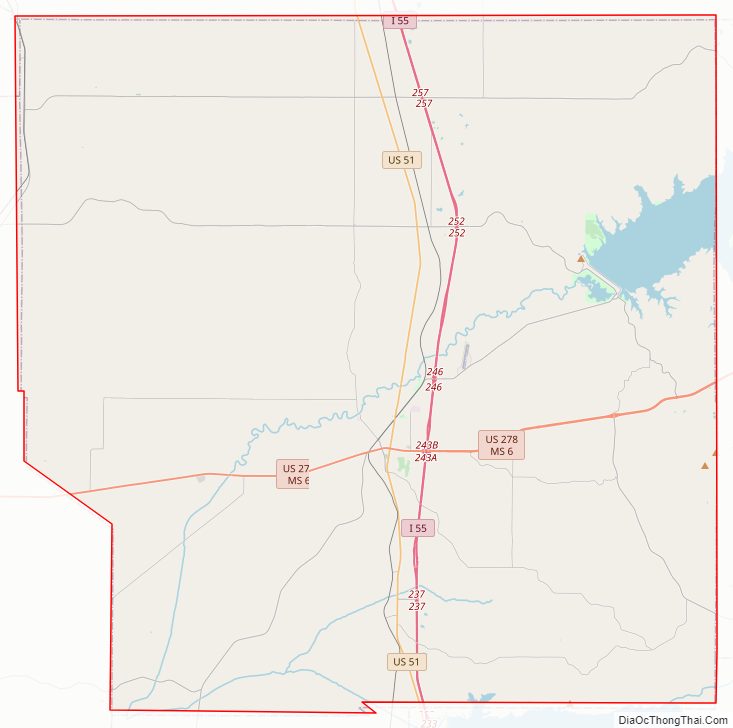
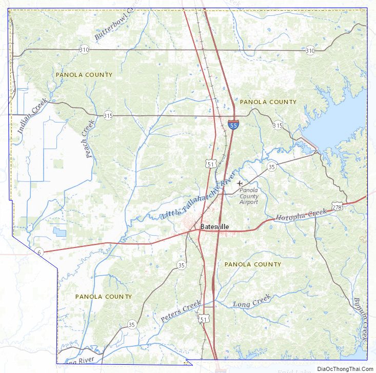
Panola County Road Map
Geography
According to the U.S. Census Bureau, the county has a total area of 705 square miles (1,830 km), of which 685 square miles (1,770 km) is land and 20 square miles (52 km) (2.8%) is water.
Major highways
- Interstate 55
- U.S. Route 51
- Mississippi Highway 3
- Mississippi Highway 6
- Mississippi Highway 35
- U.S. Route 278
Adjacent counties
- Tunica County (northwest)
- Tate County (north)
- Lafayette County (east)
- Yalobusha County (southeast)
- Tallahatchie County (southwest)
- Quitman County (west)
Panola County Topographic Map
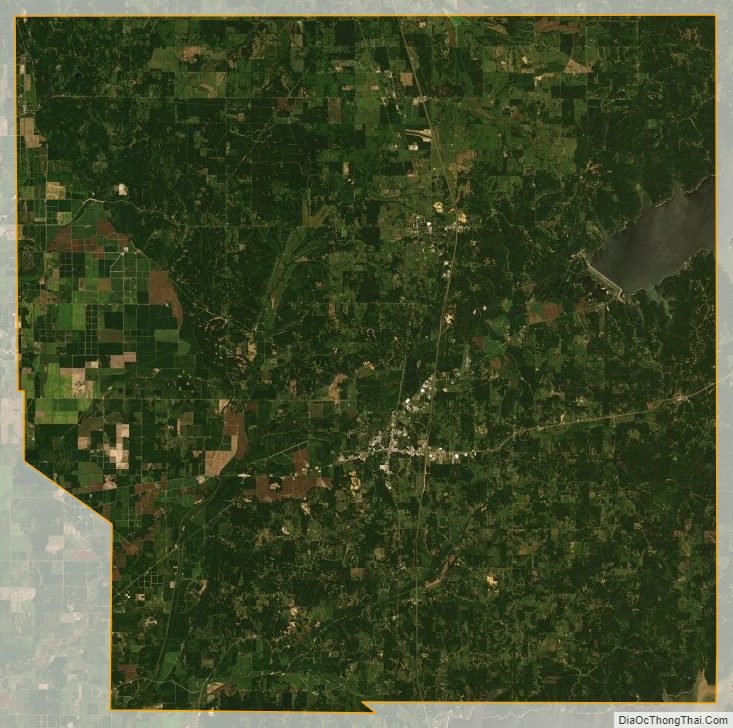
Panola County Satellite Map
Panola County Outline Map

See also
Map of Mississippi State and its subdivision:- Adams
- Alcorn
- Amite
- Attala
- Benton
- Bolivar
- Calhoun
- Carroll
- Chickasaw
- Choctaw
- Claiborne
- Clarke
- Clay
- Coahoma
- Copiah
- Covington
- Desoto
- Forrest
- Franklin
- George
- Greene
- Grenada
- Hancock
- Harrison
- Hinds
- Holmes
- Humphreys
- Issaquena
- Itawamba
- Jackson
- Jasper
- Jefferson
- Jefferson Davis
- Jones
- Kemper
- Lafayette
- Lamar
- Lauderdale
- Lawrence
- Leake
- Lee
- Leflore
- Lincoln
- Lowndes
- Madison
- Marion
- Marshall
- Monroe
- Montgomery
- Neshoba
- Newton
- Noxubee
- Oktibbeha
- Panola
- Pearl River
- Perry
- Pike
- Pontotoc
- Prentiss
- Quitman
- Rankin
- Scott
- Sharkey
- Simpson
- Smith
- Stone
- Sunflower
- Tallahatchie
- Tate
- Tippah
- Tishomingo
- Tunica
- Union
- Walthall
- Warren
- Washington
- Wayne
- Webster
- Wilkinson
- Winston
- Yalobusha
- Yazoo
- Alabama
- Alaska
- Arizona
- Arkansas
- California
- Colorado
- Connecticut
- Delaware
- District of Columbia
- Florida
- Georgia
- Hawaii
- Idaho
- Illinois
- Indiana
- Iowa
- Kansas
- Kentucky
- Louisiana
- Maine
- Maryland
- Massachusetts
- Michigan
- Minnesota
- Mississippi
- Missouri
- Montana
- Nebraska
- Nevada
- New Hampshire
- New Jersey
- New Mexico
- New York
- North Carolina
- North Dakota
- Ohio
- Oklahoma
- Oregon
- Pennsylvania
- Rhode Island
- South Carolina
- South Dakota
- Tennessee
- Texas
- Utah
- Vermont
- Virginia
- Washington
- West Virginia
- Wisconsin
- Wyoming