Park County is a county in the U.S. state of Wyoming. As of the 2020 United States Census, the population was 29,624. The county seat is Cody.
Park County is a major tourism destination. The county has over 53 percent of Yellowstone National Park’s land area. Many attractions abound, including the Buffalo Bill Historical Center, the Cody Stampede Rodeo, the Ghost Town of Kirwin, and the western museum Old Trail Town.
| Name: | Park County |
|---|---|
| FIPS code: | 56-029 |
| State: | Wyoming |
| Founded: | February 15, 1909 (established) 1911 (organized) |
| Named for: | Yellowstone National Park |
| Seat: | Cody |
| Largest city: | Cody |
| Total Area: | 6,967 sq mi (18,040 km²) |
| Land Area: | 6,942 sq mi (17,980 km²) |
| Total Population: | 29,624 |
| Population Density: | 4.3/sq mi (1.6/km²) |
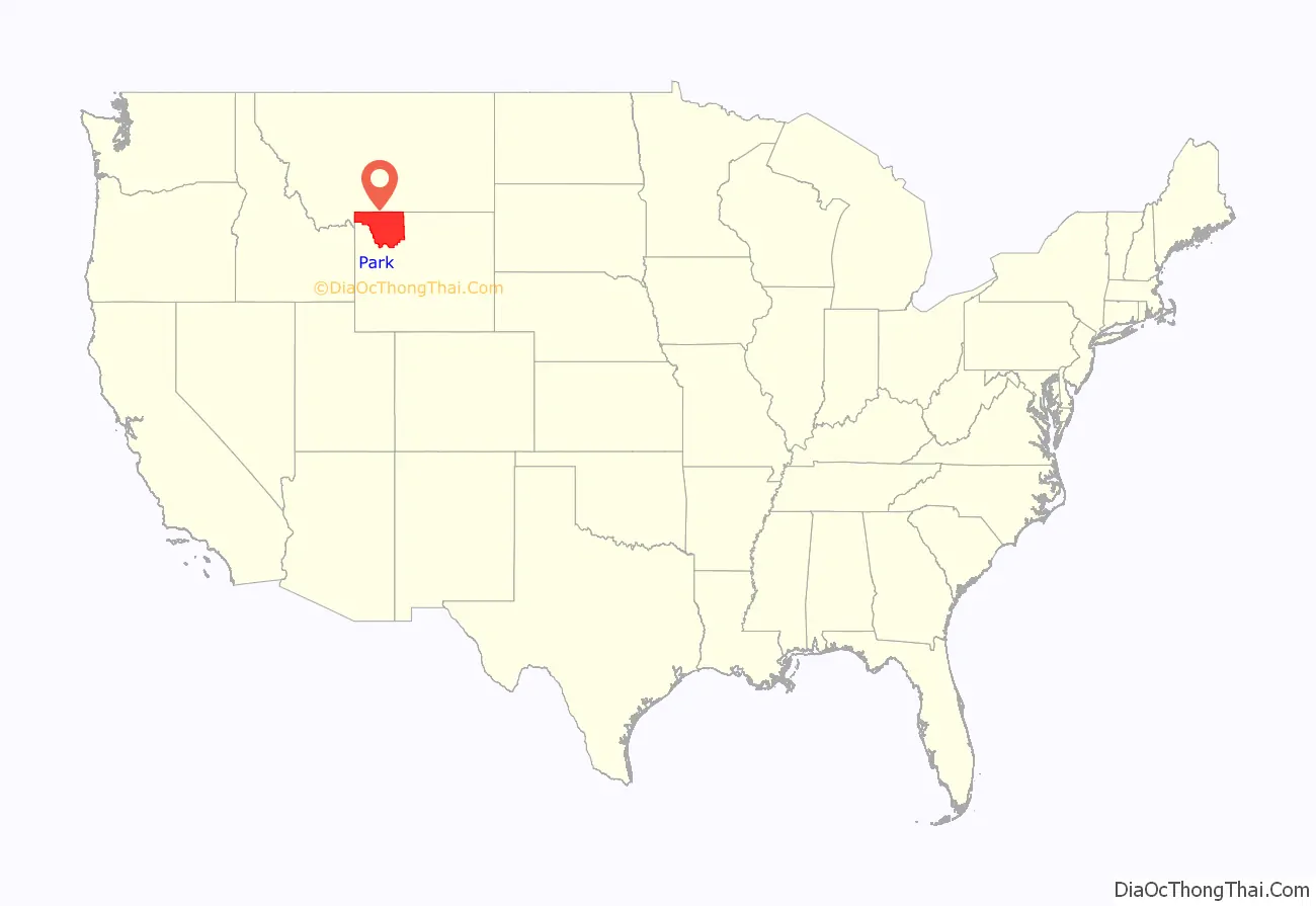
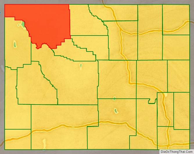
Park County location map. Where is Park County?
History
Wyoming gained separate territorial status in 1868. Before that, most of the state’s area was included in either Laramie County (part of the Dakota Territory) or as unorganized territory within the Dakota Territory. Wyoming Territory was established on July 25, 1868, at which time Laramie County was assigned to this jurisdiction. The area now known as Park County was established as Carter County, then Sweetwater County. In 1884 it was assigned to Fremont County; this continued until 1896, when it was assigned to Big Horn County.
Wyoming achieved statehood in 1890. The area of present-day Park Continued as part of Big Horn County until 1909, when Park County was authorized. The county governing structure was put in place during 1911; a courthouse was constructed 1911–1912. An addition to the building was completed in 1983, and the complete building was restored in 1985. The county was named for Yellowstone National Park which is mostly within the limits of Park County.
Immigrants from Ireland and Germany settled in what would become Park County in the 1870s. Immigrants from England were the largest immigrant group in Park County in the late 1800s and early 1900s. In 1911 when the county was organized the largest population group in the county were first generation English immigrants and their Wyoming-born children. Many English immigrants who had settled in Wyoming and become American citizens remained connected to England, many of the children of these English immigrants who had been born and raised in Wyoming joined the Canadian military in order to fight alongside Britain during World War I, and subsequently, when America joined the war many volunteered to join the United States military before the U.S. officially instituted a draft.
In 1913, Hot Springs County was created from portions of Park County, Big Horn County, and Fremont County. Park County also had minor boundary adjustments in 1929 and 1931, but otherwise its boundaries have remained unchanged.
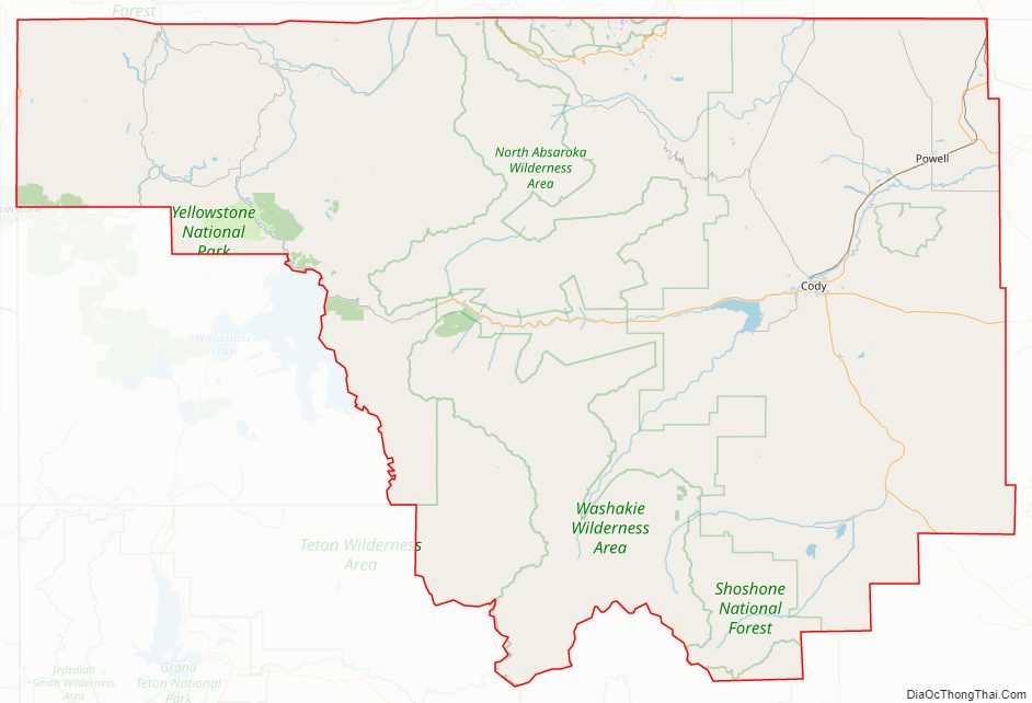
Park County Road Map
Geography
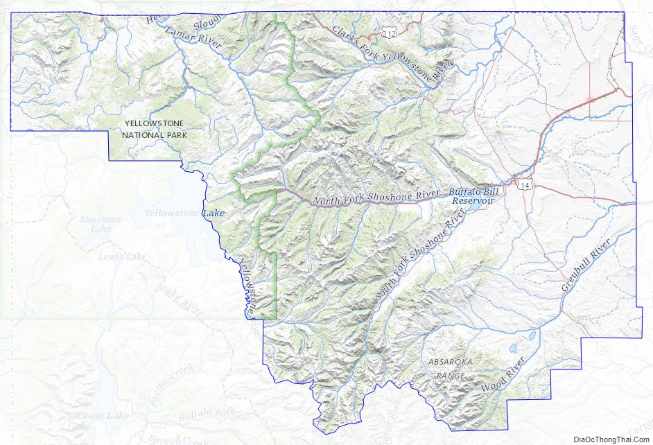
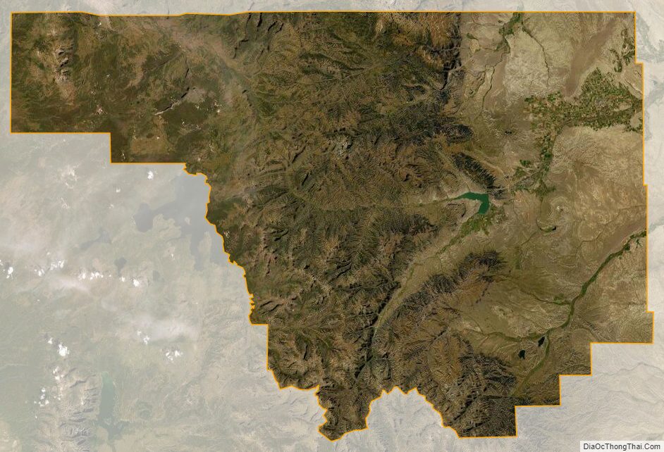
Much of Park County is held under state or federal control. Most of the Shoshone National Forest, the first national forest, and a portion of Yellowstone National Park, the first national park, fall within Park County boundaries. Three rivers flow through Park County: the Greybull and Shoshone Rivers which are tributaries to the Big Horn River, and the Clark’s Fork River which flows into the Yellowstone River.
According to the US Census Bureau, the county has a total area of 6,967 square miles (18,040 km), of which 6,942 square miles (17,980 km) is land and 25 square miles (65 km) (0.4%) is water.
Adjacent counties
- Park County, Montana – north
- Carbon County, Montana – northeast
- Big Horn County – east
- Washakie County – east-southeast
- Hot Springs County – southeast
- Fremont County – south
- Teton County – southwest
- Gallatin County, Montana – northwest
National protected areas
- Bridger-Teton National Forest (part)
- Shoshone National Forest (part)
- Yellowstone National Park (part)
Major highways
- U.S. Highway 14
- U.S. Highway 14A
- U.S. Highway 16
- U.S. Highway 20
- U.S. Highway 191
- U.S. Highway 212
- U.S. Highway 287
- Wyoming Highway 120
- Wyoming Highway 296
Park County Topographic Map
Park County Satellite Map
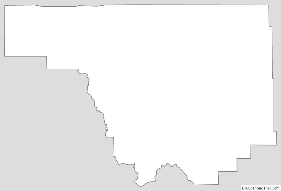
Park County Outline Map
See also
Map of Wyoming State and its subdivision: Map of other states:- Alabama
- Alaska
- Arizona
- Arkansas
- California
- Colorado
- Connecticut
- Delaware
- District of Columbia
- Florida
- Georgia
- Hawaii
- Idaho
- Illinois
- Indiana
- Iowa
- Kansas
- Kentucky
- Louisiana
- Maine
- Maryland
- Massachusetts
- Michigan
- Minnesota
- Mississippi
- Missouri
- Montana
- Nebraska
- Nevada
- New Hampshire
- New Jersey
- New Mexico
- New York
- North Carolina
- North Dakota
- Ohio
- Oklahoma
- Oregon
- Pennsylvania
- Rhode Island
- South Carolina
- South Dakota
- Tennessee
- Texas
- Utah
- Vermont
- Virginia
- Washington
- West Virginia
- Wisconsin
- Wyoming