Pawnee County is a county in the U.S. state of Nebraska. As of the 2010 United States Census, the population was 2,773. Its county seat is Pawnee City.
In the Nebraska license plate system, Pawnee County is represented by the prefix 54 (it had the fifty-fourth-largest number of vehicles registered in the county when the license plate system was established in 1922).
| Name: | Pawnee County |
|---|---|
| FIPS code: | 31-133 |
| State: | Nebraska |
| Founded: | 1854 |
| Named for: | Pawnee people |
| Seat: | Pawnee City |
| Largest city: | Pawnee City |
| Total Area: | 433 sq mi (1,120 km²) |
| Land Area: | 431 sq mi (1,120 km²) |
| Total Population: | 2,548 |
| Population Density: | 6.13/sq mi (2.37/km²) |
| Time zone: | UTC−6 (Central) |
| Summer Time Zone (DST): | UTC−5 (CDT) |
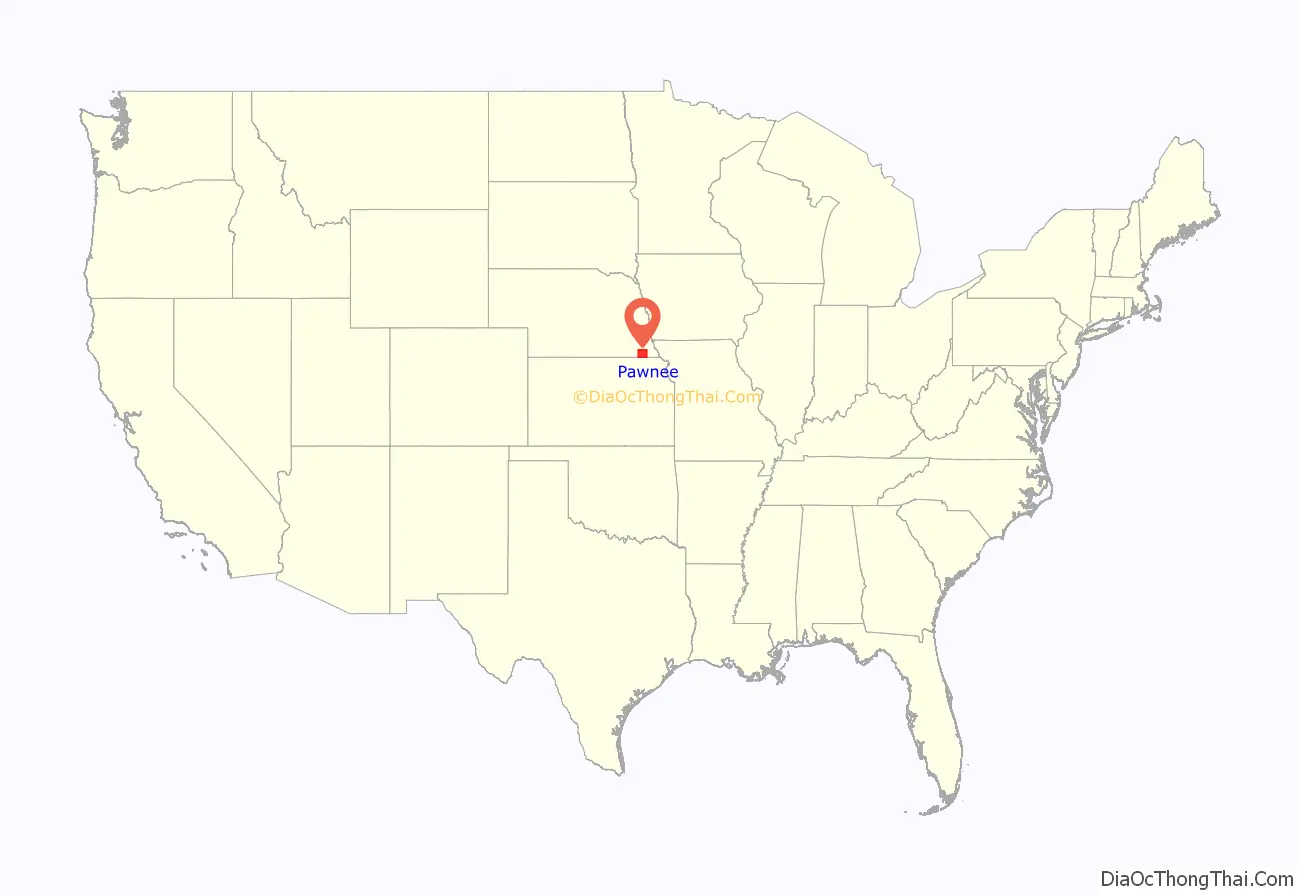
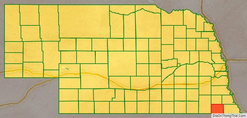
Pawnee County location map. Where is Pawnee County?
History
Pawnee County was formed in 1854. It was named for the Pawnee Native American tribe.
On May 30, 1879, the “Irving, Kansas Tornado” passed through Pawnee County. This tornado measured F4 on the Fujita scale, and had a damage path 800 yards wide and 100 miles.
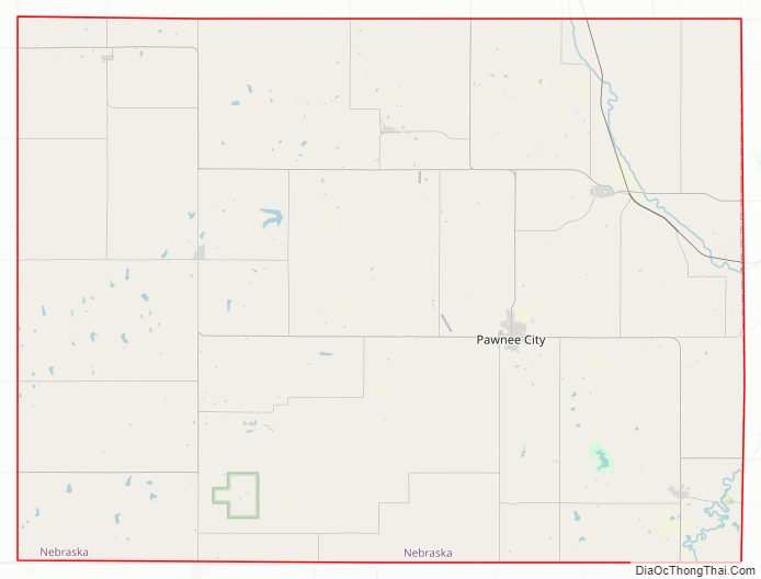
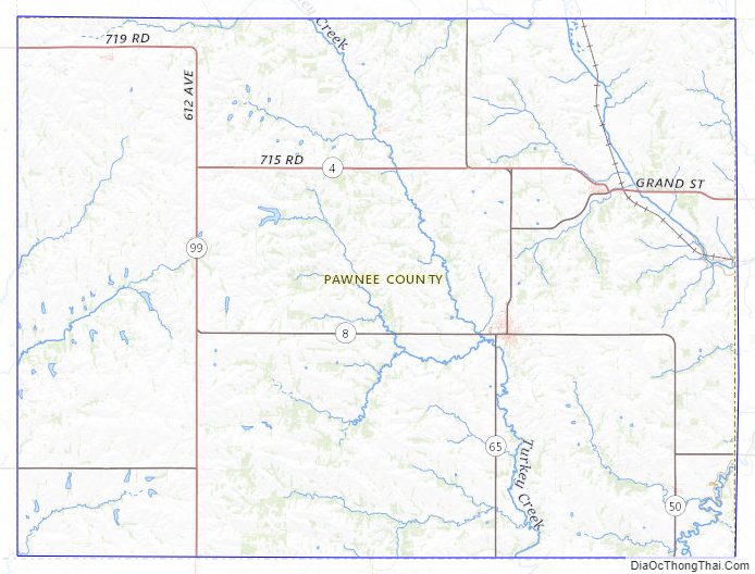
Pawnee County Road Map
Geography
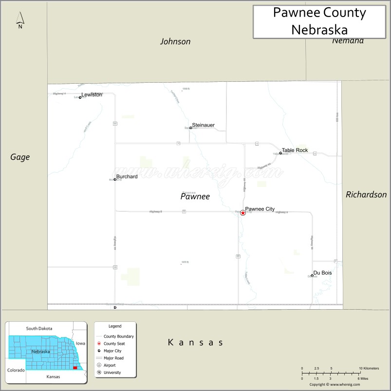
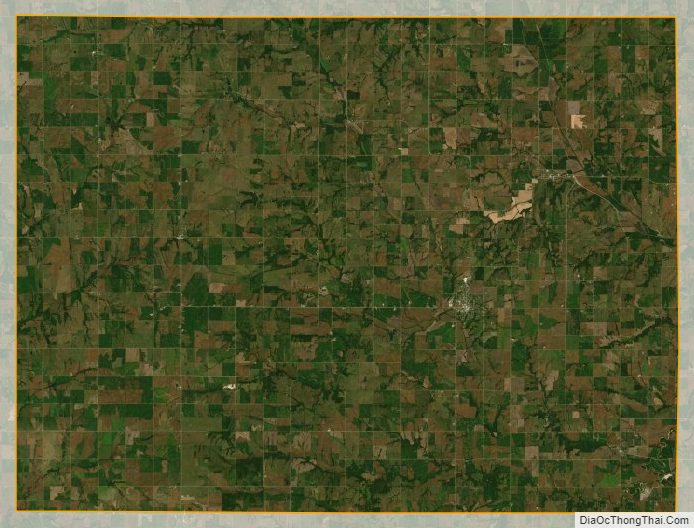
Pawnee County lies on the south line of Nebraska. Its south boundary line abuts the north boundary line of the state of Kansas. The Big Nemaha River flows southeastward through the NE corner of the county, and smaller local drainages flow upward through the county to discharge into the Big Nemaha. The county’s terrain consists of rolling hills, with its planar areas largely devoted to agriculture. The county has an area of 433 square miles (1,120 km), of which 431 square miles (1,120 km) is land and 1.9 square miles (4.9 km) (0.4%) is water.
Major highways
- Nebraska Highway 4
- Nebraska Highway 8
- Nebraska Highway 50
- Nebraska Highway 65
- Nebraska Highway 99
- Nebraska Highway 105
Adjacent counties
- Richardson County − east
- Nemaha County, Kansas − southeast
- Marshall County, Kansas − southwest
- Gage County − west
- Johnson County − north
- Nemaha County − northeast
Protected areas
- Bowwood State Wildlife Management Area
- Burchard State Wildlife Management Area
- Mayberry State Wildlife Management Area
- Pawnee Prairie State Wildlife Management Area
- Prairie Knoll State Wildlife Management Area
- Table Rock State Wildlife Management Area
Pawnee County Topographic Map
Pawnee County Satellite Map
Pawnee County Outline Map

See also
Map of Nebraska State and its subdivision:- Adams
- Antelope
- Arthur
- Banner
- Blaine
- Boone
- Box Butte
- Boyd
- Brown
- Buffalo
- Burt
- Butler
- Cass
- Cedar
- Chase
- Cherry
- Cheyenne
- Clay
- Colfax
- Cuming
- Custer
- Dakota
- Dawes
- Dawson
- Deuel
- Dixon
- Dodge
- Douglas
- Dundy
- Fillmore
- Franklin
- Frontier
- Furnas
- Gage
- Garden
- Garfield
- Gosper
- Grant
- Greeley
- Hall
- Hamilton
- Harlan
- Hayes
- Hitchcock
- Holt
- Hooker
- Howard
- Jefferson
- Johnson
- Kearney
- Keith
- Keya Paha
- Kimball
- Knox
- Lancaster
- Lincoln
- Logan
- Loup
- Madison
- McPherson
- Merrick
- Morrill
- Nance
- Nemaha
- Nuckolls
- Otoe
- Pawnee
- Perkins
- Phelps
- Pierce
- Platte
- Polk
- Red Willow
- Richardson
- Rock
- Saline
- Sarpy
- Saunders
- Scotts Bluff
- Seward
- Sheridan
- Sherman
- Sioux
- Stanton
- Thayer
- Thomas
- Thurston
- Valley
- Washington
- Wayne
- Webster
- Wheeler
- York
- Alabama
- Alaska
- Arizona
- Arkansas
- California
- Colorado
- Connecticut
- Delaware
- District of Columbia
- Florida
- Georgia
- Hawaii
- Idaho
- Illinois
- Indiana
- Iowa
- Kansas
- Kentucky
- Louisiana
- Maine
- Maryland
- Massachusetts
- Michigan
- Minnesota
- Mississippi
- Missouri
- Montana
- Nebraska
- Nevada
- New Hampshire
- New Jersey
- New Mexico
- New York
- North Carolina
- North Dakota
- Ohio
- Oklahoma
- Oregon
- Pennsylvania
- Rhode Island
- South Carolina
- South Dakota
- Tennessee
- Texas
- Utah
- Vermont
- Virginia
- Washington
- West Virginia
- Wisconsin
- Wyoming