| Name: | Pierce County |
|---|---|
| FIPS code: | 53-053 |
| State: | Washington |
| Founded: | December 22, 1852 |
| Named for: | Franklin Pierce |
| Seat: | Tacoma |
| Largest city: | Tacoma |
| Total Area: | 1,806 sq mi (4,680 km²) |
| Land Area: | 1,670 sq mi (4,300 km²) |
| Total Population: | 921,130 |
| Population Density: | 510/sq mi (200/km²) |
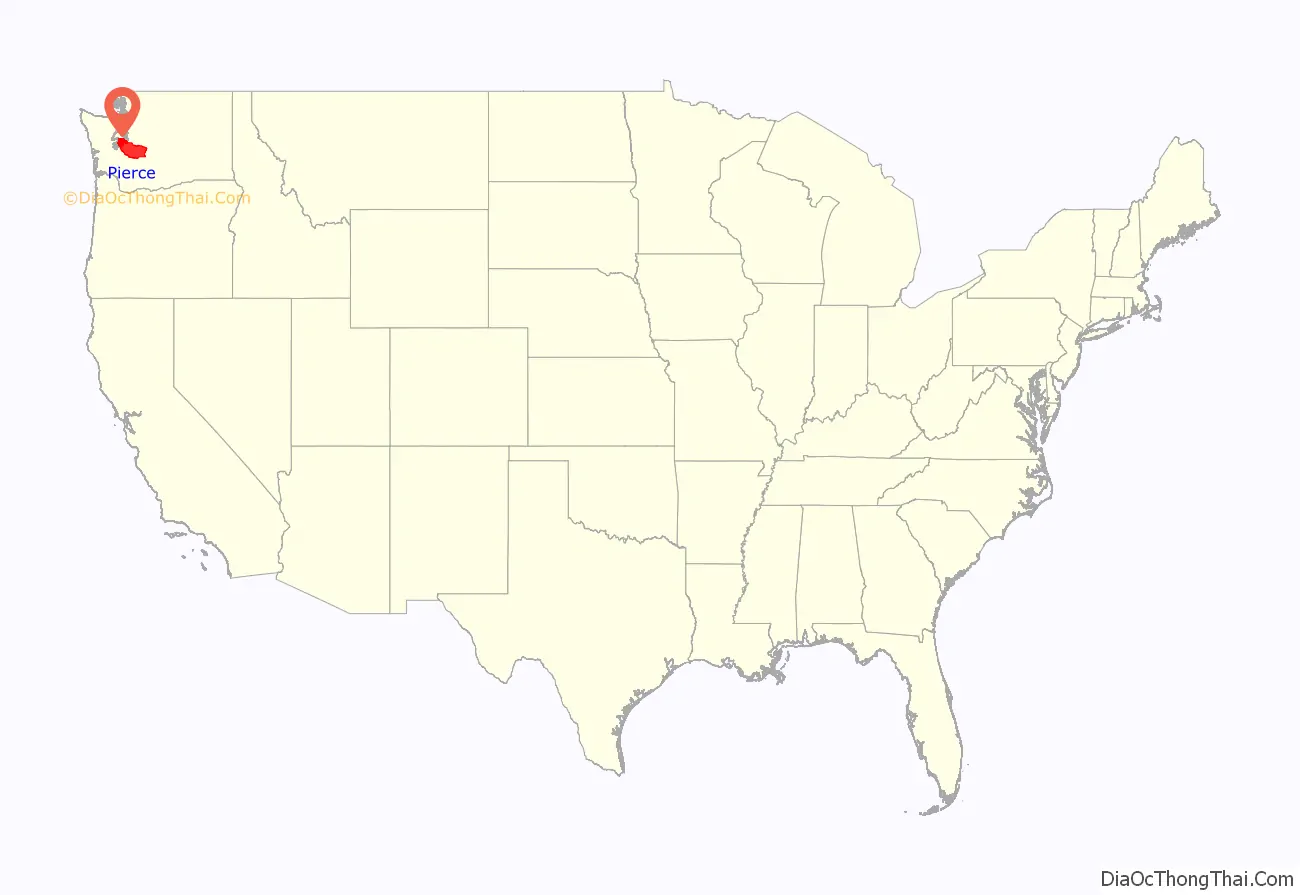
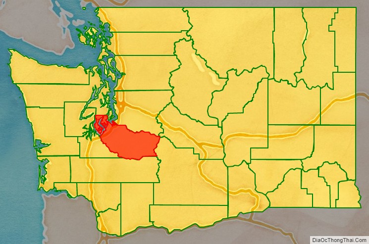
Pierce County location map. Where is Pierce County?
History
The area was originally home to the present-day Nisqually, Puyallup, Squaxin, Steilacoom, and Muckleshoot tribes. Puyallup villages were predominately near what would later become Tacoma and Nisqually settlements were in what would become southern Pierce County. Two major trails of the tribes were a northern route through Naches Pass and a southern route along the Mashel River linking with Eastern Washington tribes. Trade networks among the region’s indigenous peoples were well established long before the coming of white settlers.
In 1792 British Captain George Vancouver and his party of explorers came via ship to the shores of the region, and named a number of sites in what would become Pierce County, i.e. Mt. Rainier.
In 1832 Fort Nisqually was sited by the British Hudson’s Bay Company’s chief trader, Archibald McDonald. It was the first permanent European settlement on the Salish Sea. In cooperation with the local indigenous people, a storehouse for blankets, seeds, and potatoes was built at the mouth of Sequalitchew Creek.
In 1839 the Nisqually Methodist Episcopal Mission was established, bringing the first U.S. citizens to settle in the Puget Sound region, near the Sequalitchew Creek canyon.
In 1841 the United States Exploring Expedition set up an observatory on the bluff near the creek to survey, map and chart the waters of Puget Sound.
In 1843 the Second Fort Nisqually was erected. Business became mainly agricultural, and the fort was relocated on a flat-plains area near the banks of Sequalitchew Creek for cattle. The Fort Nisqually property was turned over to American control in 1859.
In 1846 the Oregon Treaty established the 49th Parallel as the boundary between British Canada and the United States, which left what was to become Pierce County on U.S. territory. In response to increasing tensions between Indians and settlers, the United States Army established Fort Steilacoom in 1849 at the site of the traditional home of the Steilacoom Tribe.
In 1850, Captain Lafayette Balch sited his land claim next to the fort and founded Port Steilacoom. In 1854 the town of Steilacoom became Washington Territory’s first incorporated town.
In 1854 the Treaty of Medicine Creek was enacted between the United States and the local tribes occupying the lands of the Salish Sea. The tribes listed on the Treaty of Medicine Creek are Nisqually, Puyallup, Steilacoom, Squawskin (Squaxin Island), S’Homamish, Stehchass, T’Peeksin, Squi-aitl, and Sa-heh-wamish. The treaty was signed on December 26, 1854, by Isaac I. Stevens, governor and superintendent of Indian Affairs of Washington territory at the time. The native tribes were told the treaty would help them by paying them for some of the land. It ended up taking prime farmland and relocating the tribes onto rough reservations. Chief Leschi of the Nisqually tribe protested the treaty. He and his people marched to Olympia to have their voices heard but Isaac Stevens ordered them away. When the natives refused to leave, Isaac Stevens would eventually call martial law and – after the beginning of the Puget Sound War in 1855 – initiate a search for Chief Leschi in order to arrest him. Chief Leschi was eventually captured and put on trial. The first jury couldn’t come to a verdict, so Isaac Stevens had the trial done a second time. This time Leschi was found guilty. Chief Leschi was hanged on February 19, 1858. On December 10, 2004, a historical court convened in Pierce County ruled “as a legal combatant of the Indian War Leschi should not have been held accountable under law for the death of an enemy soldier,” thereby exonerating him of any wrongdoing.[1]
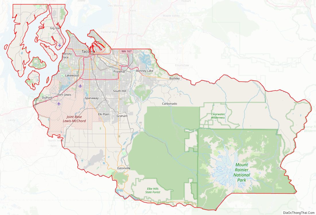
Pierce County Road Map
Geography
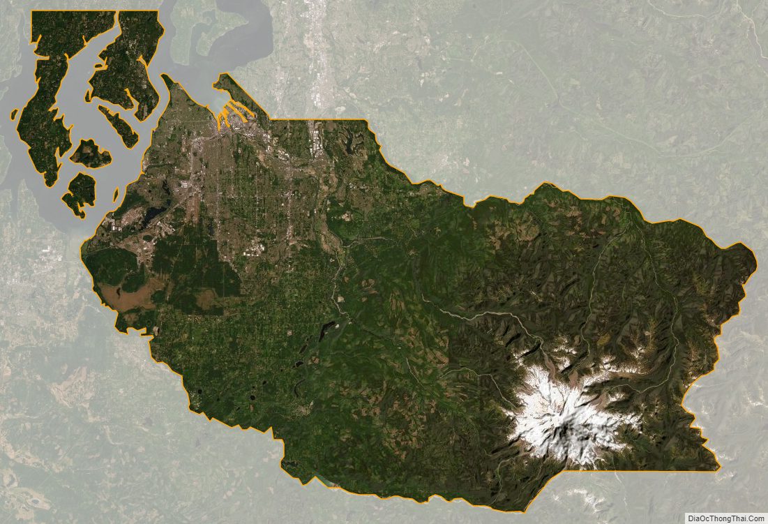
According to the United States Census Bureau, the county has a total area of 1,806 square miles (4,680 km), of which 1,670 square miles (4,300 km) is land and 137 square miles (350 km) (7.6%) is water. The highest natural point in Washington, Mount Rainier, at 14,410 feet (4,392 m), is located in Pierce County. Rainier is locally called Tahoma or Takhoma, both native names for the mountain.
Geographic features
- Anderson Island
- Carbon River
- Cascade Range
- Case Inlet
- Commencement Bay
- Fox Island
- Herron Island
- Ketron Island
- Key Peninsula
- Lake Tapps (Washington)
- McNeil Island
- Mount Rainier, highest point in both the county and Washington state.
- Nisqually River
- Puget Sound
- Puyallup River
- Raft Island
- Tacoma Narrows
Pierce County also contains the Clearwater Wilderness area.
Adjacent counties
- King County — north
- Yakima County — east
- Lewis County — south
- Thurston County — west/southwest
- Mason County — west/northwest
- Kitsap County — north/northwest
National protected areas
- Mount Baker-Snoqualmie National Forest (part)
- Mount Rainier National Park (part)
- Nisqually National Wildlife Refuge (part)
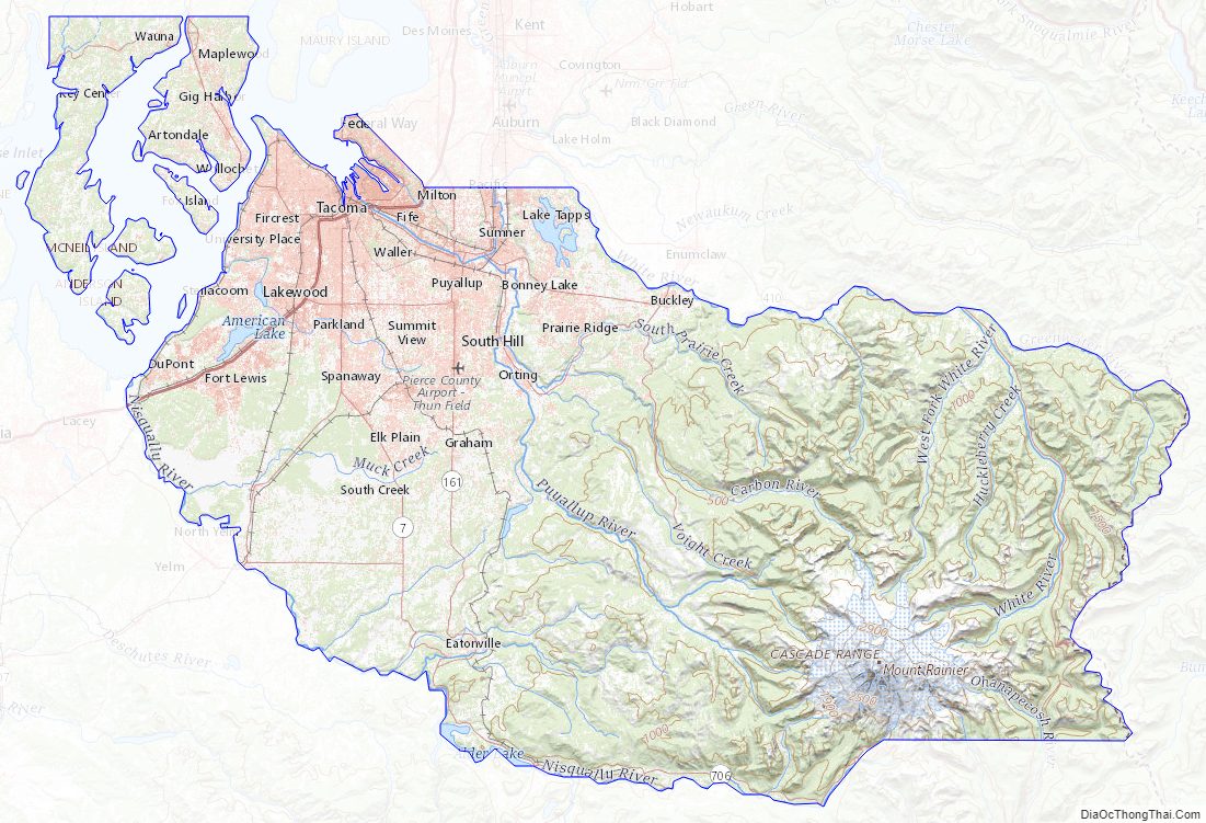
Pierce County Topographic Map
Pierce County Satellite Map
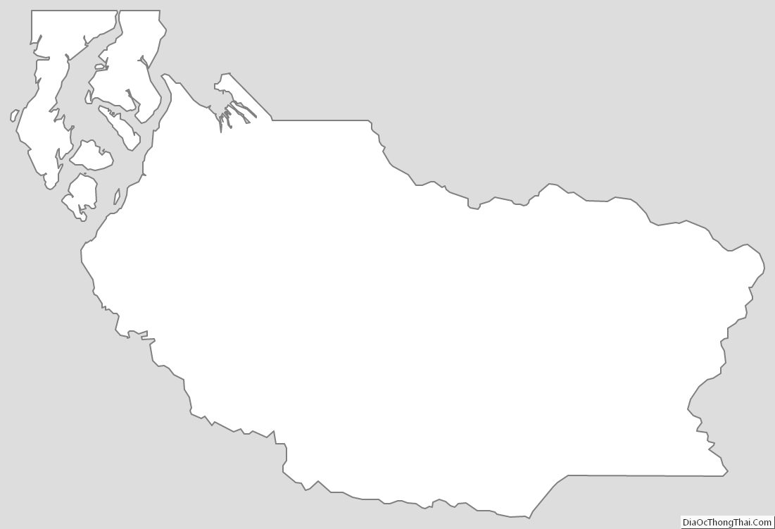
Pierce County Outline Map
See also
Map of Washington State and its subdivision:- Adams
- Asotin
- Benton
- Chelan
- Clallam
- Clark
- Columbia
- Cowlitz
- Douglas
- Ferry
- Franklin
- Garfield
- Grant
- Grays Harbor
- Island
- Jefferson
- King
- Kitsap
- Kittitas
- Klickitat
- Lewis
- Lincoln
- Mason
- Okanogan
- Pacific
- Pend Oreille
- Pierce
- San Juan
- Skagit
- Skamania
- Snohomish
- Spokane
- Stevens
- Thurston
- Wahkiakum
- Walla Walla
- Whatcom
- Whitman
- Yakima
- Alabama
- Alaska
- Arizona
- Arkansas
- California
- Colorado
- Connecticut
- Delaware
- District of Columbia
- Florida
- Georgia
- Hawaii
- Idaho
- Illinois
- Indiana
- Iowa
- Kansas
- Kentucky
- Louisiana
- Maine
- Maryland
- Massachusetts
- Michigan
- Minnesota
- Mississippi
- Missouri
- Montana
- Nebraska
- Nevada
- New Hampshire
- New Jersey
- New Mexico
- New York
- North Carolina
- North Dakota
- Ohio
- Oklahoma
- Oregon
- Pennsylvania
- Rhode Island
- South Carolina
- South Dakota
- Tennessee
- Texas
- Utah
- Vermont
- Virginia
- Washington
- West Virginia
- Wisconsin
- Wyoming