Pike County is a county on the eastern border of the U.S. state of Missouri, bounded by the Mississippi River. As of the 2010 census, the population was 18,516. Its county seat is Bowling Green. Its namesake was a city in middle Kentucky, a region from where many early migrants came. The county was organized December 14, 1818, and named for explorer Zebulon Pike. The folksong “Sweet Betsy from Pike” is generally thought to be associated with Pike County, Missouri.
Pike County is said to be the home of Momo (The Missouri Monster). The first reported sightings in the 1970s were traced to various locations throughout the county.
| Name: | Pike County |
|---|---|
| FIPS code: | 29-163 |
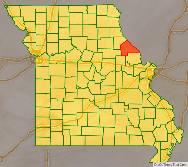
| State: | Missouri |
| Founded: | December 14, 1818 |
| Named for: | Zebulon M. Pike |
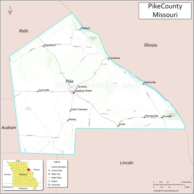
| Seat: | Bowling Green |
| Largest city: | Bowling Green |
| Total Area: | 685 sq mi (1,770 km²) |
| Land Area: | 670 sq mi (1,700 km²) |
| Total Population: | 18,516 |
| Population Density: | 27/sq mi (10/km²) |
| Time zone: | UTC−6 (Central) |
| Summer Time Zone (DST): | UTC−5 (CDT) |
| Website: | www.pikecountymo.net |
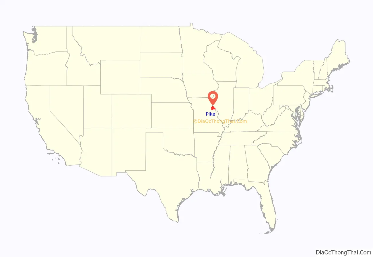
Pike County location map. Where is Pike County?
History
The history of Pike County is complicated by the fact that at its establishment in 1818, it included today’s boundaries plus all counties north of it, plus the counties bordering all of them on the west, in total over 6 or 7 times larger than its current size, and thus covering the northeast border area of today’s State of Missouri. Pike county and the counties north of it were gradually reduced in size by the creation of Ralls and subsequent new counties including Marion, Lewis, Clark, Scotland, Knox, Shelby, and Monroe.
The county was first settled by migrants from the Upper South. Some, though not all, were sympathetic to the Confederate cause in later decades. After the end of the post-Civil-War Reconstruction era, some of the county’s inhabitants enforced Jim Crow laws and racial segregation in the county to maintain what has been labeled by some as “white supremacy”. This occurred despite the fact that key US/Unionist military operations to control “Confederate” upstarts were launched from Pike County and had bases there.
In a violent period near the turn of the 20th century, five African Americans were tragically lynched in Pike County between 1891 and 1914. Among those were Curtis and Sam Young, who were both lynched for allegedly murdering the city marshall, Walter Meloan, on June 6, 1898, in Clarksville, a small town on the Mississippi River. Pike tied with Howard County, Missouri for the highest number of lynchings of African Americans in the state during this historical period.
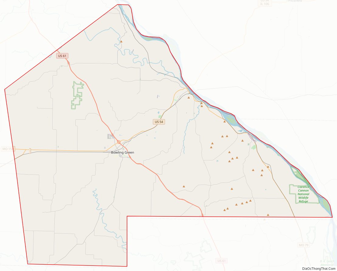
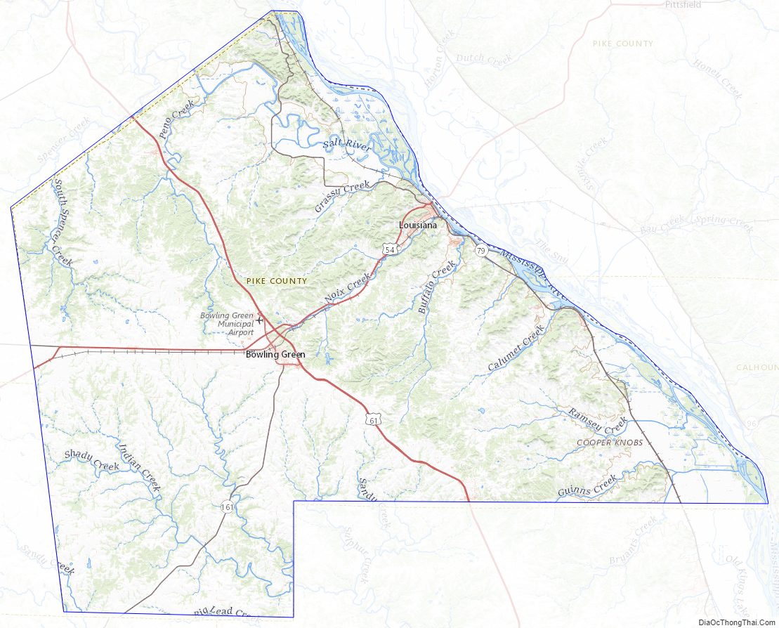
Pike County Road Map
Geography
According to the U.S. Census Bureau, the county has a total area of 685 square miles (1,770 km), of which 670 square miles (1,700 km) is land and 14 square miles (36 km) (2.1%) is water.
Adjacent counties
- Ralls County (northwest)
- Pike County, Illinois (northeast)
- Calhoun County, Illinois (east)
- Lincoln County (south)
- Montgomery County (southwest)
- Audrain County (west)
Major highways
- US 54
- US 54 Bus.
- US 54 Bus.
- US 61
- US 61 Bus.
- US 61 Spur
- Route 79
- Route 154
- Route 161
- Great River Road
Former roadways
- Red Ball Route
- Mississippi River Scenic Route
- Route 9
- Route 22
- Route 29
National protected area
- Clarence Cannon National Wildlife Refuge
Pike County Topographic Map
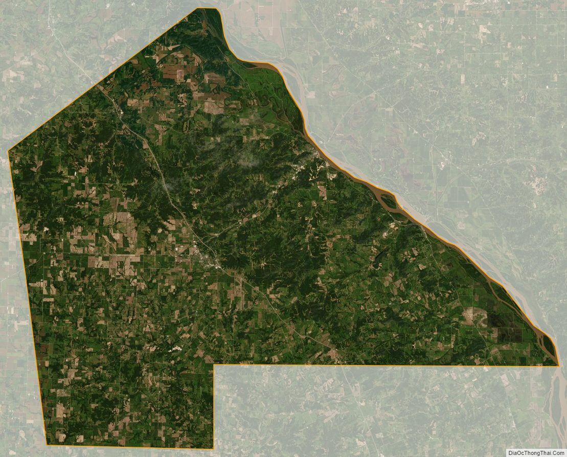
Pike County Satellite Map
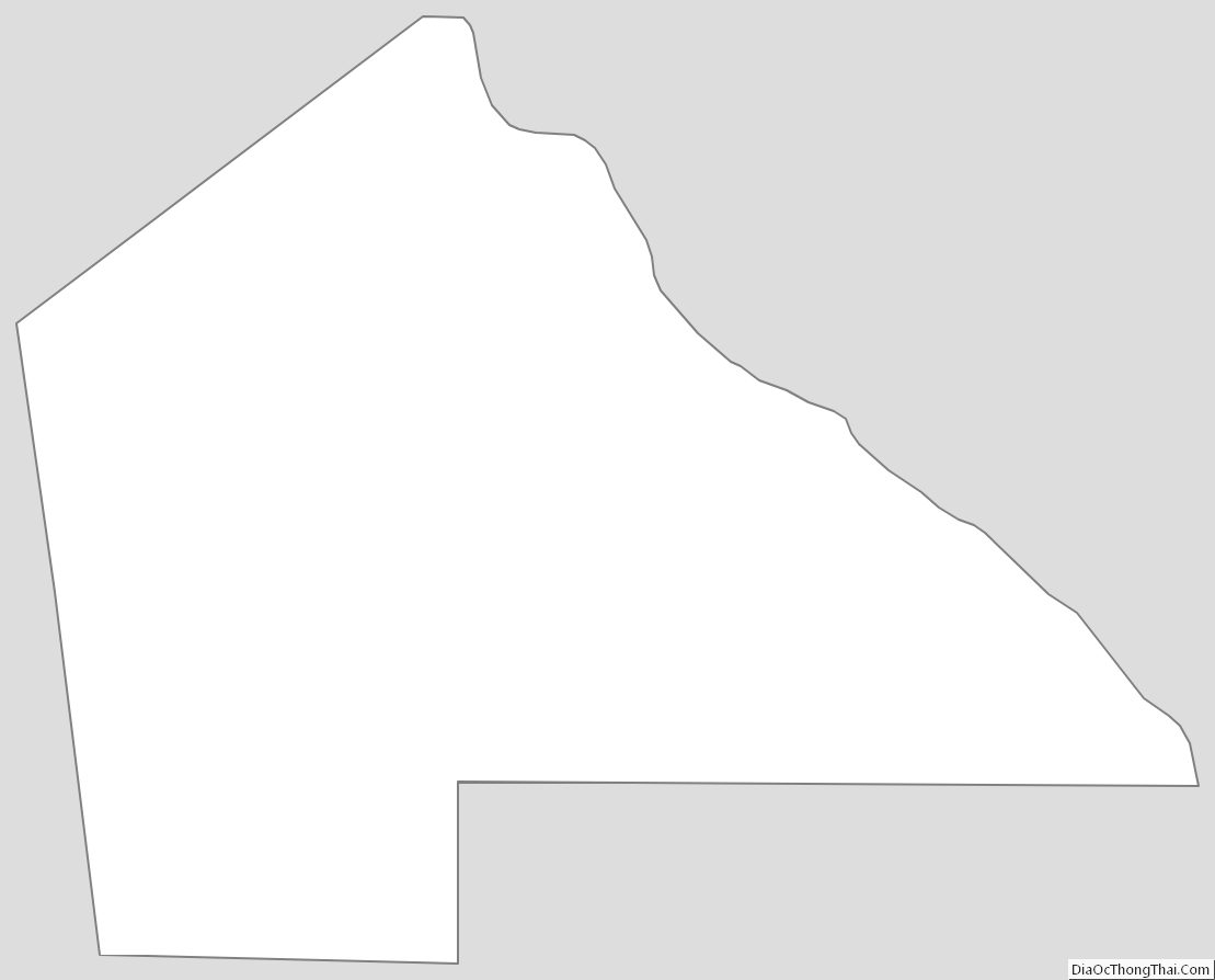
Pike County Outline Map
See also
Map of Missouri State and its subdivision:- Adair
- Andrew
- Atchison
- Audrain
- Barry
- Barton
- Bates
- Benton
- Bollinger
- Boone
- Buchanan
- Butler
- Caldwell
- Callaway
- Camden
- Cape Girardeau
- Carroll
- Carter
- Cass
- Cedar
- Chariton
- Christian
- Clark
- Clay
- Clinton
- Cole
- Cooper
- Crawford
- Dade
- Dallas
- Daviess
- De Kalb
- Dent
- Douglas
- Dunklin
- Franklin
- Gasconade
- Gentry
- Greene
- Grundy
- Harrison
- Henry
- Hickory
- Holt
- Howard
- Howell
- Iron
- Jackson
- Jasper
- Jefferson
- Johnson
- Knox
- Laclede
- Lafayette
- Lawrence
- Lewis
- Lincoln
- Linn
- Livingston
- Macon
- Madison
- Maries
- Marion
- McDonald
- Mercer
- Miller
- Mississippi
- Moniteau
- Monroe
- Montgomery
- Morgan
- New Madrid
- Newton
- Nodaway
- Oregon
- Osage
- Ozark
- Pemiscot
- Perry
- Pettis
- Phelps
- Pike
- Platte
- Polk
- Pulaski
- Putnam
- Ralls
- Randolph
- Ray
- Reynolds
- Ripley
- Saint Charles
- Saint Clair
- Saint Francois
- Saint Louis
- Sainte Genevieve
- Saline
- Schuyler
- Scotland
- Scott
- Shannon
- Shelby
- Stoddard
- Stone
- Sullivan
- Taney
- Texas
- Vernon
- Warren
- Washington
- Wayne
- Webster
- Worth
- Wright
- Alabama
- Alaska
- Arizona
- Arkansas
- California
- Colorado
- Connecticut
- Delaware
- District of Columbia
- Florida
- Georgia
- Hawaii
- Idaho
- Illinois
- Indiana
- Iowa
- Kansas
- Kentucky
- Louisiana
- Maine
- Maryland
- Massachusetts
- Michigan
- Minnesota
- Mississippi
- Missouri
- Montana
- Nebraska
- Nevada
- New Hampshire
- New Jersey
- New Mexico
- New York
- North Carolina
- North Dakota
- Ohio
- Oklahoma
- Oregon
- Pennsylvania
- Rhode Island
- South Carolina
- South Dakota
- Tennessee
- Texas
- Utah
- Vermont
- Virginia
- Washington
- West Virginia
- Wisconsin
- Wyoming