Pittsburg County is a county located in the U.S. state of Oklahoma. As of the 2010 census, the population was 45,837. Its county seat is McAlester. The county was formed from part of the Choctaw Nation in Indian Territory in 1907. County leaders believed that its coal production compared favorably with Pittsburgh, Pennsylvania at the time of statehood.
Pittsburg County comprises the McAlester, OK Micropolitan Statistical Area.
| Name: | Pittsburg County |
|---|---|
| FIPS code: | 40-121 |
| State: | Oklahoma |
| Founded: | 1907 |
| Seat: | McAlester |
| Largest city: | McAlester |
| Total Area: | 1,378 sq mi (3,570 km²) |
| Land Area: | 1,305 sq mi (3,380 km²) |
| Total Population: | 45,837 |
| Population Density: | 35/sq mi (14/km²) |
| Website: | pittsburg.okcounties.org |
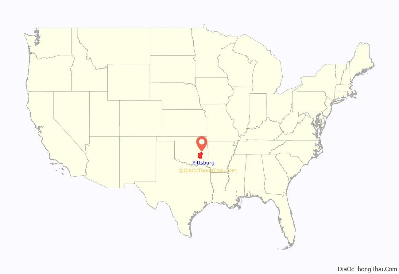
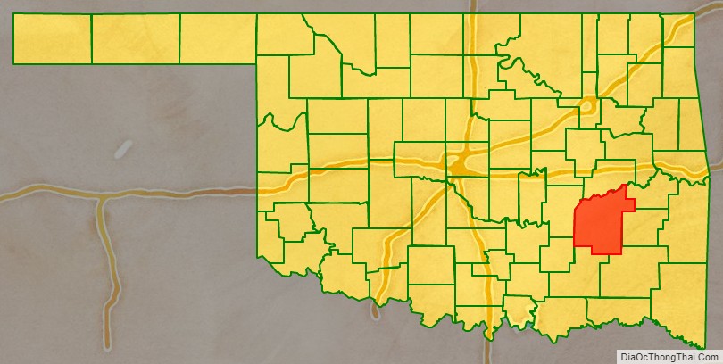
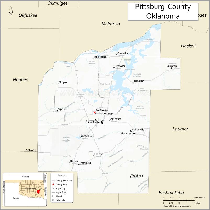
Pittsburg County location map. Where is Pittsburg County?
History
The area forming Pittsburg County was part of the Choctaw Nation after the Choctaw tribe was forced to relocate to Indian Territory from its home in the Southeastern United States in the early 1830s. Unlike the State of Oklahoma, whose county boundaries follow the precise north–south, east–west grid provided by Oklahoma’s township and range system, the Choctaw Nation established its internal divisions using easily recognizable landmarks, such as mountains and rivers, as borders. The territory of present-day Pittsburg County fell within two of the three administrative super-regions comprising the Choctaw Nation, the Moshulatubbee District and Pushmataha District, and within those districts, into Atoka County, Jack’s Fork County, Gaines County, Sans Bois County, and Tobucksy County.
Some important trails, including the Texas Road and one route of the California Trail passed through what is now Pittsburg County. In 1840, James Perry established a village called Perryville that became an important stop near the place where the two trails crossed. During the Civil War, Perryville served as an important supply depot for Confederate forces until the Union Army captured and burned the town. It became defunct after the Missouri, Kansas and Texas Railway (MK&T) bypassed it in 1872, and the remaining inhabitants moved to McAlester. The Butterfield Overland Mail route followed a route through this area.
James J. McAlester moved to the Choctaw Nation in 1872, opened a trading post and married a Chickasaw woman. This qualified him to obtain citizenship rights in the Choctaw and Chickasaw Nations. When the MK&T built its line, McAlester laid claim to the coal deposits in the Perryville area, which he and some partners leased to the Osage Coal and Mining Company, which was owned by the Missouri Pacific Railroad and acquired by the MK&T in 1888.
Pittsburg County was formed on July 16, 1907, as an original county from Choctaw land. County leaders, thinking its coal production compared favorably with Pittsburgh, Pennsylvania, named the new county after the Pennsylvania city with the “h” removed. Coal mining continued to expand until the early 20th century. Production began to decline after 1920, and never fully recovered. By 1966, the county production was no longer reported.
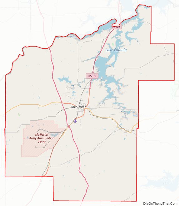
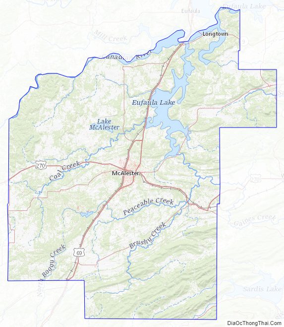
Pittsburg County Road Map
Geography
According to the U.S. Census Bureau, the county has a total area of 1,378 square miles (3,570 km), of which 1,305 square miles (3,380 km) is land and 72 square miles (190 km) (5.3%) is water. The county’s topography is generally hilly to mountainous. The Ouachita Mountains extend into the southeastern portion. The Canadian River drains most of the county and with Eufaula Lake form the northern boundary of the county. The southern part of the county is drained by several creeks that flow into the Kiamichi River and then into the Red River.
Adjacent counties
- McIntosh County (north)
- Haskell County (northeast)
- Latimer County (east)
- Pushmataha County (southeast)
- Atoka County (south)
- Coal County (southwest)
- Hughes County (west)
Pittsburg County Topographic Map
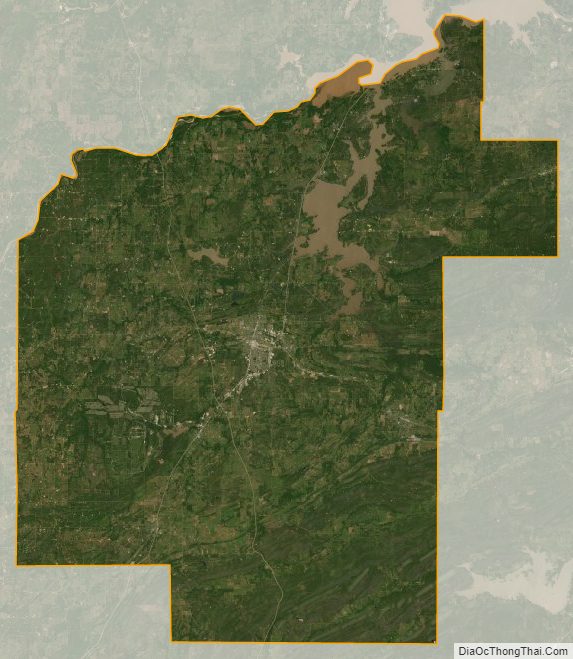
Pittsburg County Satellite Map
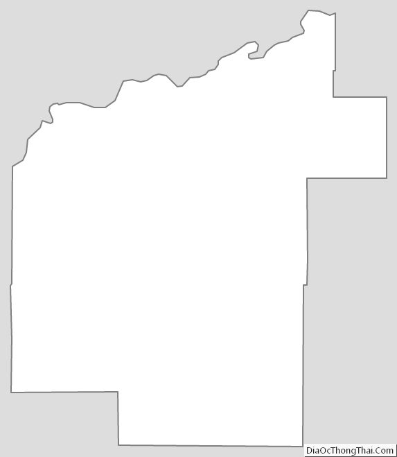
Pittsburg County Outline Map
See also
Map of Oklahoma State and its subdivision:- Adair
- Alfalfa
- Atoka
- Beaver
- Beckham
- Blaine
- Bryan
- Caddo
- Canadian
- Carter
- Cherokee
- Choctaw
- Cimarron
- Cleveland
- Coal
- Comanche
- Cotton
- Craig
- Creek
- Custer
- Delaware
- Dewey
- Ellis
- Garfield
- Garvin
- Grady
- Grant
- Greer
- Harmon
- Harper
- Haskell
- Hughes
- Jackson
- Jefferson
- Johnston
- Kay
- Kingfisher
- Kiowa
- Latimer
- Le Flore
- Lincoln
- Logan
- Love
- Major
- Marshall
- Mayes
- McClain
- McCurtain
- McIntosh
- Murray
- Muskogee
- Noble
- Nowata
- Okfuskee
- Oklahoma
- Okmulgee
- Osage
- Ottawa
- Pawnee
- Payne
- Pittsburg
- Pontotoc
- Pottawatomie
- Pushmataha
- Roger Mills
- Rogers
- Seminole
- Sequoyah
- Stephens
- Texas
- Tillman
- Tulsa
- Wagoner
- Washington
- Washita
- Woods
- Woodward
- Alabama
- Alaska
- Arizona
- Arkansas
- California
- Colorado
- Connecticut
- Delaware
- District of Columbia
- Florida
- Georgia
- Hawaii
- Idaho
- Illinois
- Indiana
- Iowa
- Kansas
- Kentucky
- Louisiana
- Maine
- Maryland
- Massachusetts
- Michigan
- Minnesota
- Mississippi
- Missouri
- Montana
- Nebraska
- Nevada
- New Hampshire
- New Jersey
- New Mexico
- New York
- North Carolina
- North Dakota
- Ohio
- Oklahoma
- Oregon
- Pennsylvania
- Rhode Island
- South Carolina
- South Dakota
- Tennessee
- Texas
- Utah
- Vermont
- Virginia
- Washington
- West Virginia
- Wisconsin
- Wyoming