| Name: | Placer County |
|---|---|
| FIPS code: | 06-061 |
| State: | California |
| Founded: | 1851 |
| Named for: | Placer mining, a reference to the area being a center of the California Gold Rush |
| Seat: | Auburn |
| Largest city: | Roseville |
| Total Area: | 1,502 sq mi (3,890 km²) |
| Land Area: | 1,407 sq mi (3,640 km²) |
| Total Population: | 404,739 |
| Population Density: | 270/sq mi (100/km²) |
| Time zone: | UTC−8 (Pacific Time Zone) |
| Summer Time Zone (DST): | UTC−7 (Pacific Daylight Time) |
| Website: | www.placer.ca.gov |
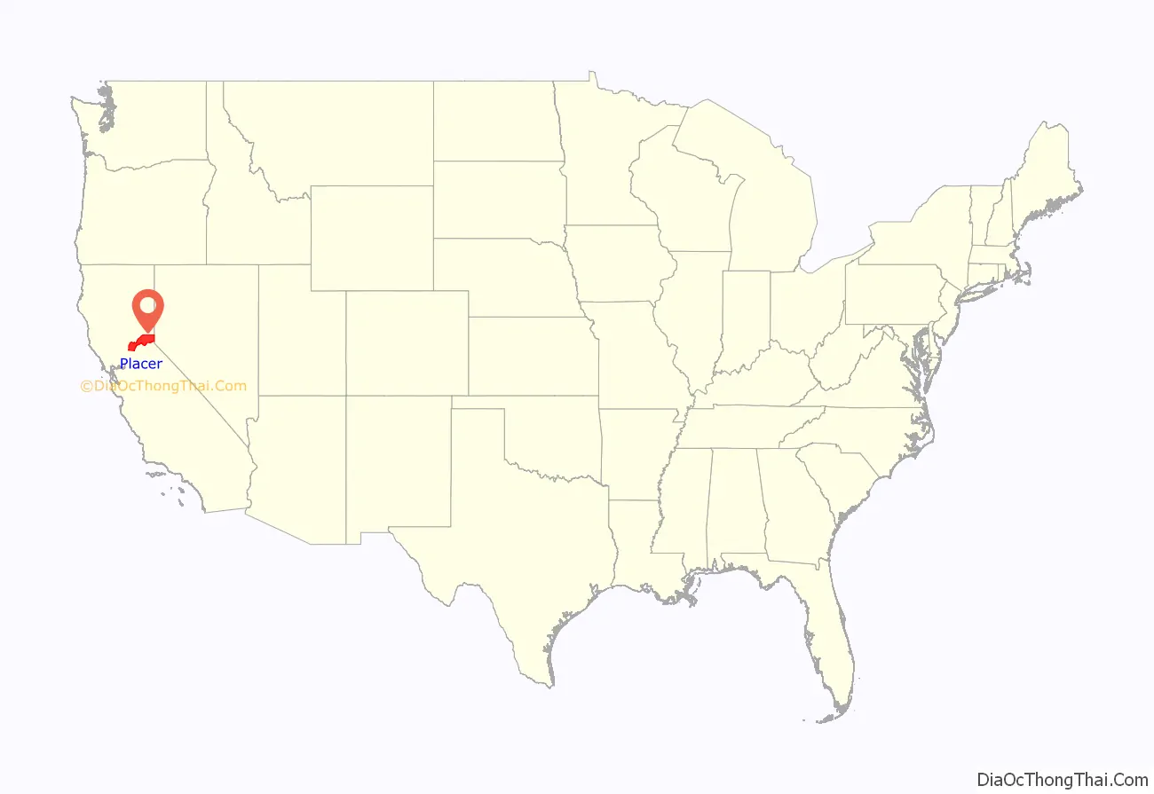
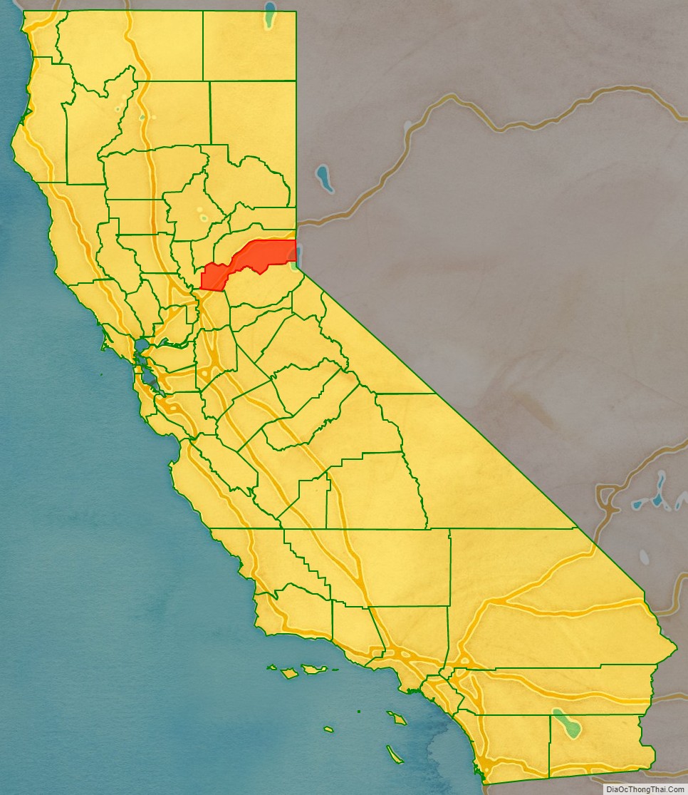
Placer County location map. Where is Placer County?
History
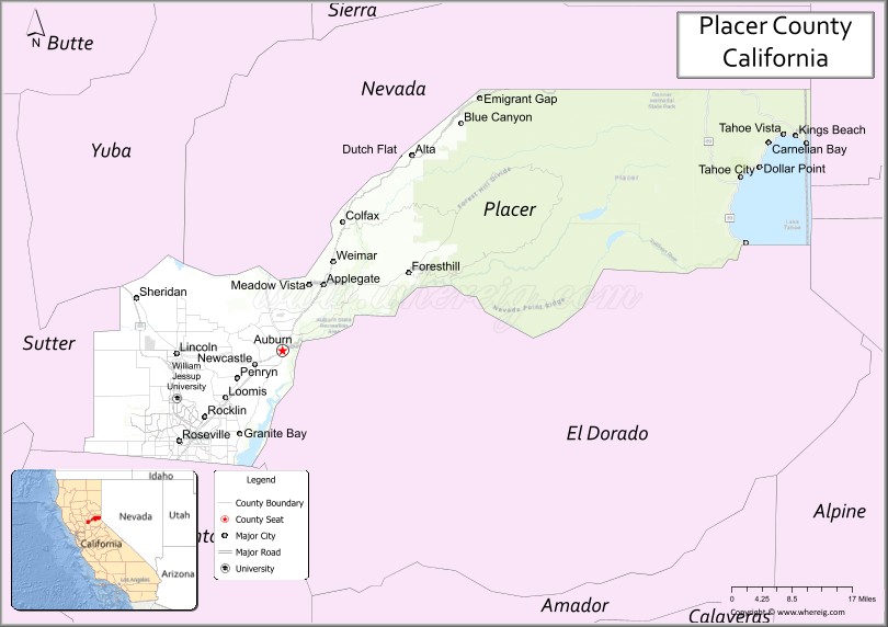
Gold mining was a major industry through the 1880s, but gradually the new residents turned to farming the fertile foothill soil, harvesting timber and working for the Southern Pacific Railroad. Auburn was settled when Claude Chana discovered gold in Auburn Ravine in May 1848 and later became a shipping and supply center for the surrounding gold camps. The cornerstone of Placer’s courthouse, which is clearly visible from Interstate 80 through Auburn, was laid on July 4, 1894. The building was renovated during the late 1980s and continues to serve the public with courtrooms, a sheriff’s office and the Placer County Museum. Roseville, once a small agricultural center, became a major railroad center and grew to the county’s most populous city after Southern Pacific Railroad moved its railroad switching yards there in 1908.
Loomis and Newcastle began as mining towns, but soon became centers of a booming fruit-growing industry, supporting many local packing houses. Penryn was founded by a Welsh miner, Griffith Griffith, who established a large granite quarry. Rocklin began as a railroad town and became home to a number of granite quarries. Lincoln and Sheridan continue to support ranching and farming. Lincoln also is the home of one of the county’s oldest businesses, the Gladding, McBean terra cotta clay manufacturing plant, established in 1875.
The 1960 Winter Olympics were hosted in Squaw Valley, in Placer County.
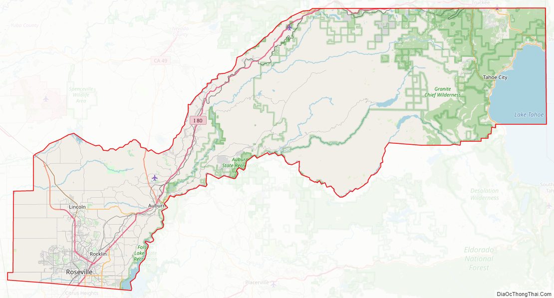
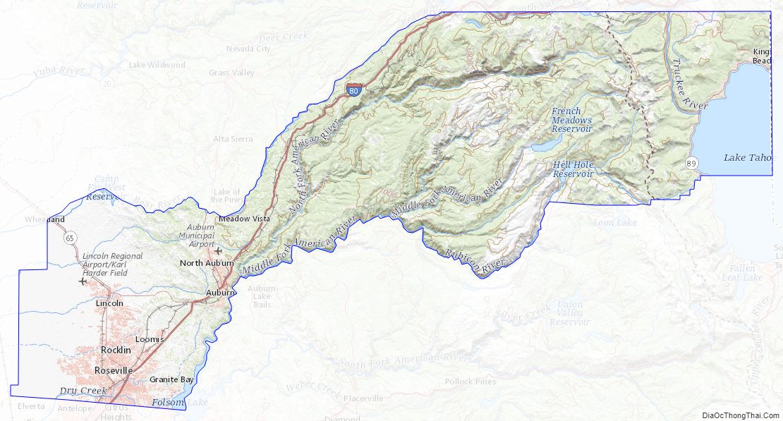
Placer County Road Map
Geography
According to the U.S. Census Bureau, the county has an area of 1,502 square miles (3,890 km), of which 1,407 square miles (3,640 km) is land and 95 square miles (250 km) (6.4%) is water. Watercourses in Placer County include the American River and Bunch Creek. 40.96% of Lake Tahoe’s surface area is in Placer County, more than in any of the four other counties in which it lies.
Adjacent counties
- Nevada County – north
- Washoe County, Nevada – northeast
- Carson City, Nevada – east
- Douglas County, Nevada – southeast
- El Dorado County – south
- Sacramento County – southwest
- Sutter County – west
- Yuba County – northwest
National protected areas
- Eldorado National Forest in part
- Tahoe National Forest in part
Placer County Topographic Map
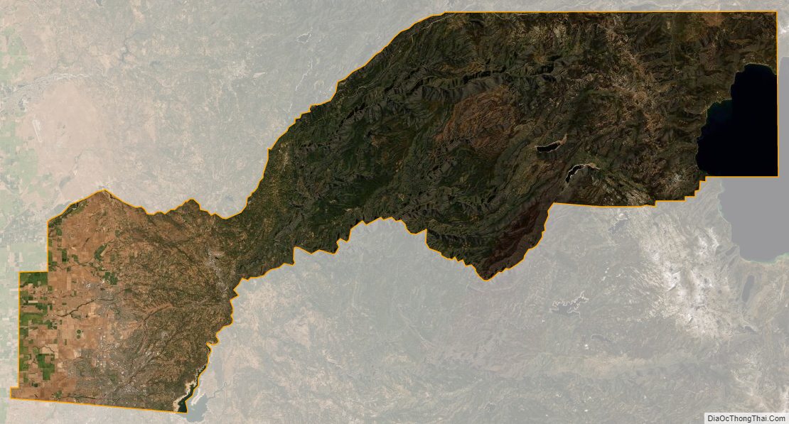
Placer County Satellite Map
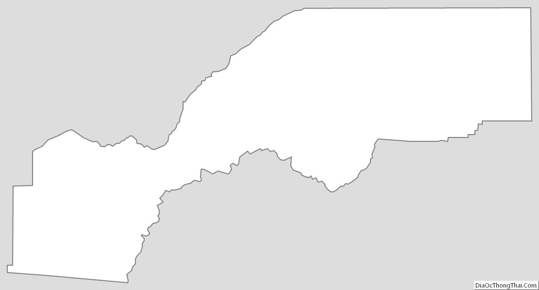
Placer County Outline Map
See also
Map of California State and its subdivision:- Alameda
- Alpine
- Amador
- Butte
- Calaveras
- Colusa
- Contra Costa
- Del Norte
- El Dorado
- Fresno
- Glenn
- Humboldt
- Imperial
- Inyo
- Kern
- Kings
- Lake
- Lassen
- Los Angeles
- Madera
- Marin
- Mariposa
- Mendocino
- Merced
- Modoc
- Mono
- Monterey
- Napa
- Nevada
- Orange
- Placer
- Plumas
- Riverside
- Sacramento
- San Benito
- San Bernardino
- San Diego
- San Francisco
- San Joaquin
- San Luis Obispo
- San Mateo
- Santa Barbara
- Santa Clara
- Santa Cruz
- Shasta
- Sierra
- Siskiyou
- Solano
- Sonoma
- Stanislaus
- Sutter
- Tehama
- Trinity
- Tulare
- Tuolumne
- Ventura
- Yolo
- Yuba
- Alabama
- Alaska
- Arizona
- Arkansas
- California
- Colorado
- Connecticut
- Delaware
- District of Columbia
- Florida
- Georgia
- Hawaii
- Idaho
- Illinois
- Indiana
- Iowa
- Kansas
- Kentucky
- Louisiana
- Maine
- Maryland
- Massachusetts
- Michigan
- Minnesota
- Mississippi
- Missouri
- Montana
- Nebraska
- Nevada
- New Hampshire
- New Jersey
- New Mexico
- New York
- North Carolina
- North Dakota
- Ohio
- Oklahoma
- Oregon
- Pennsylvania
- Rhode Island
- South Carolina
- South Dakota
- Tennessee
- Texas
- Utah
- Vermont
- Virginia
- Washington
- West Virginia
- Wisconsin
- Wyoming