Plumas County (/ˈpluːməs/ (listen)) is a county in the Sierra Nevada of the U.S. state of California. As of the 2020 census, the population was 19,790. The county seat is Quincy, and the only incorporated city is Portola. The largest community in the county is East Quincy. The county was named for the Spanish Río de las Plumas (the Feather River), which flows through it. The county itself is also the namesake of a native moth species, Hadena plumasata.
| Name: | Plumas County |
|---|---|
| FIPS code: | 06-063 |
| State: | California |
| Founded: | 1854 |
| Named for: | Spanish words for the Feather River (Río de las Plumas) |
| Seat: | Quincy |
| Total Area: | 2,613 sq mi (6,770 km²) |
| Land Area: | 2,553 sq mi (6,610 km²) |
| Total Population: | 19,790 |
| Population Density: | 7.6/sq mi (2.9/km²) |
| Time zone: | UTC-8 (Pacific Standard Time) |
| Summer Time Zone (DST): | UTC-7 (Pacific Daylight Time) |
| Website: | www.countyofplumas.com |
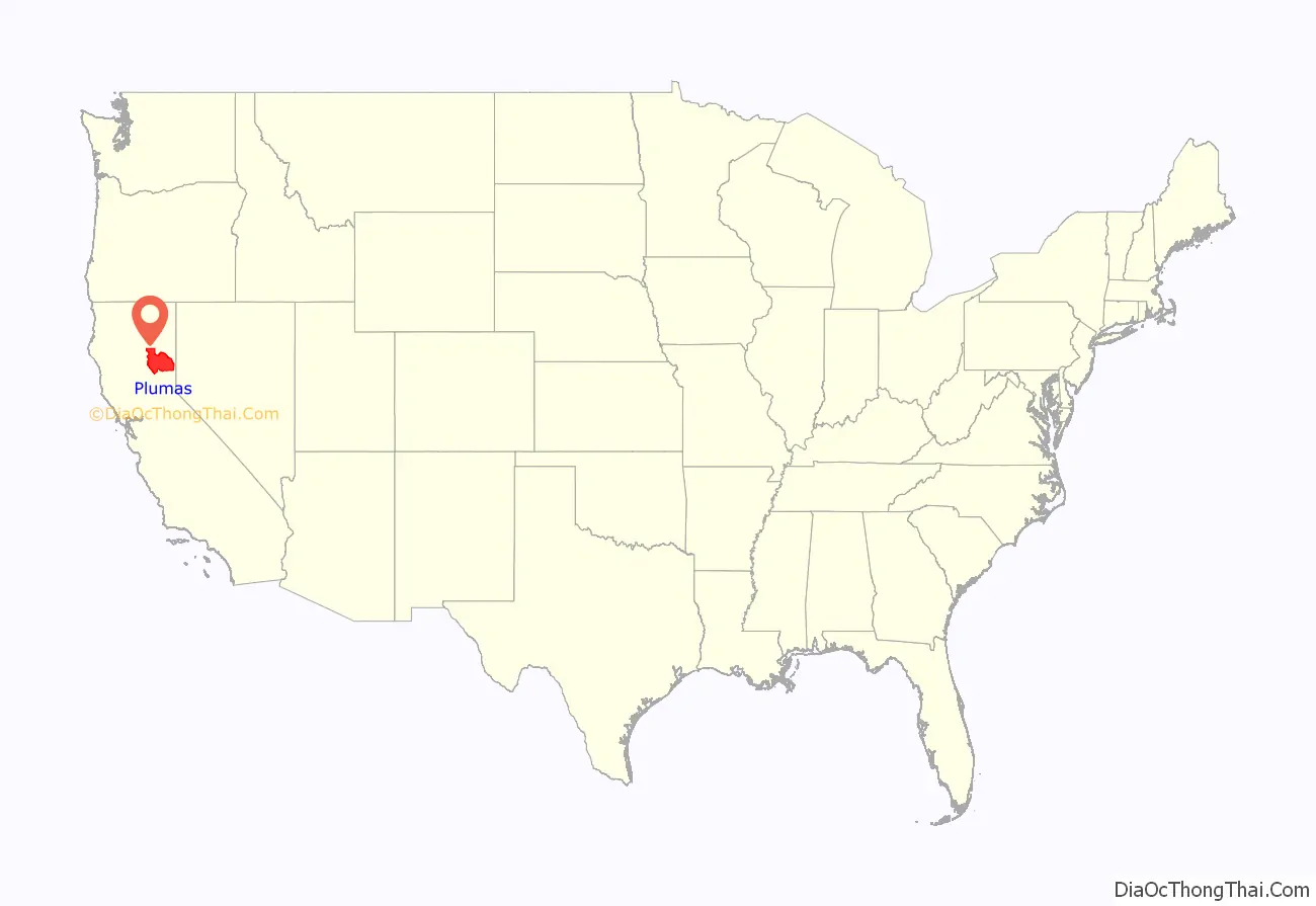
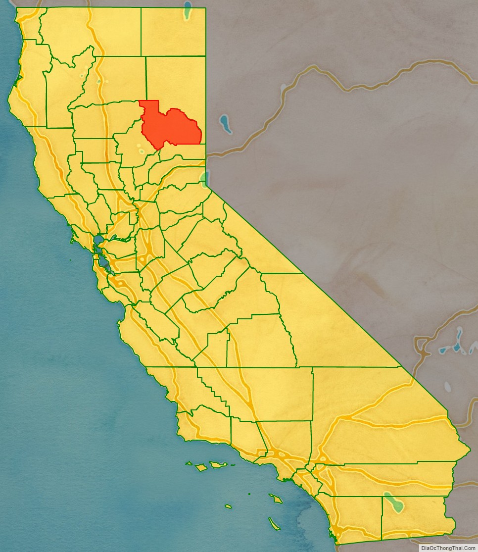
Plumas County location map. Where is Plumas County?
History
Prehistorically, the indigenous Mountain Maidu were the primary inhabitants of the area now known as Plumas County. The Maidu lived in small settlements along the edges of valleys, subsisting on roots, acorns, grasses, seeds, and occasionally fish and big game. They were decentralized and had no tribal leadership; most bands lived along waterways in and around their own valleys. Areas with high snowfall, including the Mohawk and Sierra valleys, were hunting grounds for game in the warmer months.
In 1848, European Americans discovered gold in the Sierra foothills. Miners were attracted to Plumas County in particular, largely due to the tales of Thomas Stoddard, who claimed to have discovered a lake lined with gold nuggets while lost in the wilderness. Gold-hungry prospectors flooded the area. Though hopeful miners scoured the glacial lakes for months, they did not find the purported lake of gold. But some had success panning for gold in the rivers and creeks in the area, and created squatters’ villages, the first non-Native American settlements.
Rough shanty towns quickly sprang up around successful mining areas, including Rich Bar, Indian Bar, and Rabbit Creek (now La Porte). Many were developed adjacent to the Feather River, named Río de las Plumas by Spanish explorer Captain Luis Arguello in 1820.
In 1850, African-American frontiersman James Beckwourth discovered the lowest pass through the Sierras, which became known as Beckwourth Pass. Using the pass, he blazed a trail from Western Nevada through much of Plumas County, eventually terminating in the Sacramento Valley. Many erstwhile miners followed this trail into Plumas County. Beckwourth also set up a trading post in the western Sierra Valley that still stands today. Though the Beckwourth Trail was longer than the original emigrant trail that ran south of Plumas County, its lower elevations extended its seasonal use when the higher trail was snowbound and impassable. Between 1851 and 1854, the Beckwourth Trail was frequently traveled, but in 1854, use dropped sharply when it became a toll road. The toll to move a ton of freight from Bidwell Bar to Quincy was about $18. This made using the Beckwourth Road an expensive enterprise and use of the Beckwourth Trail declined.
Plumas County was formed in 1854 during a meeting of three commissioners at the American Ranch in Quincy. It was carved from the eastern portion of Butte County. Quincy, originally a mining town, was chosen as the county seat after an early settler donated a plot of land there to establish the seat. Once it became the seat, nearby Elizabethtown faded and ultimately became defunct. In 1864, the state legislature took a large portion of Plumas County to organize Lassen County. Shortly afterward, Plumas County annexed part of Sierra County, including the prosperous mining town of La Porte.
Over the next decades, different industries drove the growth of the various settlements that sprung up around the county. Greenville began as a mining and farming community in Indian Valley in the late 1850s. Chester was formed near the area that is now Lake Almanor, as a result of cattle ranching and the timber industry.
When the Western Pacific Railroad was constructed in 1910, Portola developed as an important railroad stop. Thanks to the railroad, Plumas County could export its lumber beyond the local area, and the timber industry became dominant in the county’s economy for decades. As the railroad route extended up the Feather River Canyon, it was also used by the area’s first tourists and sightseers. When the Feather River Highway was completed in 1937 with federal investment in infrastructure by President Franklin D. Roosevelt during the Great Depression, Plumas County became linked to the Sacramento Valley year-round thanks to the route’s low elevation.
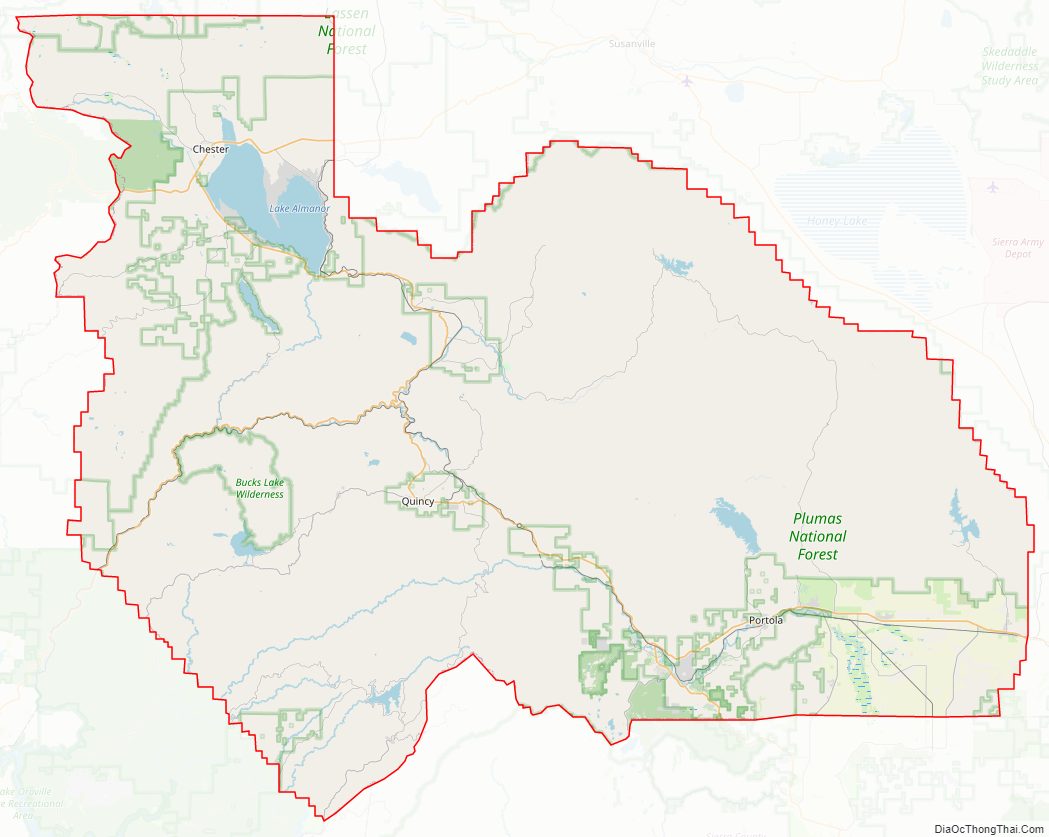
Plumas County Road Map

Geography
According to the U.S. Census Bureau, the county has an area of 2,613 square miles (6,770 km), of which 2,553 square miles (6,610 km) is land and 60 square miles (160 km) (2.3%) is water.
Plumas County is in the far northern end of the Sierra Nevada range. The area’s rugged terrain marks the transition point between the northern Sierra Nevada and the southern end of the Cascade Range. Lassen Peak, the southernmost volcanic peak in the Cascade Range, is just north of Plumas County’s border, and part of Lassen Volcanic National Park extends into the county’s northwest corner.
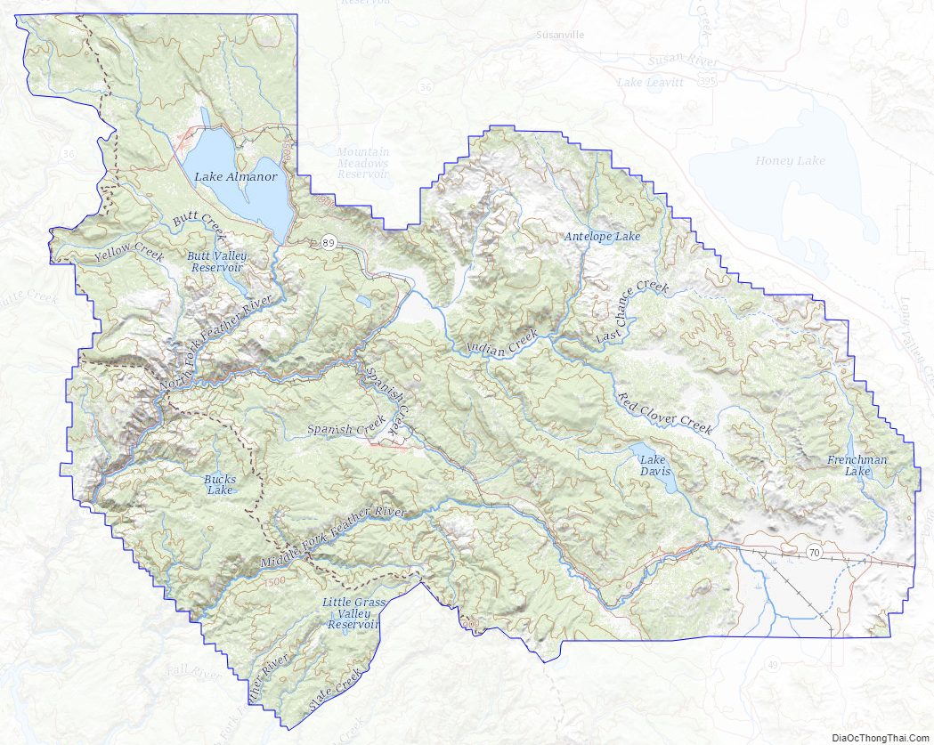
Plumas National Forest’s 1,200,000 acres (4,900 km) offer a wide variety of outdoor recreation opportunities, including hiking, camping, kayaking, swimming, mountain biking, hunting and fishing. The area has more than 100 natural and artificial lakes. Many of the natural lakes are glacial in origin and can be found in and around Lakes Basin Recreation Area. The artificial lakes include Lake Almanor, Lake Davis, Frenchman Lake, Little Grass Valley Reservoir, Antelope Lake, and Bucks Lake. Plumas County also has more than 1,000 miles (1,600 km) of rivers and streams. All three forks of the Feather River run through the area.
Designated Natural Areas
- Butterfly Valley Botanical Area
- Elephants Playground
- Happy Valley
- Little Last Chance Canyon Special Interest Area
- North Valley
- Valley Creek Special Interest Area
Water areas
Adjacent counties
- Sierra County – south
- Yuba County – southwest
- Butte County – west
- Tehama County – northwest
- Shasta County – northwest
- Lassen County – northeast
National protected areas
- Lassen National Forest (part)
- Lassen Volcanic National Park (part)
- Plumas National Forest (part)
- Tahoe National Forest (part)
Plumas County Topographic Map
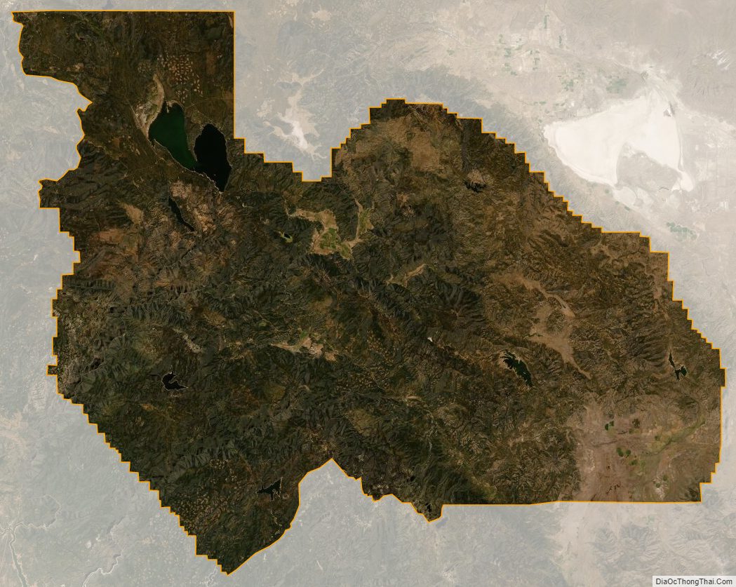
Plumas County Satellite Map
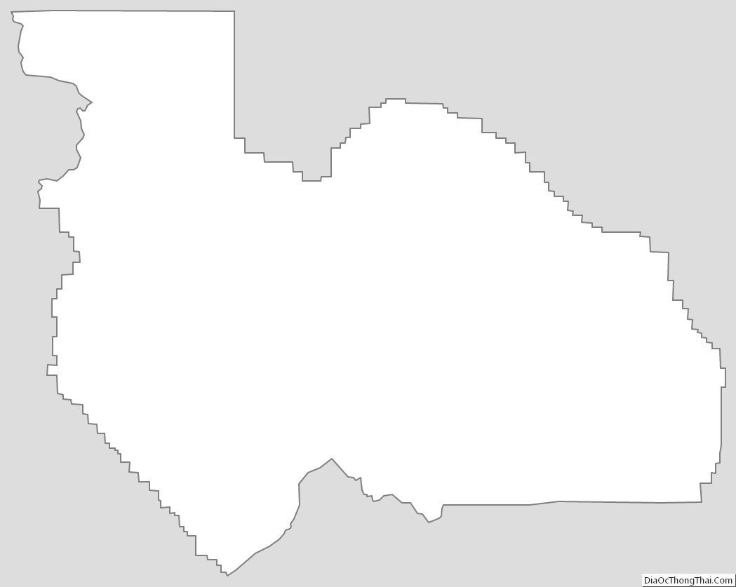
Plumas County Outline Map
See also
Map of California State and its subdivision:- Alameda
- Alpine
- Amador
- Butte
- Calaveras
- Colusa
- Contra Costa
- Del Norte
- El Dorado
- Fresno
- Glenn
- Humboldt
- Imperial
- Inyo
- Kern
- Kings
- Lake
- Lassen
- Los Angeles
- Madera
- Marin
- Mariposa
- Mendocino
- Merced
- Modoc
- Mono
- Monterey
- Napa
- Nevada
- Orange
- Placer
- Plumas
- Riverside
- Sacramento
- San Benito
- San Bernardino
- San Diego
- San Francisco
- San Joaquin
- San Luis Obispo
- San Mateo
- Santa Barbara
- Santa Clara
- Santa Cruz
- Shasta
- Sierra
- Siskiyou
- Solano
- Sonoma
- Stanislaus
- Sutter
- Tehama
- Trinity
- Tulare
- Tuolumne
- Ventura
- Yolo
- Yuba
- Alabama
- Alaska
- Arizona
- Arkansas
- California
- Colorado
- Connecticut
- Delaware
- District of Columbia
- Florida
- Georgia
- Hawaii
- Idaho
- Illinois
- Indiana
- Iowa
- Kansas
- Kentucky
- Louisiana
- Maine
- Maryland
- Massachusetts
- Michigan
- Minnesota
- Mississippi
- Missouri
- Montana
- Nebraska
- Nevada
- New Hampshire
- New Jersey
- New Mexico
- New York
- North Carolina
- North Dakota
- Ohio
- Oklahoma
- Oregon
- Pennsylvania
- Rhode Island
- South Carolina
- South Dakota
- Tennessee
- Texas
- Utah
- Vermont
- Virginia
- Washington
- West Virginia
- Wisconsin
- Wyoming