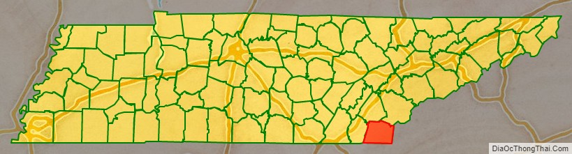
Polk County is a county located in the southeastern corner of the U.S. state of Tennessee. As of the 2020 United States census, its population was 17,544. Its county seat is Benton. The county was created on November 28, 1839, from parts of Bradley and McMinn counties, after final removal of most Cherokee from the region that year. The county was named after then-governor (and future president) James K. Polk. Polk County is included in the Cleveland, Tennessee Metropolitan Area Statistical Area, which is also included in the Chattanooga–Cleveland–Dalton, TN–GA–AL Combined Statistical Area.
| Name: | Polk County |
|---|---|
| FIPS code: | 47-139 |
| State: | Tennessee |
| Founded: | November 28, 1839 |
| Named for: | James K. Polk |
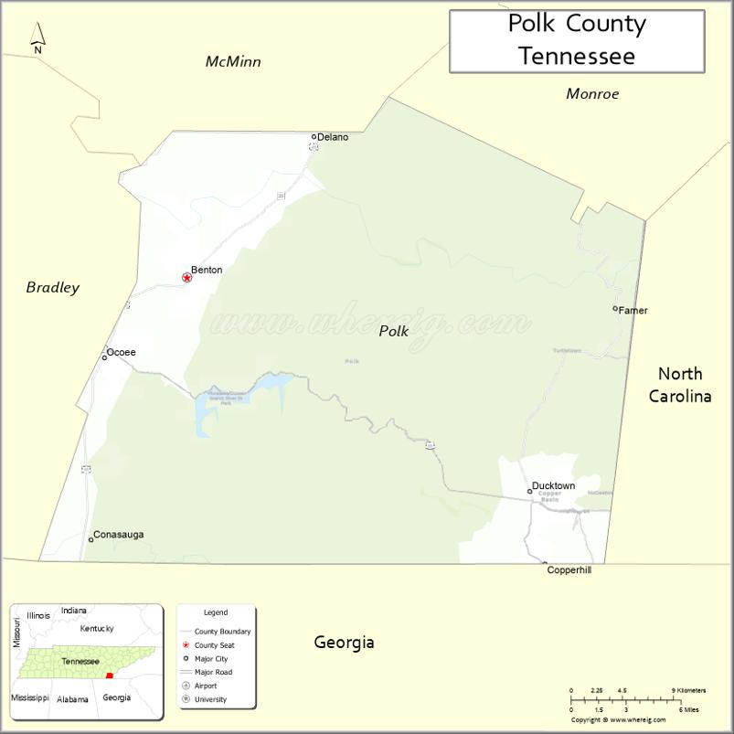
| Seat: | Benton |
| Largest town: | Benton |
| Total Area: | 442 sq mi (1,140 km²) |
| Land Area: | 435 sq mi (1,130 km²) |
| Total Population: | 17,544 |
| Population Density: | 40.33/sq mi (15.57/km²) |
| Time zone: | UTC−5 (Eastern) |
| Summer Time Zone (DST): | UTC−4 (EDT) |
| Website: | www.polkgovernment.com |
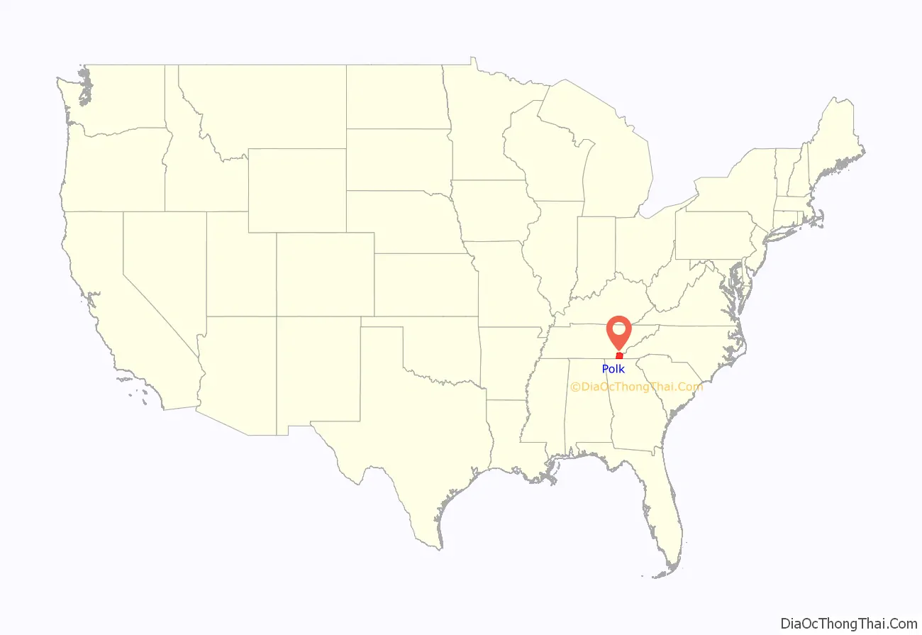
Polk County location map. Where is Polk County?
History
Prior to the settlement of the Europeans, Polk County was inhabited by the Cherokee, and before them, thousands of years of indigenous cultures. The portion of Polk County north of the Hiwassee River was ceded by the Cherokee Nation to the US in the Calhoun Treaty of 1819. The rest of the county was part of the Ocoee District. The Cherokee were forcibly removed from here in 1838-1839 and taken to Indian Territory, in a passage that became known as the Trail of Tears.
Polk County was created by an act of the Tennessee General Assembly on November 23, 1839. The location for the county seat of Benton was chosen by an election held on February 4, 1840.
Copper was discovered in Ducktown in 1843. By the 1850s, a large mining operation was underway in southeastern Polk County; the area became known as the Copper Basin. This operation continued until 1987, when the last mine closed.
During the Civil War, Polk County was one of only six counties in East Tennessee to support the Confederacy, voting in favor of Tennessee’s ordinance of secession in June 1861. During the war, the copper mines supplied about 90% of the Confederacy’s copper; their capture by Union forces after the Confederate defeat at the Battles for Chattanooga in November 1863 proved a major blow to the Confederacy. On November 29, 1864, a series of raids by Confederate bushwhacker John P. Gatewood in Polk County resulted in at least 16 deaths.
The East Tennessee Power Company, later the Tennessee Electric Power Company (TEPCO), constructed two hydroelectric dams on the Ocoee River, Ocoee Dams 1 and 2, which were completed in 1911 and 1913, respectively.
TEPCO was later purchased by the Tennessee Valley Authority (TVA), founded in 1933. It constructed an additional dam on this river, Ocoee Dam No. 3, completed in 1943, as well as the powerhouse for Apalachia Dam on the Hiwassee River in northern Polk County, which was also completed in 1943.
In 1973, a large music festival known as the “Midwest Monster Peace Jubilee and Music Festival”, commonly known as the “Monster Peace Jubilee”, was planned by Indiana-based promoter C.F. Manifest Inc. to take place on a 1,300-acre farm north of Benton on Labor Day of that year. The farm was owned by the county executive. (It has been redeveloped as the Chilhowee Gliderport.) Nicknamed “Polkstock” due to its resemblance to 1969’s Woodstock in Bethel, New York, the event was expected to attract approximately 500,000 people. Locals strongly opposed it, especially members of the religious communities, who believed the festival would bring much of the perceived rock music culture. The festival was eventually halted by the state circuit court, on the request of the district attorney, who said that the festival would constitute a public nuisance, due to drug, health, and traffic problems.
On May 27, 1983, a massive explosion at a secret illegal fireworks factory killed eleven workers. The operation, located on a bait farm a few miles south of Benton, was unlicensed. It produced M-80 and M-100 fireworks, both illegal, and was the largest illegal fireworks operation in the United States to date.
The Ocoee Whitewater Center was the site of the canoe slalom events for the 1996 Summer Olympics, based in Atlanta, Georgia.
In April 2019, Polk County was the first county in Tennessee to become a “gun sanctuary”, or Second Amendment sanctuary.
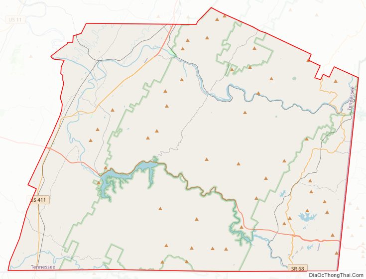
Polk County Road Map
Geography
According to the U.S. Census Bureau, the county has a total area of 442 square miles (1,140 km), of which 435 square miles (1,130 km) is land and 7.7 square miles (20 km) (1.7%) is water. As the most southeastern county in Tennessee, it is the state’s only county to share borders with both Georgia and North Carolina.
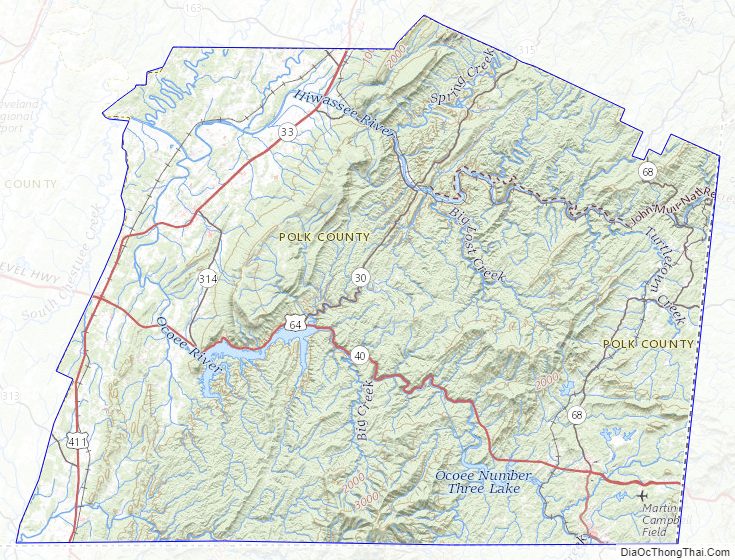
Most of the terrain of Polk County is mountainous, constituting part of the southern Blue Ridge Mountains, among the southern Appalachian Mountains. The western edge of the county is part of the Ridge-and-Valley Appalachians, which comprise about one-sixth of the county’s land area. The Copper Basin is located in the extreme southeastern part of Polk County. Big Frog Mountain, at an elevation of 4,224 ft (1,287 m), is the county’s highest point; west of Big Frog Mountain there is no higher point until the Black Hills of South Dakota or the Guadalupe Mountains of Texas. About 80% of the land area of Polk County is now part of the Cherokee National Forest, covering most of the Blue Ridge portion of the county except for the Copper Basin and other small tracts. Most of the Ridge-and-Valley portion of the county is privately owned.
The Ocoee River, site of whitewater slalom events in the Atlanta 1996 Summer Olympic Games, runs through Polk County and is vital to one of the county’s major industries, whitewater rafting. The calmer Hiwassee River, a tributary of the Tennessee River which flows through northern Polk County, is also used for rafting and tubing. The Conasauga River, the only river in Tennessee that is not part of the Mississippi River Basin, is located in southwestern Polk County. Most of the population of Polk County lives in the Ridge-and-Valley western portion of the county and the Copper Basin.
Adjacent counties
- Monroe County (northeast)
- Cherokee County, North Carolina (east)
- Fannin County, Georgia (southeast)
- Murray County, Georgia (southwest)
- Bradley County (west)
- McMinn County (northwest)
National protected areas
- Big Frog Wilderness (part)
- Cherokee National Forest (part)
State protected areas
- William L. Davenport Refuge
- Ducktown Basin Museum and Burra Burra Mine (state historic site)
- Fourth Fractional Township Wildlife Management Area
- Hiwassee/Ocoee Scenic River State Park
Polk County Topographic Map
Polk County Satellite Map

Polk County Outline Map

See also
Map of Tennessee State and its subdivision:- Anderson
- Bedford
- Benton
- Bledsoe
- Blount
- Bradley
- Campbell
- Cannon
- Carroll
- Carter
- Cheatham
- Chester
- Claiborne
- Clay
- Cocke
- Coffee
- Crockett
- Cumberland
- Davidson
- Decatur
- DeKalb
- Dickson
- Dyer
- Fayette
- Fentress
- Franklin
- Gibson
- Giles
- Grainger
- Greene
- Grundy
- Hamblen
- Hamilton
- Hancock
- Hardeman
- Hardin
- Hawkins
- Haywood
- Henderson
- Henry
- Hickman
- Houston
- Humphreys
- Jackson
- Jefferson
- Johnson
- Knox
- Lake
- Lauderdale
- Lawrence
- Lewis
- Lincoln
- Loudon
- Macon
- Madison
- Marion
- Marshall
- Maury
- McMinn
- McNairy
- Meigs
- Monroe
- Montgomery
- Moore
- Morgan
- Obion
- Overton
- Perry
- Pickett
- Polk
- Putnam
- Rhea
- Roane
- Robertson
- Rutherford
- Scott
- Sequatchie
- Sevier
- Shelby
- Smith
- Stewart
- Sullivan
- Sumner
- Tipton
- Trousdale
- Unicoi
- Union
- Van Buren
- Warren
- Washington
- Wayne
- Weakley
- White
- Williamson
- Wilson
- Alabama
- Alaska
- Arizona
- Arkansas
- California
- Colorado
- Connecticut
- Delaware
- District of Columbia
- Florida
- Georgia
- Hawaii
- Idaho
- Illinois
- Indiana
- Iowa
- Kansas
- Kentucky
- Louisiana
- Maine
- Maryland
- Massachusetts
- Michigan
- Minnesota
- Mississippi
- Missouri
- Montana
- Nebraska
- Nevada
- New Hampshire
- New Jersey
- New Mexico
- New York
- North Carolina
- North Dakota
- Ohio
- Oklahoma
- Oregon
- Pennsylvania
- Rhode Island
- South Carolina
- South Dakota
- Tennessee
- Texas
- Utah
- Vermont
- Virginia
- Washington
- West Virginia
- Wisconsin
- Wyoming