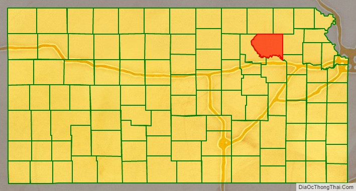
Pottawatomie County (standard abbreviation: PT) is a county located in the U.S. state of Kansas. As of the 2020 census, the county population was 25,348. The county seat is Westmoreland. The county takes its name from the Potawatomi tribe of Native Americans.
| Name: | Pottawatomie County |
|---|---|
| FIPS code: | 20-149 |
| State: | Kansas |
| Founded: | February 20, 1857 |
| Named for: | Potawatomi people |
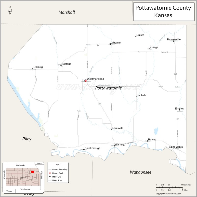
| Seat: | Westmoreland |
| Largest city: | Manhattan |
| Total Area: | 862 sq mi (2,230 km²) |
| Land Area: | 841 sq mi (2,180 km²) |
| Total Population: | 25,348 |
| Population Density: | 30.1/sq mi (11.6/km²) |
| Time zone: | UTC−6 (Central) |
| Summer Time Zone (DST): | UTC−5 (CDT) |
| Website: | pottcounty.org |
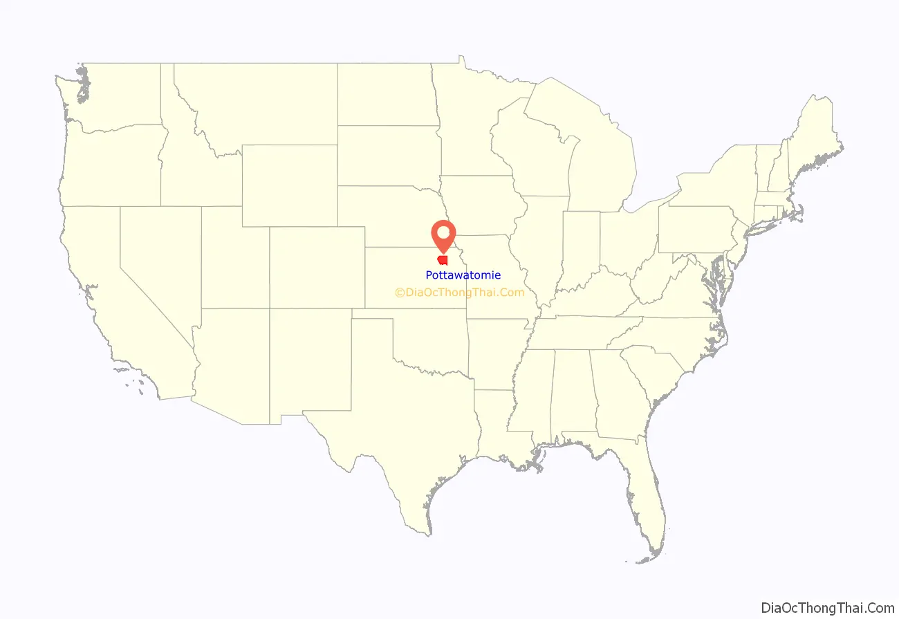
Pottawatomie County location map. Where is Pottawatomie County?
History
Early history
For millennia, the Great Plains of North America were inhabited by nomadic Native Americans. From the 16th to 18th centuries, the Kingdom of France claimed ownership of large parts of North America. In 1762, after the French and Indian War, France secretly ceded New France to Spain, by the Treaty of Fontainebleau.
19th century
In 1802, Spain returned most of the land to France, keeping title to about 7,500 square miles. In 1803, most of the land for modern day Kansas was acquired by the United States from France as part of the 828,000 square mile Louisiana Purchase.
In 1854, the Kansas Territory was organized under the provisions of the Kansas–Nebraska Act, then in 1861 Kansas became the 34th U.S. state.
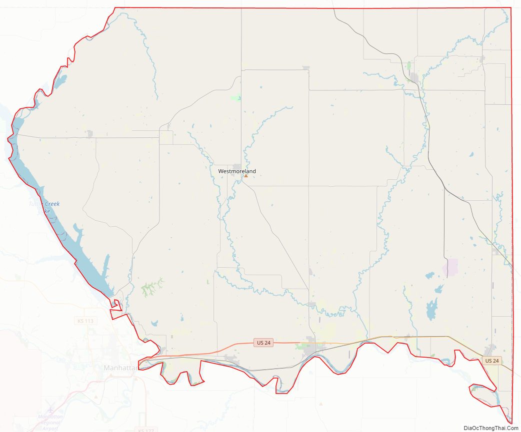
In 1857, Pottawatomie County was established by the Kansas Territorial legislature, out of land formerly included in Riley County. The present county seat of Westmoreland was selected by a vote held in 1882.
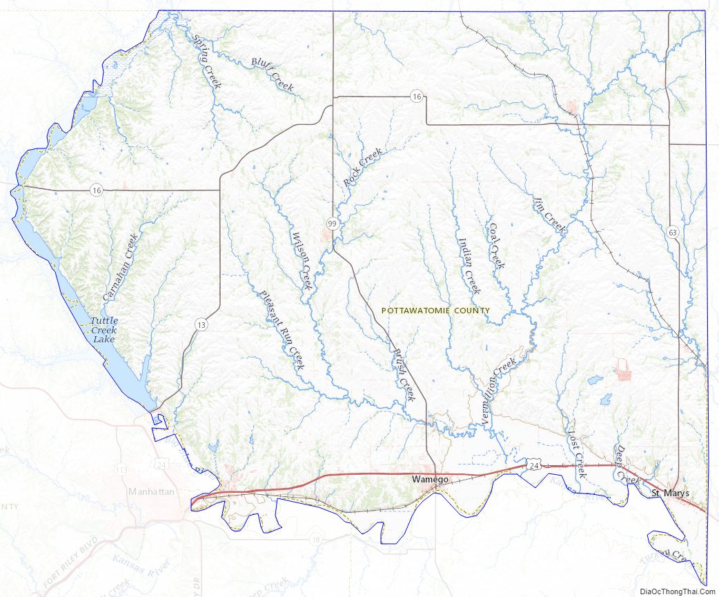
Pottawatomie County Road Map
Geography
According to the U.S. Census Bureau, the county has a total area of 862 square miles (2,230 km), of which 841 square miles (2,180 km) is land and 21 square miles (54 km) (2.4%) is water.
Adjacent counties
- Marshall County (north)
- Nemaha County (northeast)
- Jackson County (east)
- Shawnee County (southeast)
- Wabaunsee County (south)
- Riley County (west)
Pottawatomie County Topographic Map
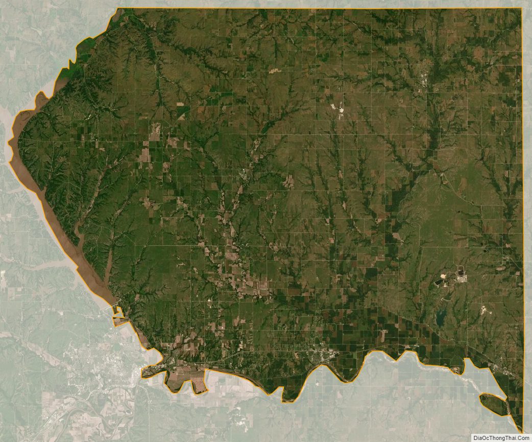
Pottawatomie County Satellite Map
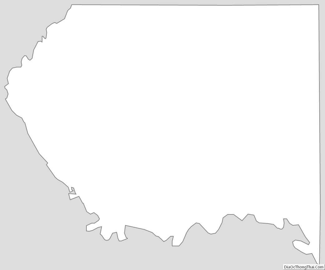
Pottawatomie County Outline Map
See also
Map of Kansas State and its subdivision:- Allen
- Anderson
- Atchison
- Barber
- Barton
- Bourbon
- Brown
- Butler
- Chase
- Chautauqua
- Cherokee
- Cheyenne
- Clark
- Clay
- Cloud
- Coffey
- Comanche
- Cowley
- Crawford
- Decatur
- Dickinson
- Doniphan
- Douglas
- Edwards
- Elk
- Ellis
- Ellsworth
- Finney
- Ford
- Franklin
- Geary
- Gove
- Graham
- Grant
- Gray
- Greeley
- Greenwood
- Hamilton
- Harper
- Harvey
- Haskell
- Hodgeman
- Jackson
- Jefferson
- Jewell
- Johnson
- Kearny
- Kingman
- Kiowa
- Labette
- Lane
- Leavenworth
- Lincoln
- Linn
- Logan
- Lyon
- Marion
- Marshall
- McPherson
- Meade
- Miami
- Mitchell
- Montgomery
- Morris
- Morton
- Nemaha
- Neosho
- Ness
- Norton
- Osage
- Osborne
- Ottawa
- Pawnee
- Phillips
- Pottawatomie
- Pratt
- Rawlins
- Reno
- Republic
- Rice
- Riley
- Rooks
- Rush
- Russell
- Saline
- Scott
- Sedgwick
- Seward
- Shawnee
- Sheridan
- Sherman
- Smith
- Stafford
- Stanton
- Stevens
- Sumner
- Thomas
- Trego
- Wabaunsee
- Wallace
- Washington
- Wichita
- Wilson
- Woodson
- Wyandotte
- Alabama
- Alaska
- Arizona
- Arkansas
- California
- Colorado
- Connecticut
- Delaware
- District of Columbia
- Florida
- Georgia
- Hawaii
- Idaho
- Illinois
- Indiana
- Iowa
- Kansas
- Kentucky
- Louisiana
- Maine
- Maryland
- Massachusetts
- Michigan
- Minnesota
- Mississippi
- Missouri
- Montana
- Nebraska
- Nevada
- New Hampshire
- New Jersey
- New Mexico
- New York
- North Carolina
- North Dakota
- Ohio
- Oklahoma
- Oregon
- Pennsylvania
- Rhode Island
- South Carolina
- South Dakota
- Tennessee
- Texas
- Utah
- Vermont
- Virginia
- Washington
- West Virginia
- Wisconsin
- Wyoming