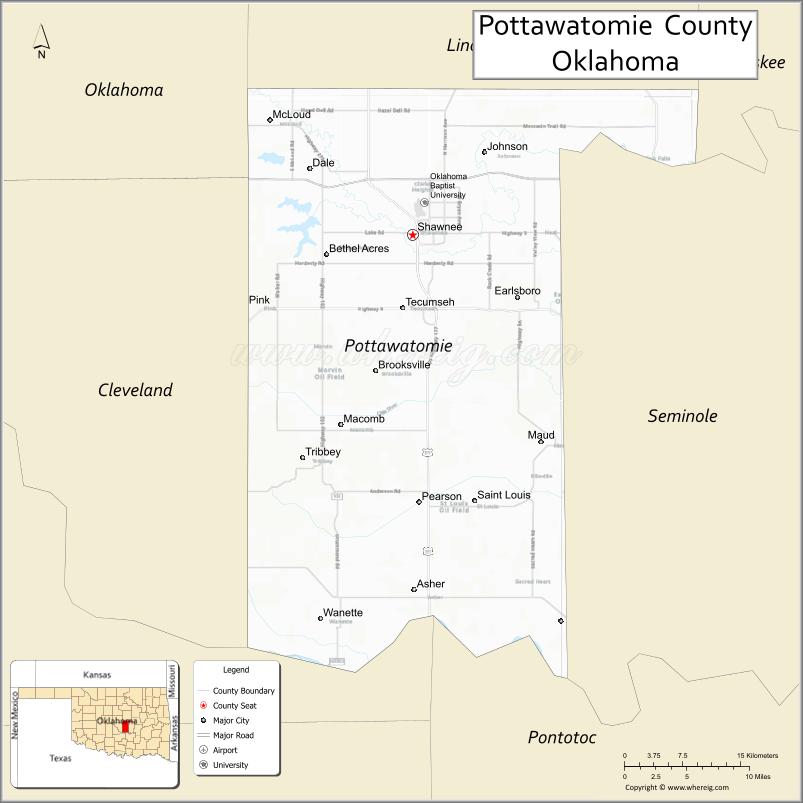
Pottawatomie County is a county located in the U.S. state of Oklahoma. As of the 2020 census, the population was 72,454. Its county seat is Shawnee.
Pottawatomie County is part of the Shawnee, OK Micropolitan Statistical Area, which is included in the Oklahoma City–Shawnee, OK Combined Statistical Area.
| Name: | Pottawatomie County |
|---|---|
| FIPS code: | 40-125 |
| State: | Oklahoma |
| Founded: | 1891 |
| Named for: | Potawatomi people |
| Seat: | Shawnee |
| Largest city: | Shawnee |
| Total Area: | 793 sq mi (2,050 km²) |
| Land Area: | 788 sq mi (2,040 km²) |
| Total Population: | 72,454 |
| Population Density: | 91/sq mi (35/km²) |
| Time zone: | UTC−6 (Central) |
| Summer Time Zone (DST): | UTC−5 (CDT) |
| Website: | pottawatomiecountyok.com |
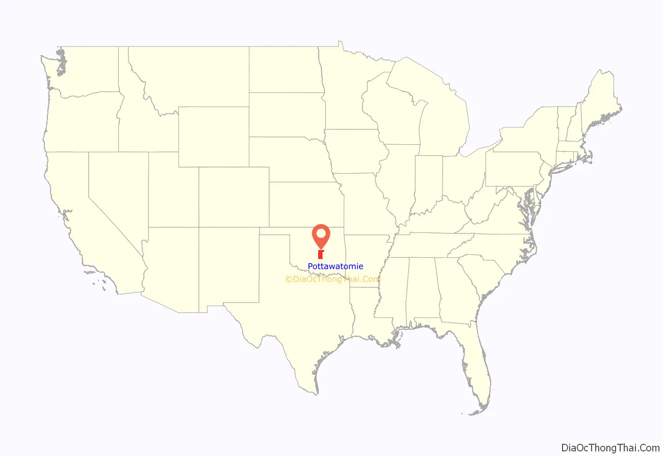
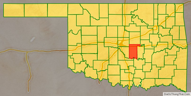
Pottawatomie County location map. Where is Pottawatomie County?
History
Pottawatomie County was carved out of land originally given to the Creek and Seminole after their forced removal from Georgia and Florida. After the Civil War, the Creek and Seminole were forced to cede their lands back to the federal government, and the area of Pottawatomie County was used to resettle the Iowa, Sac and Fox, Absentee Shawnee, Potawatomi and Kickapoo tribes.
Non-Indian settlement began on September 22, 1891, when all the tribes except the Kickapoo agreed to land allotment, where communal reservation land was divided and allotted to individual members of the tribes. The remaining land was opened to settlement.
During the land run, Pottawatomie County was organized as County “B” with Tecumseh as the county seat. In 1892, the voters of the county elected to rename County “B” as Pottawatomie County after the Potawatomi Indians.
In 1895, the Kickapoo gave up their land rights and their land was given away to white settlers in the last land run in Oklahoma.
In 1930, Shawnee, now bigger in size than Tecumseh, was approved by the voters to become the new county seat. The Pottawatomie County Court House was built in 1934 by the Public Works Administration. The court house project cost $250,000 to complete.
On May 19, 2013, during an outbreak of tornadoes, a mobile home park was nearly destroyed, killing a 79-year-old man and injuring at least six others as well as damaging at least 35 structures. Frame and brick homes west of Shawnee were also affected.
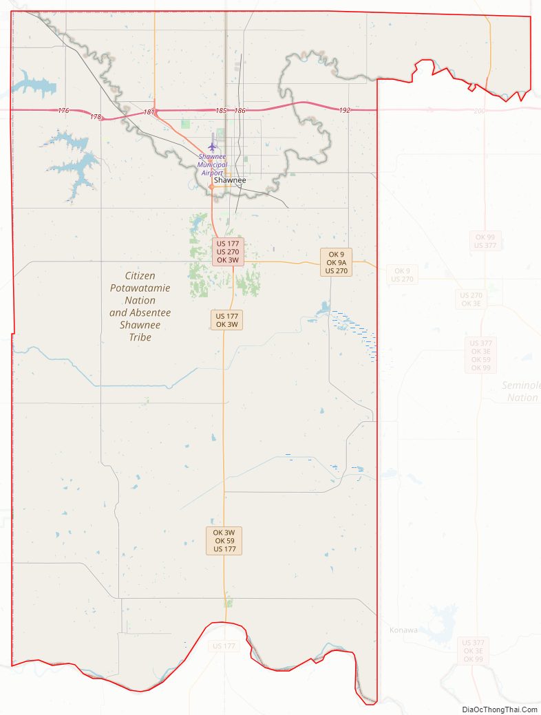
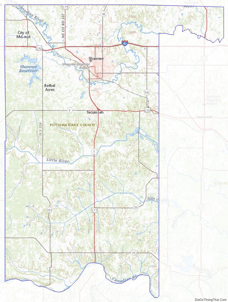
Pottawatomie County Road Map
Geography
According to the U.S. Census Bureau, the county has a total area of 793 square miles (2,050 km), of which 788 square miles (2,040 km) is land and 5.7 square miles (15 km) (0.7%) is water.
Adjacent counties
- Lincoln County (north)
- Okfuskee County (northeast)
- Seminole County (east)
- Pontotoc County (southeast)
- McClain County (southwest)
- Cleveland County (west)
- Oklahoma County (northwest)
Pottawatomie County Topographic Map
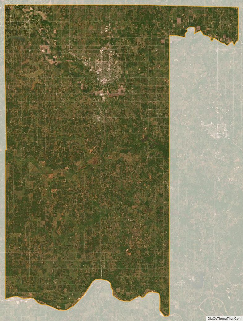
Pottawatomie County Satellite Map
Pottawatomie County Outline Map

See also
Map of Oklahoma State and its subdivision:- Adair
- Alfalfa
- Atoka
- Beaver
- Beckham
- Blaine
- Bryan
- Caddo
- Canadian
- Carter
- Cherokee
- Choctaw
- Cimarron
- Cleveland
- Coal
- Comanche
- Cotton
- Craig
- Creek
- Custer
- Delaware
- Dewey
- Ellis
- Garfield
- Garvin
- Grady
- Grant
- Greer
- Harmon
- Harper
- Haskell
- Hughes
- Jackson
- Jefferson
- Johnston
- Kay
- Kingfisher
- Kiowa
- Latimer
- Le Flore
- Lincoln
- Logan
- Love
- Major
- Marshall
- Mayes
- McClain
- McCurtain
- McIntosh
- Murray
- Muskogee
- Noble
- Nowata
- Okfuskee
- Oklahoma
- Okmulgee
- Osage
- Ottawa
- Pawnee
- Payne
- Pittsburg
- Pontotoc
- Pottawatomie
- Pushmataha
- Roger Mills
- Rogers
- Seminole
- Sequoyah
- Stephens
- Texas
- Tillman
- Tulsa
- Wagoner
- Washington
- Washita
- Woods
- Woodward
- Alabama
- Alaska
- Arizona
- Arkansas
- California
- Colorado
- Connecticut
- Delaware
- District of Columbia
- Florida
- Georgia
- Hawaii
- Idaho
- Illinois
- Indiana
- Iowa
- Kansas
- Kentucky
- Louisiana
- Maine
- Maryland
- Massachusetts
- Michigan
- Minnesota
- Mississippi
- Missouri
- Montana
- Nebraska
- Nevada
- New Hampshire
- New Jersey
- New Mexico
- New York
- North Carolina
- North Dakota
- Ohio
- Oklahoma
- Oregon
- Pennsylvania
- Rhode Island
- South Carolina
- South Dakota
- Tennessee
- Texas
- Utah
- Vermont
- Virginia
- Washington
- West Virginia
- Wisconsin
- Wyoming