Potter County is a county located in the U.S. state of Texas. As of the 2020 census, its population was 118,525. Its county seat is Amarillo. The county was created in 1876 and organized in 1887. It is named for Robert Potter, a politician, signer of the Texas Declaration of Independence, and the Texas Secretary of the Navy.
Potter County is included in the Amarillo metropolitan area.
| Name: | Potter County |
|---|---|
| FIPS code: | 48-375 |
| State: | Texas |
| Founded: | 1887 |
| Named for: | Robert Potter |
| Seat: | Amarillo |
| Largest city: | Amarillo |
| Total Area: | 922 sq mi (2,390 km²) |
| Land Area: | 908 sq mi (2,350 km²) |
| Total Population: | 118,525 |
| Population Density: | 130/sq mi (50/km²) |
| Time zone: | UTC−6 (Central) |
| Summer Time Zone (DST): | UTC−5 (CDT) |
| Website: | www.mypottercounty.com |
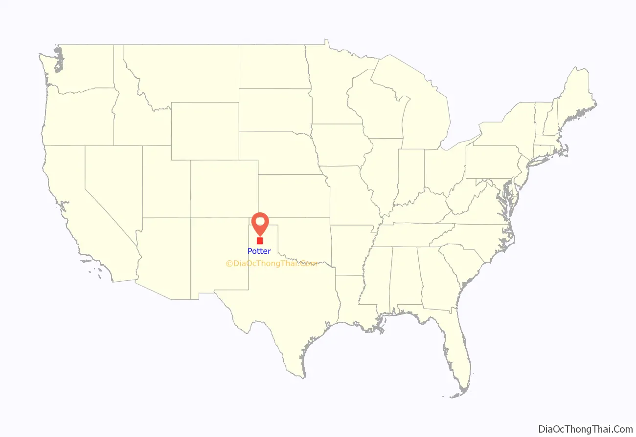
Potter County location map. Where is Potter County?
History
LX Ranch
The LX Ranch was established in the county by W.H. “Deacon” Bates and David T. Beals by 1877. In July 1876, Bates, along with some cowboys that included Charlie Siringo, established a herd of steers and ranch headquarters along Ranch Creek on the north bank of the Canadian River. The headquarters eventually included a bunkhouse, kitchen, storeroom, stables, corrals, blacksmith shop, wagon sheds, and a post office named Wheeler. The LX also established the county’s first cemetery. The ranch eventually extended from Dumas to the Palo Duro Canyon and 35 miles east to west. By 1884, the ranch encompassed 187,000 acres, 45,000 cattle, and 1000 horses, when the operation was sold to the American Pastoral Company. In 1902, the ranch headquarters were moved to Bonita Creek, on the south bank of the Canadian River. On 6 October 1910, that company sold 30,354 acres south of the river to Lee Bivins, and on 1 June 1911, R.B. “Ben” Masterson acquired 89,139 acres on the north side. On 19 May 1915, Bivins bought an additional 53,329 LX acres, which included the LX brand.
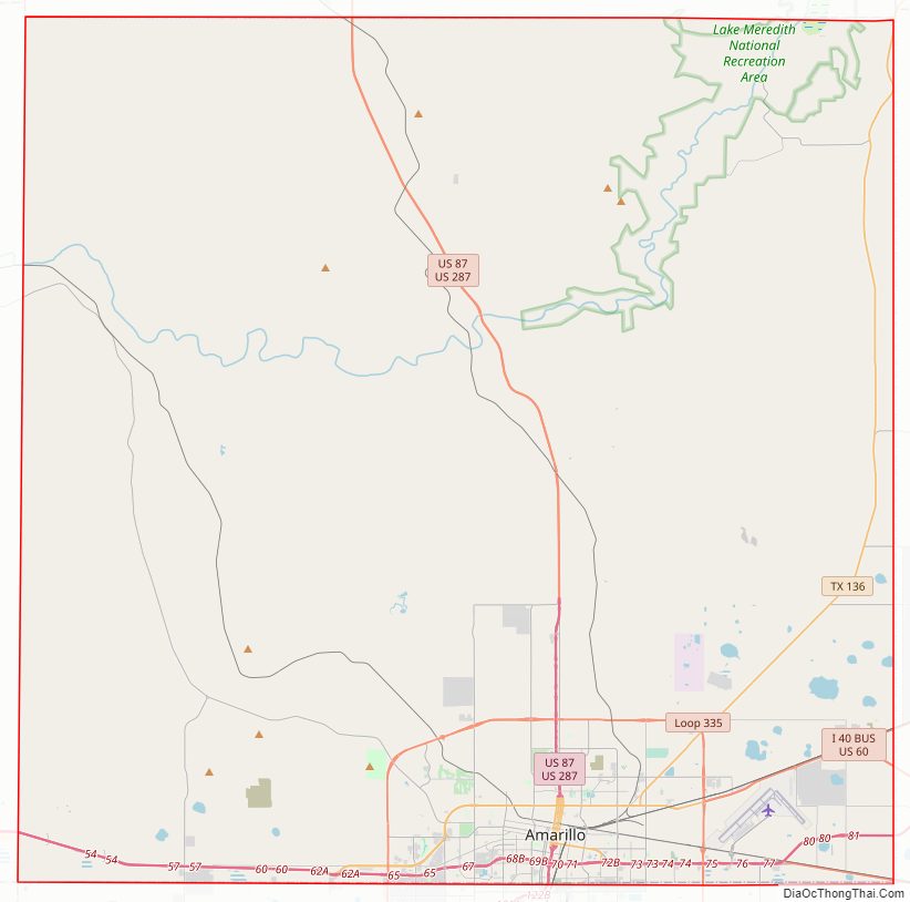
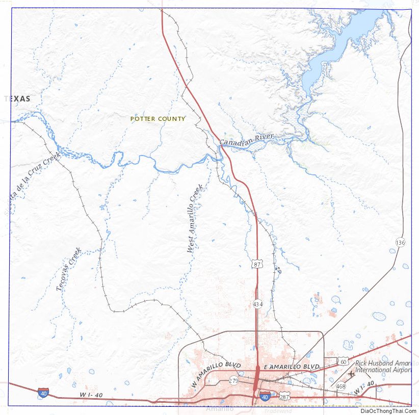
Potter County Road Map
Geography
According to the U.S. Census Bureau, the county has a total area of 922 square miles (2,390 km), of which 14 square miles (36 km) (1.5%) are covered by water.
Major highways
- I-27
- I-40
- I-40 BL
- US 60
- US 66
- US 87
- US 287
- SH 136
- SH 279
- Loop 335
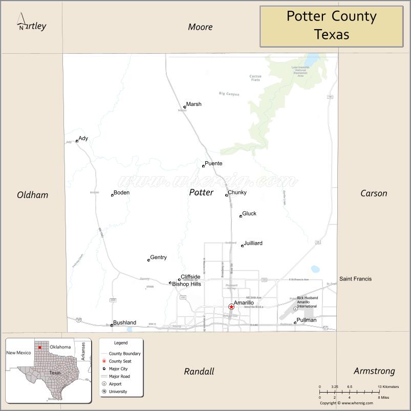
Adjacent counties
- Moore County (north)
- Hutchinson County (northeast)
- Carson County (east)
- Armstrong County (southeast)
- Randall County (south)
- Deaf Smith County (southwest)
- Oldham County (west)
- Hartley County (northwest)
National protected areas
- Alibates Flint Quarries National Monument
- Lake Meredith National Recreation Area (part)
Potter County Topographic Map
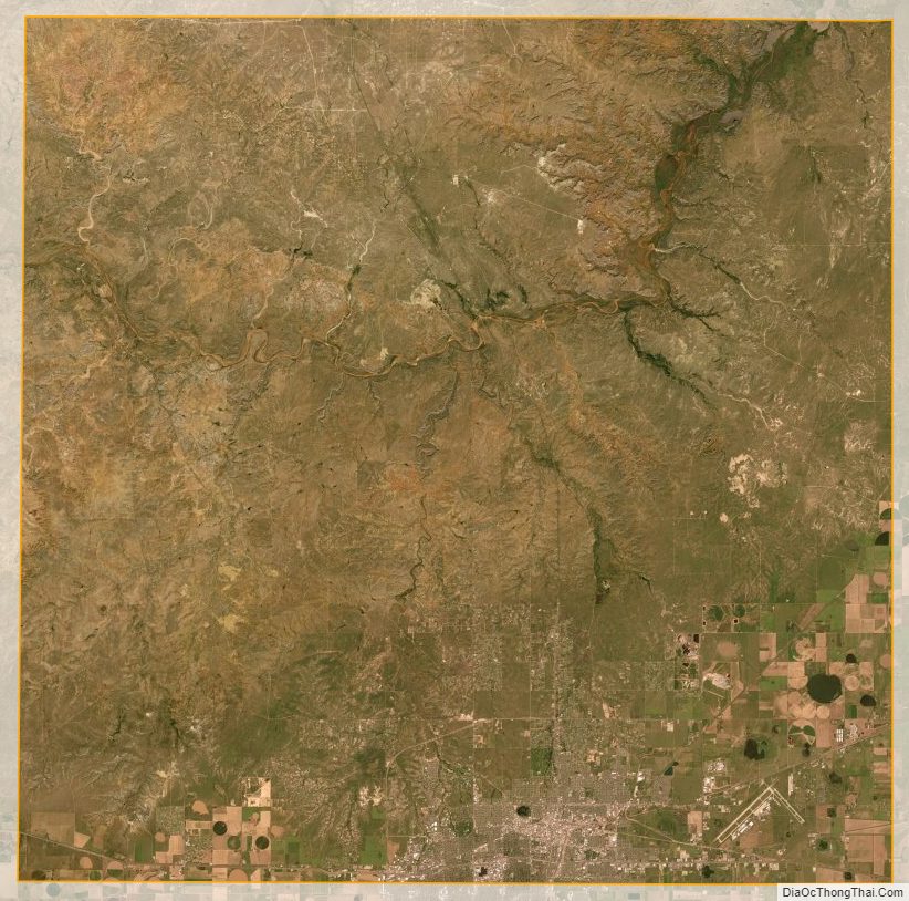
Potter County Satellite Map
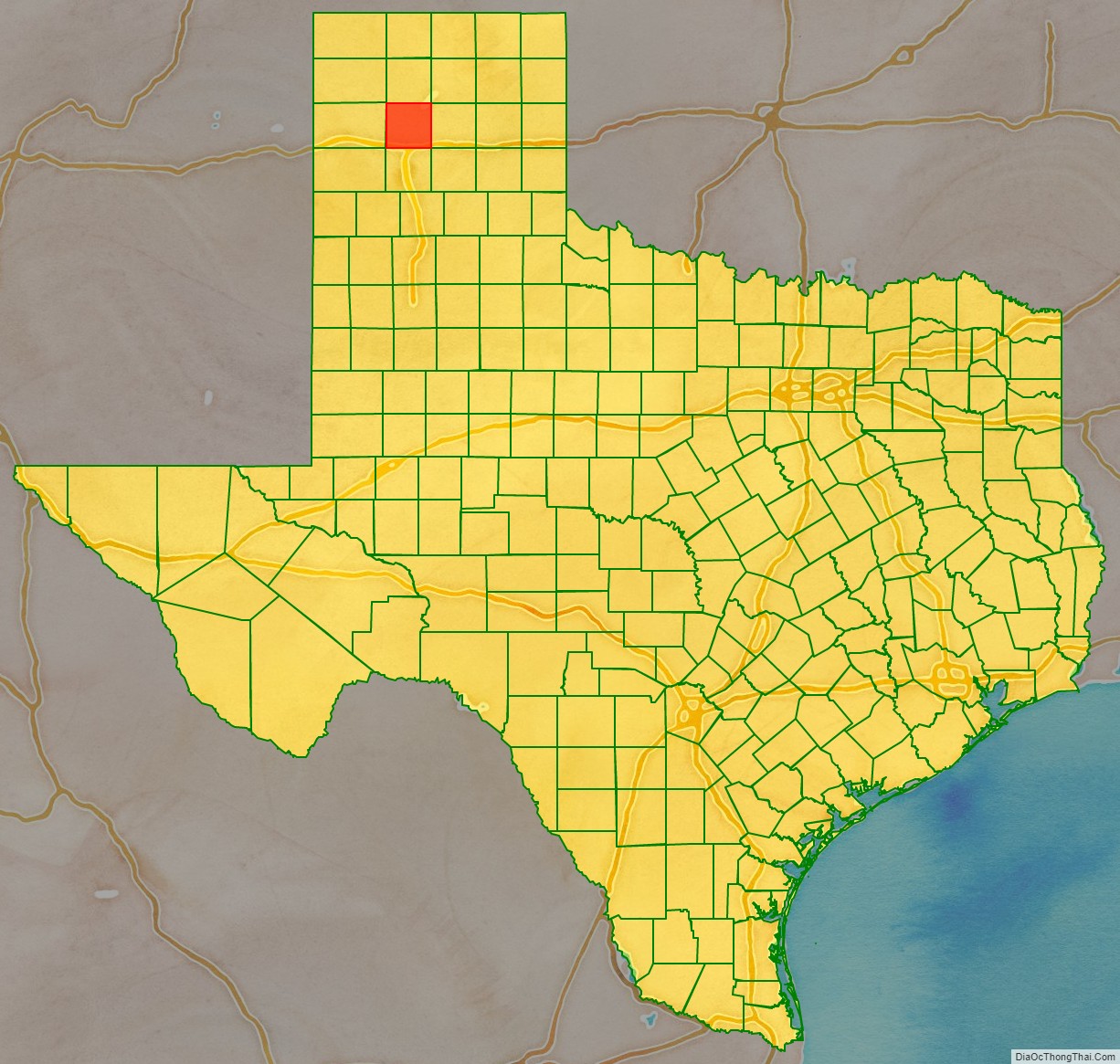
Potter County Outline Map

See also
Map of Texas State and its subdivision:- Anderson
- Andrews
- Angelina
- Aransas
- Archer
- Armstrong
- Atascosa
- Austin
- Bailey
- Bandera
- Bastrop
- Baylor
- Bee
- Bell
- Bexar
- Blanco
- Borden
- Bosque
- Bowie
- Brazoria
- Brazos
- Brewster
- Briscoe
- Brooks
- Brown
- Burleson
- Burnet
- Caldwell
- Calhoun
- Callahan
- Cameron
- Camp
- Carson
- Cass
- Castro
- Chambers
- Cherokee
- Childress
- Clay
- Cochran
- Coke
- Coleman
- Collin
- Collingsworth
- Colorado
- Comal
- Comanche
- Concho
- Cooke
- Coryell
- Cottle
- Crane
- Crockett
- Crosby
- Culberson
- Dallam
- Dallas
- Dawson
- Deaf Smith
- Delta
- Denton
- Dewitt
- Dickens
- Dimmit
- Donley
- Duval
- Eastland
- Ector
- Edwards
- El Paso
- Ellis
- Erath
- Falls
- Fannin
- Fayette
- Fisher
- Floyd
- Foard
- Fort Bend
- Franklin
- Freestone
- Frio
- Gaines
- Galveston
- Garza
- Gillespie
- Glasscock
- Goliad
- Gonzales
- Gray
- Grayson
- Gregg
- Grimes
- Guadalupe
- Hale
- Hall
- Hamilton
- Hansford
- Hardeman
- Hardin
- Harris
- Harrison
- Hartley
- Haskell
- Hays
- Hemphill
- Henderson
- Hidalgo
- Hill
- Hockley
- Hood
- Hopkins
- Houston
- Howard
- Hudspeth
- Hunt
- Hutchinson
- Irion
- Jack
- Jackson
- Jasper
- Jeff Davis
- Jefferson
- Jim Hogg
- Jim Wells
- Johnson
- Jones
- Karnes
- Kaufman
- Kendall
- Kenedy
- Kent
- Kerr
- Kimble
- King
- Kinney
- Kleberg
- Knox
- La Salle
- Lamar
- Lamb
- Lampasas
- Lavaca
- Lee
- Leon
- Liberty
- Limestone
- Lipscomb
- Live Oak
- Llano
- Loving
- Lubbock
- Lynn
- Madison
- Marion
- Martin
- Mason
- Matagorda
- Maverick
- McCulloch
- McLennan
- McMullen
- Medina
- Menard
- Midland
- Milam
- Mills
- Mitchell
- Montague
- Montgomery
- Moore
- Morris
- Motley
- Nacogdoches
- Navarro
- Newton
- Nolan
- Nueces
- Ochiltree
- Oldham
- Orange
- Palo Pinto
- Panola
- Parker
- Parmer
- Pecos
- Polk
- Potter
- Presidio
- Rains
- Randall
- Reagan
- Real
- Red River
- Reeves
- Refugio
- Roberts
- Robertson
- Rockwall
- Runnels
- Rusk
- Sabine
- San Augustine
- San Jacinto
- San Patricio
- San Saba
- Schleicher
- Scurry
- Shackelford
- Shelby
- Sherman
- Smith
- Somervell
- Starr
- Stephens
- Sterling
- Stonewall
- Sutton
- Swisher
- Tarrant
- Taylor
- Terrell
- Terry
- Throckmorton
- Titus
- Tom Green
- Travis
- Trinity
- Tyler
- Upshur
- Upton
- Uvalde
- Val Verde
- Van Zandt
- Victoria
- Walker
- Waller
- Ward
- Washington
- Webb
- Wharton
- Wheeler
- Wichita
- Wilbarger
- Willacy
- Williamson
- Wilson
- Winkler
- Wise
- Wood
- Yoakum
- Young
- Zapata
- Zavala
- Alabama
- Alaska
- Arizona
- Arkansas
- California
- Colorado
- Connecticut
- Delaware
- District of Columbia
- Florida
- Georgia
- Hawaii
- Idaho
- Illinois
- Indiana
- Iowa
- Kansas
- Kentucky
- Louisiana
- Maine
- Maryland
- Massachusetts
- Michigan
- Minnesota
- Mississippi
- Missouri
- Montana
- Nebraska
- Nevada
- New Hampshire
- New Jersey
- New Mexico
- New York
- North Carolina
- North Dakota
- Ohio
- Oklahoma
- Oregon
- Pennsylvania
- Rhode Island
- South Carolina
- South Dakota
- Tennessee
- Texas
- Utah
- Vermont
- Virginia
- Washington
- West Virginia
- Wisconsin
- Wyoming