Quitman County is a county located in the southwestern part of the U.S. state of Georgia. As of the 2020 census, the population was 2,235, making it the second-least populous county in Georgia. The county seat is Georgetown. The county was created on December 10, 1858, and named after General John A. Quitman, leader in the Mexican–American War, and once Governor of Mississippi. In November 2006, residents voted to consolidate the city government of Georgetown and the county government of Quitman into a consolidated city-county.
| Name: | Quitman County |
|---|---|
| FIPS code: | 13-239 |
| State: | Georgia |
| Founded: | 1858 |
| Named for: | John A. Quitman |
| Seat: | Georgetown |
| Largest city: | Georgetown |
| Total Area: | 161 sq mi (420 km²) |
| Land Area: | 151 sq mi (390 km²) |
| Total Population: | 2,235 |
| Population Density: | 15/sq mi (6/km²) |
| Time zone: | UTC−5 (Eastern) |
| Summer Time Zone (DST): | UTC−4 (EDT) |
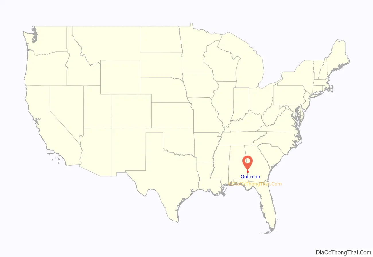
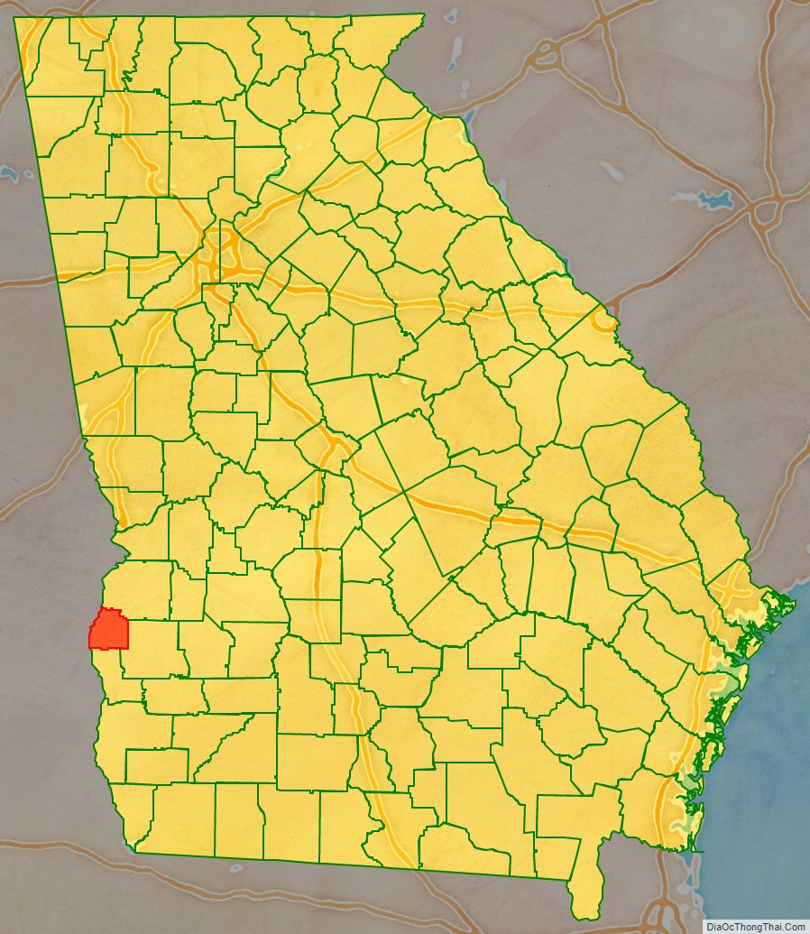
Quitman County location map. Where is Quitman County?
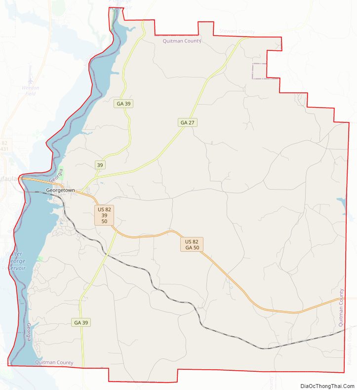
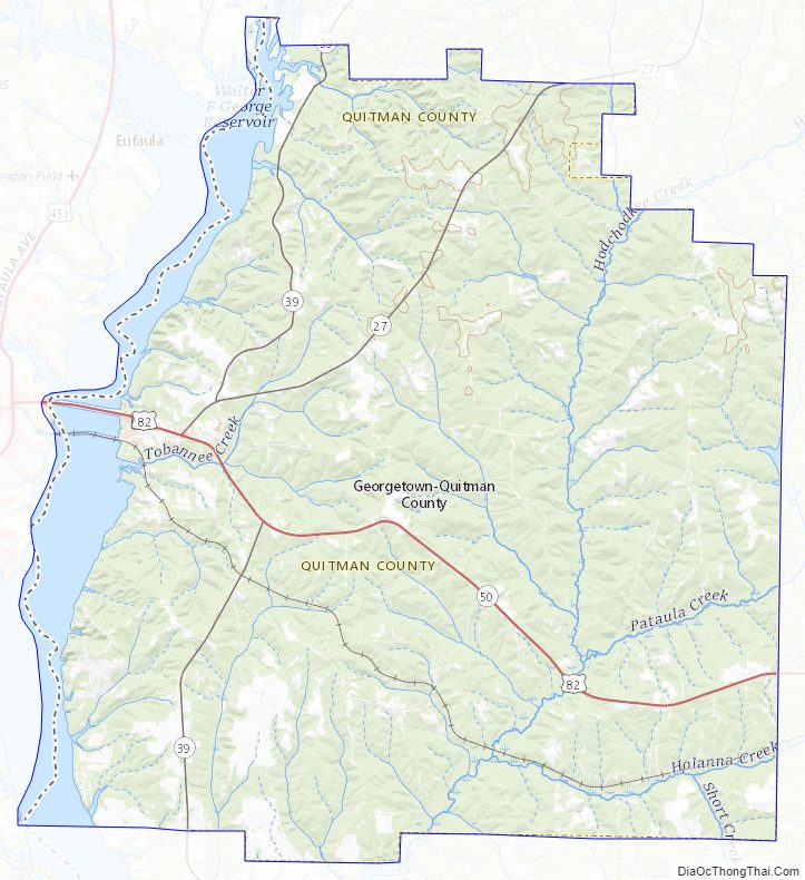
Quitman County Road Map
Geography
According to the U.S. Census Bureau, the county has a total area of 161 square miles (420 km), of which 151 square miles (390 km) is land and 9.3 square miles (24 km) (5.8%) is water. The entirety of Quitman County is located in the Middle Chattahoochee River–Walter F. George Lake sub-basin of the ACF River Basin (Apalachicola-Chattahoochee-Flint River Basin).
Major highways
- U.S. Route 82
- State Route 27
- State Route 39
- State Route 50
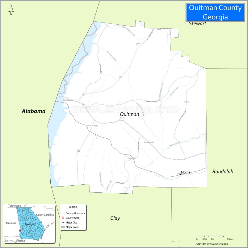
Adjacent counties
- Stewart County (north)
- Randolph County (east)
- Clay County (south)
- Barbour County, Alabama (west/CST Border)
National protected area
- Eufaula National Wildlife Refuge (part)
Quitman County Topographic Map
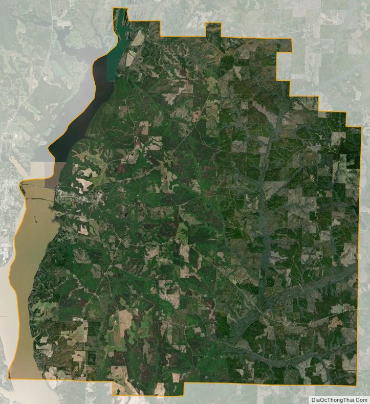
Quitman County Satellite Map
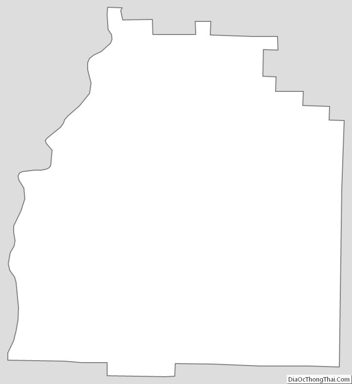
Quitman County Outline Map
See also
Map of Georgia State and its subdivision:- Appling
- Atkinson
- Bacon
- Baker
- Baldwin
- Banks
- Barrow
- Bartow
- Ben Hill
- Berrien
- Bibb
- Bleckley
- Brantley
- Brooks
- Bryan
- Bulloch
- Burke
- Butts
- Calhoun
- Camden
- Candler
- Carroll
- Catoosa
- Charlton
- Chatham
- Chattahoochee
- Chattooga
- Cherokee
- Clarke
- Clay
- Clayton
- Clinch
- Cobb
- Coffee
- Colquitt
- Columbia
- Cook
- Coweta
- Crawford
- Crisp
- Dade
- Dawson
- Decatur
- DeKalb
- Dodge
- Dooly
- Dougherty
- Douglas
- Early
- Echols
- Effingham
- Elbert
- Emanuel
- Evans
- Fannin
- Fayette
- Floyd
- Forsyth
- Franklin
- Fulton
- Gilmer
- Glascock
- Glynn
- Gordon
- Grady
- Greene
- Gwinnett
- Habersham
- Hall
- Hancock
- Haralson
- Harris
- Hart
- Heard
- Henry
- Houston
- Irwin
- Jackson
- Jasper
- Jeff Davis
- Jefferson
- Jenkins
- Johnson
- Jones
- Lamar
- Lanier
- Laurens
- Lee
- Liberty
- Lincoln
- Long
- Lowndes
- Lumpkin
- Macon
- Madison
- Marion
- McDuffie
- McIntosh
- Meriwether
- Miller
- Mitchell
- Monroe
- Montgomery
- Morgan
- Murray
- Muscogee
- Newton
- Oconee
- Oglethorpe
- Paulding
- Peach
- Pickens
- Pierce
- Pike
- Polk
- Pulaski
- Putnam
- Quitman
- Rabun
- Randolph
- Richmond
- Rockdale
- Schley
- Screven
- Seminole
- Spalding
- Stephens
- Stewart
- Sumter
- Talbot
- Taliaferro
- Tattnall
- Taylor
- Telfair
- Terrell
- Thomas
- Tift
- Toombs
- Towns
- Treutlen
- Troup
- Turner
- Twiggs
- Union
- Upson
- Walker
- Walton
- Ware
- Warren
- Washington
- Wayne
- Webster
- Wheeler
- White
- Whitfield
- Wilcox
- Wilkes
- Wilkinson
- Worth
- Alabama
- Alaska
- Arizona
- Arkansas
- California
- Colorado
- Connecticut
- Delaware
- District of Columbia
- Florida
- Georgia
- Hawaii
- Idaho
- Illinois
- Indiana
- Iowa
- Kansas
- Kentucky
- Louisiana
- Maine
- Maryland
- Massachusetts
- Michigan
- Minnesota
- Mississippi
- Missouri
- Montana
- Nebraska
- Nevada
- New Hampshire
- New Jersey
- New Mexico
- New York
- North Carolina
- North Dakota
- Ohio
- Oklahoma
- Oregon
- Pennsylvania
- Rhode Island
- South Carolina
- South Dakota
- Tennessee
- Texas
- Utah
- Vermont
- Virginia
- Washington
- West Virginia
- Wisconsin
- Wyoming